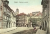
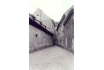
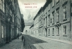
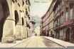
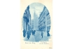
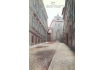
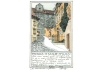
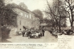
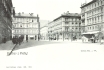
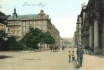
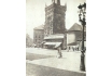
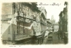
31 - The Nový Svět (the New World) district in Hradčany
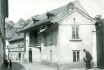
On the right, in the street of the same name (Nový Svět) we can see
the ornate building of the hotel Zlatá hvězda (The Golden Star), No. 87,
behind it Zelený kříž (The Green Cross) with a gas lantern, and on the
left the nameless building No. 88. The hotel Golden Star actually
consists of two buildings wedged into one another in a bizarre fashion,
probably because of a lack of space, or because of the necessity to
observe the street line, or because of both. As a result we can see the
irregular ground plan of one of them. An interesting thing about the
front building is the low ceiling, as is indicated by the disposition of
the lower and upper windows. Judging from the curious gaze of the
gentleman wearing a bowler, we can conclude that something very
interesting must have been taking place inside.
PHOTOGRAPHIC POSTCARD. T. VOJTA, 1918
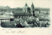
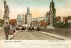
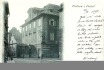
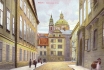
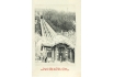
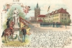
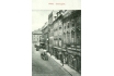
32 - A view of Prague Castle, with the incompletely constructed St Vitus Cathedral
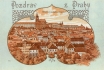
And a part of the Lesser Town, from the slopes of the Petřín Hill,
most probably from the Schönborn Garden. In the forefront lies the
Colloredo-Schönborn Palace - today, the United States Embassy. A drawing
or a photograph of an earlier date, from around 1888, served as the
basis for this picture postcard.
COLOURED LITHOGRAPH. B. F. P. (PERHAPS BATOVEC F., PRAGUE), AROUND 1900
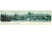
| 33 - One of the most typical views of the Lesser Town roofs and spires from Na Valech Garden of Prague Castle
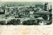
From the left, St Thomas’s Church, the Bridge Tower on the Lesser
Town side, two low pyramids of steeples of St Mary the Virgin Church of
the order of the Knights of St John, and the dome of St Nicholas’s
Church, with its slender belfry - an inseparable landmark of the Lesser
Town - and of the whole historical centre, which could not be
contemplated without this dominant feature. On the furthest left is the
Charles Bridge; on the right, near the National Theatre, is the Emperor
Franz Chain Bridge (it was still standing then but was removed in 1898).
TWO-PART POSTCARD. PHOTOTYPE. PICTURE 1897. K. BELLMANN, 1899
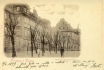
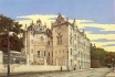
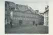
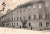
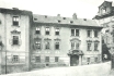
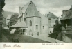
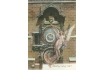
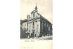
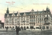
| 34 - South-eastern front of the former Straka Academy
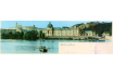
Now office of the Government of the Czech Republic. This Neo-Baroque
building, No. 128, was built in 1896 at the cost of more than one
million guldens, funds provided by Count J. P. Straka’s Foundation for
the impoverished descendants of Czech nobility. Originally, a Jesuit
garden and a “summer house” were located here. After abolition of the
Jesuit order, a dance-hall functioned here, and, towards the end of the
19th century, the Bicyclists’ Club established its base here; there was a
bicycle and athletic track of 200 meters length in the garden. Above
right is Mary Magdalene’s Bastion.
TWO-PART POSTCARD. COLOURED PHOTOTYPE. K. BELLMANN, 1900
| 35 - A fascinating panorama of Prague Castle and the Lesser Town
Viewed from the embankment wall at Křižovnické Square. The building
Prašný Dvůr (The Powder Courtyard), No. 515, is located to the left of
the Charles Bridge, on Kampa Island. Behind the poplars, one can see the
mouth of Čertovka (The Devil’s stream). The oblong ground-level
building, No. 102, is Herget’s brick-kiln and, on the right, is its
owner’s house. This riverside housing is crowned by the elongated line
of Prague Castle with St Vitus Cathedral on the horizon.
TWO-PART POSTCARD. PHOTOTYPE. K. BELLMANN, 1899
| 36 - St Nicholas’s Church - supreme Late Baroque in its full beauty
The photograph was taken from the Schönborn Garden. The majestic St
Nicholas Church was originally built for the Jesuits in 1703-1751. The
architects and master builders of the pre-dominant part of the Church
were K. Dientzenhofer and his son, K. I. Dientzenhofer - the two most
important master builders of Prague Baroque. Later on, the slender spire
of the belfry was built, the work of A. Lurago. Immediately below, the
roofs and upper floors of the northern fronts of houses in Tržiště
Street are clearly shown (see picture 61).
TWO-PART POSTCARD. PHOTOTYPE. K. BELLMANN, 1899
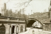
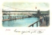
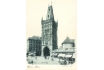
| 37 - The Charles Bridge after the great flood of September 4th, 1890
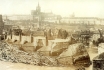
The Charles Bridge as it collapsed after the great flood of September
4th, 1890. In front of the Bridge, blocking the spans, there is drift
wood of all kinds: from rafts, from dumps in Podskalí, and from
elsewhere. The Bridge was not able to resist the huge pressure of water
for very long. The level of the Vltava River suggests that the
photograph might have been taken one or two days after the centre of the
Bridge broke. Behind the Bridge, one can well see the flooded houses of
the Lesser Town on the riverside. One little-known interesting point
concerns the shape of the Bridge. When looking at the Bridge from the
Bridge Tower on the Lesser Town side, it can be seen that it is not
straight but curved approximately into the shape of a very elongated
letter S, resembling the human spine. The St Vitus Cathedral, with its
main steeple (with three recognizable architectural styles), still lacks
its transept and western nave. The newly rising western steeples are
under scaffolding.
PHOTOGRAPHIC POSTCARD. PICTURE SEPTEMBER 1890. Z. REACH, 1920s

| 38 - The Lesser Town end of the Charles Bridge
Leading into a gate between Juditina věž (Judith’s Tower) of 1172 and
the higher Bridge Tower on the Lesser Town side (finished perhaps
before 1470). Thirty Baroque statues, two of them in the foreground,
decorate the Bridge. Tram rails can be seen on the Bridge. By 1883-1905,
horse-drawn trams and, in 1905-1908, electric trams were running here.
As it was impossible to erect trolley power-lines that would obstruct
historical monuments, trams in the section from Křižovnické Square to K
mostu Street were powered through a lower lead with contacts (along the
rails) and special electrical fittings which secured the supply of
current only for moving trams. Otherwise, the contacts in the road were
without power. The originator of this odd solution, F. Křižík, was an
outstanding Czech electrical engineer and inventor, as well as creator
of the first Prague electric tram.
COLOURED PHOTOTYPE. K. BELLMANN, 1900
| 39 - A span of the Charles Bridge on Kampa Island
On the left, the upper part of the Bridge tower on the Lesser Town
side protrudes. Under this, at ground level, is the annex to the house U
Zlatého lva (The Golden Lion), No. 493, and a line of little shops. In
the picture, only one is open, the ladies’ hairdressers of F.
Holejšovský. The place in front of the little shops still belongs to
Kampa Square. From here, a connecting lane under a span of the Charles
Bridge leads to a small open place at the end of Lužická Street, over a
short bridge across an arm of the Vltava River, which flows around
Kampa.
PHOTOGRAPHIC POSTCARD. AROUND 1910
| 40 - A view of a part of Prague Venice
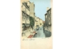
And of the adjacent arm of the Vltava River, called Čertovka (The
Devil’s Stream), facing north-east. This arm embraces Kampa Island at
the Lesser Town bank and, together with the surrounding picturesque
houses, creates an attractive milieu with a special atmosphere
resembling Venice. The photographer stood on the little bridge over
Čertovka, behind the third span of the Charles Bridge (see picture 39).
On the left, the rear wings of the houses in Lužická Street, i.e. part
of the house U Pláničků, No. 87 (with open windows), followed by the
house U Felbrů, by the higher newer house Červená bota (The Red Boot)
(where a tollbooth used to be), and by the houses U Brykců and U Tří
kaprů (The Three Carps). F. Holina, an excellent calligrapher and
chamberlain to a General of the Order of the Knights of the Cross, lived
in the next house U Tří zelených křížků (The Three Green Crosses).
Here, Czech writers and patriots, including Jan Neruda, gathered in the
first half of the 19th century (see page 66). Holina’s daughter, Anna,
was Neruda’s lifelong love.
COLOURED PHOTOTYPE. K. BELLMANN, 1899
| 41 - A view from the same place as the previous picture, but southwards
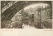
One can see the Velkopřevorský Mill, No. 489, probably built by the
second third of the 14th century. In the course of time it acquired
various nicknames, such as Maltézský (Maltese) and Spálený (Burnt-out).
It was sold to the Lesser Town municipality in 1596, and reconstructed
approximately into its current appearance in 1597-1598. The great mill
wheel, now renovated and sometimes in operation, is still situated in
the annex to the building. On the left, there is a wall of a garden on
Kampa belonging to the house U Zlatého lva (The Golden Lion), with
workshop of the sculptor J. Krucký (see picture 45). Later, there was a
restaurant here. From the Golden Lion, stairs lead to the river. Here,
boats were berthed, water was brought, and laundry was washed and
rinsed, as was common along all riversides. On the right, there is a
ground-floor wing of a newer house adjacent to the bridge.
PHOTOTYPE. V. KRÁTKORUKÝ, AROUND 1900
| 42 - The southern side of the Velkopřevorské Square with Count Buquoy’s two palaces
The first from the left is the Great Buquoy Palace, No. 486, with
statues by M. Braun and a large garden which ends at the arm of the
Vltava. Archbishop Valdštejn (Wallenstein) built the Palace in place of
three houses. Two of them were owned by Valdštejn and the third one bore
the name U Černého orla (The Black Eagle). The Palace was bought by
Count F. L. Buquoy in 1748. Nowadays, the embassy of France is located
here. Behind is the little Buquoy Palace, No. 484, with a valuable
Renaissance gable; it closes the square on the western side. Though this
square is located close to the main thoroughfares, and today’s tourist
routes, no road traverses it. The majestic peace and picturesqueness of
nearby Kampa seem to reach as far as here. The conclusion of the text
below the picture: I look forward to our meeting tonight supports the
supposition that the sender could fully rely upon the then postal
services.
PHOTOTYPE. L. J. ČECH, 1899
| 43 - The northern part of Maltézské Square (of the Knights of St John)
The northern part of Maltézské Square (of the Knights of St John)
with a statue of St John the Baptist by J. Brokoff, from the year 1715.
On the left, one can see a Baroque house, No. 479, with a portal; behind
it, the house Stará pošta (Old Post) with an inn, No. 480. The Prague
General Post Office was located here in 1622-1723. Behind the Old Post
is the entry to Prokopská Street, where one of the Prague Lottery
centres (see picture 88) was situated at the time the photograph was
taken. From about 1855, railway carriages produced in the Ringhoffer
factory at Smíchov were transported from there in horse-drawn fashion to
the state railway station in Hybernská Street; the section between
Maltézské Square and the Charles Bridge ranked among the most difficult.
At that time, there was no railway connection between the left and
right banks of the Vltava; this was only accomplished by building the
Railway Bridge below Vyšehrad in 1871 (see picture 540).
COLOURED PHOTOTYPE. 1905
| 44 - The Na Kampě Square - a view from south to north, to the stairs
to the Charles Bridge
More compact housing on Kampa was possible after the elevation of the
terrain on the Island by bringing fire debris from houses burnt down
after a big fire in Hradčany and the Lesser Town in 1541. The house U
zlatých nůžek (The Golden Scissors), No. 494, (at the end of the
left-hand row) is one of the oldest, first mentioned in 1568. The only
continuously built-up space on the Island, with two- and three-storeyed
medieval, Baroque and Neo-Classical houses, it is now a picturesque
quiet corner in the centre of the Island, which revives the traditional
potters’ market (including ceramics) once a year. Kampa, however, has
not always been so idyllic. Förster’s textile factory, where about 130
workers (both men and women) worked, was situated in the two-storeyed
house U Štýgrů, No. 511 (the fourth from the right), towards the end of
the 18th century.
PHOTOTYPE. K. BELLMANN, 1901
| 45 - J. Krucký’s sculpting and plastering workshop in the house U Zlatého lva (The Golden Lion), No. 493
View of the area outside the workshop, in the garden, which was
enclosed by a wall from the Čertovka side (see picture 41). The location
of the workshop close to water was logical, as the work mostly required
plaster of Paris. The company’s range was relatively wide, as the
picture shows. It manufactured and supplied prefabricated decorative
elements for building industry needs - pyramids, little steeples,
pylons, obelisks, and various reliefs, as well as statues of the saints,
little angels, and other statuettes for churches and cemeteries. J.
Krucký himself is probably on the right and, to the left, are his three
employees. From a collector’s point of view it is interesting to note
that the house was, at the end of the 18th century (according to F.
Ruth’s Chronicle of Royal Prague and Neigbouring Places), the home of A.
Renner, a teacher, whose collection included such varied things as an
electric machine, a vacuum pump, barometers, ashcans and an accordion,
of which he is said to have been the first Czech producer.
PHOTOTYPE. PHOTOGRAPHER A. F. WANNER, ŠTĚCHOVICE N. VLTAVOU. J. KRUCKÝ, AROUND 1910
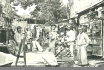
| 46 - A quiet corner U Rybáře (The Fisher) in the place of today’s park and square at Klárov
This is a small part of a large complex of military supply bases
(formerly bakeries), which were pulled down in 1917. The predominant
part is situated behind the photographer. The buildings in the picture
stood near the end of the former Železná lávka (Iron Footbridge) on the
Lesser Town bank, at the corner of U Železné lávky (At the Iron
Footbridge) and Pavelská Streets. The house with stairs, No. 129,
demolished in 1916, probably served as an administrative building for
the supply bases, while the low building on the right, No. 125
(demolished in 1917) most likely served as a store. Pavelská Street,
ending with a passage through the cross-wing of building No. 129 (see
picture 47), led behind these buildings. It is worth noticing that the
courtyard is being swept by civil employees of the military
administration, while the soldiers themselves are enjoying their leisure
time at the end of their shift.
PHOTOGRAPHIC POSTCARD. AROUND 1910
| 47 - Pavelská Lane - a view eastwards
It was a connection between Letenská Street and the entrance to the
Iron Footbridge on the Lesser Town bank. (It went through Lužická
Street, which reached as far as today’s Klárov, to the Home for the
Blind). On the left, a low component of the military supply base, No.
125, (built in 1769, rebuilt in 1837) and, behind, a higher house, No.
129, where the lane ends in a subway (for the opposite side of these
houses, see picture 46). Behind the subway, steps led to the raised
terrain of U Železné Lávky Street. On the right, the house No. 126
(built about 1540), the former guard-room at the ferry which operated
before the Iron Footbridge was built. The buildings in the picture were
pulled down around 1917. Today, there is a park here - a part of Klárov
square.
PHOTOGRAPHIC POSTCARD. AROUND 1910
| 48 - The Lusatio-Serbian Seminary, No. 90/13, at the corner of Lužická Street and Míšeňská Street (right)
Upper Lusatia belonged to the Bohemian Kingdom since the time of
Charles IV, but it became property of the Saxon Elector in 1635, and
the local Slavic language and the Catholic faith began to retreat before
the German language and Protestantism. For this reason, brothers Šimon
from Bautzen founded the Catholic seminary for Upper-Lusatian students
in 1704, originally in house No. 11, which was bought by the brothers in
1707, together with the neighbouring plot. In about 1728, they built a
Baroque house here (in the picture) later owned by the Bautzen Chapter.
Josef II intended to abolish this seminary but the Chapter sprang to its
defence. In 1846, Lusatio-Serbian students founded here Serbowka - the
first Slavic student association in Prague. Notable Czech Slavists, such
as J. Dobrovský, V. Hanka and others, were in the habit of visiting
Serbowka in order to take care of the linguistic and patriotic education
of its members.
PHOTOTYPE. B. EHRLICH, 1898
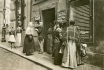
| 49 - One of the yards of a tenement house, perhaps in Lužická Street
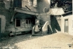
This kind of house was usually constructed by builders without
detailed plans, who dealt with problems and details directly on the spot
during the course of building. In this way, they succeeded in creating
houses with courtyards which have preserved their charm up to the
present day. The romantic atmosphere of these places is described in
Lesser Town Stories by J. Neruda. The woman on the stairs (which lead to
a gallery) may have had anything in the jug with a narrow neck - water
from a pump on the municipal water main, beer, or lamp oil; who knows?
PHOTOGRAPHIC POSTCARD. PROBABLY THE 1920s
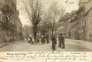
50 - The last part of the street Pod Bruskou, called the Mouse Hole
Ascending from the first curve of Chotkova (Chotek) road northwards.
Behind this, near the column, follows a path leading to Chotek Park, to
the Letenská Plain, and to Dejvice. When the city walls were still
standing in the north of Prague and Chotek road was non-existent, the
street Pod Bruskou and its continuation formed a very busy pass in the
rock, through which the main thoroughfare passed northward out of the
city via Písecká Gate. On the right, one can see three picturesque
houses, Červený jelínek (The Little Red Deer), No. 135, followed by Nos.
136 and 137, with the inn V Balonu (In the Balloon). The little houses
overstep the street line and are reminiscent of Prague wooden buildings
of ancient times, with their various projections and cellars under the
pavements. In the place of these houses, on the left-hand side,
luxurious Hoffmeister hotel now stands. An older Písecká Gate stood in
the place shown in the lower part of the picture, in 1588-1829.
PHOTOGRAPHIC POSTCARD. AROUND 1912
| 51 - The western part of Letenská Street, here considerably narrowed down, near Malostranské Square

In the background, one can see the arch of the two-storey linking
wing with the former corridor between the Oettingen-Wallerstein Palace
(originally Lobkovic, built around 1551), No. 34, in Josefská Street,
and St Thomas’s Church. There is a buttress arch with a small roof
between the two buildings. A single pair of rails and trolley power-line
for electric trams lead through the lane. It is apparent that the
cramped space served for pedestrians as well. Nowadays, there is a
separate subway for pedestrians in the ground floor of the Palace (on
the right, outside the picture), and also a separate passage for cars.
PHOTOGRAPHIC POSTCARD. K. BELLMANN, 1910
| 52 - A part of Letenská Street: a view from its intersection with
Lužická Street westwards
In the middle in the background, there is a high wall with the
entrance to the garden of Valdštejnský Palace. The steeples of St Vitus
Cathedral can be seen above the wall. Trams ran here on the Exhibition
Area - Malostranské Square - Smíchov route, but only in one direction.
They returned through Valdštejnská Street situated to the north (see
picture No. 59). Both streets were narrow and twisting, hence the
single-track line. On the left are the nobilities’ houses -
Windischgrätz house, No. 119, from the 18th century and, behind it, the
Thurn-Taxis House from the 17th century. On the right, a state
administration house, No. 123, with a metal-plate spread-eagle emblem on
the wall, which several offices occupied successively from the eighties
of the 19th century.
PHOTOTYPE. F. J. JEDLIČKA, AROUND 1908
| 53 - The second building of Klar’s Home for the Blind
This home was founded by Professor A. Klar in 1832, originally for
four inhabitants. The first building was erected by the founder’s son,
Alois, in 1836-1844. This building failed to offer sufficient capacity,
and a second was therefore built at the beginning of the 20th century.
The corner building on the triangular plot opposite the Straka Academy
was built by A. Möse, according to the project draft of J. Piskač in
1906-1908. In contrast to other houses of that time, elements of the Art
Nouveau are scanty on this building. A mixture of historical styles are
used, for instance, for houses in Mikulášská Street. Among others, a
ceremonial hall and a winter swimming-pool for the needs of the home
(and for hire as well), were established in the three-wing building.
After the adjacent barracks were abolished in 1930, this building found
itself at the corner of the newly-created streets U Bruských kasáren and
Pod Letnou.
COLOURED PHOTOTYPE. J. BLAŽEK, 1910
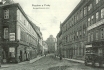
| 54 - Barracks at Bruska - No. 132 in Pod Bruskou (Under Bruska) Street
The correct name should be Nad Bruskou (Over Bruska), as it refers
to the Bruska Brook, which flows underground. In the times when Brusnice
still ran on the surface, a mill, a slaughterhouse, and a brewery were
located here, from 1599. Later on, under the rule of Maria Theresa, the
Bruska Brook ran underground from Jelení Příkop (the Deer Ditch) to the
Vltava (crossing the present-day Klárov). At that time, military
workshops, then Barracks of the 28th Regiment, were located here. The
Barracks were pulled down in 1930. In their place was one of the Prague
public transport company’s transforming stations, used by trams. The low
building on the right, No. 149, was also owned by the military
administration. Above, there is a steeple of the old Klar Home for the
Blind.
PHOTOTYPE. K. BELLMANN, 1900
| 55 - Pod Bruskou Street - a view northwards
On the left, a one-storey building, No. 149, originally the royal
lime-works and Brick-Kiln from 1612; from 1779, it was a military supply
base. Towards the end of the 19th century, it became the seat of the
Imperial Royal Military Economic Commission. The building was demolished
in 1924. On the right, one can see a part of Klar’s Home for the Blind,
No. 131. This Empire-style building from the years 1836-1844 was built
by V. Kulhánek. A large portal of the gateway to the home’s courtyard is
adjacent to the north-east corner of the building. Behind it, the
Barracks, No. 132, at that time the seat of the 28th regiment, founded
in 1698. The regiment bore the name of the Italian King Umberto until
1915. However, it was best known as the Prague Children. Under this name
the regiment became famous, particularly during the First World War,
because some of its soldiers got, under unclear circumstances, to the
Russian side in 1915. This was believed to have been a deliberate
desertion, the regiment was dissolved by the Emperor’s decree, and its
banner was deposited in a museum. However, the last unit of the regiment
fighting on the Italian front displayed such bravery in battle that the
emperor revised his decision, and in 1916 the regiment was reinstated.
COLOURED PHOTOTYPE. AROUND 1902
| 56 - Tomášská Street - a view from Malostranské Square northwards
This is one of the few streets lying on flat ground, most unusual in
the Lesser Town. It links two squares, Malostranské and Valdštejnské.
The two sides of the street differ in appearance: the western side has
arcades along its entire length. On the right, the house U Zlatého
jelena (The Golden Deer), No. 26, ranks among the most significant
Baroque houses of the Lesser Town. Above the entrance is a sculptural
group of St Hubert with a deer by F. M. Brokoff. The front and the
Baroque adaptation is the work of K. I. Dientzenhofer. The plumber’s
shop of J. Koprnický was in this house. Almost all the houses on the
left-hand side originate from the 14th century. The nearest edifice with
an arcade, No. 518, was owned by the Šternberks after 1836. Almost at
the end of this side of the street, the house No. 15 stands where the
painter and graphic artist V. Morstadt (1802-1875), the engraver of many
well-known Prague vistas, lived and died.
COLOURED PHOTOTYPE. 1910
| 57 - The Ledeburský (also Trauttmannsdorf) Palace, No. 162, at Valdštejnské Square
A spread-out Baroque building with two gateways and an interestingly
designed roof, covered by slate from 1898, and with high chimneys. Above
the building, part of the southern wing of the Prague Castle can be
seen. On the right, behind the Palace, in Valdštejnská Street, are two
narrow houses, U Zlatého slunce (The Golden Sun) and Kastelmurovský. On
the furthest right, one can see the corner of the early Baroque
Valdštejn (Wallenstein) Palace. On the left is a corner of the Aldringen
(also Aueršperský) Palace, No. 16, with an arcade, the last house on
the western side of Tomášská Street. The then owner, Duke K. V.
Aueršperk, sold the Palace to the National Committee for the Extension
of the Parliament Offices in 1904.
PHOTOGRAPHIC POSTCARD. PICTURE AROUND 1899. Z. REACH, END OF THE 1920s
| 58 - The pub U Schnellů, No. 27, at the corner of Tomášská (left) and Letenská Streets
This is a Renaissance house rebuilt in the Baroque style in 1787,
when it was bought by O. Schnell. The house became famous because of its
Pilsner pub and wine-cellar, and it has ranked among the best-known up
to the present day. Behind this, in Tomášská Street, is the house U
Zlatého jelena (The Golden Deer) . On the right, in Letenská Street, one
can see the Church of St Thomas, with three naves; it is one of the
largest churches in Prague. The originally Gothic Church was completed
in 1379. It suffered damage during the Hussite wars, and was
subsequently under repair for a long time. It burnt down after a
lightning strike in 1723. The Baroque adaptation is the work of K. I.
Dientzenhofer. At the beginning of Tomášská Street, a municipal
policeman, wearing a typical hat with cock feathers, is standing.
Accordingly, policemen were called shaggies in the vernacular.
COLOURED AUTOTYPE. HUSNÍK & HÄUSLER, 1899
| 59 - Valdštejnská Street after rain
The painter stood approximately half-way up the street, facing west.
On the left, the wall of the Valdštejnský Palace Garden with the
entrance and a part of its north-east wing. On the right, the late
Baroque Fürstenberg Palace, No. 153, today the embassy of Poland. It was
built for Count Netolický in the years 1743-1760. The garden of this
Palace, ascending terrace-like up to Prague Castle, ranks among the most
beautiful in Prague. Behind the Fürstenberg Palace, hidden from view,
stands the Kolovrat Palace (nowadays the Ministry of Culture); fur- ther
on is the entrance into the Kolovrat Garden, and the widespreading
house U Tří králů (The Three Kings), No. 158, with a high Baroque
portal. The main southern tower of St Vitus Cathedral rises above this
house. The rails of the one-way tramway wind along the street (see the
text of picture 52).
FOUR-COLOURED AUTOTYPE. AFTER A WATER-COLOUR BY J. ŠETELÍK, END OF THE 1920s.
V. KRÁTKORUKÝ, AROUND 1930
| 60 - The Imperial Royal Military Swimming-Pool, at the Lesser Town bank behind the Iron Footbridge
Founded in 1809 by a lover of swimming, Captain Arnošt of Pfuol, it
was the oldest in Austria, the swimming-pool in Vienna being opened in
1812 (in Berlin, 1817). It served primarily for swimming lessons for
soldiers, but civilians swam here as well. Due to frequent quarrels and
disputes, civilians established the Citizens’ Swimming-Pool somewhat
further down the stream. The original Military Swimming-Pool was
stabilised by being bound to several anchored ships, loaded with four
guns and iron balls. Despite this, the swimming-pool floated away as far
as Roztoky during the flood in 1824. Local people immediately took
possession of the swimming costumes left in the cubicles and then
father-workers and children dressed in them walked about for a long
time, looking mottled (V. Krolmus). Swimming exercises, accompanied by
military brass bands, were held here in the 1840s. Strange games, like
swimming in full military outfit or carrying up gun balls from the river
bottom, were also very popular but the free-and-easy times terminated
in 1846 when Duke B. Rohan drowned during such an event.
COLOURED PHOTOTYPE. LEDERER & POPPER, 1902
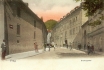
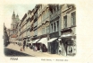
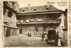
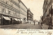
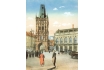
61 - The market in the street of the same name (Tržiště)
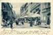
A photo taken from the lower end of Tržiště Street, which leads into
Karmelitská Street. At the end of the street, to the left, outside the
picture, the Schönborn Palace is situated, now the embassy of the United
States of America. The moderately ascending street is rather wide in
the context of the Lesser Town. The burghers’ houses have simple
frontages, and are not especially imposing. The buildings on the right
side of the street stand in the locality of the former ditch and
Přemyslid Gothic bulwark, which had passed through here. Thus, after
removing the walls and filling-in the ditch, the plots (which originally
reached only to the walls by the burghers’ houses with fronts facing
the Malostranské Square) were extended. In the southern parts of the
extended plots, the houses on the right side of Tržiště Street were
gradually erected. The Lesser Town marketplace was originally situated
at Malostranské Square but, in 1784, it was moved to this street. The
picture, taken in the morning at about 10 o’clock (see the shadows),
shows only a few stands with sunshades, as the market-place was no
longer busy by that time. In contrast to marketplaces in the old and new
towns this one was rather small. In spite of this, it was sufficient
for the Lesser Town people, as they bought other goods in small shops.
Small shops, as well as places rendering various services, existed in
almost every house; a part of one of them can be seen on the right - J.
Žák’s pressing shop. The posing children show children’s fashions of
that time - the group of barefoot children in the middle of the picture
undoubtedly ranked among the poorer ones, whereas the three neat
children with small hats (left) indicate more wealthy parents.
PHOTOTYPE. K. BELLMANN, 1899
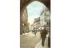
| 62 - A vista through the Bridge Gate into K Mostu Street westwards
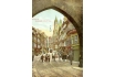
The picture expresses the then character of the relatively short
street which leads to Malostranské Square. In the background, the house U
Petržilků with a bay window, No. 272, and the belfry of the Church of
St Nicholas in the square are shown. Trams were running in both
directions over the Charles Bridge and through the street until 1908.
Interesting electric lights are hanging on the wires above the rails.
The lights cannot be seen in the following older three pictures, proving
that they were installed shortly before the picture was taken.
LACQUERED COLOURED COMBINED PRINT. D. KOSINER AND CO., 1908
| 63 - The north side of K Mostu Street
This is very old housing, either replaced (particularly after fires)
or adapted by stylised reconstructions in the course of centuries. On
the right, the double-house U sv. Salvátora (St Salvator) and Černý
medvěd (The Black Bear), Nos. 54 and 53. At ground level, one can see
the stationer's shop of J. Šváb Malostranský with a display of picture
postcards and cabaret songs, published and sold by him. The cards were
predominantly funny, the themes drawn from both better and less
well-known Prague painters, like M. Aleš, K. V. Muttich, and Jiras. This
is why the artistic value of these picture postcards varied greatly.
Šváb began publishing them around 1890, and his own collection was most
highly appreciated at the world exhibition in Paris in 1900, gaining the
Grand Prix.
COLOURED PHOTOTYPE. PROBABLY E. ČÍŽEK, AROUND 1898
| 64 - K Mostu Street
A view westwards from about the middle of the street towards
Malostranské Square and St Nicholas’s Church. On the left, the portal of
the Kounický Palace, No. 277, designed by A. Schmidt in 1780 in the
spirit of the Classical decorative revival - today the embassy of
Serbia. The house with a bay window in the background, named U
Petržilků, stands in Malostranské Square. On the right can be seen the
long, slightly protruding front of the Lesser Town Savings Bank from the
year 1895, built on the side of three houses in this street and one in
Malostranské Square (see picture 74).
PHOTOTYPE. E. SCHMIDT, DRESDEN - BUDAPEST, 1898
| 65 - Street traffic in K Mostu (to the Bridge) Street

A view from the west towards the Bridge Towers and Charles Bridge. On
the right, in front of the Judith Tower, stands the Saxon House, No.
55. Originally a Gothic house owned by Saxon Dukes in the second half of
the 14th century, it was rebuilt in the Renaissance style around 1590.
The appearance today is Neo-Classical, dating from the years 1826-1828
when J. Chaura removed the Renaissance gables and added an extra floor.
Until 1899, F. Kytka’s bookshop was situated here (see the corner of the
building on the furthest right), then the shop of J. Šváb Malostranský,
who moved to this place from his little shop on the opposite side of
the street. The best Lesser Town shops were concentrated in this street,
in much the same way as in the main streets of the Old and New Towns.
On the right, Lázeňská Street, from which drays with railway carriages
drove out, turning to the right to the Charles Bridge (see the text of
picture 43).
COLOURED PHOTOTYPE. H. Z. ZUNA, 1899
| 75 - The Assembly of the Kingdom of Bohemia
A complex of the former Thunovský Palace, No. 176, it ranks among the
largest buildings in Prague, occupying the entire eastern side of
Sněmovní (Assembly) Street. Originally, five mediaeval houses stood on a
plot nearly 100 m in length; by their integration, successive
additions, reconstructions and modifications, a bulky building with a
complicated internal plan was formed. The Palace underwent major Baroque
development after the Thun family bought it. The original Baroque front
acquired a Neo-Classical appearance but both the Baroque portals were
saved. The palace has two courtyards and a labyrinth of corridors with a
great number of rooms. Countess Thun sold the Palace to the Czech
estates in 1799. From 1861, the assembly of the Bohemian Kingdom sat
here, and so did the revolutionary National Assembly of the Czechoslovak
Republic for a while after 1918. At present, the Palace is the site of
the Parliament of the Czech Republic. On the left, one of the typical
gas street-lamps made of cast iron can be seen.
PHOTOTYPE. L. J. ČECH, AROUND 1900
| 76 - Sněmovní Street
A view from approximately half-way along the street, southwards. On
the left, part of the front of the assembly building; in the middle, the
rear double wing of the Smiřický Palace in Thunova Street, which
intersects Sněmovní Street. At the end of the western side of the
street, where it narrows (behind the lamp), one can see the side of the
office building of the Imperial Royal Vice-Governor, No. 1. Nearby, on
the right, is the entrance portal of the corner house U Zlatého stromu
(The Golden Tree), also known as the Kolovratský House, No. 177, the
former St Nicholas parsonage. Following recent investigations, the
origin of the oldest marketplace in Prague and the oldest settlement is
believed to be located in the area in the picture.
LACQUERED COLOURED COMBINED PRINT. D. KOSINER AND CO., 1908
| 78 - Pětikostelní (Five-Church) Square, now Sněmovní Street
This incorrect but long-established name arose in the 17th century by
a verbatim translation of the name of the owner, Fünfkirchen, who
possessed several houses in this locality. Five churches never stood
here, just two, even in the old days, St Andrew and St Martin Churches.
On the right, the house called Turkova hlava (The Turk’s Head), No. 164,
originally Gothic, perhaps from the turn of the 15th century, followed
by Zlatá labuť (The Golden Swan), one of the best preserved Prague
Renaissance houses. Across the street is the house U Kominíků (The
Chimney-sweeps), No. 171. Looking at this peaceful corner, one would
never say that the most ancient history of the town relates to these
places. In the Middle Ages, a road led across the square to the southern
gate of Prague Castle, walled up in the time of Charles IV.
LACQUERED COLOURED COMBINED PRINT. D. KOSINER AND CO., 1908
| 79 - A view from approximately the centre of Thunovská Street facing
west
Looking as if it were a bit of Italy or Croatia transferred to
Prague. The street has a cramped character, especially here and in its
continuation, there are supporting buttress arches. On the left, the
rear wing of the Imperial Royal Vice-Governor’s Office, No. 1, the
former Jesuit Grammar School. In the middle of the picture, in the
background, there is the eastern Renaissance front of the house Zlatý
kapr (The Golden Carp), No. 181. This narrow high house protrudes into
the street, narrowing it down, and seems to create a doubly-vaulted
corridor with its buttress arches. In front of it, a monument of the
English politician Winston Churchill (1874-1965) is placed today. On the
right, the front of the house Stará fara (The Old Parsonage) or U
Zlatého domu (The Golden House), No. 178; behind it, the house U Bílého
slona (The White Elephant).
COLOURED PHOTOTYPE. R. SVOBODA, AROUND 1908
| 88 - One of the Prague collection offices for a lottery game
One of the Prague collection offices for a lottery game in Prokopská
Street, close to its entry into Karmelitská Street. The lottery game
called Lotynka was a popular entertainment for all strata of the
population. Five numbers were selected out of ninety. Besides the
possibility of winning, Lotynka also had in itself something mysterious
and magical for most of those who became addicted to it. It was believed
that a high chance of winning could be gained by an inspiration which
come subconsciously in a dream. In connection with this, the demand for
dream-books, known in the Czech lands from the middle of the 16th
century, increased. In addition to Lotynka, various other lottery games
existed at the same time. For example, a lottery ticket for the benefit
of the Czech Children’s Hospital in Prague cost one crown in 1913-1914,
and the main prize was 40,000 crowns. At the same time, the Lottery
Office in Charles Square also issued promotional picture postcards with
the portraits of some of the main winners, their names, towns of origin,
and the sums they won.
PHOTOGRAVURE. PICTURE AROUND 1890, PHOTOGRAPHER F. WERNER.
UNIE PRAGUE, BEGINNING OF THE 1920s
| 89 - A work-room of the Girls’ Orphanage of St Notburga, where needlework is being performed
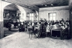
Girls sewed on machines while the piano was played. The institution
was led by the sisters of mercy who also taught there. From the girls’
facial expressions, their contentment and good humour can be read,
testifying to the kind educational methods of the sisters. It contrasts
with the haste, nervousness and high workload of today’s teachers.
PHOTOTYPE. AROUND 1925
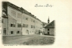
| 90 - A view of a little house , a pavilion and a greenhouse, in the Schönborn Garden
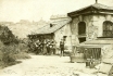
A southern view of a little house (perhaps for a gardener), a
pavilion and a greenhouse, in the Schönborn Garden. In the centre of the
background, the almost indistinct roof of the Schwarzenberg Palace at
Hradčany. There is an interesting text on the back: a son writes to his
father "I am sending you a postcard from the garden of the Counts of
Schönborn, taken by your camera." This is an example of sending a
photograph as a postcard. The person on the photograph is most probably
K. Tomsa, who made the photograph, signed it, and sent it to his father,
Director V. Tomsa, to Letiny Spa near Blovice, where he was staying
during the summer vacation.
PHOTOGRAPHIC POSTCARD. PHOTOGRAPHER PROBABLY K. TOMSA. 1912
| 91 - The Girls’ Orphanage of St Notburga in Šporkova Street, No. 321, a view of the south-west front
The house, called Šporkovský, has a late Baroque front with beautiful
stucco decoration. Originally it was called U Dvou zlatých (žlutých)
lvů (The Two Golden or Yellow Lions). From 1835, it was in the
possession of the Prague association of the ladies of St Notburga for
Orphan Girls’ Education in Ladies’ Art Work. This women’s association
was founded in 1813. Inside the building, there was St Notburga’s Chapel
with a painting by F. Čermák. On the right, a part of the front of an
interesting house U Kameníka (The Stonecutter) (see picture 92).
PHOTOTYPE. AROUND 1925
| 92 - The house U Kameníka (The Stonecutter) in Šporkova Street, No. 320
It is a large edifice, like a palace of irregular shape. Its north
front faces Janská Street, the east side looks to Šporkova Street (in
the picture). This narrow front, richly decorated with stucco, ranks
among the most important in the Lesser Town. The year 1729, inscribed
over the portal, reveals when a storey was added to the house and when
it was reconstructed in the Baroque style. On the left, a corner of the
St Notburga Institute; on the right, a house called Bílá voda (White
Water), No. 319, (with a garden in front), the original late Baroque
front of which was adapted to the Neo-Classical style. This is another
example of a picturesque quiet corner of the Lesser Town where several
buildings with very valuable architecture are concentrated in a small
area. This picture postcard is interesting in that it was issued by the
Artěl Art Cooperative, founded by two avantgarde Prague artists (P.
Janák and V. Hofman) in 1908. The output of the cooperative was
relatively broad-ranging, including modern objects of art, such as
furniture, textiles, wallpaper, ceramics, and also picture postcards.
The Cooperative, seated in Na Příkopě Street, was dissolved in 1934.
COLOURED LITHOGRAPH. AUTHOR OF THE DRAWING, M. H., ARTĚL, 1915
| 100 - A view through Karmelitská Street northwards

Towards St Nicholas’s Church and the U Klíčů (The Keys) opening (see
the closer detailed picture 94). On the left, the large front of the
German Institute for the Education of Teachers, No. 528. In the inside
area, there was a German grammar school, where Dr. M. Tyrš, the first
leader of the Sokol movement, studied. Above the rigorously functional
building, one can see the top of the gable of the Church of the Virgin
Mary Victorious, where the world-famous little statue of the Infant of
Prague is kept. On the right, the corner Rohanský House, No. 386, formed
by uniting and reconstructing two houses in 1787. In the street are
rails for two-way tram traffic. The tram is running southwards down the
electrified route from Malostranské Square to Smíchov. This connection
was built here, following some delay, after the first stage of
demolition of the house complex the Keys - the traffic did not start
until June, 1901.
PHOTOTYPE. AROUND 1902
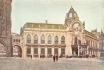
| 101 - A view through Karmelitská Street from the U Klíčů (The Keys)
opening towards Újezd
On the left, on the corner of Prokopská and Karmelitská Streets, is
the house U Zlatého pštrosa (The Golden Ostrich), No. 376, originally
from the 14th century, adapted to the Garni Hotel in 1884. The next in
line is the house U Černého lva (The Black Lion), also called the
Thun-Hohenštejnský Palace from 1747, No. 379, and behind it, the Grand
Muscon Palace. The former St Mary Magdalene Church is in the centre. In
1740, the Church had a beautiful Baroque front with two onion-shaped
domes. At the time the picture was taken, the whole building was already
converted into the Gendarme Barracks. At the turn of the century, two
bodies - the police and the gendarmes - were engaged in ensuring the
security of the monarchy. The police were active in the towns (in
Prague there were then over 1,000 policemen), the gendarmes in the
country. From the right: the house U Zlaté koruny (the Golden Crown),
No. 375, where the office of the association of Prague Removal Companies
and, on the ground floor, a pork-butcher’s shop were located. In front
of the shop, there is a van of the F. Zátka Company, a soda-water
producer and supplier. one can also see a palace building, the site of
the technical department of the office of the Imperial
Royal Vice-Governor; behind it, a hospital called Petřín.
PHOTOTYPE. F. J. JEDLIČKA, 1905
| 102 - The Imperial Royal Czech Science Secondary School in
Novodvorská Street, No. 457, a former grammar school
The house was built in 1876 and it was visited by Emperor Franz Josef
I in 1880. Inside the spacious building there is a gorgeous staircase
and the Chapel of St Wenceslas. The two-storeyed house of Count E.
Chotek is behind it. Chotek was, among others things, the owner of the
Nový Dvůr estate near Kutná Hora, from which the name of the street was
derived. The street is closed at the back by a low two-storey building,
No. 464 - a studio of J. Eckert (1833-1905), a court photographer and
municipal council member. In the early 1890s, he started to document the
Prague quarters scheduled for clearance, and most of the older pictures
published by Z. Reach in the 1920s originate from his estate. On the
left, in the background, the former Markvartský House, No. 462,
protrudes into the street, narrowing it down substantially.
PHOTOTYPE. AROUND 1908
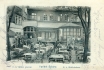
| 103 - The garden restaurant Na Nebozízku, also called Haasenburg, No. 411
It stands well up on the slope of the Petřín Hill, under the top
station of the funicular. Around 1800, there was a vineyard here,
through which a zig-zag path, in the shape of a small auger (nebozízek
in Czech), led up. At that time, B. Haase, a book-printer (1824),
acquired it; the restaurant building was named after him. After
integration into the town administration (1784), the Petřín area started
to decline, with some exceptions. In the first half of the 19th
century, the upper part of the park was turned into an orchard,
especially slope under Nebozízek, with the aim of establishing a
recreation area to counter-balance the densely populated parts of the
town. In 1882, this cultivated area started to be known as Petřín Park.
The steps of an ever-growing number of Prague inhabitants, in particular
lovers, made for Petřín in their leisure time. Subsequently, some
technical attractions were located here (a lookout tower, funicular,
mirror labyrinth) at the end of the 19th century. In the background of
the picture, one can see a glazed verandah, affording not only an
uncommon vista of Prague, but also a view of the moving funicular
carriages.
PHOTOTYPE. 1901
| 104 - The Petřín funicular - the route and the lower station
It was built in 1891 on the initiative of the Club of Czech Tourists,
in connection with the construction of the Petřín Lookout Tower and
with the staging of the Provincial Jubilee Exhibition. On the route, 397
metres long, with an elevation difference of 102.2 metres and a slope
of 26 degrees, two carriages moved with a 7-cubic metres water tank
each, on a common cable. The principle consisted in that the descending
carriage, with a full tank, used its weight to raise the ascending
carriage, with an empty tank. There were three rails (one in common), in
the middle with an abt shunting-place for the carriages to pass. The
journey took 6 minutes, the fare in 1891 was 12 kreutzers up and 6
kreutzers down; a return ticket cost 15 kreutzers, later on 12
kreutzers. On the top right, one can see the Petřín Lookout Tower, 60
metres high, the construction which was inspired by the Eiffel Tower in
Paris. It enjoyed the unprecedented interest of Prague inhabitants and
of the Jubilee Exhibition visitors; from its gallery, there was (and
still is) a ravishing view of the whole of Prague, and also far and
wide, as far as the border mountains in the north of Bohemia. Visitors
could also ascend the top of the lookout tower in a lift driven by a gas
engine for 1 crown in 1900.
PHOTOTYPE. PICTURE AROUND 1900. POSTCARD ISSUED AROUND 1910
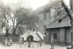
| 105 - The small Gothic, originally Romanesque, Church of St John the Baptist on the Laundry
It stands at the corner of Říční and Všehrdova Streets, close to
Újezd, in the centre of a picturesque group of little houses. The former
parsonage church is actually the last remainder of the mediaeval
village of Újezd, lying outside the Přemyslid walls of the new town
under the Castle. It originated in the early 12th century and there was
initially a cemetery around it. In 1660, the Lesser Town hospital, a
part of which can be seen in the background on the right of the Church
in Všehrdova Street, was established by the Church (see the next
picture). At the time of taking the picture, in the long abolished
Church, there was a store and sale of coal. On the furthest right, one
can see part of the corner house, No. 446, bought in 1585 by the Lesser
Town Municipality, and ceded to its clerk, J. Kocín of Kocínov, for 23
years’ free use. The house was also called Osecké prádlo (the Osek
Laundry) as the laundry of J. Holovský was once there. (It was pulled
down in 1903.)
PHOTOTYPE. K. BELMANN 1900
| 106 - A view into the courtyard of the former hospital, later called Na Prádle (The Laundry), No. 440
In fact, this is a courtyard of the Church of St John the Baptist
(which stands outside the picture on the right). The whole spacious
house, L-shaped on the ground plan, with, on the left, a Renaissance
column gallery, was built around 1660 by G. de Capauli. Most of the
picture is occupied by its north-east gallery wing. On the left, below
two arcades, one can see annexes which served as cellars or sheds. The
Church and the hospital, where about forty impoverished Lesser Town
burghers lived, were abolished in 1784. Then both edifices were bought
in 1787 by the burgher F. Vogl, and converted to a laundry. After that,
the house and the church got the nickname The Laundry. At the time of
taking the picture, neither the hospital nor the laundry was there, just
tenants were living in the house. Among them, maybe, was the cabman who
can be seen in the courtyard engaged in cab maintenance.
PHOTOTYPE. A. L. KOPPE. 1905
| 107 - The beginning of Chotkova Road, a view from the Lesser Town
embankment westwards
The street is a continuation of the Emperor Franz Bridge (today the
Legion Bridge), terminating at the Újezd Barracks. In the section in the
picture, the road is quite wide, since the row of houses on the left
(in the shadow) was built at the time when the original chain bridge
stood here. Its construction, including the anchoring of the chains,
reached up to Královská (formerly Mostecká) and Všehrdova Streets, i.e.
to the level of the corner of the first house from the right, No. 560,
hence far beyond the present embankment wall. The picture shows the
situation after the replacement of the chain bridge by today’s stone
bridge in 1901, after filling in the hollows of the former wedged-in
bridgehead and levelling the terrain. Three corner houses in the
postcard are typical of common civic housing in the last quarter of the
19th century.
SVĚTLOTISK. K. BELMANN 1905
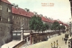
| 108 - A view through Chotkova Road from Újezd eastwards, towards
the Emperor Franz Bridge
Almost the whole street originated in the mid-19th century in
connection with the construction of the chain bridge in 1841, for which
Count K. Chotek, in particular, was responsible. Gardens and plots in
this area were parcelled out in 1839 with regard to the newly demarcated
axis of the future street. Two houses on the left and right, as far as
Šeříková Street, were among the first built here. The houses of the
so-called barracks type acted as an economical pattern for social
housing, for example, in the area of Karlín and Žižkov. In brick gallery
houses, with court-yard wings, were flats without bathrooms or toilets
(these were located at the ends of brick gallery and wings). Behind the
last house on the right, No. 530, are still empty plots. Later there was
housing, but on the other side, as can be seen in the preceding
picture. The southern side of the street now belongs to Smíchov.
PHOTOTYPE. F. J. JEDLIČKA 1901
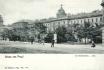
| 109 - A view of the southern part of the Újezd Barracks from Chotkova Road

On the left there stands a beautiful cast-iron column with a
decorative relief frame, denoting one of the public transport stops. The
inscription on the table reveals where the tram lines ran from here.
From this stop one could take the tram running to the left (to Smíchov)
or to the right (to Malostranské Square). On the portal of the stone
wall of the Barracks are an advertisement and sign-posts to the
funicular, the lookout tower, the café, and the restaurant on Petřín.
On the furthest left, a corner house, No. 419, with the shop of Mrs
Kejřová. From 1845, J. Barrande, a well-known French scientist, lived in
this house, with writer J. Neruda’s mother in attendance on him. One
cannot fail to notice the women, with their long skirts, sweeping the
Prague pavements and streets. It is certain that Prague streets were far
cleaner then than they are now.
PHOTOTYPE. KOLEM 1903
| 110 - The Újezd Barracks in the street of the same name
A noon picture of the east front of the Barracks, No. 413. They were
built around 1712 on the site of a part of the Petřín vineyard of F.
Fleischmann the Elder of Thunbach. In the north and south, they were
terminated by short transverse wings. In 1775 they were raised by one
floor. An interesting feature of the otherwise monotonous, strictly
functional, building were the pairs of chimneys protruding at regular
intervals, determining the width of the dormitories. The courtyard of
the Barracks, at an elevated level, was separated from the street by a
stone wall. Unlike the previous picture, here one can well see the rails
of the direct tram route Smíchov - Malostranské Square. One of the tram
stops is under the Barracks entrance. In the Barracks, J. neruda, a
Czech
poet and writer, was born on July 9, 1834; his parents owned a canteen
here. The Barracks were demolished in 1932.
COLOURED PHOTOTYPE. PICTURE AROUND 1902. F. J. JEDLIČKA, AROUND 1906
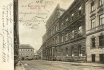
| 111 - The Albrecht Barracks
The spacious edifice was built in 1890 in a rather more pretentious
style than was the case with the other-wise standardized barracks
buildings of the Austro-Hungarian Empire. After the formation of the
Czechoslovak Republic (1918), the Barracks were renamed Štefánik’s
Barracks. Today, the Palace of Justice is here. After 1945, the Soviet
tank No. 23, which was allegedly the first to arrive to help
revolutionary Prague in May 1945, stood in front of the building. After
the events of 1989, it was discovered that the tank had actually been
chosen randomly. In 1990 it was painted pink by some radical members of
the then Federal Assembly, as a protest against outmoded symbols of the
former regime, and it was removed shortly after. The open space in front
of the Palace, originally nameless, was successively called Štefánik
Square, the Square of Soviet Tank Crews, and is now Kinských Square.
SVĚTLOTISK. K. BELMANN 1903
| 112 - A view from the entrance into the Albrecht Barracks, towards
Újezd Street northwards
The Barracks were named after the famous Austrian military commander,
archduke Albrecht. The street in the picture postcard is wrongly
denoted as Brückengasse (Mostecká Street). In fact, the latter ran on
the right, one block further along the front of the rear wing of the
Barracks. From the left, are new tenement houses, new Nos. 600-595,
reaching up to the Újezd Barracks, the southern traverse wing of which
can be seen in the background. Nearby stood the Újezd Gate, demolished
in 1892. In front of the Gate, there used to be a deep moat, serving the
people of the neigbourhood as an illicit dump and, in winter, for the
youth as a skating rink. A soldier is walking towards the photographer,
probably to the nearest pub round the corner.
COLOURED PHOTOTYPE. K. BELLMANN, 1900
113 - The Old Town Clock (horologue) on the southern side of the Town Hall tower
It was constructed in 1410 by Master Nicholas from Kadaň and the
astronomer J. Schindel. This original version of the clock was already
an impressive example of astronomical knowledge and the art of clock
construction. In 1490 the clock was given into the care of Jan z Ruože,
known as Master Hanuš, wrongly cited by some sources as the creator of
the horologue. He improved the clock by adding its dial, the display of
calendar dates and, apparently, also the figure of the Grim Reaper.
Another important caretaker of the horologue was, from 1552, J. Táborský
from Klokoty who improved the astronomical functions of the clock, and
devoted to it the remarkable manuscript entitled A Report on the Prague
Clock of 1570. The marching apostles were added to the horologue in the
18th century. In 1866 the decayed and long non-functional horologue was
repaired by R. Božek. The graphic decoration from that time was created
by the painter Josef Mánes. The original lower calendar plate is today
kept in the Prague City Museum, its copy on the horologue is the work of
E. K. Liška. The fire in the town hall in 1945 also partially damaged
the clock. It was brought back into operation in 1948.
COLOURED PHOTOTYPE. AROUND 1900
|
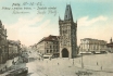
114 - The former Imperial and Royal Military Academy near the Powder Tower
The former Imperial and Royal Military Academy near the Powder Tower
which stood on the site of the present-day Municipal House, the Paříž
Hotel, the Trade Chamber and the Allianz Insurance Company. The
buildings in the picture were originally a part of the Royal Court built
in 1380 as the second residence of King Wenceslas IV. It was also used
in this way by subsequent Czech rulers until the tradition was
interrupted by Vladislav Jagiello who, in 1484, returned to Prague
Castle. The buildings underwent a number of reconstructions, first in
the 17th century for purposes of the Archiepiscopal Seminary, while
after 1777 it was used as military barracks and a military academy. In
1900 the Military Academy moved to its new premises in the Hradčany
Quarter. The decaying buildings of the old Military Academy were used
for housing circuses, while in the winters the space was used as a
skating rink. After 1902 the structures were demolished and the statue
of Franz Josef II, standing at the wall of the Barracks, moved
elsewhere. The former existence of a royal court in this location is
reflected in the name of Králodvorská ulice (i.e. the Royal Court
Street).
COLOURED LITHOGRAPH. THE BROTHERS KÜNZLI, ZURICH, 1898 |
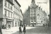
115 - The Powder Tower
The Powder Tower with adjacent small shops and the Church of St
Engelbert as seen from the U Hybernů Building. From the 13th century the
entrance to the Old Town was guarded by a gate standing on this site,
and which in the course of time decayed so much that popular parlance
began to dub it Odraná (The Tattered One/Gate). So in 1475 King
Vladislav Jagiello ordered the construction of a new gate which was
built a few yards away from the original one by Václav of Žlutice and
later Matěj Rejsek of Prostějov. Actually, the New Gate, as it was at
first called, was rather meant to impress than to serve any defensive
purposes, and the rich decoration of the structure was to be in accord
with the importance of the adjacent Royal Court which was linked with
the Gate by a bridge. However, after the King’s permanent removal to the
Castle in 1484, the Gate remained unfinished for centuries. It received
its current name due to the fact that in 1700 the building served as a
temporary storage place for gun- powder. In the meantime the unfinished
structure continued to dilapidate and, moreover, was seriously damaged
during the Prussian wars and so the damaged decoration was removed from
the gate after 1799. The year 1822 saw the installation of a clock and
the repair of the roof. The present Neo-Gothic appearance of the tower
dates to the years 1878-1886 when J. Mocker added new decoration to the
front, removed the clock and put a new roofing on the Gate. The small
shops on the right were constructed by the Prague Municipality in 1816
to replace the old wooden stalls standing until then in the Horse Market
and at Můstek. Around the year 1900 the buildings and lots on the site
of the former Royal Court Barracks were purchased by the Trade Bank in
what must have been one of the largest Prague land speculations of the
time. After its parcelling out the area should have been used for the
building of 11 residential buildings. However, in 1902 the Town Council
decided on the construction of its own representative Municipal
Building, and purchased the lots from the Trade Bank, as well as the
little shops adjacent to the Powder Tower from their owners. This was
really the luckiest hour of their lives as they grabbed the opportunity
and demanded the highest imaginable price - and got it. Thus e.g. the
watch maker Šťastný received for his premises of 10 square metres the
incredible sum of 200 thousand crowns (at that time the price of a
three-storey building in the centre of Prague)!
TWO-PART POSTCARD. PHOTOTYPE. K. BELLMANN, 1899 |
116 - A less usual view of the Powder Tower
A less usual view of the Powder Tower from Josefské Square showing,
among other things, the narrow lane between the gate and the Church of
St Engelbert which was a short-cut between Celetná Street and the
Square. In front of the Tower we can see small shops of traders and
craftsmen. The company signs inform us that they were dealing in (and
possibly also producing) shoes, hats, tobacco goods, etc. Such shops
were also in the rear part of the gate with shop windows facing the
lane. On the left, on the corner of Na Příkopě and Celetná Streets, we
can see the terraced building No. 966 with another row of small shops
(see also picture 115). The structure was owned by the oldest Prague
bank, the Czech Discount Bank, founded in 1863. The building housed a
pharmacy, a German bookshop and the Café Francais, one of the largest
and most elegant of its kind in Prague. In the years 1854-1865 the
building also housed the studio of the pioneer of Czech photography V.
Horn, and possibly (judging from the sign on the ground floor below the
terrace) also another well-known photographer, J. F. Langhans, during
the reconstruction of his house in Vodičkova Street. On the right we can
see the beautifully shaped iron-cast gas lamp-post, the work of A.
Lindsbauer. The lady in the foreground protects the whiteness of her
skin, as was the custom at the time, with a parasol.
PHOTOGRAPH. AROUND 1900 |
117 - The Baroque Church of St Engelbert in Celetná Street, next to the Powder Tower
It was built in the years 1676-1694, probably by J. B. Mathey for
Archbishop John Frederick, Count of Waldstein, as an Archiepiscopal
Seminary. After its abolition the Church was used as Prague’s garrison
church. During Easter celebrations it was used for display of a
militarily decorated Christ’s Tomb, and during the Resurrection it was
the starting point of military processions. The celebrations were
rounded off by a military parade in Na Příkopě Street in front of the
Černá růže (The Black Rose) Building. This happened in 1900 for the last
time. Three years later the Church was demolished to make way for
construction of the Municipal Building. The Church was adjacent to the
building of the Military Academy, in front of the Church was a small
park, today replaced by U Prašné brány Street. Most of the pedestrians
in the picture are going to the lane behind the Church which connected
Celetná Street with Josefské Square (see the previous picture).
PHOTOTYPE. F. J. JEDLIČKA, 1902 |
118 - A panoramic view of Na Příkopě Street and of the Powder Tower as seen from the building U Hybernů
This is a unique and little known picture of the temporary state of
affairs after demolition of the Church of St Engelbert, of the Military
Academy and of the small shops. The whole parcel was bought in 1899 by
the Trade Bank. The ideas about the use of the empty parcel were many.
Apart from intention to build residential buildings, the next most
popular idea was to construct the building of the Provincial Assembly of
the Kingdom of Bohemia. Eventually a lot of 4,200 square metres was
parcelled out, purchased by the City of Prague and used for construction
of the Municipal Building, begun in 1905. In the background on the
right we can see Art Nouveau structures in Petrohradská Street (nowadays
U Prašné brány), new Nos. 1078 and 1079, built in the years 1903-1904
and designed by B. Bendelmeyer and E. Weichert.
COLOURED PHOTOTYPE. 1904 |
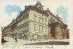
119 - A view of the Hotel Paříž on the corner of Králodvorská Street and Pařížská Street
A view of the Hotel Paříž on the corner of Králodvorská Street (on
the left) and Pařížská Street (on the right). The new social centres,
imposing hotels and cafés arising at the beginning of the 20th century,
were expressions of Prague’s ambition to become at least partly a match
for the established European metropoles, especially the metropoles of
potentially pro-Czech nations, Paris and St Petersburg. This is also why
one of the streets in this area was named after the Russian capital of
the time: Petrohradská. The first building on the left, No. 668, housed
the men’s tailor’s shop of A. Slavíček, and on the ground floor, the
cleaning firm of J. K. Novotný. The third building, No. 666, housed the
perfumery of the Imperial Royal supplier F. Prochaska. On the right is
the corner of the newly constructed building new No. 1079. Behind it we
can see a part of the scaffolding serving the construction of the
Municipal Building. Just off the picture on the right were low-rise
structures on the site of the later Hotel Steiner.
PHOTOTYPE. PICTURE AROUND 1906. K. BELLMANN, 1907 |
120 - The Hotel Paříž and the Palace of the Trade Chamber as seen from Josefské Square (from the building U Hybernů)
This block arose approximately on the site of the northern wing of
the military barracks. The imposing Hotel Paříž, new No. 1080, was built
in the years 1904-1905 and designed by J. Vejrych in a pseudohistorical
style combining Gothic and Art Nouveau elements. In 1900 the design of
the Hotel received one of the prizes at the world exhibition in Paris.
The adjacent palace of the Trade Chamber by A. Turek was built a year
earlier in a Neo-Renaissance style. The picture was taken shortly before
digging of the foundations for the Municipal Building which nowadays
hides the view of the other two buildings when we stand at the building U
Hybernů.
COLOURED PHOTOTYPE. F. J. JEDLIČKA, 1905 |
123 - A view of the Powder Tower and of a part of the Municipal Building in 1911
Shortly before its completion, as seen from the intersection of
Senovážná Street (on the left) and Hybernská Street. The favourable side
illumination emphasizes the Neo-Gothic sculptural decoration of the
Powder Tower with its figures of Czech kings and emblems of lands of the
Bohemian Crown. On the left we can see the Neo-Classical building with
the Café Francais and the cramped secondhand book shop of J. M. Berwald
below the terrace. On the right we can see a part of the wing of the
Municipal Building and its connecting corridor with the Powder Tower,
linked into one architectural whole (parallel with the bridge once
connecting the Powder Tower and the Royal Court). The Art Nouveau
building was constructed to the designs of A. Balšánek and O. Polívka.
Although criticised in its time as a monstrosity, it is undoubtedly one
of the most important buildings constructed in that style in Prague. It
stands out because of the rare balance between its external architecture
and the interiors. The work of the craftsmen and artisans, whether the
stucco, the metal chiselling, wood panelling, wallpaper or furniture,
all represents the pro verbial perfectionism of its time, and continues
to generate deserved admiration even today. The decorative work was
produced by such great sculptors as J. V. Myslbek, L. J. Šaloun, A. Mára
or J. Mařatka, and the painters A. Mucha, M. Švabinský, F. Ženíšek, J.
Preisler, J. Obrovský, J. Panuška and M. Aleš. The mosaic above the
portal of the main entrance is the work of K. Špillar, as are the mural
pictures in side, in the Smetana Hall. The Municipal Building was from
the very beginning a centre not only of social and cultural life, but
also of political life. In 1918 it was the site of many events connected
with the Czech nation’s yearning for its independence, crowned by the
Independence Declaration on October 28, 1918. The Building is still the
venue of concerts, balls, congresses, lectures, courses, important
rallies and many other events.
TWO-PART POSTCARD. COLOURED COMBINED PRINT. AROUND 1911 |
124 - The imposing front of the Municipal Building as seen from
Hybernská Street
The cranked wings of the Building lend emphasis to the entrance with
its balcony, as well as to the mosaic “Homage to Prague” by K. Špillar.
The central space in the Building is the Smetana Concert Hall. The
second storey houses salons in the wings, while the ground floor in the
right wing houses a café and in the left a restaurant. The café offered a
rich selection of periodicals from all parts of the Austro-Hungarian
Empire, as well as from the rest of Europe and overseas. It was possible
to peruse them for as long as you liked - all you had to do was to
order a cup of coffee. The ground floor, especially the rear wing
(facing Petrohradská Street) and the side wing (facing Pařížská Street)
were set aside for luxury shops. E.g. from Petrohradská Street you could
enter the exclusive tailor’s shop of V. Mareš. In front of the building
we can see the taxi-cab stand which moved here from the Trade Chamber
Building.
FOUR-COLOUR AUTOTYPE. MINERVA, 1912 |
125 - A view of Celetná Street as seen from the Powder Tower
This is the route along which the Czech kings went to the
Staroměstské Square and via the Lesser Town to the Castle on their
Coronation day. The attic of the Art Nouveau corner building, new No.
1078, on the right (see picture 118) was, around 1910, the lodgings and
studio of the leading Czech graphic artist and painter M. Švabinský, the
designer, among other things, of a number of Czechoslovak stamps and
banknotes. Behind it is the Baroque Pachtovský Palace with an attic
roof, No. 585, also known as The Little Royal Court. It was built after
the major 1689 fire, and in the mid-18th century reconstructed by K. I.
Dientzenhofer. At the beginning of the 20th century it housed the
renowned bookshop of J. Andrejs, on the opposite side was the most
important German book shop in Prague, that of Borrosch & André. The
roof of the next building, U Zlatého anděla (The Golden Angel), No. 588,
housed in about 1846 the daguerrotype studio of M. V. Lobethal. The
picture is a proof that at the time a true gentleman could hardly appear
on the street without a hat and cane.
COLOURED COMBINED PRINT. MONOPOL, 1910 |
126 - Celetná Street with the Powder Tower in the background
The northern side of Celetná Street with the Powder Tower in the
background. On the left we can see the Baroque building U Zlatého jelena
(The Golden Deer), No. 598, whose ground floor housed the prestigious
bookshop of A. Hynek. The facade of the building was under
reconstruction when the picture was taken. We can also see that hanging
scaffolding is by no means a recent invention, in fact it was patented a
long time ago by the Czech inventor Březina (see picture 535). In the
middle of the picture is the five-storey department store U Města Paříže
(The Town of Paris), No. 596, one of Prague’s two largest department
stores at that time. From the 1860s it was possible to buy here
stereophotographs (the store had its own projector where customers could
check on the pictures they were about to buy). The tall building gave
way in 1934 to a Functionalist building housing one of the shops of the
Baťa footwear chain by J. Gočár. Just operating in the street is a
horse-drawn tram connecting Malostranské Square in the Lesser Town and
the Quarter of Olšany.
PHOTOTYPE. K. BELLMANNM, 1899 |
127 - A view of the southern front of buildings in Celetná Street looking towards the Powder Tower
The original version of the street name, Caletná, documented as early
as 1300, was derived from calty, a kind of pastry similar to
present-day Czech Christmas cakes (also known in German cuisine as
Stollen). The buildings in the picture have undergone little change till
today, with exception of the Forberger Building, No. 564 (the first
structure on the right) which was somewhat unfortunately adapted for the
purposes of Charles University. The ground floor housed the shop of K.
Schuss which dealt in brilliant jewels, binoculars and omega watches.
The shop window is illuminated by three electric lamps belonging to the
shop, the advertising clock shows us that when the picture was taken it
was 7.30 in the morning. The next little shop, one of about thirty such
shops in Prague, was a Postcard Market. The buildings with Baroque
facades are obviously much lower than the tall structure U České orlice
(The Czech Eagle) of 1896 by F. Ohmann with frescoes by M. Aleš. The
last structure in the row, still with scaffolding, but practically
completed, is the unique Cubist building U Černé Matky Boží (The Black
Madonna - see picture 131).
PHOTOTYPE 1912 |
128 - The restaurant and the variety show of K. Sýkora in the courtyard of the Menhart Building, No. 595, in Celetná Street
The courtyard of this Baroque palace used to be a cheerful place in
the past. As early as the 18th century it hosted theatre performances
and
concerts, various artistes, such as rope-walkers, the Italian company of
flying men and puppeteers. Sýkora clearly tried to continue the
tradition of the house, even though Prague was teeming with
entertainment and artistic venues at the turn of the century. One of the
artists employed here in 1901 was the Hungarian singer and dancer G.
Székely who dressed in the uniform of a hussar captain, danced and sang
music-hall songs. Her portrait also appears on the publicity postcard
issued by Sýkora on the occasion of her guest performances in Prague.
And this is only one of many such postcards published by him. The
building is today home of the Theatre in Celetná and of the Theatre
Institute.
PHOTOTYPE. AROUND 1900 |
129 - The Turkish wine cellar Orient
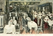
Was situated in the basement of the building U Černé Matky Boží (The
Black Madonna)the second storey of the building housed J. Tůma’s café of
the same name. The interior we can see in the picture may at first
sight create the illusion of the Orient (the narrow columns with
openwork semi-arches and ornamentation), however it was a far cry from
the real thing. The chairs with high backs remind one rather of typical
Czech peasant furniture, and the piano was also not exactly very
widespread in Turkey either. And of course the owners conveniently
ignored the fact that Islam strictly prohibits any kind of alcohol,
including wine. Nevertheless the numerous guests did not seem to mind,
probably also thanks to the fact that the waitresses were beautiful
odalisques. As far as the wine was concerned, the Monarchy was virtually
self-sufficient in its production, nor was there any dearth of high
quality tobacco goods, due to the 1878 Austrian occupation of
Bosnia-Herzegovina, the only oriental part of Austria-Hungary.
COLOURED PHOTOTYPE. 1912 |
130 - The garden of the Café U Červeného orla (The Red Eagle), No.593, in Celetná Street
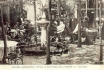
The Café, with its long tradition, was among other things a favourite
meeting place for Czech patriots and writers. The picture emanates the
sedate, almost family atmosphere of the place. The few tables of the
Café are close to each other, used by the small but regular clientele,
consisting chiefly of well-off burghers, advocates, journalists, owners
of nearby shops and realtors. The relaxed mood under the trees was, in
the summer, further underlined by the fountain (today’s air humidifiers
are only an imperfect substitute). It was equally pleasant to sit here
in the evening as the place was lighted by several gas lamps.
PHOTOTYPE. AROUND 1900 |
131 - The Cubist building U Černé Matky Boží (The Black Madonna), new No. 569
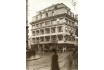
On the corner of Celetná Street and Ovocný trh Square was built on
the site of the original two buildings: U Zlaté mříže (The Golden Bars)
and U Černé Matky Boží, and it represents one of the highest
achievements of Czech Cubist architecture, unique in a world-wide
context. The sensitively designed building with its moderate Cubist
decor fits surprisingly well in the neighbourhood of prevalently Baroque
structures. Above the ground-floor shops, on the second storey, was the
spacious Orient Café, while the third storey housed a large millinery.
On the corner of the second storey, behind a gilded grille, is the
statue of the Black Madonna with her child, brought here from the
original building. The horse-drawn platform in front of the building was
used for the repair of tram wires. Even though there were already some
motor-driven fitting vehicles from 1909, they were still too few in
number to be able to carry out all the necessary work.
PHOTOGRAPH. 1912 |
132 -The Church of St James with monastery and the Old Town butchers’ shops
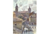
As seen from Masná Street looking towards Štupartská Street, which
becomes broader at this spot, turning into a little square. The place in
front of the butchers’ shops was used by stall-holders selling
vegetables and fruit. The Minorite Monastery was founded in 1232 by
Wenceslas I and appended to the already existing Church. The Baroque
remodelling dates back to the first half of the 18th century. The Church
used to be the church of the Old Town butchers whose shops, No. 956 (on
the left in the picture), stood in the neighbourhood of the Monastery
from times immemorial till 1935. The site is currently covered by a
park. The butchers, with their broad axes, were always ready and able to
defend the Monastery, whether it was during the Hussite riots, or
during the invasion of marauders from the Bavarian town of Passau in
1611. John Luxemburg granted the butchers a number of privileges, as
well as their own emblem: a one-tailed lion holding an axe. This was
also confirmed by Charles IV. The butchers’ shops were a popular part of
19th and early 20th century city folklore. People liked to go to the
shops to have their tripe soup, especially after a night spent in
dancing and other entertainment.
FOUR-COLOUR AUTOTYPE. AFTER A WATER-COLOUR BY J. ŠETELÍK, THE END OF THE 1920s.
V. KRÁTKORUKÝ, AROUND 1930 |
133 - A view of the Týn Courtyard and of the Church of Our Lady as seen from the eastern gate
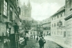
The word Týn is apparently of Celtic origin, and means among other
things a market surrounded by a wooden fence. Prague´s Týn (also called
Ungelt) was, between the 10th and 18th centuries, a center for
international trade and for the collection of custom duties from
imported goods. The foreign merchants were obliged to report themselves
in Týn, present their goods and sell it only wholesale and right on the
spot, provided they had paid their dues. The income from custom duties
belonged to the king, however the city was entitled to a provision for
collecting the money. In the picture we can see the western gate of the
Courtyard. To the right of it stands the beautiful Renaissance building,
No. 639, with its arcades, sgraffiti and frescoes, which was donated by
emperor Rudolf II to J. Granovský junior for his services. The inn (in
the picture under the Church) used to serve as a hotel for foreign
merchants. The more recent building on the right (behind the lantern)
was the seat of the Old Town Cemetery office which was responsible for
the management of graves. The architectural beauty of the long
dilapidating structures came to life again after the recent restoration
of the Courtyard.
PHOTOTYPE. K. BELLMANN, 1910 |
134 - A view of Štupartská Street looking towards the butchers’ shops
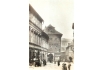
From the opposite angle to that in picture 132. The street section
between Ungelt (Týn) and the butchers’ shops is an example of a typical
narrow and meandering Old Town street. Such streets arose in times when
it was still usual to build on the spur of the moment rather than on the
basis of city planning. The advantage of such construction development
was easier defence in case of an enemy attack. On the left we can see
the building Nad Branou, (Above the Gate) No. 645, with the entrance to
the Ungelt. The two-storey Modrý dům (Blue House) behind it housed in
1835 the café U Komárků which was the meeting place of the Czech
National Revival elite including F. L. Čelakovský, K. H. Mácha, P. J.
Šafařík or F. Palacký. The originally Gothic corner building U Božího
oka (God’s Eye) with its beautiful Baroque front, No. 634, housed in its
courtyard a furniture factory. The shop-window of A. Walter’s
stationery displays a collection of postcards. The Minorite Monastery on
the opposite side of the street was one of the centres of education
from the time of Charles IV. The theological faculty of the Monastery
was a serious rival to the Jesuit Order even after the Battle of the
White Mountain when the Jesuits enjoyed the strongest official backing.
PHOTOGRAPHIC POSTCARD. PICTURE AROUND 1912. Z. REACH, 1920s |
135 - A view of Dlouhá Road from Staroměstské Square looking
towards Eliščina Street
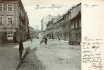
The name Dlouhá (Long) was used as early as 1310 and, with its 520
metres, it was indeed one of the longest streets in historical Prague.
It ended at a gate with a drawbridge over a moat whose filling in
created a free space on which the later Eliščina Street arose. Prior to
the rise of the New Town Dlouhá Road was the busiest street in the Old
Town, later it was overtaken by Celetná Street. Dlouhá was also known as
a street of breweries: in the 16th century there were 13 of them here,
and some of them operated until the end of the 19th century. The
buildings we can see on the right, with exception of the five- storey
building on the corner of Rybná Street, are still extant, without having
undergone substantial changes. The Art Nouveau building, new No. 714,
is interesting for the fact that it had its own lift as early as 1899.
On the left, on the corner of Rámová Street, stands the building U Dvou
zlatých nohů (The Two Golden Legs), No. 737. The two-wheeled cart in the
picture was the most frequently used vehicle for transport of goods.
PHOTOTYPE. K. BELLMANN, 1900 |
136 - Two Baroque buildings on the corner of Dlouhá Road and Masná Street
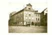
A view of two Baroque buildings on the corner of Dlouhá Road (on the
left) and Masná Street (on the right): the brewery U Zlaté štiky (The
Golden Pike), No. 705, with a tall gable, and the adjacent house U Zlaté
krávy (The Golden Cow). The name of the brewery is already documented
in the 15th century. In 1725 the building No. 705 was bought by F. M.
Kaňka, the creator of a number of Prague Baroque buildings who also had
the privilege to brew beer. Following demolition of the buildings an Art
Nouveau building was built in 1913 by K. Janda on a rather diminished
lot. This led to doubling of the width of Dlouhá Road. The house sign
from the original structure was moved on the building, and we can still
read its message today: this is a house ruled by the lord / we call it
the house of the Golden Pike. From 1915 this building was home of
Prague’s most famous Jewish writer, Franz Kafka (1883-1924).
PHOTOGRAPHIC POSTCARD. PICTURE AROUND 1907. Z. REACH, 1920s |
137 - A view from the intersection of Týnská Street, Dušní Street and Dlouhá Road
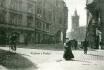
A view from the intersection of Týnská Street (on the left), Dušní
Street (on the right) and Dlouhá Road, looking towards Staroměstské
Square. Dlouhá Road had three narrow stretches along its course (see
also picture 136). Its intersection with Staroměstské Square was
broadened in 1906 by demolition of the corner Baroque building U Slona
(The Elephant), No. 609, by shifting the street line, and by creating
the arcade (for a view from the Square see picture 176). The building on
the left, No. 610, had been remodelled in Neo-Renaissance style and
elevated in 1885. The building on the right, new No. 925, on the corner
of Dlouhá and Dušní Streets, is one of the more recent buildings (it was
built in 1897). The picture captures atmosphere of a sunlit morning,
enlivened by the image of a maid with a cornet in her hand, a cycling
messenger and a street cleaner who seems to have already done his work.
The John Huss monument, which is today an integral part of the Old Town
scene, did not yet exist, being erected only in 1915.
PHOTOTYPE. K. BELLMANN, 1907 |
153 - A view of the Old Town
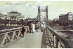
The Crown Prince Rudolf Embankment as seen from Železná (Iron), also
Řetězová (Chain), or Rudolfova (Rudolf) platform bridge. On the left we
can see the Rudolfinum, on the right the building of the Arts and Crafts
School. The pedestrian bridge was built in the years 1868-1870 at a
cost of 272 thousand guldens on the site of the time-honoured municipal
(lower) ferry to the north of the present day Mánes Bridge. The bridge
stood on only one pillar fixed in the river bed, it was 200 metres long
and 3.8 metres wide. The designer of the bridge was K. Veselý, iron was
supplied by the British firm Ruston & Co. and chains from another
firm in Sheffield. The bridge was removed in 1914, and the only trace of
its existence is the name of the Lesser Town street U Železné lávky (At
the Iron Bridge). At that time there already existed the neigbouring
Franz Ferdinand d’Este Bridge made of stone, nowadays called Mánesův
Bridge. The two soldiers in the picture are apparently on their way from
the nearby Bruské Barracks in the Lesser Town.
COLOURED COMBINED PRINT. V. KRÁTKORUKÝ, AROUND 1906
| 154 - The Rudolfinum, today called Dům umělců (The Artists’ House)
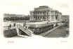
Was built by J. Schulz and J. Zítek in the years 1876-1886 in honour
of the Crown Prince Rudolf. The 2 million guldens this construction cost
was financed by the Czech Savings Bank. The northern wing of the
building holds art collections, the southern wing houses a concert hall.
Before the Second World War the Rudolfinum served as the seat of the
Czechoslovak Parliament. The building was erected on a terrain elevated
by dumps and in the context of the newly arranged embankment. The
original terrain was approximately at the height of the foot of the
staircase we can see in the forefront of the picture. This lower terrain
was apparently the level of the Jewish Town before its clearance. The
street between the railing and the Rudolfinum was called Sanytrová after
the enormous heaps of malodorous saltpetre (in colloquial Czech sanytr)
used for production of gunpowder. The heaps reached the height of
four-storey buildings and were here from the 16th century to the
beginning of the 19th century.
PHOTOTYPE. LEDERER & POPPER, AROUND 1904
| 155 - Complex of mostly Neo-Renaissance school buildings in Křižovnická Street, loking towards the Rudolfinum
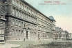
They were built here on an artificially elevated terrain in the years
1879-1885. On the left there is the Basic Boys’ School of St Francis,
its girls’ counterpart is in the other wing of the building facing the
embankment. The middle building housed the Institute for the Education
of Woman Teachers also called the Paedagogium, founded in 1870. The next
structure is the Arts and Crafts School built in the years 1881-1884,
to plans by F. Schmoranz junior and J. Machytka, as the first
institution of its kind in Austria. It also housed a Painters’ Academy
which, in 1902, moved to its own building in Letná. At the furthest
right we can see the beginning of a paved depression with railings and
stairs (see the previous picture) which provided access to older
buildings still standing on the original lower level of the terrain.
COLOURED PHOTOTYPE. F. J. JEDLIČKA, 1906
| 156 - Platnéřská Street as seen from Mikulášská Street looking towards Mariánské Square
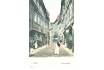
It used to be one of the oldest and most picturesque lanes in the Old
Town with gabled, originally Gothic houses, later remodelled in
Renaissance or Baroque style. From the 14th century it was called
Ostružnická (i.e. the spur street) or Platnéřská (i.e. armour-plated
street), after the most important product of the street’s craftsmen,
namely spurs or armour made from plate. However, the street was also
known for its production of arms. In the 17th century these crafts began
to fade from the street, and from the beginning of the 19th century the
street already had a new name, Klempířská (i.e. tinsmiths´street). The
building U Tří jezdců (The Three Riders), No. 121, on the northern side
of the street on the right, was at the beginning of the 16th century
owned by the caretaker of the Old Town Clock, Jakub. The building U
Železného muže (The Iron Man) beyond it, No. 119, used to be the seat
(from 1573) of the Guild of Armour Makers, as is reflected in the house
sign: a knight in armour.
COLOURED PHOTOTYPE. REINICKE & RUBIN, MAGDEBURG, 1904
| 157 - A view of Linhartské Square looking towards the Klementinum
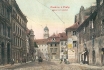
The space arose here in the Middle Ages through the parcelling out
of the Romanesque Jaroš Courtyard. It was on this site that, from the
end of the 13th century, stood the Church of St Linhart. Near the
Courtyard there was also a settlement of merchants, most likely French.
From 1346 the place was used as (and called) the New Hen Market, as it
specialized in selling poultry. The 16th century saw here a rise of
municipal kitchens for Prague’s poor. Hence another historical name of
this area, V Kuchyňkách (In the Kitchens). The Church of St Linhart and
its cemetery stood originally on the site depicted in the picture (on
lot No. 128). The second building on the right, No. 129, with the
protruding corner, stood close to the church entrance. In front of it
stands a Baroque structure which was probably constructed after
demolition of the Church in 1789. Standing beyond buildings Nos. 133 and
131 (in the middle of the picture) was, until 1791, the Church of Our
Lady in the Pool with a cemetery. While the left side of the Square is
still extant, the buildings on the right were all demolished in 1908.
COLOURED PHOTOTYPE. F. J. JEDLIČKA, 1906
| 158 - A view of Platnéřská Street as seen from Mariánské Square, looking towards Mikulášská Street
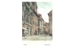
On the left, on the northern side of the street, we can see the
building U Zlaté koule (The Golden Ball), No. 106, with the inn U Města
Plzně (The Town of Pilsen) with a lantern above the entrance, beyond it
the Renaissance building U Sedmi Švábů (The Seven Swabians), No. 108, on
the corner of Žatecká Street. (The other corner building was, from
1865, a home of the Prague executioner, J. Pipperger, an upholsterer by
profession. Pipperger carried out executions till his death in 1888.)
Above the intersection with Žatecká Street continues the row of
buildings we can see from the opposite angle to that in picture 156. The
whole street was demolished in 1908, terrain elevated by 2 metres, and
on it the new axis of the new Platnéřská Street was fixed. On the site
of the whole left block of buildings up to the intersection with Žatecká
Street the City Library was built by F. Roith between 1926-1930.
Demolition of Platnéřská Street is undoubtedly one of the worst losses
that occurred in the wake of the Old Town clearance.
COLOURED PHOTOTYPE. K. ZUNA, AROUND 1902
| 159 - The northern side of Mariánské Square after demolition of the corner building No. 102 (in 1890)

On the left we can see the corner of the Klementinum, further the
building housing the City Library founded in 1891. The Library was moved
here in 1903. Its fund of books at the turn of the century amounted to
40 thousand volumes. The hefty four-storey building with the statue of
the Virgin Mary, Nos. 101 and 103, was owned by one Sommerschus who sold
and probably also produced stoves. The space around the heap of paving
blocks was covered until 1791 by the Church of Our Lady in the Pool and
by a cemetery (the name of the Church refers to the pools that appeared
here after each summer flood). The demolished building, No. 102, in
Platnéřská Street (in front of the buildings on the right) housed from
1771 the first workshop of F. Ringhoffer who enriched himself so much by
the production of vats for breweries that in the course of time he
could buy another five buildings in the neighbourhood. His descendants
then expanded production and in 1852 moved the now legendary firm to
large factory halls in the Prague Quarter of Smíchov where their
activities also included production of railway and tram cars. The
buildings in the picture were demolished in 1908, except for the rear
wings of buildings Nos. 101 and 103, to make way for the new building of
the City Library.
PHOTOGRAPHIC POSTCARD. PICTURE AROUND 1896. Z. REACH, 1920s
| 160 - The northern side of Linhartské Square looking towards Mikulášská Street
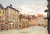
On the left there is the building U Kozla (The Buck), also called U
Zlatého čápa (The Golden Stork), No. 114, in the years 1840-1843 the
domicile of the author of the lyrics of the Czech national anthem and
playwright J. K. Tyl. Further we can see the buildings U Modré boty (The
Blue Shoe), No. 129, and U Černého orla (The Black Eagle) which share
the number 128 with two further structures. On the site of these two
buildings and in the space in front of them stood the above cited Church
of St Linhart with a cemetery. In the background we can see building
No. 12, U Zlatého zvonku (The Golden Bell) with arcades, which was a
part of Linhartské Square. It could not be seen from this place until
1798 as the view was obscured by the Church. All the buildings on the
left side were demolished in 1908 to make way for construction of the
New Town Hall. The Square was then changed into Linhartská Street, with a
new, shifted street line.
FOUR-COLOUR AUTOTYPE. AFTER AN OIL-PAINTING BY J. MINAŘÍK, AROUND 1907.F. J. JEDLIČKA, AROUND 1915
| 161 - A picture of the north-western part of the Town Hall block taken from the roof of a building in Kaprová Street
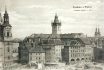
The opening to view of the original, narrow Mikulášská Street was
made possible by demolition of the whole block of old buildings
delimited by Kaprová and Žatecká Streets and Linhartské Square. The
group of structures we can see in the picture are among the oldest in
the Old Town (prevalently Gothic, on the left side remodelled in
Neo-Classical style and in Baroque style on the right side, with Nos.
12, 11 and 10 with Romanesque foundations). The best-known of them, the
building U Zelené žáby (The Green Frog), No. 13, with a famous wine
parlour, is in the middle of the picture, under the tower of the Old
Town Hall. The enclosure on the left protects the remnants of the
Romanesque building No.16, Andělská Kolej (the Angelic Hostel), the
former student hostel founded by Charles IV, which was uncovered during
clearance. The body of the structure was demolished in 1911, two
previous years of passionate polemics and protests notwithstanding. The
place became the site of the construction of the New Town Hall,
currently housing the Prague City Hall.
PHOTOTYPE. K. BELLMANN, 1909
| 162 - A view of Mikulášská Street with a part of the New Town Hall block as seen from Kaprová Street
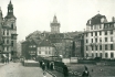
The tower on the left is that of the Baroque Church of St Nicholas.
Alongside it is the Neo-Baroque structure of 1902 by R. Kříženecký which
replaced the old Prelates’ Office of the abolished Monastery of the
Slavonic Dominicans, demolished in 1897. The former Prelates’ Office
housed, in the years 1859-1897, a workshop and a printing office of the
well-known firm K. Bellmann which later specialised in publication of
Prague postcards. Last but not least, it was the birthplace (in 1883) of
the writer F. Kafka. The picture shows the situation after clearance.
On the right there is the building of the New Town Hall, constructed
between 1908-1911 by O. Polívka. The side wing of the Town Hall creates a
part of the new Platnéřská Street. The empty lot next to the extended
Kaprová Street was used in the 1920s for construction of Pragues’ City
Administration Building. On the site of the stored construction material
stood the former Andělská Kolej (the Angelic Hostel) (see picture 161),
allegedly the oldest residential building in Prague.
PHOTOGRAPHIC POSTCARD. J. ŠOREYS, AROUND 1914
| 163 - The eastern front of the Klementinum at Mariánské Square
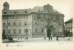
The Klementinum was founded by the Jesuit Order summoned to Prague by
Ferdinand I on the site of the older Dominican Monastery and Church of
St Clement, dating back to the 11th century (hence the Klementinum). The
construction of the whole Baroque complex was begun approximately in
1600 by C. Lurago, and completed about 1730 by F. M. Kaňka, and
possibly also by K. I. Dientzenhofer. The mission of the Jesuit Order
was to spread the Roman Catholic faith, education and school
institutions. In 1654 Ferdinand III connected the Klementinum University
with Charles University into one, Charles-Ferdinand University. In 1773
the Jesuit Order was abolished, and the Klementinum became the domicile
of the Archiepiscopal Seminary which was in turn moved to the Prague
Quarter of Dejvice in 1928. From 1842 the tower of the astronomical
observatory on the left was used for announcing noon (by thence waving a
flag). The book fund of the Klementinum Library amounted in 1900 to 2
million volumes. Today the whole Klementinum complex serves the purposes
of the National Library.
PHOTOTYPE. K. BELLMANN, 1899
| 164 - The northern side of Malé Square with a glimpse of Linhartské
Square

In popular parlance the whole area used to be called (and still is by
some) Malý ryneček (The Small Marketplace). On the left there is a part
of building No. 143, followed by the Neo-Renaissance building U Tří
bílých růží (The Three White Roses), new No. 142, built by F. Rechsiegel
in the years 1895-1897 with sgraffiti designed by M. Aleš. From 1850 to
1990 this building housed the most popular ironmongery in Prague, V. J.
Rott, nowadays it houses a luxurious delicatessen. The corner building U
Černého beránka (The Black Lamb), No. 138, constructed in 1871 by I.
Ullmann, was also owned by Rott. This building housed the Old Town Post
Office. On the right we can see a part of building No. 4. In the middle
of the Square there is a fountain with a Renaissance lattice from 1560,
which used to be covered on the cold days of winter with wooden casing
filled with manure to protect the lattice against freezing. A model of
this Renaissance square(to an authentic scale) could be seen by visitors
to the Ethnographic Exhibition in 1895.
COLOURED PHOTOTYPE. LEDERER & POPPER, 1898
| 165 - A view of the north-eastern front of the buildings of Malé Square
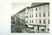
On the right we can see the Late Renaissance Petzold Building known
also as Zlatý roh (The Golden Horn), No. 4. The original ground floor
shops (such as that of the First Czech Dairy in Prague on the margin of
the picture) were removed in the 1930s to make way for the arcade
restoration. The arcades of the further five buildings had been
preserved. In the background we have a glimpse of the narrow Mikulášská
Lane with a part of the corner of building No. 128 on Linhartské Square,
linked at this point in time with the tram system. On the left, in the
space before the fountain, stands a miniaturized version of the
four-branch Lindsbauer gas lamp post. In comparison with the previous
picture it is obvious that the lamp post has undergone a curious
adaptation of the gas lanterns with what appear to be electric bulbs.
PHOTOGRAPHIC POSTCARD. PICTURE AROUND 1907. Z. REACH, 1920s
| 166 - The southern side of Malé Square
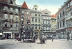
With the imposing, originally Gothic buildings owned in the past by
foreign pharmacists. There were seven of them in Prague at the beginning
of the 14th century, all of them settled in the Old Town, e.g.
Augustino of Florence whose pharmacy was in the building U Modrého
jelena (The Blue Deer, also known as the Richter House), No. 459 (the
first on the left), or Angelo, likewise from Florence, whose pharmacy
was in the building called V Ráji (In Paradise), No. 144 (the second on
the right). The other buildings also housed apothecaries, however only
one of them continues in the tradition: U Zlaté koruny (The Golden
Crown), No. 457 (in the middle of the picture). Apart from medicaments
the pharmacists used to produce various kinds of sweets (there were no
specialised sweet shops in those days). The Blue Deer Building also made
history by housing the first telephone exchange in Prague, launched in
1882 with 98 participants. Next to the fountain we can see the cast-iron
stand of the municipal water main.
COLOURED PHOTOTYPE. PICTURE AROUND 1910. R. MACHAČ, 1914. SENT BY POST ONLY IN 1974!
| 182 - A view of Na Můstku (At the Bridge) Street as seen from Václavské Square, looking towards Rytířská Street
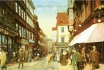
The ancient name is derived from the little stone Gothic bridge over
the moat which started at a gate in the Old Town fortification, and its
remnants are in the vestibule of the Můstek Metro Station. The
fortification still stood here long after founding of the New Town and
was demolished only at the end of the 17th century. The corner building
on the right, new No. 388, constructed in 1900, was known for the
department store of E. Löbl which sold cloth, and a café originally
called Kovářova, later the Edison. Beyond it stands a slightly older
structure with a bay called U Kasírů. Both buildings were demolished in
the mid-1970s in connection with construction of the Metro, and on their
site the building of the ČKD Company was erected in the 1980s. In the
background, on the corner of Provaznická Street, is building No. 386
with the shop of A. Müller. At the furthest left we can see the famous
jewelry shop of J. Rechner. The buildings on the left side of the
street, and the original buildings on the right side, between
Provaznická and Rytířská Streets, are still extant.
COLOURED COMBINED PRINT. AROUND 1905
| 183 - Na Můstku Street from an opposite angle to that in the previous picture

Thanks to this publicity postcard of the M. Pressburg Company (a
cravat manufacturer) we have an interesting view of Václavské Square. On
the left is the above-cited bay of the u Kasírů Building, new No. 387,
behind it is the building U Zlatého jednorožce (The Golden Unicorn),
protruding into the street. Its demolition in 1900 made it possible to
shift the street line, broaden the street and to build the Löbl
department store (see picture 312). On the right, behind the block of
buildings, once stood the Gate of St Gall, the largest and most
important gate in the Old Town fortification. However, by creating a
street in this area shortly after founding of the New Town which
connected the Old Town with Václavské Square, the Gate lost its
significance. The striking advertisement for the Na Příkopě based money
exchange of J. G. Selig proves that the busy centre of Prague could not,
even a century ago, do without exchange offices.
PHOTOTYPE. K. BELLMANN, 1897
| 184 - A picture of Melantrichova Street as seen from Rytířská Street, showing both sides of the street
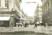
In the rear, in front of building No. 463, the street turns to the
right and eventually intersects with Staroměstské Square (see picture
186). On the left we can see a small group of ladies attracted by the
shop window of the firm O. Tuček. The exquisite Neo-Renaissance carved
frame of the shop window is decorated on the corner by two lions,
illustrating the name of this Neo-Classical building of 1835, built on
the site of three small Gothic cloth shops, namely U Dvou červených lvů
(The Two Red Lions). The Neo-Renaissance building, new No. 536, of 1894
on the opposite corner houses the City Savings Bank. This building also
replaced the original small shops (see picture 195). It was at that time
that the Prague city planners seriously considered demolition of a
number of buildings between Václavské Square and Staroměstské Square in
order to create a boulevard linking the two squares, passing through the
Na Můstku and Melantrichova Streets.
PHOTOTYPE. K. BELLMANN, 1907
| 185 - The south-western side of Melantrichova Street as seen from Rytířská Street
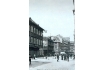
The first two buildings on the left, Nos. 962 and 514, and the lane
which separates them, arose in the 18th and 19th centuries on the site
of small mediaeval textile shops. This historical past is reflected in
the name of the lane: V Kotcích (The Small Shops). The third building on
the left on the corner of Havelská Street was in the 14th century owned
by J. Junoš, one of the handful of Prague burghers who lived in the
German Havelské Town. Junoš’s building housed in 1597 the printing
office of D. Sedlčanský who published what is regarded as the first
Czech periodical (according to the 1903 Chronicle of J. Ruth), Noviny
pořádné, probably one of the first Central European periodicals. As we
can see in the picture, the streets are cleaned by women, apparently
instead of the male street cleaners who had to go to war. Typical of the
first war years is also the fashion of gentlemen’s straw boaters which
spread like wildfire throughout Central Europe in the summer of 1914.
PHOTOGRAPHIC POSTCARD. PICTURE AROUND 1915. Z. REACH, 1920s
| 186 - A section of Melantrichova Street before Staroměstské Square
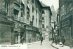
On the left we can see a part of a building, with another beautifully
carved window frame, which is probably a fashion shop, and beyond it
two buildings of the former Servite Monastery of St Michael, Nos. 970
and 971. The Baroque Monastery of the Servites was founded in 1628, and
abolished by Emperor Josef II. Next to the protruding corner with the
advertisement for the C. Lüftner Company (a warehouse for leather and
preparations for shoemakers) is the passage to the St Michael Church.
This church, first documented in 1313, saw, 90 years later, the first
preachings of Master John Huss. From the 17th century the street was
called Sirková (derived from the Czech word for sulphur, which was sold
here). In 1894 it was renamed after the Czech nobleman J. Melantrich
from Aventinum who owned his legendary printing office in the building U
Dvou velbloudů (The Two Camels), No. 471. This building is just off the
picture, to the right of the photographer. The pulled-down shutters hid
the shop windows of mostly furriers’ shops. The shutters had to be down
as it was either Sunday or one of the church holidays, both strictly
observed in the Austrian Monarchy.
PHOTOTYPE. 1908
| 187 - A view of Železná Street as seen from the Stavovské Theatre, looking towards Staroměstské Square
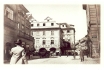
The name of the street was derived from the presence, from the 14th
century, of many ironmongeries in the street. In the 16th century the
street was inhabited by a number of foreign, especially German
merchants. On the left we can see the former Monastery of the
Shoe-wearing Carmelites linked to the Church of St Gall. One could get
to the Church through Havelská Street which begins at the corner
building U Goliáše (The Goliath). The building with an arcade and
gables, No. 495, and the building beyond it, No. 494, both dating back
to the 17th century, were demolished in 1898. They were replaced by a
Neo-Renaissance commercial and residential building (see picture 189).
On the right is the corner of the Karolinum and the lane leading to
Ovocný trh Square. At the time this picture was taken, the abolished
monastery housed the Association for the Advancement of Industries in
Bohemia, founded in 1833. From 1849 it was the seat of the Prague
Realgymnasium (grammar-school with a scientific bias) with Czech as the
language of instruction, and later the seat of the Imperial Royal Lace
Factory.
PHOTOGRAPHIC POSTCARD. PICTURE 1898. Z. REACH, 1920s
| 188 - The intersection of Melantrichova Street with Staroměstské Square
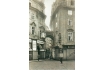
With the buildings Na Kamenci (On the Stone) and U Vola (The Ox).
Both buildings are connected by a horizontal arch. The narrowness and
meandering of mediaeval lanes was partly unintentional, partly
intentional. In the first case it was the result of the more or less
spontaneous attempt to make the most of the available space and to
broaden one’s own premises at the expense of the public road. This
arbitrariness was in some cases so flagrant that the use of parcels for
building had to be regulated by special rules. In cases where this was
intentional, the reasons were defensive, especially in towns bothered by
frequent enemy attacks, as the meandering streets offered better cover
to the defenders when retreating. In this Sunday picture we can see the
above-mentioned shops of A. Horák and E. Bittner (see picture 168).
PHOTOGRAPHIC POSTCARD. PICTURE AROUND 1910. Z. REACH, 1920s
| 189 - A view of Železná Street as seen from Rytířská Street
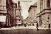
From an angle opposite to that in picture 187. The present picture
was taken several years later and from a greater distance. In the
picture we can see the corner of No. 539 with a shop selling linen
goods, and a part of the front of what is now called Stavovské divadlo
(The Theatre of the Estates) and what was then the Royal Provincial
German Theatre. On the site of two houses called U Goliáše (The Goliath)
stands a five-storey Neo-Renaissance building of the same name. The
name is also epitomised by the statue on the level of the second storey.
Behind the Theatre we can see a part of the building of the Karolinum.
Beyond it the street turns somewhat to the left and ends at the
intersection with Staroměstské Square.
PHOTOTYPE. K. BELLMANN, 1907
| 190 - Vejvodova Street, narrow and picturesque, as seen from Jilská Street, looking towards Michalská Street
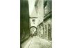
On the right we can see a part of the building U Zlatého kohouta (The
Golden Rooster), No. 430 (with a second front facing Michalská Street),
further the building U Žluté růže (The Yellow Rose), No. 431, with an
unusual roofed underpass which houses a part of a flat. Vejvodova Street
owes its name to the Lord Mayor J. V. Vejvoda who, in the 18th century,
owned a building on the corner of Jilská Street (No. 353 - on the
right, just off the picture). Previously the street was called Míčová
(Ball Street), after the real tennis court at the house on the opposite
corner of Jilská Street (No. 445, on the left, just off the picture).
This house was bought in 1675 by the Italian V. Ringolini. It was the
venue not only of ball games, but also of dancing parties. Ringolini was
one of the dancing masters who taught Prague people how to dance
foreign dances. He also acquired the exclusive right to hold balls in
the Old Town.
PHOTOTYPE. K. BELLMANN, 1909
| 191 - The building of the Karolinum on the corner of Železná Street and Ovocný trh Square
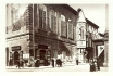
This centre of Charles University, the oldest university in Central
Europe, has always been connected with fate and social development of
the Czech nation. This was the case with issuing of the Decree of Kutná
Hora, with activities of John Huss, or with the student movement in
1848. The university was founded by Charles IV on April 7, 1348 for the
good of the Kingdom of Bohemia so that its inhabitants eager to get
acquainted with arts would not have to look for this abroad, but would
have access to these arts in their own kingdom. Of the original Gothic
Rothlev House only the bay Chapel of St Cosmo and St Damian survived the
Baroque remodelling by F. M. Kaňka. The ground floor used to house
shops of booksellers and pharmacists. Around the year 1910 the building
housed a hairdressers and the Maader and Son Company - the exclusive
representative office of the fishing company Nordsee. The space between
the Karolinum and the Stavovské Theatre (on the right) was used for
trading in dogs.
PHOTOGRAPHIC POSTCARD. PICTURE AROUND 1910. Z. REACH, 1920s
| 192 - A view of Havířská Street as seen from the Stavovské Theatre, looking towards Na Příkopě Street
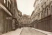
The name of the street has nothing to do with mining (as the Czech
meaning of the street name might indicate), but apparently arose as a
corruption of a name or a nickname of one or other of the two owners of
buildings in this street (Haller and Tobiáš, who both hailed from Kutná
Hora, a famous mining town). The street arose through demolition of a
part of the city fortification in approximately 1402. The fortification
ran approximately along the line of Provaznická Street, behind the
second building on the right. The fronts of the mediaeval buildings
standing before them, faced Ovocný trh Square. The structures in the
street are mostly Neo-Classical, with exception of the corner Baroque
building on the right, No. 398. The opposite corner house U Modrého
hroznu (The Blue Grapes), No. 580, was also Baroque, and in the 18th and
19th centuries housed a well-known café and wine-parlour frequented by
patrons of the adjacent theatre who came here after the performance
through a covered corridor linking the two buildings. After demolition
of the house U Modrého hroznu a new building was constructed here in
1899. In the background we can see the Rococo Sylva-Tarouc Palace in Na
Příkopě Street.
PHOTOGRAPHIC POSTCARD. PICTURE AROUND 1910. Z. REACH, 1920s
| 193 - The interior of the Old Town Marketplace

It was on this site that food and all kinds of articles were sold in
the open. Only increased hygienic demands of the 19th century, as well
as technical developments (electricity, artificial refridgeration,
heating, water mains, etc.) led to construction of covered market halls
with all the appropriate facilities. The first market built by the City
of Prague was erected in the public space between the new building
complexes in Rytířská and Ovocná Streets in the years 1894-1897 at a
cost of 2.7 million crowns. In the passage-like market hall accessible
from both these streets were over 300 stalls located among cast iron
columns supporting the glassed roof. Moving of the stallholders from the
open air to the market hall was no easy matter. The stallholders,
mostly women, were averse to the many novelties, not to speak of the
fact that the rent for the market hall stalls was by no means
negligible. However, eventually the spacious hall housed the majority of
the open-air stallholders from Vaječný trh (The Egg Market) in Rytířská
Street.
LACQUERED COLOURED COMBINED PRINT. D. KOSINER AND CO., 1907
| 194 - Rytířská Street
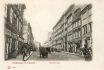
Rytířská Street between Uhelný trh and Ovocný trh Squares with the
Stavovské Theatre in the background. The name of the street (the Street
of Knights) was derived from the knightly tournaments documented for the
first time in connection with the Czech coronation of Charles IV, and
carried on still in the 18th century. Otherwise, the street was best
known as a marketplace, one of the largest in Prague, with a number of
stalls both in the street and under the arcades, full of hustle and
bustle. The articles sold here included practically everything: both
dead and live poultry, eggs, curds, butter, soups, doughnuts, coffee,
etc. The whole pother ended here in 1897 with construction of the market
hall inside the Neo-Renaissance administrative building designed by J.
Fialka. The hefty five-storey structure was built on the site of four
old houses, Nos. 405 to 408. Of the old buildings we can actually see
only the first three buildings on the right, originally mediaeval, with
arcades. The middle of the three buildings (No. 410) was from 1651 the
domicile of the famous Baroque sculptor J. J. Bendl.
PHOTOTYPE. H. SEIBT, MEISSEN, AROUND 1898
| 195 - Rytířská (Knight) Street between the Stavovské Theatre and Uhelný trh Square
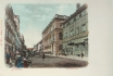
It was originally a part of the New Marketplace in the Havelská (St
Gall) Quarter, founded in the 13th century and inhabited by German
settlers. The Marketplace had an advantageous location between the Old
and the New Towns, and its importance grew even more after Charles IV
had ordered moving of the sale of some articles to this market from
Staroměstské Square. The stalls in Rytířská Street offered such varied
articles as cloth and fur, but also meat. After demolition of the stalls
in 1891 the street saw construction of the City Savings Bank designed
by O. Polívka and A. Wiehl, and built in the years 1892-1894 at the cost
of 1.2 million crowns. Cecorations on and in the building were created
by some of the leading sculptors and painters of the time. The
originally three-storey structure (in the picture) was elevated in the
1930s by one more storey. On the right we can see a part of the former
Carmelite Monastery, a Baroque building of 1671. In 1848 it housed the
St Wenceslas Committee, the leading Czech political authority during the
revolution of that year.
COLOURED PHOTOTYPE. LEDERER & POPPER, AROUND 1900
| 196 - A part of Rytířská (Knight) Street
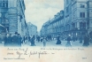
Between Melantrichova and Na Můstku Streets, looking towards the
Stavovské Theatre. Until the end of the 19th century this area was one
of Prague’s busiest marketplaces. The stretch on the left side used to
be called Husí trh, i.e. The Goose Market, as geese were sold here
direct from the wagons (a decent half of a goose then cost one and a
half guldens). In the area on the right side one could buy ironware and
other kitchen utensils. On the left we can see the corner of the newly
built City Savings Bank, on the opposite corner we can see the house U
Modré růže (The Blue Rose), No. 403, with the originally Gothic tower
which was a part of the Havelské Town fortification. The picture makes
it obvious that most of the market people had already moved to the
nearby market hall. The hustle and bustle and the usual haggling over
prices were replaced by the a metropolitan image of carriages and
pedestrians heading for Václavské Square.
PHOTOTYPE. E. SCHMIDT, DRESDEN - BUDAPEST, 1899
| 197 - Rytířská (Knight) Street with the Stavovské (Nosticovo) Theatre and the former St Gall Carmelite Monastery
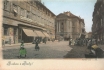
The Stavovské Theatre was built in Neo-Classical style in the years
1781-1783 by A. Haffenecker. It was further adapted in the 19th and the
20th centuries. The Theatre was founded by count Nostic-Rieneck, a
member of a group of patriotic Czech noblemen aiming to uplift Prague’s
cultural life. The Theatre became famous thanks to its performances of
W. A. Mozart: The Marriage of Figaro and the premiere of Don Giovanni in
1787. Language of the performances was prevalently German (until 1920),
but at certain periods also Czech. Thus, e.g., in 1834 the Theatre saw a
performance of J. K. Tyl’s comedy Fidlovačka to the music of F. Škroup,
which included the future Czech national anthem Kde domov můj. The
monastery building on the left was built in early Baroque style by D.
Orsi and M. Lurago. On the right we can still see a few remaining
stalls.
COLOURED PHOTOTYPE. K. BELLMANN, 1900
| 198 - The northern side of Havelská Street (also called Zelený/Zelný trh)
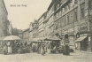
The area is a part of the former marketplace of the Havelské Town.
The street saw, among other things, the cheerful coronation of Wenceslas
II on June 2, 1297 when wells yielded wine rather than the usual water.
Another famous historical celebration took place here in connection
with the coronation of Charles IV on September 2, 1347. After 1362 the
original marketplace of Havelské Town was divided by small shops into
two parallel streets, today’s Rytířská and Havelská (in the picture).
The houses with Gothic arcades have retained their historical appearance
until today, with exception of the corner house U Mrázů, No. 504 (on
the right) which was in the 1920s insensitively reconstructed for
purposes of the bank on the opposite corner. The Czech name of the
market (Zelený or Zelný) means Green or Cabbage, with vegetables still
being the chief article sold here today. Even though the picturesque
sun-shades and the baskets of the market women belong to the past, the
local marketplace remains the most popular marketplace in Prague.
PHOTOTYPE. K. BELLMANN, 1907
| 199 - The north-eastern side of Uhelný trh Square as seen from the intersection with Martinská Street
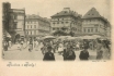
It is from here that we can best see how the original marketplace of
Havelské Town gradually split - through erection of stalls and of two
rows of buildings - into three streets: Rytířská, V Kotcích and
Havelská. On the left the square intersects with Skořepka Street.
Protruding in front of the intersection is building No. 424, with the
café U Tří stupňů (The Three Grades) (see picture 201). Until the
beginning of the 19th century there was a smithy in the middle of the
Square which also sold charcoal - hence also the Czech name of the
Square: Uhelný trh (The Coal Market). At the time of taking of the
picture the articles sold here also included cut flowers and funeral
wreaths. As in Ovocný trh, the Uhelný trh Square was also location of
many refreshment stalls. Until the First World War you could obtain here
a ladle of hot potatoes or noodles, a cupful of soup or a big doughnut,
any of these for a mere two kreutzers.
PHOTOTYPE. K. BELLMANN, 1900
| 200 - The south-eastern side of Ovocný trh (The Fruit Market) Square

From the 14th century to the 18th century the Square was called Masný
trh (The Meat Market) after the chief article sold here in this period.
From the 18th century the market was reserved for sale of vegetables.
It was open throughout the year, with the busiest time being obviously
between spring and autumn. But even at times when no fresh local fruit
was available, the stalls offered dates, figs, oranges, pressed
appricots, nuts and many other fruits. The first buildings on the right,
Nos. 576-574 (the last one with a passage to Na Příkopě Street), were
demolished at the end of the 1920s. For a long time it remained empty,
until in 1997 the commercial centre Myslbek was constructed here. The
fourth building, No. 573, with the former hostel established in 1381 by
Wenceslas IV for masters of the free arts, was also used as a passage to
Na Příkopě Street, but was broader, with a number of small shops,
especially furniture shops. This commercial passage, one of the first in
Prague, was established in 1872. The next building with the broken
gable housed, in the years 1539-1784, the Prague Mint.
PHOTOTYPE. PROBABLY E. ČÍŽEK, AROUND 1900
| 201 - The building with the Café U Tří stupňů (The Three Grades) in Uhelný trh Square, No. 424
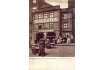
It is the only building of the row of arcaded old buildings which
lined the western side of the Square which is still extant. All the
other buildings were demolished and on their site was constructed the
residential building U Šturmů (on the left, on the corner of Skořepka
Street), and in 1883 a school building (on the right). The Café, also
called U Sester kafíčkových (The Coffee Sisters), was mostly frequented
by greengrocers and other stallholders. A hefty cup of coffee with milk
was offered at a price of 8 kreutzers, i.e. 16 hellers, at a time when,
for instance, a stamp for a postcard cost 5 hellers. The second-hand
clothing shop (next to the Café) certainly suffered from no dearth of
customers. The market woman in the foreground is selling her products
immediately from her basket. This postcard was used by the owner of the
Café for publicity purposes.
PHOTOTYPE. UNIE PRAGUE, AROUND 1900
| 202 - The north-western side of Ovocný trh Square looking towards Celetná Street
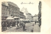
The first two buildings on the left, Nos. 560 and 563, were in the
1960s reconstructed for use by Charles University. The fifth,
five-storey building U České orlice (The Czech Eagle) was constructed in
1896 by F. Ohmann in an attempt to create a specific Czech
architectural style combining elements of Gothic, Renaissance and Czech
folk architecture. At the end of the row we can see the building U Zlaté
mříže (The Golden Bar), No. 570, replaced in 1912 by Gočár’s Cubist
building. In the background we can see the jagged wing of building No.
587 which, in the revolutionary year 1848, housed the headquarters of
the ill-famed Austrian General Windischgrätz who suppressed the
democratic rebellion. Interesting period details include the gas lamps
lighting the shop windows on the right, as well as the stylish public
convenience behind the sun-shades.
PHOTOTYPE. K. BELLMANN, 1899
| 203 - The Church of St Gall (Havel in Czech) as seen from Zelný trh Square
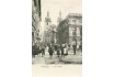
The originally Gothic church was founded by Wenceslas I in 1232 as
the parish church for the Havelské Town. Later the Church served as a
grave for remains of St Gall acquired by Charles IV in St Gallen,
Switzerland. The Baroque remodelling of the Church was carried out in
1723-1738. Unfortunately, the Neo- Renaissance building of the City
Savings Bank built on the site of the former stalls partly obscures the
view of the Church. The area in front of the Church, and the narrow lane
along it, was in the 18th century covered by stalls, standing mostly in
the arcades, and rented from their Christian owners by Jewish merchants
from the ghetto. Due to the noise of their trading, the Jewish
merchants had permanent conflicts with the Carmelites. This area was
called the Jewish Tandlmarkt, to differentiate it from the Christian
Tandlmarkt on the site of Zelný trh Square.
PHOTOTYPE. KOLEM 1900
| 204 - The courtyard of the Mühldorf House, No. 185, with a passage conecting Anenská and Karlova Streets
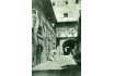
The original low-rise mediaeval structure was reconstructed many
times over, as is attested by its current four storeys with its
Neo-Classical front facing Karlova Street, and by its courtyard annexes
with a porch and the large lunette windows. In contrast to the small
windows of the main wing, these had the advantage of allowing more
sunlight into the flats, certainly a fact welcomed by families with
children who were tenants of this building. Apart from the posing
family, we can also see omnipresent, practical two-wheeled carts. From
1902 the building was owned by the Jewish religious community which also
established here a ritual mikve bath. In the period between the two
world wars the Prague brewery Pragovar opened here the beerhouse U
Rytíře Malvaze which until recently served many generations of students
who came here from the nearby Klementinum Library.
PHOTOTYPE. K. BELLMANN, 1909
| 205 - The southern part of Husova Street from the Church of St Giles, looking towards Na Perštýně Street
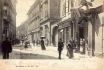
Originally Dominikánská (Dominican) Street, it was renamed in 1870
after the church reformer Master John Huss. On the right we can see
building No. 241 which, from the end of the 14th century, held the
Archives of the Property Register of the Czech Kingdom. The third
building on the right housed the German Technical University in Prague,
while the Czech Technical University had its home in Charles Square. The
corner building, No. 236, housed the Old Prague Pub called U Vocelků,
renowned for its cuisine and good beer. The large shady garden was on
Sundays the venue of afternoon and evening brass band concerts which
diffused noise throughout the otherwise quiet environment.
PHOTOTYPE. K. BELLMANN, 1902
| 206 - Betlemské (Bethlehem) Square looking west
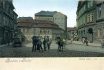
In the middle we can see the bulky house U Halánků, No. 269, a former
brewery plus malthouse owned from 1826 by the Náprstek family. V.
Náprstek, a Czech patriot and traveller, inspired by technical progress
in America, decided on his return from the U.S. in 1858 to found a Czech
Industrial Museum. He used the building U Halánků for this purpose and
also, in 1886, the newly-built four-storey building (in the background)
designed by A. Baum and B. Münzberger. Later the Museum also included
ethnographic and historic collections. In the Middle Ages the Square was
the site of the Bethlehem Chapel used by John Huss for his preachings.
The Chapel was demolished in 1784 and its remnants can be found in the
building No. 255 (at the furthest right). In the 1950s, following
demolition of both buildings on the right, the Chapel was reconstructed
in a somewhat modified form.
COLOURED PHOTOTYPE. K. BELLMANN, 1900
| 207 - The northern part of Husova Street
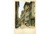
Between the intersections with Karlova Street and Mariánské Square.
On the right we can see the house U Hesínů, No. 154, with the
exquisitely carved shop-window of the firm Raymann and Co. which had
here a store for its linen and table-cloths. The Austrian Eagle with two
heads, with the imperial crown and with winged lions on the sides,
attests to the fact that this firm was an Imperial Royal Court supplier.
The next building, the originally mediaeval house U Zlatého koníka (The
Golden Horse), was remodelled in Neo-Classical style in 1804. Behind it
stands one of the leading works of the Prague Baroque, the monumental
Clam-Gallas Palace built in 1713-1729 by J. B. Fischer of Erlach. It was
in fact a reconstruction, using remnants of the Gothic palace of the
margrave John Henry, brother of Charles IV. The decoration, including
the eight giants on both entrance portals, is the work of M. Braun.
Currently the building houses the Prague City Archives, founded in 1851.
The original location of the City Archives was in the northern wing of
the Old Town Hall which burnt down during the anti-Nazi uprising in May
1945. While a great deal of the archive materials burned to ashes, the
preserved documents were deposited in the Clam-Gallas Palace.
COLOURED PHOTOTYPE. K. BELLMANN, 1899
| 208 - Seminářská Street
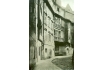
Meandering around the Klementinum complex to the right to Karlova
Street. The name of the street was derived from the General Seminary for
Priests founded in 1783 by Josef II in the Klementinum. Looking at the
sunlit facades, we can see on the left in the shade a part of the
Trauttmannsdorf House, No. 159, earmarked for demolition to provide the
Seminary standing on the opposite side of the street with more light.
Fortunately, the plan was never realised. The following building, the
little Nostic House, also called U Černé hvězdy (The Black Star), No.
177, is a Renaissance structure with exquisite sgraffiti on the front.
The street continues with building No. 176 with a Baroque front,
followed by the house U Zlaté studně (The Golden Well) with Baroque
porches on brackets, a bay and two gables. In 1900 the City Electric
Transportation Company intended to include even this narrow lane in the
tram network. However, the protests of experts and of the Club for Old
Prague, prevented this plan from materialising.
PHOTOTYPE. K. BELLMANN, 1909
| 209 - The house U Zlaté studně (The Golden Well), No. 175
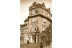
On the corner of Karlova and Seminářská Streets. The name of the
house was apparently derived from a legend about gold treasure hidden in
the local well. The facade of the originally mediaeval house is
remarkable thanks to its Baroque stucco decoration by J. O. Mayer dating
from the beginning of the 17th century. The front relief shows
altogether seven saints, including St Rochus, the patron saint of plague
sufferers (on the right above the shop window). St Rochus apparently
owes his inclusion among the saints to the fact that the house owner, J.
Wersser, and his wife survived the plague epidemic of 1714. Due to the
decrepit state of the house, it underwent a partial renovation in 1957
during which the shop window was removed. The structure returned to its
original beauty only in 1987 when the fourth storey was completely
rebuilt. The building was connected with the adjacent building in
Seminářská Street which had to be rebuilt too. Karlova Street (on the
right), although narrow and meandering, used to be one of the most
important and busy streets of Prague, a part of the Royal Coronation
Route, and a part of routes for other processions between Staroměstské
Square and the Castle.
PHOTOGRAPHIC POSTCARD. PICTURE AROUND 1910. Z. REACH, 1920s
| 210 - A view of the intersection of Jilská and Jalovcová and Karlova Street
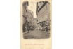
A view of the intersection of Jilská (on the right) and Jalovcová (on
the left) and the little Karlova Street in the background. This is how
the final stretch of Karlova Streets between Husova Street and Malé
Square, a part of which we can see behind the group of buildings in the
middle, was popularly known. The little Karlova Street runs a somewhat
complicated course in this area. It starts behind the first building on
the left, it turns into the above-described stretch, and finally ends in
Malé Square (in the background on the right). Jilská (St Giles) Street
is so called after the nearby Church of St Giles of the 14th century,
belonging to the Dominican Monastery. The first house on the left, U
Kočků, No. 147, originally Gothic with a Romanesque core, a wonderful
Baroque front and portal, was owned around the year 1700 by I. Bull, the
administrator of tobacco production in Bohemia. The opposite building, U
Velryby (The Whale), No. 453, used to house the Czech People’s
Bookshop, including a secondhand bookshop, and the publishing house of
J. Springer which specialised in musical literature.
PHOTOTYPE. AROUND 1900
| 211 - The little Karlova Street, looking towards Jilská Street
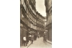
The narrow lane was part of the Royal Coronation Route. It used to be
one of the busiest Old Town streets with a large number of shops. On
the left we can see the above-mentioned house U Hesínů, housing the shop
of Raymann and Company, and beyond it building No. 152. Further, we can
see building No. 149 with its three dormer-windows in the gable. It
arose through linking of two Gothic houses and by their Neo-Renaissance
remodelling in around 1600. It has a beautiful courtyard with
Renaissance arcades, and with Renaissance and Baroque ceilings in some
rooms. On the building we can see the circular-shaped advertisement for
jackets manufactured by the Dejl Company. Beyond it is No. 146, whose
corner can be seen in picture 210. This building housed the umbrella
shop of J. Morgenstern. On the right we can see the house U Panny Marie
Pomocné (Our Lady of Succour) of the 14th century, with a facade
remodelled in Neo-Classical style, and with the clothing shop of J.
Löbl. The shop windows have their own electric lighting. The first shop
on the left has only the metal holders on which the lights are yet to be
fixed.
PHOTOGRAPHIC POSTCARD. PICTURE AROUND 1912. Z. REACH, 1920s
| 212 - Křižovnické (Knights of the Cross) Square as seen from the Old Town Bridge Tower
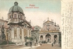
Its present appearance dates back to 1849 when the statue of Charles
IV was erected here at a cost of 60 thousand guldens (acquired through
public collection). The dominant structure of the Square is the domed St
Francis Seraphinus Church of the Knights of the Cross, built between
1679 and 1688 to the plans of the French architect J. B. Mathey. The
Church is a part of the Monastery of the Knights of the Cross with the
Red Star, the only purely Czech order, founded by St Agnes of Bohemia in
the 13th century. In the middle we can see an entrance to the
Klementinum, next to it the Church of St Salvator, founded in 1578 by
the Jesuits. The Early Baroque front of the Church was finished in 1601.
The entrance portico is most probably the work of C. Lurago, the
statues on the front were created by J. J. Bendl. In the background we
can see an electric tram passing from the National Theatre to Linhartské
Square, while the horse-drawn tram in the opposite direction is heading
for the Charles Bridge.
COLOURED PHOTOTYPE. 1905
| 213 - The Old Town Mills and Waterworks with Novotného lávka
(Novotný Bridge) (on the left) and the Karlovy (Charles) Baths
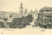
The access bridge is so named after an old Prague family of millers.
Mills stood in this place from time immemorial, and in the 15th century
a water tower was added (in the middle). The water ran from the tower
through a wooden pipe-line to public fountains. The buildings in the
picture were built later, after two large fires in 1848 and 1878. On the
left we can see the Waterworks, No. 201, built by A. Wiehl in 1883 on
the site of a burnt-out mill in the Czech Neo-Renaissance style. Another
building on the site of the Mills, No. 200, also dates back to the end
of the 19th century. The Waterworks was closed in 1913, following
construction of a water main bringing water from Kárané. The buildings
to the right of the tower, standing along Poštovská Street, Nos.
198-194, were constructed after 1848. The middle double building housed,
until the 1970s, the Karlovy Baths. The new building (at the time of
taking of this picture on the right), new No. 206, was built after 1896
on the site of three older buildings.
PHOTOTYPE. AROUND 1900
| 214 - The first Prague embankment, the Franz Embankment

Was constructed after demolition of old buildings in the period
1841-1843. After Na Příkopě and Ferdinandova Streets, this was the third
Prague promenade, affording a new, intriguing view of the Hradčany
Castle. The Neo-Gothic statue with the equestrian statue of Emperor
Franz I was erected at the expense of the Czech Estates. The foundation
stone was laid in August 1845 on occasion of the arrival of the first
train in Prague. The statue has a shape of a Gothic tower with the
bronze statue, created to the model of J. Max, inserted into it. In the
lower part of the statue, which serves as a fountain, we can see 25
allegorical stone statues by the same sculptor. In 1919, after the Czech
Declaration of Independence, this pro-Austrian statue was moved to the
Lapidarium of the National Museum, while a part of the original monument
still adorns the Embankment. The buildings in the picture are
Neo-Classical. Electric trams started to operate on the Embankment in
1901.
COLOURED PHOTOTYPE. 1901
| 215 - The last journey of a horse-drawn tram
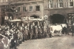
From Křížovnické Square over Charles Bridge to the Lesser Town on May
13, 1905. In front of the white horses drawing the festively decorated
car full of passengers went a policeman, behind the carriage a numerous
crowd of Prague locals. After that horse-drawn trams were replaced by
electric trams with special electric mains providing power from below
(see the caption to picture 38), because conservation considerations
ruled out erection of columns for electric trolley wires. Humorous
periodicals then suggested that the wires could be fixed to the throats
of the stone saints on the Bridge. A humorous postcard illustrating this
idea was even published. At any rate, the supply of electricity from
below led to many problems and, following intervention of the General
Inspectorate of the Austrian Railways, the trams were withdrawn from
Charles Bridge for good after three years of operation, even though the
trackage remained here till 1914. In the picture, behind the horse-drawn
car, we can see electric trolley wires leading to both routes
connecting Křižovnické Square and the Franz Embankment. It is a little
curious that the optician J. Šebek anounces in his advertisement (next
to one of the thoroughfares) that he has at his disposal his own home
telegraph.
PHOTOGRAPHIC POSTCARD. PICTURE 1905. Z. REACH, 1920s
| 217 - The garden restaurant on Střelecký ostrov (Fusilier Island)
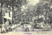
It offered a place of repose in the midst of nature and in the shade
of trees in the very heart of Prague. The music pavilion in the
background hosted a military band every day. In some restaurants it was
usual to print the programme on the back of postcards which could be
posted by the visitors during the concert. The name of the Island is
fitting as it has always been used for shooting (first with bows, later
with rifles). However, the Island was also the site of mills, and for
some time it was used for growing hops. Prague’s marksmen began to use
the Island under Emperor Ferdinand I, and in 1742 they acquired the
Island which became their property. In 1812 they opened a new shooting
range and an inn. The shooters here also included - during their Prague
stays - Emperor Franz Josef I and the Crown Prince Rudolf. In 1882 the
Island hosted the first grand Sokol Rally. The Island was also sought
out by workers’ organizations for their celebrations - thus it hosted
the first May day celebrations in Bohemia in 1890. The Island also had
its own baths and a swimming pool. Information on the entrance fees
appears on the board fixed to the tree.
PHOTOTYPE. E. JÍLOVSKÝ, 1916
| 218 - A bird’s-eye view of the former Convent of St Anna
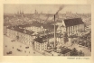
Between Anenské Square (on the left) and Liliová Street (behind the
Church). However, the picture is not necessarily quite true to reality.
The Convent, No. 211, was founded as a Templar monastery in the 13th
century. From 1313 it housed nuns belonging to the Convent of St
Dominic, whose spiritual needs were met by the new Gothic red-brick
Church of St Anna (in the picture without the tower which was removed in
1870). Following closure of the Convent and the Church, the buildings
were bought in 1795 by the printer Schönfeld. He quickly became rich
through publication of official gazettes in both German and Czech from
1786, and so he could devote himself to his passion - collecting
antiques. From 1835 the buildings housed the printing firm of B. Haas,
which also owned the adjacent building No. 948 (with the chimney) which
housed a part of the printing office and a storehouse.
PHOTOGRAVURE. PROBABLY AFTER A WATER-COLOUR OR GOUACHE FROM AROUND 1900. PUBLISHED AFTER 1910
| 219 - The Emperor Franz Chain Bridge connecting Ferdinandova Street
via the Střelecký Island with Chotkova Street
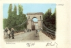
It was built in the years 1839-1841 by V. Lanna to the plans of B.
Schnirch. Until then Prague had only one bridge - Charles Bridge. The
chain bridge had five quarry-stone pillars, it was borne by four chains
on either side, and the bridge decking and railing were wooden. Built at
the cost of 333 thousand guldens, it was no doubt elegant, but its
unstable construction led to swaying, and it could not be used by the
horse-drawn trams. The passengers had to get off at the National
Theatre, cross the Bridge on foot, and continue on the other side by
taking another tram. At the same time the crossing of the Bridge was
mercilessly taxed at 1 kreutzer (no bridge toll was collected on Charles
Bridge). As early as 1870 experts aired their objections to the lack of
safety of the Bridge, its use was gradually limited, and finally in
1898 it was removed.
COLOURED PHOTOTYPE. AROUND 1896
| 220 - A temporary bridge
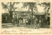
A temporary bridge, serving during construction of the new Emperor
Franz Bridge in the years 1898-1901, as seen from the Old Town side. The
wooden bridge was constructed, thanks to the famed workmanship of
Prague carpenters, in a mere 4 months, 33 metres streamwards from the
old bridge, at the cost of 260,000 crowns. It was 343 metres long, 7.3
metres wide and consisted of 17 sections. How thoughtful and frugal the
project was, is attested by the fact that the axis of the bridge was
determined in a way that would prevent any damage to the verdour on both
Střelecký Island and the embankment. Its construction, moreover, was
carried out with the intention of moving the whole bridge to the Quarter
of Libeň after it had met its purpose. It was dismantled in 1902, and
from 1903 it connected, after being extended by 57 metres (at the cost
of 360,000 crowns), the quarters of Libeň and Holešovice. This wooden
bridge served this purpose until construction of the present stone
bridge in the 1920s.
PHOTOTYPE. K. BELLMANN, 1899
| 221 - The Emperor Franz Bridge
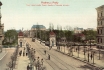
Not the Franz Josef I Bridge as it says by mistake on the postcard,
made of stone (nowadays Most Legií, i.e. the Bridge of Legions), as seen
from Chotkova Road. It was built in 1898-1901 on the site of the
original chain bridge (see picture 219) by the Hungarian company
Gregersen and Son, to the designs of A. Balšánek. The pillars began to
be built under the old bridge, as the new temporary bridge nearby was
not yet completed. It was only after completion and opening of the
temporary bridge and after removal of the old chain bridge that the
building of the new bridge could continue. The Bridge has 10 pillars and
9 vault sections, is 343 metres long and 16.4 metres wide. The total
cost of the construction amounted to 3.9 million crowns. The opening of
the Bridge in 1901 occurred in the presence of Emperor Franz Josef I
himself. Thanks to an ambiguous newspaper caption under a picture
showing the Emperor on a walk across the bridge, referring to this
activity as Procházka (meaning a walk, but at the same time one of the
most frequent Czech surnames), the irreverent Prague people nicknamed
the ruler old Procházka. On the sides we can see the stone huts of the
bridge toll collectors.
COLOURED PHOTOTYPE. F. J. JEDLIČKA, AROUND 1902
153 - A view of the Old Town
The Crown Prince Rudolf Embankment as seen from Železná (Iron), also
Řetězová (Chain), or Rudolfova (Rudolf) platform bridge. On the left we
can see the Rudolfinum, on the right the building of the Arts and Crafts
School. The pedestrian bridge was built in the years 1868-1870 at a
cost of 272 thousand guldens on the site of the time-honoured municipal
(lower) ferry to the north of the present day Mánes Bridge. The bridge
stood on only one pillar fixed in the river bed, it was 200 metres long
and 3.8 metres wide. The designer of the bridge was K. Veselý, iron was
supplied by the British firm Ruston & Co. and chains from another
firm in Sheffield. The bridge was removed in 1914, and the only trace of
its existence is the name of the Lesser Town street U Železné lávky (At
the Iron Bridge). At that time there already existed the neigbouring
Franz Ferdinand d’Este Bridge made of stone, nowadays called Mánesův
Bridge. The two soldiers in the picture are apparently on their way from
the nearby Bruské Barracks in the Lesser Town.
COLOURED COMBINED PRINT. V. KRÁTKORUKÝ, AROUND 1906
| 154 - The Rudolfinum, today called Dům umělců (The Artists’ House)
Was built by J. Schulz and J. Zítek in the years 1876-1886 in honour
of the Crown Prince Rudolf. The 2 million guldens this construction cost
was financed by the Czech Savings Bank. The northern wing of the
building holds art collections, the southern wing houses a concert hall.
Before the Second World War the Rudolfinum served as the seat of the
Czechoslovak Parliament. The building was erected on a terrain elevated
by dumps and in the context of the newly arranged embankment. The
original terrain was approximately at the height of the foot of the
staircase we can see in the forefront of the picture. This lower terrain
was apparently the level of the Jewish Town before its clearance. The
street between the railing and the Rudolfinum was called Sanytrová after
the enormous heaps of malodorous saltpetre (in colloquial Czech sanytr)
used for production of gunpowder. The heaps reached the height of
four-storey buildings and were here from the 16th century to the
beginning of the 19th century.
PHOTOTYPE. LEDERER & POPPER, AROUND 1904
| 155 - Complex of mostly Neo-Renaissance school buildings in Křižovnická Street, loking towards the Rudolfinum
They were built here on an artificially elevated terrain in the years
1879-1885. On the left there is the Basic Boys’ School of St Francis,
its girls’ counterpart is in the other wing of the building facing the
embankment. The middle building housed the Institute for the Education
of Woman Teachers also called the Paedagogium, founded in 1870. The next
structure is the Arts and Crafts School built in the years 1881-1884,
to plans by F. Schmoranz junior and J. Machytka, as the first
institution of its kind in Austria. It also housed a Painters’ Academy
which, in 1902, moved to its own building in Letná. At the furthest
right we can see the beginning of a paved depression with railings and
stairs (see the previous picture) which provided access to older
buildings still standing on the original lower level of the terrain.
COLOURED PHOTOTYPE. F. J. JEDLIČKA, 1906
| 156 - Platnéřská Street as seen from Mikulášská Street looking towards Mariánské Square
It used to be one of the oldest and most picturesque lanes in the Old
Town with gabled, originally Gothic houses, later remodelled in
Renaissance or Baroque style. From the 14th century it was called
Ostružnická (i.e. the spur street) or Platnéřská (i.e. armour-plated
street), after the most important product of the street’s craftsmen,
namely spurs or armour made from plate. However, the street was also
known for its production of arms. In the 17th century these crafts began
to fade from the street, and from the beginning of the 19th century the
street already had a new name, Klempířská (i.e. tinsmiths´street). The
building U Tří jezdců (The Three Riders), No. 121, on the northern side
of the street on the right, was at the beginning of the 16th century
owned by the caretaker of the Old Town Clock, Jakub. The building U
Železného muže (The Iron Man) beyond it, No. 119, used to be the seat
(from 1573) of the Guild of Armour Makers, as is reflected in the house
sign: a knight in armour.
COLOURED PHOTOTYPE. REINICKE & RUBIN, MAGDEBURG, 1904
| 157 - A view of Linhartské Square looking towards the Klementinum
The space arose here in the Middle Ages through the parcelling out
of the Romanesque Jaroš Courtyard. It was on this site that, from the
end of the 13th century, stood the Church of St Linhart. Near the
Courtyard there was also a settlement of merchants, most likely French.
From 1346 the place was used as (and called) the New Hen Market, as it
specialized in selling poultry. The 16th century saw here a rise of
municipal kitchens for Prague’s poor. Hence another historical name of
this area, V Kuchyňkách (In the Kitchens). The Church of St Linhart and
its cemetery stood originally on the site depicted in the picture (on
lot No. 128). The second building on the right, No. 129, with the
protruding corner, stood close to the church entrance. In front of it
stands a Baroque structure which was probably constructed after
demolition of the Church in 1789. Standing beyond buildings Nos. 133 and
131 (in the middle of the picture) was, until 1791, the Church of Our
Lady in the Pool with a cemetery. While the left side of the Square is
still extant, the buildings on the right were all demolished in 1908.
COLOURED PHOTOTYPE. F. J. JEDLIČKA, 1906
| 158 - A view of Platnéřská Street as seen from Mariánské Square, looking towards Mikulášská Street
On the left, on the northern side of the street, we can see the
building U Zlaté koule (The Golden Ball), No. 106, with the inn U Města
Plzně (The Town of Pilsen) with a lantern above the entrance, beyond it
the Renaissance building U Sedmi Švábů (The Seven Swabians), No. 108, on
the corner of Žatecká Street. (The other corner building was, from
1865, a home of the Prague executioner, J. Pipperger, an upholsterer by
profession. Pipperger carried out executions till his death in 1888.)
Above the intersection with Žatecká Street continues the row of
buildings we can see from the opposite angle to that in picture 156. The
whole street was demolished in 1908, terrain elevated by 2 metres, and
on it the new axis of the new Platnéřská Street was fixed. On the site
of the whole left block of buildings up to the intersection with Žatecká
Street the City Library was built by F. Roith between 1926-1930.
Demolition of Platnéřská Street is undoubtedly one of the worst losses
that occurred in the wake of the Old Town clearance.
COLOURED PHOTOTYPE. K. ZUNA, AROUND 1902
| 159 - The northern side of Mariánské Square after demolition of the corner building No. 102 (in 1890)
On the left we can see the corner of the Klementinum, further the
building housing the City Library founded in 1891. The Library was moved
here in 1903. Its fund of books at the turn of the century amounted to
40 thousand volumes. The hefty four-storey building with the statue of
the Virgin Mary, Nos. 101 and 103, was owned by one Sommerschus who sold
and probably also produced stoves. The space around the heap of paving
blocks was covered until 1791 by the Church of Our Lady in the Pool and
by a cemetery (the name of the Church refers to the pools that appeared
here after each summer flood). The demolished building, No. 102, in
Platnéřská Street (in front of the buildings on the right) housed from
1771 the first workshop of F. Ringhoffer who enriched himself so much by
the production of vats for breweries that in the course of time he
could buy another five buildings in the neighbourhood. His descendants
then expanded production and in 1852 moved the now legendary firm to
large factory halls in the Prague Quarter of Smíchov where their
activities also included production of railway and tram cars. The
buildings in the picture were demolished in 1908, except for the rear
wings of buildings Nos. 101 and 103, to make way for the new building of
the City Library.
PHOTOGRAPHIC POSTCARD. PICTURE AROUND 1896. Z. REACH, 1920s
| 160 - The northern side of Linhartské Square looking towards Mikulášská Street
On the left there is the building U Kozla (The Buck), also called U
Zlatého čápa (The Golden Stork), No. 114, in the years 1840-1843 the
domicile of the author of the lyrics of the Czech national anthem and
playwright J. K. Tyl. Further we can see the buildings U Modré boty (The
Blue Shoe), No. 129, and U Černého orla (The Black Eagle) which share
the number 128 with two further structures. On the site of these two
buildings and in the space in front of them stood the above cited Church
of St Linhart with a cemetery. In the background we can see building
No. 12, U Zlatého zvonku (The Golden Bell) with arcades, which was a
part of Linhartské Square. It could not be seen from this place until
1798 as the view was obscured by the Church. All the buildings on the
left side were demolished in 1908 to make way for construction of the
New Town Hall. The Square was then changed into Linhartská Street, with a
new, shifted street line.
FOUR-COLOUR AUTOTYPE. AFTER AN OIL-PAINTING BY J. MINAŘÍK, AROUND 1907.F. J. JEDLIČKA, AROUND 1915
| 161 - A picture of the north-western part of the Town Hall block taken from the roof of a building in Kaprová Street
The opening to view of the original, narrow Mikulášská Street was
made possible by demolition of the whole block of old buildings
delimited by Kaprová and Žatecká Streets and Linhartské Square. The
group of structures we can see in the picture are among the oldest in
the Old Town (prevalently Gothic, on the left side remodelled in
Neo-Classical style and in Baroque style on the right side, with Nos.
12, 11 and 10 with Romanesque foundations). The best-known of them, the
building U Zelené žáby (The Green Frog), No. 13, with a famous wine
parlour, is in the middle of the picture, under the tower of the Old
Town Hall. The enclosure on the left protects the remnants of the
Romanesque building No.16, Andělská Kolej (the Angelic Hostel), the
former student hostel founded by Charles IV, which was uncovered during
clearance. The body of the structure was demolished in 1911, two
previous years of passionate polemics and protests notwithstanding. The
place became the site of the construction of the New Town Hall,
currently housing the Prague City Hall.
PHOTOTYPE. K. BELLMANN, 1909
| 162 - A view of Mikulášská Street with a part of the New Town Hall block as seen from Kaprová Street
The tower on the left is that of the Baroque Church of St Nicholas.
Alongside it is the Neo-Baroque structure of 1902 by R. Kříženecký which
replaced the old Prelates’ Office of the abolished Monastery of the
Slavonic Dominicans, demolished in 1897. The former Prelates’ Office
housed, in the years 1859-1897, a workshop and a printing office of the
well-known firm K. Bellmann which later specialised in publication of
Prague postcards. Last but not least, it was the birthplace (in 1883) of
the writer F. Kafka. The picture shows the situation after clearance.
On the right there is the building of the New Town Hall, constructed
between 1908-1911 by O. Polívka. The side wing of the Town Hall creates a
part of the new Platnéřská Street. The empty lot next to the extended
Kaprová Street was used in the 1920s for construction of Pragues’ City
Administration Building. On the site of the stored construction material
stood the former Andělská Kolej (the Angelic Hostel) (see picture 161),
allegedly the oldest residential building in Prague.
PHOTOGRAPHIC POSTCARD. J. ŠOREYS, AROUND 1914
| 163 - The eastern front of the Klementinum at Mariánské Square
The Klementinum was founded by the Jesuit Order summoned to Prague by
Ferdinand I on the site of the older Dominican Monastery and Church of
St Clement, dating back to the 11th century (hence the Klementinum). The
construction of the whole Baroque complex was begun approximately in
1600 by C. Lurago, and completed about 1730 by F. M. Kaňka, and
possibly also by K. I. Dientzenhofer. The mission of the Jesuit Order
was to spread the Roman Catholic faith, education and school
institutions. In 1654 Ferdinand III connected the Klementinum University
with Charles University into one, Charles-Ferdinand University. In 1773
the Jesuit Order was abolished, and the Klementinum became the domicile
of the Archiepiscopal Seminary which was in turn moved to the Prague
Quarter of Dejvice in 1928. From 1842 the tower of the astronomical
observatory on the left was used for announcing noon (by thence waving a
flag). The book fund of the Klementinum Library amounted in 1900 to 2
million volumes. Today the whole Klementinum complex serves the purposes
of the National Library.
PHOTOTYPE. K. BELLMANN, 1899
| 164 - The northern side of Malé Square with a glimpse of Linhartské
Square
In popular parlance the whole area used to be called (and still is by
some) Malý ryneček (The Small Marketplace). On the left there is a part
of building No. 143, followed by the Neo-Renaissance building U Tří
bílých růží (The Three White Roses), new No. 142, built by F. Rechsiegel
in the years 1895-1897 with sgraffiti designed by M. Aleš. From 1850 to
1990 this building housed the most popular ironmongery in Prague, V. J.
Rott, nowadays it houses a luxurious delicatessen. The corner building U
Černého beránka (The Black Lamb), No. 138, constructed in 1871 by I.
Ullmann, was also owned by Rott. This building housed the Old Town Post
Office. On the right we can see a part of building No. 4. In the middle
of the Square there is a fountain with a Renaissance lattice from 1560,
which used to be covered on the cold days of winter with wooden casing
filled with manure to protect the lattice against freezing. A model of
this Renaissance square(to an authentic scale) could be seen by visitors
to the Ethnographic Exhibition in 1895.
COLOURED PHOTOTYPE. LEDERER & POPPER, 1898
| 165 - A view of the north-eastern front of the buildings of Malé Square
On the right we can see the Late Renaissance Petzold Building known
also as Zlatý roh (The Golden Horn), No. 4. The original ground floor
shops (such as that of the First Czech Dairy in Prague on the margin of
the picture) were removed in the 1930s to make way for the arcade
restoration. The arcades of the further five buildings had been
preserved. In the background we have a glimpse of the narrow Mikulášská
Lane with a part of the corner of building No. 128 on Linhartské Square,
linked at this point in time with the tram system. On the left, in the
space before the fountain, stands a miniaturized version of the
four-branch Lindsbauer gas lamp post. In comparison with the previous
picture it is obvious that the lamp post has undergone a curious
adaptation of the gas lanterns with what appear to be electric bulbs.
PHOTOGRAPHIC POSTCARD. PICTURE AROUND 1907. Z. REACH, 1920s
| 166 - The southern side of Malé Square
With the imposing, originally Gothic buildings owned in the past by
foreign pharmacists. There were seven of them in Prague at the beginning
of the 14th century, all of them settled in the Old Town, e.g.
Augustino of Florence whose pharmacy was in the building U Modrého
jelena (The Blue Deer, also known as the Richter House), No. 459 (the
first on the left), or Angelo, likewise from Florence, whose pharmacy
was in the building called V Ráji (In Paradise), No. 144 (the second on
the right). The other buildings also housed apothecaries, however only
one of them continues in the tradition: U Zlaté koruny (The Golden
Crown), No. 457 (in the middle of the picture). Apart from medicaments
the pharmacists used to produce various kinds of sweets (there were no
specialised sweet shops in those days). The Blue Deer Building also made
history by housing the first telephone exchange in Prague, launched in
1882 with 98 participants. Next to the fountain we can see the cast-iron
stand of the municipal water main.
COLOURED PHOTOTYPE. PICTURE AROUND 1910. R. MACHAČ, 1914. SENT BY POST ONLY IN 1974!!
| 182 - A view of Na Můstku (At the Bridge) Street as seen from Václavské Square, looking towards Rytířská Street
The ancient name is derived from the little stone Gothic bridge over
the moat which started at a gate in the Old Town fortification, and its
remnants are in the vestibule of the Můstek Metro Station. The
fortification still stood here long after founding of the New Town and
was demolished only at the end of the 17th century. The corner building
on the right, new No. 388, constructed in 1900, was known for the
department store of E. Löbl which sold cloth, and a café originally
called Kovářova, later the Edison. Beyond it stands a slightly older
structure with a bay called U Kasírů. Both buildings were demolished in
the mid-1970s in connection with construction of the Metro, and on their
site the building of the ČKD Company was erected in the 1980s. In the
background, on the corner of Provaznická Street, is building No. 386
with the shop of A. Müller. At the furthest left we can see the famous
jewelry shop of J. Rechner. The buildings on the left side of the
street, and the original buildings on the right side, between
Provaznická and Rytířská Streets, are still extant.
COLOURED COMBINED PRINT. AROUND 1905
| 183 - Na Můstku Street from an opposite angle to that in the previous picture
Thanks to this publicity postcard of the M. Pressburg Company (a
cravat manufacturer) we have an interesting view of Václavské Square. On
the left is the above-cited bay of the u Kasírů Building, new No. 387,
behind it is the building U Zlatého jednorožce (The Golden Unicorn),
protruding into the street. Its demolition in 1900 made it possible to
shift the street line, broaden the street and to build the Löbl
department store (see picture 312). On the right, behind the block of
buildings, once stood the Gate of St Gall, the largest and most
important gate in the Old Town fortification. However, by creating a
street in this area shortly after founding of the New Town which
connected the Old Town with Václavské Square, the Gate lost its
significance. The striking advertisement for the Na Příkopě based money
exchange of J. G. Selig proves that the busy centre of Prague could not,
even a century ago, do without exchange offices.
PHOTOTYPE. K. BELLMANN, 1897
| 184 - A picture of Melantrichova Street as seen from Rytířská Street, showing both sides of the street
In the rear, in front of building No. 463, the street turns to the
right and eventually intersects with Staroměstské Square (see picture
186). On the left we can see a small group of ladies attracted by the
shop window of the firm O. Tuček. The exquisite Neo-Renaissance carved
frame of the shop window is decorated on the corner by two lions,
illustrating the name of this Neo-Classical building of 1835, built on
the site of three small Gothic cloth shops, namely U Dvou červených lvů
(The Two Red Lions). The Neo-Renaissance building, new No. 536, of 1894
on the opposite corner houses the City Savings Bank. This building also
replaced the original small shops (see picture 195). It was at that time
that the Prague city planners seriously considered demolition of a
number of buildings between Václavské Square and Staroměstské Square in
order to create a boulevard linking the two squares, passing through the
Na Můstku and Melantrichova Streets.
PHOTOTYPE. K. BELLMANN, 1907
| 185 - The south-western side of Melantrichova Street as seen from Rytířská Street
The first two buildings on the left, Nos. 962 and 514, and the lane
which separates them, arose in the 18th and 19th centuries on the site
of small mediaeval textile shops. This historical past is reflected in
the name of the lane: V Kotcích (The Small Shops). The third building on
the left on the corner of Havelská Street was in the 14th century owned
by J. Junoš, one of the handful of Prague burghers who lived in the
German Havelské Town. Junoš’s building housed in 1597 the printing
office of D. Sedlčanský who published what is regarded as the first
Czech periodical (according to the 1903 Chronicle of J. Ruth), Noviny
pořádné, probably one of the first Central European periodicals. As we
can see in the picture, the streets are cleaned by women, apparently
instead of the male street cleaners who had to go to war. Typical of the
first war years is also the fashion of gentlemen’s straw boaters which
spread like wildfire throughout Central Europe in the summer of 1914.
PHOTOGRAPHIC POSTCARD. PICTURE AROUND 1915. Z. REACH, 1920s
| 186 - A section of Melantrichova Street before Staroměstské Square
On the left we can see a part of a building, with another beautifully
carved window frame, which is probably a fashion shop, and beyond it
two buildings of the former Servite Monastery of St Michael, Nos. 970
and 971. The Baroque Monastery of the Servites was founded in 1628, and
abolished by Emperor Josef II. Next to the protruding corner with the
advertisement for the C. Lüftner Company (a warehouse for leather and
preparations for shoemakers) is the passage to the St Michael Church.
This church, first documented in 1313, saw, 90 years later, the first
preachings of Master John Huss. From the 17th century the street was
called Sirková (derived from the Czech word for sulphur, which was sold
here). In 1894 it was renamed after the Czech nobleman J. Melantrich
from Aventinum who owned his legendary printing office in the building U
Dvou velbloudů (The Two Camels), No. 471. This building is just off the
picture, to the right of the photographer. The pulled-down shutters hid
the shop windows of mostly furriers’ shops. The shutters had to be down
as it was either Sunday or one of the church holidays, both strictly
observed in the Austrian Monarchy.
PHOTOTYPE. 1908
| 187 - A view of Železná Street as seen from the Stavovské Theatre, looking towards Staroměstské Square
The name of the street was derived from the presence, from the 14th
century, of many ironmongeries in the street. In the 16th century the
street was inhabited by a number of foreign, especially German
merchants. On the left we can see the former Monastery of the
Shoe-wearing Carmelites linked to the Church of St Gall. One could get
to the Church through Havelská Street which begins at the corner
building U Goliáše (The Goliath). The building with an arcade and
gables, No. 495, and the building beyond it, No. 494, both dating back
to the 17th century, were demolished in 1898. They were replaced by a
Neo-Renaissance commercial and residential building (see picture 189).
On the right is the corner of the Karolinum and the lane leading to
Ovocný trh Square. At the time this picture was taken, the abolished
monastery housed the Association for the Advancement of Industries in
Bohemia, founded in 1833. From 1849 it was the seat of the Prague
Realgymnasium (grammar-school with a scientific bias) with Czech as the
language of instruction, and later the seat of the Imperial Royal Lace
Factory.
PHOTOGRAPHIC POSTCARD. PICTURE 1898. Z. REACH, 1920s
| 188 - The intersection of Melantrichova Street with Staroměstské Square
With the buildings Na Kamenci (On the Stone) and U Vola (The Ox).
Both buildings are connected by a horizontal arch. The narrowness and
meandering of mediaeval lanes was partly unintentional, partly
intentional. In the first case it was the result of the more or less
spontaneous attempt to make the most of the available space and to
broaden one’s own premises at the expense of the public road. This
arbitrariness was in some cases so flagrant that the use of parcels for
building had to be regulated by special rules. In cases where this was
intentional, the reasons were defensive, especially in towns bothered by
frequent enemy attacks, as the meandering streets offered better cover
to the defenders when retreating. In this Sunday picture we can see the
above-mentioned shops of A. Horák and E. Bittner (see picture 168).
PHOTOGRAPHIC POSTCARD. PICTURE AROUND 1910. Z. REACH, 1920s
| 189 - A view of Železná Street as seen from Rytířská Street
From an angle opposite to that in picture 187. The present picture
was taken several years later and from a greater distance. In the
picture we can see the corner of No. 539 with a shop selling linen
goods, and a part of the front of what is now called Stavovské divadlo
(The Theatre of the Estates) and what was then the Royal Provincial
German Theatre. On the site of two houses called U Goliáše (The Goliath)
stands a five-storey Neo-Renaissance building of the same name. The
name is also epitomised by the statue on the level of the second storey.
Behind the Theatre we can see a part of the building of the Karolinum.
Beyond it the street turns somewhat to the left and ends at the
intersection with Staroměstské Square.
PHOTOTYPE. K. BELLMANN, 1907
| 190 - Vejvodova Street, narrow and picturesque, as seen from Jilská Street, looking towards Michalská Street
On the right we can see a part of the building U Zlatého kohouta (The
Golden Rooster), No. 430 (with a second front facing Michalská Street),
further the building U Žluté růže (The Yellow Rose), No. 431, with an
unusual roofed underpass which houses a part of a flat. Vejvodova Street
owes its name to the Lord Mayor J. V. Vejvoda who, in the 18th century,
owned a building on the corner of Jilská Street (No. 353 - on the
right, just off the picture). Previously the street was called Míčová
(Ball Street), after the real tennis court at the house on the opposite
corner of Jilská Street (No. 445, on the left, just off the picture).
This house was bought in 1675 by the Italian V. Ringolini. It was the
venue not only of ball games, but also of dancing parties. Ringolini was
one of the dancing masters who taught Prague people how to dance
foreign dances. He also acquired the exclusive right to hold balls in
the Old Town.
PHOTOTYPE. K. BELLMANN, 1909
| 191 - The building of the Karolinum on the corner of Železná Street and Ovocný trh Square
This centre of Charles University, the oldest university in Central
Europe, has always been connected with fate and social development of
the Czech nation. This was the case with issuing of the Decree of Kutná
Hora, with activities of John Huss, or with the student movement in
1848. The university was founded by Charles IV on April 7, 1348 for the
good of the Kingdom of Bohemia so that its inhabitants eager to get
acquainted with arts would not have to look for this abroad, but would
have access to these arts in their own kingdom. Of the original Gothic
Rothlev House only the bay Chapel of St Cosmo and St Damian survived the
Baroque remodelling by F. M. Kaňka. The ground floor used to house
shops of booksellers and pharmacists. Around the year 1910 the building
housed a hairdressers and the Maader and Son Company - the exclusive
representative office of the fishing company Nordsee. The space between
the Karolinum and the Stavovské Theatre (on the right) was used for
trading in dogs.
PHOTOGRAPHIC POSTCARD. PICTURE AROUND 1910. Z. REACH, 1920s
192 - A view of Havířská Street as seen from the Stavovské Theatre, looking towards Na Příkopě Street
The name of the street has nothing to do with mining (as the Czech
meaning of the street name might indicate), but apparently arose as a
corruption of a name or a nickname of one or other of the two owners of
buildings in this street (Haller and Tobiáš, who both hailed from Kutná
Hora, a famous mining town). The street arose through demolition of a
part of the city fortification in approximately 1402. The fortification
ran approximately along the line of Provaznická Street, behind the
second building on the right. The fronts of the mediaeval buildings
standing before them, faced Ovocný trh Square. The structures in the
street are mostly Neo-Classical, with exception of the corner Baroque
building on the right, No. 398. The opposite corner house U Modrého
hroznu (The Blue Grapes), No. 580, was also Baroque, and in the 18th and
19th centuries housed a well-known café and wine-parlour frequented by
patrons of the adjacent theatre who came here after the performance
through a covered corridor linking the two buildings. After demolition
of the house U Modrého hroznu a new building was constructed here in
1899. In the background we can see the Rococo Sylva-Tarouc Palace in Na
Příkopě Street.
PHOTOGRAPHIC POSTCARD. PICTURE AROUND 1910. Z. REACH, 1920s
| 193 - The interior of the Old Town Marketplace
It was on this site that food and all kinds of articles were sold in
the open. Only increased hygienic demands of the 19th century, as well
as technical developments (electricity, artificial refridgeration,
heating, water mains, etc.) led to construction of covered market halls
with all the appropriate facilities. The first market built by the City
of Prague was erected in the public space between the new building
complexes in Rytířská and Ovocná Streets in the years 1894-1897 at a
cost of 2.7 million crowns. In the passage-like market hall accessible
from both these streets were over 300 stalls located among cast iron
columns supporting the glassed roof. Moving of the stallholders from the
open air to the market hall was no easy matter. The stallholders,
mostly women, were averse to the many novelties, not to speak of the
fact that the rent for the market hall stalls was by no means
negligible. However, eventually the spacious hall housed the majority of
the open-air stallholders from Vaječný trh (The Egg Market) in Rytířská
Street.
LACQUERED COLOURED COMBINED PRINT. D. KOSINER AND CO., 1907
| 194 - Rytířská Street
Rytířská Street between Uhelný trh and Ovocný trh Squares with the
Stavovské Theatre in the background. The name of the street (the Street
of Knights) was derived from the knightly tournaments documented for the
first time in connection with the Czech coronation of Charles IV, and
carried on still in the 18th century. Otherwise, the street was best
known as a marketplace, one of the largest in Prague, with a number of
stalls both in the street and under the arcades, full of hustle and
bustle. The articles sold here included practically everything: both
dead and live poultry, eggs, curds, butter, soups, doughnuts, coffee,
etc. The whole pother ended here in 1897 with construction of the market
hall inside the Neo-Renaissance administrative building designed by J.
Fialka. The hefty five-storey structure was built on the site of four
old houses, Nos. 405 to 408. Of the old buildings we can actually see
only the first three buildings on the right, originally mediaeval, with
arcades. The middle of the three buildings (No. 410) was from 1651 the
domicile of the famous Baroque sculptor J. J. Bendl.
PHOTOTYPE. H. SEIBT, MEISSEN, AROUND 1898
| 195 - Rytířská (Knight) Street between the Stavovské Theatre and Uhelný trh Square
It was originally a part of the New Marketplace in the Havelská (St
Gall) Quarter, founded in the 13th century and inhabited by German
settlers. The Marketplace had an advantageous location between the Old
and the New Towns, and its importance grew even more after Charles IV
had ordered moving of the sale of some articles to this market from
Staroměstské Square. The stalls in Rytířská Street offered such varied
articles as cloth and fur, but also meat. After demolition of the stalls
in 1891 the street saw construction of the City Savings Bank designed
by O. Polívka and A. Wiehl, and built in the years 1892-1894 at the cost
of 1.2 million crowns. Cecorations on and in the building were created
by some of the leading sculptors and painters of the time. The
originally three-storey structure (in the picture) was elevated in the
1930s by one more storey. On the right we can see a part of the former
Carmelite Monastery, a Baroque building of 1671. In 1848 it housed the
St Wenceslas Committee, the leading Czech political authority during the
revolution of that year.
COLOURED PHOTOTYPE. LEDERER & POPPER, AROUND 1900
| 196 - A part of Rytířská (Knight) Street
Between Melantrichova and Na Můstku Streets, looking towards the
Stavovské Theatre. Until the end of the 19th century this area was one
of Prague’s busiest marketplaces. The stretch on the left side used to
be called Husí trh, i.e. The Goose Market, as geese were sold here
direct from the wagons (a decent half of a goose then cost one and a
half guldens). In the area on the right side one could buy ironware and
other kitchen utensils. On the left we can see the corner of the newly
built City Savings Bank, on the opposite corner we can see the house U
Modré růže (The Blue Rose), No. 403, with the originally Gothic tower
which was a part of the Havelské Town fortification. The picture makes
it obvious that most of the market people had already moved to the
nearby market hall. The hustle and bustle and the usual haggling over
prices were replaced by the a metropolitan image of carriages and
pedestrians heading for Václavské Square.
PHOTOTYPE. E. SCHMIDT, DRESDEN - BUDAPEST, 1899
| 197 - Rytířská (Knight) Street with the Stavovské (Nosticovo) Theatre and the former St Gall Carmelite Monastery
The Stavovské Theatre was built in Neo-Classical style in the years
1781-1783 by A. Haffenecker. It was further adapted in the 19th and the
20th centuries. The Theatre was founded by count Nostic-Rieneck, a
member of a group of patriotic Czech noblemen aiming to uplift Prague’s
cultural life. The Theatre became famous thanks to its performances of
W. A. Mozart: The Marriage of Figaro and the premiere of Don Giovanni in
1787. Language of the performances was prevalently German (until 1920),
but at certain periods also Czech. Thus, e.g., in 1834 the Theatre saw a
performance of J. K. Tyl’s comedy Fidlovačka to the music of F. Škroup,
which included the future Czech national anthem Kde domov můj. The
monastery building on the left was built in early Baroque style by D.
Orsi and M. Lurago. On the right we can still see a few remaining
stalls.
COLOURED PHOTOTYPE. K. BELLMANN, 1900
| 198 - The northern side of Havelská Street (also called Zelený/Zelný trh)
The area is a part of the former marketplace of the Havelské Town.
The street saw, among other things, the cheerful coronation of Wenceslas
II on June 2, 1297 when wells yielded wine rather than the usual water.
Another famous historical celebration took place here in connection
with the coronation of Charles IV on September 2, 1347. After 1362 the
original marketplace of Havelské Town was divided by small shops into
two parallel streets, today’s Rytířská and Havelská (in the picture).
The houses with Gothic arcades have retained their historical appearance
until today, with exception of the corner house U Mrázů, No. 504 (on
the right) which was in the 1920s insensitively reconstructed for
purposes of the bank on the opposite corner. The Czech name of the
market (Zelený or Zelný) means Green or Cabbage, with vegetables still
being the chief article sold here today. Even though the picturesque
sun-shades and the baskets of the market women belong to the past, the
local marketplace remains the most popular marketplace in Prague.
PHOTOTYPE. K. BELLMANN, 1907
| 199 - The north-eastern side of Uhelný trh Square as seen from the intersection with Martinská Street
It is from here that we can best see how the original marketplace of
Havelské Town gradually split - through erection of stalls and of two
rows of buildings - into three streets: Rytířská, V Kotcích and
Havelská. On the left the square intersects with Skořepka Street.
Protruding in front of the intersection is building No. 424, with the
café U Tří stupňů (The Three Grades) (see picture 201). Until the
beginning of the 19th century there was a smithy in the middle of the
Square which also sold charcoal - hence also the Czech name of the
Square: Uhelný trh (The Coal Market). At the time of taking of the
picture the articles sold here also included cut flowers and funeral
wreaths. As in Ovocný trh, the Uhelný trh Square was also location of
many refreshment stalls. Until the First World War you could obtain here
a ladle of hot potatoes or noodles, a cupful of soup or a big doughnut,
any of these for a mere two kreutzers.
PHOTOTYPE. K. BELLMANN, 1900
| 200 - The south-eastern side of Ovocný trh (The Fruit Market) Square
From the 14th century to the 18th century the Square was called Masný
trh (The Meat Market) after the chief article sold here in this period.
From the 18th century the market was reserved for sale of vegetables.
It was open throughout the year, with the busiest time being obviously
between spring and autumn. But even at times when no fresh local fruit
was available, the stalls offered dates, figs, oranges, pressed
appricots, nuts and many other fruits. The first buildings on the right,
Nos. 576-574 (the last one with a passage to Na Příkopě Street), were
demolished at the end of the 1920s. For a long time it remained empty,
until in 1997 the commercial centre Myslbek was constructed here. The
fourth building, No. 573, with the former hostel established in 1381 by
Wenceslas IV for masters of the free arts, was also used as a passage to
Na Příkopě Street, but was broader, with a number of small shops,
especially furniture shops. This commercial passage, one of the first in
Prague, was established in 1872. The next building with the broken
gable housed, in the years 1539-1784, the Prague Mint.
PHOTOTYPE. PROBABLY E. ČÍŽEK, AROUND 1900
| 201 - The building with the Café U Tří stupňů (The Three Grades) in Uhelný trh Square, No. 424
It is the only building of the row of arcaded old buildings which
lined the western side of the Square which is still extant. All the
other buildings were demolished and on their site was constructed the
residential building U Šturmů (on the left, on the corner of Skořepka
Street), and in 1883 a school building (on the right). The Café, also
called U Sester kafíčkových (The Coffee Sisters), was mostly frequented
by greengrocers and other stallholders. A hefty cup of coffee with milk
was offered at a price of 8 kreutzers, i.e. 16 hellers, at a time when,
for instance, a stamp for a postcard cost 5 hellers. The second-hand
clothing shop (next to the Café) certainly suffered from no dearth of
customers. The market woman in the foreground is selling her products
immediately from her basket. This postcard was used by the owner of the
Café for publicity purposes.
PHOTOTYPE. UNIE PRAGUE, AROUND 1900
| 202 - The north-western side of Ovocný trh Square looking towards Celetná Street
The first two buildings on the left, Nos. 560 and 563, were in the
1960s reconstructed for use by Charles University. The fifth,
five-storey building U České orlice (The Czech Eagle) was constructed in
1896 by F. Ohmann in an attempt to create a specific Czech
architectural style combining elements of Gothic, Renaissance and Czech
folk architecture. At the end of the row we can see the building U Zlaté
mříže (The Golden Bar), No. 570, replaced in 1912 by Gočár’s Cubist
building. In the background we can see the jagged wing of building No.
587 which, in the revolutionary year 1848, housed the headquarters of
the ill-famed Austrian General Windischgrätz who suppressed the
democratic rebellion. Interesting period details include the gas lamps
lighting the shop windows on the right, as well as the stylish public
convenience behind the sun-shades.
PHOTOTYPE. K. BELLMANN, 1899
| 203 - The Church of St Gall (Havel in Czech) as seen from Zelný trh Square
The originally Gothic church was founded by Wenceslas I in 1232 as
the parish church for the Havelské Town. Later the Church served as a
grave for remains of St Gall acquired by Charles IV in St Gallen,
Switzerland. The Baroque remodelling of the Church was carried out in
1723-1738. Unfortunately, the Neo- Renaissance building of the City
Savings Bank built on the site of the former stalls partly obscures the
view of the Church. The area in front of the Church, and the narrow lane
along it, was in the 18th century covered by stalls, standing mostly in
the arcades, and rented from their Christian owners by Jewish merchants
from the ghetto. Due to the noise of their trading, the Jewish
merchants had permanent conflicts with the Carmelites. This area was
called the Jewish Tandlmarkt, to differentiate it from the Christian
Tandlmarkt on the site of Zelný trh Square.
PHOTOTYPE. KOLEM 1900
| 204 - The courtyard of the Mühldorf House, No. 185, with a passage conecting Anenská and Karlova Streets
The original low-rise mediaeval structure was reconstructed many
times over, as is attested by its current four storeys with its
Neo-Classical front facing Karlova Street, and by its courtyard annexes
with a porch and the large lunette windows. In contrast to the small
windows of the main wing, these had the advantage of allowing more
sunlight into the flats, certainly a fact welcomed by families with
children who were tenants of this building. Apart from the posing
family, we can also see omnipresent, practical two-wheeled carts. From
1902 the building was owned by the Jewish religious community which also
established here a ritual mikve bath. In the period between the two
world wars the Prague brewery Pragovar opened here the beerhouse U
Rytíře Malvaze which until recently served many generations of students
who came here from the nearby Klementinum Library.
PHOTOTYPE. K. BELLMANN, 1909
| 205 - The southern part of Husova Street from the Church of St Giles, looking towards Na Perštýně Street
Originally Dominikánská (Dominican) Street, it was renamed in 1870
after the church reformer Master John Huss. On the right we can see
building No. 241 which, from the end of the 14th century, held the
Archives of the Property Register of the Czech Kingdom. The third
building on the right housed the German Technical University in Prague,
while the Czech Technical University had its home in Charles Square. The
corner building, No. 236, housed the Old Prague Pub called U Vocelků,
renowned for its cuisine and good beer. The large shady garden was on
Sundays the venue of afternoon and evening brass band concerts which
diffused noise throughout the otherwise quiet environment.
PHOTOTYPE. K. BELLMANN, 1902
| 206 - Betlemské (Bethlehem) Square looking west
In the middle we can see the bulky house U Halánků, No. 269, a former
brewery plus malthouse owned from 1826 by the Náprstek family. V.
Náprstek, a Czech patriot and traveller, inspired by technical progress
in America, decided on his return from the U.S. in 1858 to found a Czech
Industrial Museum. He used the building U Halánků for this purpose and
also, in 1886, the newly-built four-storey building (in the background)
designed by A. Baum and B. Münzberger. Later the Museum also included
ethnographic and historic collections. In the Middle Ages the Square was
the site of the Bethlehem Chapel used by John Huss for his preachings.
The Chapel was demolished in 1784 and its remnants can be found in the
building No. 255 (at the furthest right). In the 1950s, following
demolition of both buildings on the right, the Chapel was reconstructed
in a somewhat modified form.
COLOURED PHOTOTYPE. K. BELLMANN, 1900
| 207 - The northern part of Husova Street
Between the intersections with Karlova Street and Mariánské Square.
On the right we can see the house U Hesínů, No. 154, with the
exquisitely carved shop-window of the firm Raymann and Co. which had
here a store for its linen and table-cloths. The Austrian Eagle with two
heads, with the imperial crown and with winged lions on the sides,
attests to the fact that this firm was an Imperial Royal Court supplier.
The next building, the originally mediaeval house U Zlatého koníka (The
Golden Horse), was remodelled in Neo-Classical style in 1804. Behind it
stands one of the leading works of the Prague Baroque, the monumental
Clam-Gallas Palace built in 1713-1729 by J. B. Fischer of Erlach. It was
in fact a reconstruction, using remnants of the Gothic palace of the
margrave John Henry, brother of Charles IV. The decoration, including
the eight giants on both entrance portals, is the work of M. Braun.
Currently the building houses the Prague City Archives, founded in 1851.
The original location of the City Archives was in the northern wing of
the Old Town Hall which burnt down during the anti-Nazi uprising in May
1945. While a great deal of the archive materials burned to ashes, the
preserved documents were deposited in the Clam-Gallas Palace.
COLOURED PHOTOTYPE. K. BELLMANN, 1899
| 208 - Seminářská Street
Meandering around the Klementinum complex to the right to Karlova
Street. The name of the street was derived from the General Seminary for
Priests founded in 1783 by Josef II in the Klementinum. Looking at the
sunlit facades, we can see on the left in the shade a part of the
Trauttmannsdorf House, No. 159, earmarked for demolition to provide the
Seminary standing on the opposite side of the street with more light.
Fortunately, the plan was never realised. The following building, the
little Nostic House, also called U Černé hvězdy (The Black Star), No.
177, is a Renaissance structure with exquisite sgraffiti on the front.
The street continues with building No. 176 with a Baroque front,
followed by the house U Zlaté studně (The Golden Well) with Baroque
porches on brackets, a bay and two gables. In 1900 the City Electric
Transportation Company intended to include even this narrow lane in the
tram network. However, the protests of experts and of the Club for Old
Prague, prevented this plan from materialising.
PHOTOTYPE. K. BELLMANN, 1909
| 209 - The house U Zlaté studně (The Golden Well), No. 175
On the corner of Karlova and Seminářská Streets. The name of the
house was apparently derived from a legend about gold treasure hidden in
the local well. The facade of the originally mediaeval house is
remarkable thanks to its Baroque stucco decoration by J. O. Mayer dating
from the beginning of the 17th century. The front relief shows
altogether seven saints, including St Rochus, the patron saint of plague
sufferers (on the right above the shop window). St Rochus apparently
owes his inclusion among the saints to the fact that the house owner, J.
Wersser, and his wife survived the plague epidemic of 1714. Due to the
decrepit state of the house, it underwent a partial renovation in 1957
during which the shop window was removed. The structure returned to its
original beauty only in 1987 when the fourth storey was completely
rebuilt. The building was connected with the adjacent building in
Seminářská Street which had to be rebuilt too. Karlova Street (on the
right), although narrow and meandering, used to be one of the most
important and busy streets of Prague, a part of the Royal Coronation
Route, and a part of routes for other processions between Staroměstské
Square and the Castle.
PHOTOGRAPHIC POSTCARD. PICTURE AROUND 1910. Z. REACH, 1920s
| 210 - A view of the intersection of Jilská and Jalovcová and Karlova Street
A view of the intersection of Jilská (on the right) and Jalovcová (on
the left) and the little Karlova Street in the background. This is how
the final stretch of Karlova Streets between Husova Street and Malé
Square, a part of which we can see behind the group of buildings in the
middle, was popularly known. The little Karlova Street runs a somewhat
complicated course in this area. It starts behind the first building on
the left, it turns into the above-described stretch, and finally ends in
Malé Square (in the background on the right). Jilská (St Giles) Street
is so called after the nearby Church of St Giles of the 14th century,
belonging to the Dominican Monastery. The first house on the left, U
Kočků, No. 147, originally Gothic with a Romanesque core, a wonderful
Baroque front and portal, was owned around the year 1700 by I. Bull, the
administrator of tobacco production in Bohemia. The opposite building, U
Velryby (The Whale), No. 453, used to house the Czech People’s
Bookshop, including a secondhand bookshop, and the publishing house of
J. Springer which specialised in musical literature.
PHOTOTYPE. AROUND 1900
| 211 - The little Karlova Street, looking towards Jilská Street
The narrow lane was part of the Royal Coronation Route. It used to be
one of the busiest Old Town streets with a large number of shops. On
the left we can see the above-mentioned house U Hesínů, housing the shop
of Raymann and Company, and beyond it building No. 152. Further, we can
see building No. 149 with its three dormer-windows in the gable. It
arose through linking of two Gothic houses and by their Neo-Renaissance
remodelling in around 1600. It has a beautiful courtyard with
Renaissance arcades, and with Renaissance and Baroque ceilings in some
rooms. On the building we can see the circular-shaped advertisement for
jackets manufactured by the Dejl Company. Beyond it is No. 146, whose
corner can be seen in picture 210. This building housed the umbrella
shop of J. Morgenstern. On the right we can see the house U Panny Marie
Pomocné (Our Lady of Succour) of the 14th century, with a facade
remodelled in Neo-Classical style, and with the clothing shop of J.
Löbl. The shop windows have their own electric lighting. The first shop
on the left has only the metal holders on which the lights are yet to be
fixed.
PHOTOGRAPHIC POSTCARD. PICTURE AROUND 1912. Z. REACH, 1920s
| 212 - Křižovnické (Knights of the Cross) Square as seen from the Old Town Bridge Tower
Its present appearance dates back to 1849 when the statue of Charles
IV was erected here at a cost of 60 thousand guldens (acquired through
public collection). The dominant structure of the Square is the domed St
Francis Seraphinus Church of the Knights of the Cross, built between
1679 and 1688 to the plans of the French architect J. B. Mathey. The
Church is a part of the Monastery of the Knights of the Cross with the
Red Star, the only purely Czech order, founded by St Agnes of Bohemia in
the 13th century. In the middle we can see an entrance to the
Klementinum, next to it the Church of St Salvator, founded in 1578 by
the Jesuits. The Early Baroque front of the Church was finished in 1601.
The entrance portico is most probably the work of C. Lurago, the
statues on the front were created by J. J. Bendl. In the background we
can see an electric tram passing from the National Theatre to Linhartské
Square, while the horse-drawn tram in the opposite direction is heading
for the Charles Bridge.
COLOURED PHOTOTYPE. 1905
| 213 - The Old Town Mills and Waterworks with Novotného lávka
(Novotný Bridge) (on the left) and the Karlovy (Charles) Baths
The access bridge is so named after an old Prague family of millers.
Mills stood in this place from time immemorial, and in the 15th century
a water tower was added (in the middle). The water ran from the tower
through a wooden pipe-line to public fountains. The buildings in the
picture were built later, after two large fires in 1848 and 1878. On the
left we can see the Waterworks, No. 201, built by A. Wiehl in 1883 on
the site of a burnt-out mill in the Czech Neo-Renaissance style. Another
building on the site of the Mills, No. 200, also dates back to the end
of the 19th century. The Waterworks was closed in 1913, following
construction of a water main bringing water from Kárané. The buildings
to the right of the tower, standing along Poštovská Street, Nos.
198-194, were constructed after 1848. The middle double building housed,
until the 1970s, the Karlovy Baths. The new building (at the time of
taking of this picture on the right), new No. 206, was built after 1896
on the site of three older buildings.
PHOTOTYPE. AROUND 1900
| 214 - The first Prague embankment, the Franz Embankment
Was constructed after demolition of old buildings in the period
1841-1843. After Na Příkopě and Ferdinandova Streets, this was the third
Prague promenade, affording a new, intriguing view of the Hradčany
Castle. The Neo-Gothic statue with the equestrian statue of Emperor
Franz I was erected at the expense of the Czech Estates. The foundation
stone was laid in August 1845 on occasion of the arrival of the first
train in Prague. The statue has a shape of a Gothic tower with the
bronze statue, created to the model of J. Max, inserted into it. In the
lower part of the statue, which serves as a fountain, we can see 25
allegorical stone statues by the same sculptor. In 1919, after the Czech
Declaration of Independence, this pro-Austrian statue was moved to the
Lapidarium of the National Museum, while a part of the original monument
still adorns the Embankment. The buildings in the picture are
Neo-Classical. Electric trams started to operate on the Embankment in
1901.
COLOURED PHOTOTYPE. 1901
| 215 - The last journey of a horse-drawn tram
From Křížovnické Square over Charles Bridge to the Lesser Town on May
13, 1905. In front of the white horses drawing the festively decorated
car full of passengers went a policeman, behind the carriage a numerous
crowd of Prague locals. After that horse-drawn trams were replaced by
electric trams with special electric mains providing power from below
(see the caption to picture 38), because conservation considerations
ruled out erection of columns for electric trolley wires. Humorous
periodicals then suggested that the wires could be fixed to the throats
of the stone saints on the Bridge. A humorous postcard illustrating this
idea was even published. At any rate, the supply of electricity from
below led to many problems and, following intervention of the General
Inspectorate of the Austrian Railways, the trams were withdrawn from
Charles Bridge for good after three years of operation, even though the
trackage remained here till 1914. In the picture, behind the horse-drawn
car, we can see electric trolley wires leading to both routes
connecting Křižovnické Square and the Franz Embankment. It is a little
curious that the optician J. Šebek anounces in his advertisement (next
to one of the thoroughfares) that he has at his disposal his own home
telegraph.
PHOTOGRAPHIC POSTCARD. PICTURE 1905. Z. REACH, 1920s
| 217 - The garden restaurant on Střelecký ostrov (Fusilier Island)
It offered a place of repose in the midst of nature and in the shade
of trees in the very heart of Prague. The music pavilion in the
background hosted a military band every day. In some restaurants it was
usual to print the programme on the back of postcards which could be
posted by the visitors during the concert. The name of the Island is
fitting as it has always been used for shooting (first with bows, later
with rifles). However, the Island was also the site of mills, and for
some time it was used for growing hops. Prague’s marksmen began to use
the Island under Emperor Ferdinand I, and in 1742 they acquired the
Island which became their property. In 1812 they opened a new shooting
range and an inn. The shooters here also included - during their Prague
stays - Emperor Franz Josef I and the Crown Prince Rudolf. In 1882 the
Island hosted the first grand Sokol Rally. The Island was also sought
out by workers’ organizations for their celebrations - thus it hosted
the first May day celebrations in Bohemia in 1890. The Island also had
its own baths and a swimming pool. Information on the entrance fees
appears on the board fixed to the tree.
PHOTOTYPE. E. JÍLOVSKÝ, 1916
| 218 - A bird’s-eye view of the former Convent of St Anna
Between Anenské Square (on the left) and Liliová Street (behind the
Church). However, the picture is not necessarily quite true to reality.
The Convent, No. 211, was founded as a Templar monastery in the 13th
century. From 1313 it housed nuns belonging to the Convent of St
Dominic, whose spiritual needs were met by the new Gothic red-brick
Church of St Anna (in the picture without the tower which was removed in
1870). Following closure of the Convent and the Church, the buildings
were bought in 1795 by the printer Schönfeld. He quickly became rich
through publication of official gazettes in both German and Czech from
1786, and so he could devote himself to his passion - collecting
antiques. From 1835 the buildings housed the printing firm of B. Haas,
which also owned the adjacent building No. 948 (with the chimney) which
housed a part of the printing office and a storehouse.
PHOTOGRAVURE. PROBABLY AFTER A WATER-COLOUR OR GOUACHE FROM AROUND 1900. PUBLISHED AFTER 1910
| 219 - The Emperor Franz Chain Bridge connecting Ferdinandova Street
via the Střelecký Island with Chotkova Street
It was built in the years 1839-1841 by V. Lanna to the plans of B.
Schnirch. Until then Prague had only one bridge - Charles Bridge. The
chain bridge had five quarry-stone pillars, it was borne by four chains
on either side, and the bridge decking and railing were wooden. Built at
the cost of 333 thousand guldens, it was no doubt elegant, but its
unstable construction led to swaying, and it could not be used by the
horse-drawn trams. The passengers had to get off at the National
Theatre, cross the Bridge on foot, and continue on the other side by
taking another tram. At the same time the crossing of the Bridge was
mercilessly taxed at 1 kreutzer (no bridge toll was collected on Charles
Bridge). As early as 1870 experts aired their objections to the lack of
safety of the Bridge, its use was gradually limited, and finally in
1898 it was removed.
COLOURED PHOTOTYPE. AROUND 1896
| 220 - A temporary bridge
A temporary bridge, serving during construction of the new Emperor
Franz Bridge in the years 1898-1901, as seen from the Old Town side. The
wooden bridge was constructed, thanks to the famed workmanship of
Prague carpenters, in a mere 4 months, 33 metres streamwards from the
old bridge, at the cost of 260,000 crowns. It was 343 metres long, 7.3
metres wide and consisted of 17 sections. How thoughtful and frugal the
project was, is attested by the fact that the axis of the bridge was
determined in a way that would prevent any damage to the verdour on both
Střelecký Island and the embankment. Its construction, moreover, was
carried out with the intention of moving the whole bridge to the Quarter
of Libeň after it had met its purpose. It was dismantled in 1902, and
from 1903 it connected, after being extended by 57 metres (at the cost
of 360,000 crowns), the quarters of Libeň and Holešovice. This wooden
bridge served this purpose until construction of the present stone
bridge in the 1920s.
PHOTOTYPE. K. BELLMANN, 1899
| 221 - The Emperor Franz Bridge
Not the Franz Josef I Bridge as it says by mistake on the postcard,
made of stone (nowadays Most Legií, i.e. the Bridge of Legions), as seen
from Chotkova Road. It was built in 1898-1901 on the site of the
original chain bridge (see picture 219) by the Hungarian company
Gregersen and Son, to the designs of A. Balšánek. The pillars began to
be built under the old bridge, as the new temporary bridge nearby was
not yet completed. It was only after completion and opening of the
temporary bridge and after removal of the old chain bridge that the
building of the new bridge could continue. The Bridge has 10 pillars and
9 vault sections, is 343 metres long and 16.4 metres wide. The total
cost of the construction amounted to 3.9 million crowns. The opening of
the Bridge in 1901 occurred in the presence of Emperor Franz Josef I
himself. Thanks to an ambiguous newspaper caption under a picture
showing the Emperor on a walk across the bridge, referring to this
activity as Procházka (meaning a walk, but at the same time one of the
most frequent Czech surnames), the irreverent Prague people nicknamed
the ruler old Procházka. On the sides we can see the stone huts of the
bridge toll collectors.
COLOURED PHOTOTYPE. F. J. JEDLIČKA, AROUND 1902
222 - The Old-New Synagogue and the Jewish Town Hall
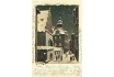
The particular architectural character of the Jewish ghetto, which
was narrow and cramped, never inspired Prague’s postcard producers. An
exception to this is the Old Jewish Cemetery, and the complex of the
Old-New Synagogue and the Jewish Town Hall in Rabínská Street. Featured
in this postcard are the latter two buildings. The picturesque character
of the buildings is accentuated by the atmosphere of a winter evening.
COLOURED LITHOGRAPH. AROUND 1898
| 223 - A panoramic view of the houses on the Old Town part of the river bank neighbouring the Jewish ghetto
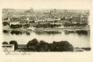
Interestingly, the picture shows the contrast between the traditional
economic character and the modern representative character of the area.
On the right, we can see the architecturally imposing Rudolfinum, while
behind the building there is a row of small peripheral houses, former
saltpetre plants, penitentiaries, sawmills and wood storehouses. The Old
Town part of the river bank is separated from the heavily built-up
ghetto, by Sanytrova (today 17. listopadu) Street. in the background we
can see the ghetto which is visually demarcated by the Church of the
Holy Spirit, the Church of St Salvator and the Church of St Nicholas.
EXTRA-LARGE POSTCARD. PICTURE AROUND 1895. K. BELLMANN, 1898
| 224 - A view of the Jewish Town Hall and of a part of the Old-New
Synagogue in Rabínská Street from the north
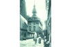
The originally Gothic Town Hall was presumably built as early as in
the 16th
century. Later it was rebuilt in the Renaissance style, and in the 1760s
it acquired a new Baroque appearance. The Baroque reconstruction was
based on the project by J. Schwanitzer (also called Schlesinger). The
front of the Town Hall faces Rabínská Street, and it is one of the few
old ghetto buildings with a Baroque decorative facade, which was quite
common in other parts of Prague. A part of the building is a wooden
tower with a Hebrew clock. In 1908 the construction was extended by
three floors. The Jewish Town Hall is the only secular building of the
ghetto which was saved during the slum clearance (see picture 273).
PHOTOTYPE. PHOTOBROM W FIRM, AROUND 1905
| 225 - The Old-New Synagogue, built in the last quarter of the 13th
century
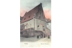
Not only is it one of the oldest European Jewish monuments, it is
also one of the earliest Gothic buildings in Prague. The Synagogue has
always been the religious centre of the ghetto. Its particular role and
importance was emphasized by the fact that it stood apart from other
buildings, unlike other Prague synagogues. There was a small marketplace
in front of its back facade - it was the only area of the ghetto which
could be called a square. On the right side of the postcard we can see a
part of house No. 220, the so-called Wedeles House, on the corner of
Červená and Rabínská Streets. It is one of the five ghetto synagogues
which survived the slum clearances.
COLOURED PHOTOTYPE. AROUND 1900
| 226 - A view of Červená Street from the south-west
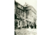
The part of the street we can see formed the northern part of a small
square behind the Old-New Synagogue. On the right the street leads to
Cikánská Street (see picture 228). The name of the street (červená means
red) is linked to the red colour of the meat stores which used to be
here. At the time this picture was taken, the meat stores had moved to
the northern part of Masařská Street in front of the Velkodvorská (Grand
Court) Synagogue. The impressive Moscheles House, No. 167, dominates
the centre of the street. Its Baroque terrace was particularly
attractive to photographers who tried to capture the unique character of
the disappearing ghetto. The cracked plaster shows the extent to which
the building had been neglected.
PHOGOGRAPHIC POSTCARD. PICTURE BEFORE 1903. Z. REACH, 1920s
| 227 - Small square behind the Old-New Synagogue
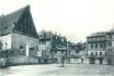
Used to serve as a marketplace, called either the Dřevěný (Wood) or
the Řeznický (Meat) Square, depending on the predominant goods in the
market. The picture was taken after demolition of the buildings behind
the synagogue, especially after No. 164, on the right of Červená Street,
had been pulled down. This opened a view to the possibly most bizzare
building complex of the ghetto - the Baroque Moscheles House, No. 167,
in the northern part of the Square. Differences in heights of the
buildings, some houses having several storeys, others only one, were
typical of the ghetto.
PHOTOGRAPHIC POSTCARD. PICTURE BEFORE 1903, Z. REACH, 1920s
| 228 - A vista of Červená Street
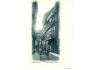
A vista of Červená Street, from its intersection with Cikánská Street
towards the little square behind the Old-New Synagogue. The postcard
shows a typical ghetto street. Because of its east-west direction the
sun could penetrate the street, while the streets running north-south
were darker. On the right, behind the house No. 172, stands the
Moscheles House, No. 167. It is an imposing four-storey Baroque building
with a terrace. Behind it is the side wall of the originally Gothic,
later Renaissance, Wedeles House, No. 220, standing on the corner of
Červená and Rabínská Streets. During the flood which hit the ghetto in
1890, the water reached the middle of the windows on the ground floor.
The houses in Červená Street were pulled down between 1903 and 1905.
PHOTOTYPE. K. BELLMANN, 1897
| 229 - Střelná Street
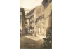
Part of the Old Town between Dušní and Cikánská Streets, as seen from
Dušní in the direction of Cikánská. There were many cul-de-sacs and
houses with right of way beneath them in the Jewish ghetto and the
neighbouring parts of the Old Town. One of these houses was the famous
four-storey house with a built-on gallery - U Šišlingů, No. 890, which
was situated between Střelná and Cikánská Streets. This house and others
surrounded the Church of the Holy Spirit and formed a narrow strip of
Christian ground which separated the eastern and western parts of the
ghetto. The street on the left in front of house No. 891, where V.
Kratochvíl kept a store, leads to a small square in front of the
Church of the Holy Spirit. The long house, No. 889, with its
interesting, uneven front (on the right) stands on the corner of Dušní
Street. Both houses on the right side of the street were demolished
between 1909-1911. The house on the left was one of the last three
original houses that surrounded the Church (see picture 233) and it was
demolished three years later.
PHOTOGRAPHIC POSTCARD. PICTURE BEFORE 1909. Z. REACH, 1920s
| 230 - The Spanish Synagogue
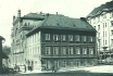
On the corner of Dušní and Vězeňská Streets which was designed by I.
Ullmann and J. Niklas. It was built in the second half of the 19th
century in the Moorish style, replacing the original and oldest
synagogue called the Old School in a Jewish settlement of the same name.
The Old School Synagogue and several Jewish houses surrounding it
formed a separate area which never merged with the western part of the
ghetto. Most of the houses in the area were demolished in 1911 and 1912.
Behind the synagogue, on the raised ground on the corner of the
restructured U staré školy (The Old School) Street and Vězeňská Street,
we can see the construction of house new No. 115, designed by J.
Dneboský. The house on the corner with the Neo-Classical facade was the
last surviving of the original houses and it was demolished in 1935.
PHOTOGRAPHIC POSTCARD. PICTURE 1912. Z. REACH, 1920s
| 231 - A view of the northern part of Cikánská Street in the direction of Janské Square
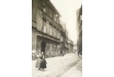
Cikánská was a side street of the Josefov Quarter which ran through
the ghetto from north to south. The houses were not particularly
architecturally imposing and, like most of the other houses in the
ghetto, they had very simple facades. Typically, there were cornices
between the floors and ledges above the windows, which protected the
window panes which were inserted towards the front, in the Baroque
fashion, and were thus exposed to the rain. On the left, behind houses
Nos. 190, 191 and 192 and in front of No. 884 (the house with the
street- lamp) Rabínská Street opens into Cikánská. In the background, we
can see a part of a two-storey house, No. 875, in Janské Square (see
picture 139). The houses on the left side of the street were demolished
in 1905 and 1906.
PHOTOGRAPH. 1902
| 232 - Vězeňská Street, as seen from Kozí (Goat) Square
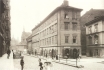
On the right, there are the original buildings of the area around
the Old School, on the left, there are houses built on elevated ground
after the slum clearance. The two ground levels are separated by
railings and connected by stairs. The street on the right, which is
lined by buildings Nos. 860 and 150, leads to the Old School Synagogue.
The two-storey rectory of the Church of the Holy Spirit, No. 894,
standing behind four houses, Nos. 147, 146, 144 and 143, was demolished
as late as in 1933. The other houses were pulled down in 1912. In the
northern part of the street on the left there are new houses, new Nos.
910-914, built in 1905 and 1906. In the background, we can see two
houses - new No. 66 on the left, built in 1904 on the corner of
Mikulášská and Široká Streets and designed by J. Vejrych, and new No.
124 on the right, behind the rectory, built in 1908 on the corner of
Široká and E. Krásnohorské Streets and designed by F. Niklas.
PHOTOGRAPHIC POSTCARD. PICTURE 1909. Z. REACH, 1920s
| 234 -A view of Dušní in the direction of the Church of the Holy Spirit
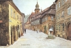
We can see the Christian and Jewish parts of the area merge, and two
narrow streets, the Jewish Masařská Street on the right and the
Christian Bílkova Street on the left, lead into Dušní Street. On the
left, in the foregound, there is the two-storey house No. 861, U Bílků,
decorated by a Baroque cartouche, which gave its name to the side
street. (Originally Bílkova Street was a cul-de-sac, later it was
connected with Cikánská Street after houses 855 and 856 were demolished
in 1901 and 1902, see picture 143.) Nos. 186, 888, 889, 893, on the
right, next to the Church of the Holy Spirit, were demolished between
1911 and 1914. in the front, there is a public
well with interest ing roofing.
FOUR-COLOUR AUTOTYPE. AFTER AN OIL-PAINTING BY J. MINAŘÍK, 1907. F. J. JEDLIČKA, 1915
| 235 - A courtyard of No. 156 in the area around the Old School
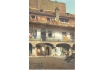
The houses in the district were built in the Middle Ages and had
Renaissance galleries and Baroque attics. There were many busy stores
and businesses centred around the spacious courtyard, which resembled a
small square. No. 156 was, in contrast to the cramped neighbouring
houses, spacious and sunny. The photographer’s intention was not,
apparently, to portray people, he was interested in the sunlit courtyard
and none of the people in the postcard seem aware of the photographer’s
presence, with the exception of the woman at the wash-tub who has just
finished doing her laundry. In the background we can see the wall of
house No. 287. The picture was taken a short time before the demolition
of the buildings in 1911.
COLOURED PHOTO-LITHOGRAPH. PICTURE 1908. MONOPOL, PROBABLY THE 1930s
| 236 - House Nos. 180 and 182 on the corner of Masařská Street and
Cikánská Street
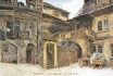
Originally, there was a lovely, architecturally varied courtyard and a
Baroque gallery with an external roofed staircase, which was one of the
most typical architectural elements to be found in the Jewish ghetto.
This house, like many others, originally belonged to the banker J.
Bassevi. It may have been one of those houses built on the periphery of
the ghetto, which belonged to Protestant exiles and which Bassevi bought
after 1621. Before the slum clearance, the courtyard was a popular
motif for painters and photographers interested in depicting the
disappearing parts of Prague. The house was demolished in 1910.
FOUR-COLOUR AUTOTYPE. AFTER AN OIL-PAINTING BY J. MINAŘÍK, 1907.
F. J. JEDLIČKA, 1915
| 238 - The southern part of Hampejská Street with Nos. 229, 231, 232 and (behind the tree) 234
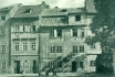
The picture could have been taken only after the opposite house, No.
230, was demolished in 1907. The wall on the right lines the Old Jewish
Cemetery. The street makes a curve to the right along the Cemetery and
the Klausen Synagogue and then, following a straight section, leads into
Rabínská Street (see picture 237). The houses in Hampejská have a
common architectural motif - hinged windows, which suggests a mediaeval
origin of the buildings. As the name implies (Brothel Street), Hampejská
was a centre of prostitution in the ghetto. However, this was not the
only place in the ghetto and the neighbourhood where prostitution was
practiced. There were brothels in V Kolnách, Valentinská and U
Milosrdných Streets (see picture 147), on the corner of Josefovská and
Kaprová Streets, in the U Denice pub in Rabínská Street and in other
places. The houses in Hampejská were pulled down in 1909./p>
PHOTOTYPE. K. BELLMANN, 1909
| 239 - Buildings Nos. 221, 222, 223 and 225 (from the left) in Rabínská Street
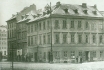
Facing the Old-New Synagogue between Břehová Street (in the
foreground) and Hampejská Street (in the background) show the typical
architectural style of the ghetto, marked by simplicity and sobriety.
The houses were built and some reconstructed in the first half of the
19th century. At that time, this section of the western part of the
ghetto was full of construction and reconstruction activity - houses
were being enlarged and every free space was used to erect a new
building. The picture shows one of the last strips of old buildings in
the area. In the background there is the southern part of the newly
built Široká and Mikulášská Streets. The old houses in the picture were
demolished in 1909. In 1910 and 1911, a modern appartment complex, new
No. 41, was built in their place - it was again marked by a sober
architectural tone and was based on designs by R. Klenka and F. Weyr.
PHOTOGRAPHIC POSTCARD. PICTURE 1909. Z. REACH, 1920s
| 240 - The western end of Josefovská Street
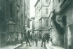
Should the photographer have moved forward from the standpoint he has
adopted in picture 241 behind the small shops in the Cemetery wall, he
would have seen
exactly the same scene we see in the above picture. On the right, behind
house No. 20 with a street lamp, there is a cul-de-sac - Pinkasova
Lane, which runs vertically towards Josefovská and leads to the Pinkas
Synagogue (see picture 248). Behind Pinkasova Lane stands house No. 8
and other buildings of Valentinské Square, which can be seen in picture
242. The posters on No. 19 (on the left) announce that the store of K.
Lang has moved to a different part of the street. Three men and children
pose for the photographer. The inscription on the postcard identifies
the man standing in the middle as the builder Lehký (this is probably
Emanuel Lehký, businessman in the field of sewerage systems). The slum
clearance in this part of the ghetto took place in 1908.
PHOTOGRAPHIC POSTCARD. PICTURE 1907. Z. REACH, 1920s
| 242 - Valentinské Square
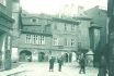
Pat the intersection of Josefovská and Kaprová Streets (on the right)
and Valentinská Street. The photographer is standing at the end of
Valentinská. This small square was one of the places where Jewish and
Christian Prague mixed. The architec turally varied houses, Nos. 11, 10,
9 and 8, in the northern part of the Square were administratively part
of Josefov. Behind No. 8 (on the right) ran Pinkasova Lane, which led to
the Pinkas Synagogue. The houses were demolished in 1907. Today, part
of the building of the Philosophical Faculty of Charles university and
the northern part of new Valentinská Street stand on the site.
PHOTOGRAPHIC POSTCARD. PICTURE 1902. Z. REACH, 1920s
| 243 - The second-hand store which belonged to Moses Reach
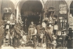
It was built into a wall which divided the western end of Josefovská
Street from the Old Jewish Cemetery (see picture 241). There were many
such second-hand stores in the ghetto. According to the writer I.
Herrmann, who in 1902 writes about life in the Prague ghetto, there was
hardly an empty space between the walls which was not used as a
second-hand store. All sorts of goods were available in the Jewish
second-hand stores: antiques, rare books, clothes, hardware and
bric-a-brac. Some dealers had stores, others carried bundles or pushed
their goods, priced at one or two guldens, on carts. They walked the
streets of the ghetto and at the end of the day they might make a profit
of a few kreutzers, which assured a poor living.
PHOTOGRAHIC POSTCARD. PICTURE AROUND 1898. Z. REACH, END OF THE 1920s
| 245 - A part of the northern side of Josefovská Street
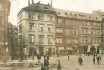
Between Rabínská Street (on the left) and Šmilesova Street (on the
right, this street is not in the picture). Josefovská was the widest
street of the ghetto. Its original name was Široká („wide“), and this is
also the name of the new street which was built in its place. Although
Josefovská Street was wide, this picture was taken only after the
opposite part of the street had been pulled down in 1896-1898, which
enabled the photographer to stand at a distance. On the left, on the
corner of Rabínská Street, stands No. 264, on the opposite corner No.
95. Apparently the latter func tioned as one of the most elegant and
luxurious brothels in the ghetto and in the whole city of Prague. It was
run by one J. Friedmann who managed to be both a detective and
conspirator. The houses in the picture were demolished in 1905. In
picture 258 we can see the demolition of the three houses on the right,
Nos. 105 (a part), 104 and 98.
PHOTOGRAPHIC POSTCARD. PICTURE AROUND 1900. Z. REACH, 1920s
| 246 - A different part of the northern side of Josefovská Street
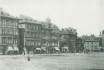
In the middle of the postcard there are four houses, Nos. 127, 126,
125 and 124 between Šmilesova Street (on the left) and Cikánská Street
(on the right). The house on the corner, No. 127, is standing on the
site where Pařížská Street runs today - see picture 268. Josefovská
Street then runs along No. 900 on the corner of Cikánská and Kostelní
Streets and leads to the intersection of Dušní and Vězeňská Streets (on
the right, just off the picture). Although this was the busiest street
of the ghetto, the houses were not architecturally impressive as most of
the buildings underwent alterations during the 19th century. Due to the
intensive attitude towards the demolitions between 1903 and 1905,
without any archeological research, much precious information about the
architectural development of the ghetto was lost. The opposite, southern
part of the street was no longer extant at the time of taking this
picture. But we can see it in the following postcard.
PHOTOGRAPHIC POSTCARD. PICTURE AROUND 1900. Z. REACH, 1920s
| 247 - The southern side of Josefovská Street
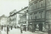
The street was 400 metres long, thus it was the longest thoroughfare
in the Jewish Town. It led to Kaprová Street in the west, and to
Vězeňská Street in the north-east. The picture was taken a short time
before the demolitions in this part of Josefovská Street started, and it
captures the liveliness of the street. The three houses on the right
are Nos. 92, 91 and 90. Rabbi Löw (1520-1609), the supposed creator of
the legendary Golem, used to live in a house standing on the site of No.
90. The original Meislova Street leads into Josefovská behind these
houses. In the background, in front of No. 115, protruding into the
street, we can see the building of the New Synagogue, No. 113,
distinguished by its high windows. All the buildings in this picture
were demolished between 1896 and 1898.
PHOTOGRAPHIC POSTCARD. PICTURE 1896. Z. REACH, 1920s
| Rabbi Löw

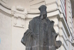
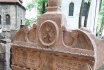
Judah Loew ben Bezalel, alt. Loewe, Löwe, or Levai, (c. 1520 – 17
September 1609)[1] widely known to scholars of Judaism as the Maharal of
Prague, or simply The MaHaRaL, the Hebrew acronym of "Moreinu ha-Rav
Loew," ("Our Teacher, Rabbi Loew") was an important Talmudic scholar,
Jewish mystic, and philosopher who served as a leading rabbi in the city
of Prague in Bohemia for most of his life.
Within the world of Torah and Talmudic scholarship, he is known for
his works on Jewish philosophy and Jewish mysticism and his work Gur
Aryeh al HaTorah, a supercommentary on Rashi's Torah commentary.
The Maharal is the subject of a nineteenth-century legend that he
created The Golem of Prague, an animate being fashioned from clay.
Rabbi Loew is buried at the Old Jewish Cemetery, Prague in Josefov,
where his grave and intact tombstone can still be visited. His
descendants' surnames include Loewy, Loeb, Lowy, Oppenheimer, Pfaelzer,
and Keim.
The Golem of Prague
The most famous golem narrative involves Judah Loew ben Bezalel, the
late 16th century chief rabbi of Prague, also known as the Maharal, who
reportedly created a golem to defend the Prague ghetto from antisemitic
attacks[8] and pogroms. Depending on the version of the legend, the Jews
in Prague were to be either expelled or killed under the rule of Rudolf
II, the Holy Roman Emperor. To protect the Jewish community, the rabbi
constructed the Golem out of clay from the banks of the Vltava river,
and brought it to life through rituals and Hebrew incantations. As this
golem grew, it became increasingly violent, killing gentiles and
spreading fear. A different story tells of a golem that fell in love,
and when rejected, became the violent monster seen in most accounts.
Some versions have the golem eventually turning on its creator or
attacking other Jews.
The Emperor begged Rabbi Loew to destroy the Golem, promising to stop
the persecution of the Jews. To deactivate the Golem, the rabbi rubbed
out the first letter of the word "emet" (truth or reality) from the
creature's forehead leaving the Hebrew word "met", meaning dead. The
Golem's body was stored in the attic genizah of the Old New Synagogue,
where it would be restored to life again if needed. According to legend,
the body of Rabbi Loew's Golem still lies in the synagogue's attic.
Some versions of the tale state that the Golem was stolen from the
genizah and entombed in a graveyard in Prague's Žižkov district, where
the Žižkov Television Tower now stands. A recent legend tells of a Nazi
agent ascending to the synagogue attic during World War II and trying to
stab the Golem, but he died instead. When the attic was renovated in
1883, no evidence of the Golem was found.[10] A film crew who visited
and filmed the attic in 1984 found no evidence either. The attic is not
open to the general public.
Some strictly orthodox Jews believe that the Maharal did actually
create a golem. Menachem Mendel Schneerson (the last Rebbe of Lubavitch)
wrote that his father-in-law, Yosef Yitzchok Schneersohn, told him that
he saw the remains of the Golem in the attic of Alt-Neu Shul. Rabbi
Chaim Noach Levin also wrote in his notes on Megillas Yuchsin that he
heard directly from Rabbi Yosef Shaul Halevi, the head of the Rabbinical
court of Lemberg, that when he wanted to go see the remains of the
Golem, the sexton of the Alt-Neu Shul said that Rabbi Yechezkel Landau
had advised against going up to the attic after he himself had gone up.
The evidence for this belief has been analyzed from an orthodox Jewish
perspective by Shnayer Z. Leiman.
Source and more informations :
www.en.wikipedia.org/wiki/Judah_Loew_ben_Bezalel
en.wikipedia.org/wiki/The_Golem_of_Prague
| 248 - The cul-de-sac Pinkasova
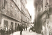
It originates in Josefovská Street and leads to the Pinkas Synagogue
(see picture 249) and to the Old Jewish Cemetery. On the right, we can
see the bay of the synagogue projecting into the street, in the
background we see a part of the Museum of Decorative Arts, built on a
piece of land belonging to the Cemetery. It was in this narrow and quiet
lane that the numbering of houses in the ghetto began, with the house
of the Jewish Burial Society, No. 1. (in the back, in front of the
wall). The numbering existed already before 1770. The houses on the left
side of the street, Nos. 1 - 5 and No. 8 on the corner, date back to
the second half of the 18th century and were built after the fire of
1754. On the right there is a house with a street lamp, No. 20. we saw
the builder Lehký posing in pictures 240 and 244. His appearance in all
these photographs can be explained by his involvement in the slum
clearances. The houses in this street were demolished during 1907 and
1908.
PHOTOGRAPHIC POSTCARD. PICTURE 1906. Z. REACH, 1920s
| 249 - The western wall of the Pinkas Synagogue, No. 23, originally
facing Pinkasova Lane
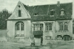
The synagogue was built in the second half of the 15th century in
the Late Gothic style. It takes its name from Rabbi J. Pinchas, the
supposed founder. It was often reconstructed, the most significant
alterations being in the Renaissance style which it has retained till
today. In 1908 the surrounding houses were demolished and the terrain
elevated by about 2 metres, and so the synagogue became fully visible.
On the left we can see trees behind the wall of the Old Jewish Cemetery.
It is remarkable that the Synagogue was not destroyed during the slum
clearances, although its corner projects into the newly built Široká
Street. The synagogue underwent a number of reconstructions from the end
of the 19th century. Today the synagogue serves as a memorial to all
the Bohemian and Moravian jewish victims of the Nazis.
PHOTOTYPE. K. BELLMANN, AROUND 1909
| 250 - The Jewish baths existed in the ghetto from the 15th century
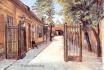
They were built between the cul-de-sac Goldřichodvorská and Sanytrová
Streets, on the periphery of the ghetto. The bath in this picture was
situated in the block between the nameless lane leading to the Old
jewish Cemetery and Sanytrová Street. This bath was not the only one.
Another bath was situated in the house neighbouring the New Synagogue in
Josefovská. The bath had an important cleansing, but also ritual,
function in the life of the jews. The two buildings, No. 274 (on the
left), and the bath itself, No. 208 (on the right), were demolished in
1905 and in 1908 respectively. Baths were often situated next to
synagogues, and they were a favourite motif of photographers, often
appearing on postcards.
FOUR-COLOUR AUTOTYPE. AFTER AN OIL-PAINTING BY J. MINAŘÍK, AROUND 1905.
F. J. JEDLIČKA, 1915
| 251 - The Jewish cemetery
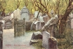
Was founded in this place in the first half of the 15th century as a
replacement for the original Jewish cemetery, situated in the area of
what is today Vladislavova Street in the New Town. Apparently, there was
an even older burial ground, founded as early as in the 11th century,
next to a Jewish settlement near the present Újezd in the Lesser Town.
The new cemetery originally covered a smaller area, but it was gradually
enlarged after more land was bought. However, once no more land was
available, people had to be buried on top of one other in several
layers. The tombstones were usually raised from the deeper layers to the
top and so today they are crammed, one next to the other. This is a
typical feature of the Prague Jewish cemetery. There are as many as 12
thousand tombstones, the oldest tomb being that of the doctor, poet and
rabbi Avigdor Kara (1439). The last burial was in 1787.
COLOUR PHOTOTYPE. UNIE PRAGUE, AROUND 1905
| 252 - The tripple corner of Úzká Street (on the left) and Jáchymova
Street (on the right)
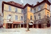
Two Renaissance houses, exceptionally large in the context of the
ghetto, No. 61, U Vápenice, and No. 62, Trefanovského, were joined,
forming an interesting small square. The houses had simple facades,
restored in the 19th century. There were small stores on the ground
floors and a gas lamp-post and a well in the middle of the square. The
shop on the corner of the house on the left belonged to A. Plass, who
moved in 1897, when the house was demolished, to No. 32 (see picture
253). No. 61, U Vápenice, served as the first college in Prague after
Charles IV bought the house from the Jew Lazarus and then donated it to
the university.
FOUR-COLOUR AUTOTYPE. AFTER AN OIL-PAINTING BY J. MINAŘÍK, BEFORE 1897.
F. J. JEDLIČKA, 1915
| 253 - The corner of Kaprová and Úzká Streets
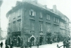
No. 32 belonged administratively to the Old Town, but the house
behind it, No. 59 (on the right), was already part of josefov. On the
left, the Christian Kaprová Street runs west towards the bank, on the
right we can see the Jewish street called Úzká. The picture was taken
from the railed-off, elevated ground on the site of the already
demolished house No. 30. we can see A. Plass’s general shop (see picture
252) bearing signs advertising Maggi (a spicy sauce), Kolínská káva
(coffee), and V. Gráf’s shoe-shop with a display of wellingtons. The
original, pre-clearance street was, as its name Úzká (narrow) indicates,
only 3 metres wide. The house on the corner was demolished in 1905.
PHOTOGRAPHIC POSTCARD. PICTURE AROUND 1903. Z. REACH, 1920s
| 254 - The western side of the busy Úzká Street with a view towards Josefovská Street
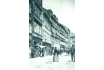
The original name of the street was Zlatá (Golden). As in the
previous postcards, the photographer was standing on the site of already
demolished houses. In this case, he stood at the opposite side of the
street, several metres south of the Meisl Synagogue, now standing
solytarily in the midst of the cleared area. The high, originally Gothic
houses never allowed any sun to penetrate the narrow street, and so the
place was gloomy and depressing. However, this picture shows facades
flooded with sunlight, rows of high windows and, on the ground floor,
shops with all sorts of goods. At No. 55, on the left, we can see a
second-hand clothes shop, further on, at No. 53, there is a pottery
store, with a display of jugs, mugs and various china goods. The facade
of No. 53 has apparently been recently restored, and itstands in
contrast to the shabby facades of the neighbour ing houses. But even
this house was demolished in 1905 during the clearances in this street.
In the middle of the street there stands a four-storey house, No. 50,
with three remarkable hinged dormer-windows. No. 264 in Josefovská
Street closes the view of the street (see picture 245).
PHOTOGRAPHIC POSTCARD. PICTURE 1902. Z. REACH, 1920s
| 255 - Meislova Street
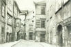
Meislova Street, as seen from Staroměstské Square towards the north
(picture 257 shows the street from the opposite side). Meislova
originated at the square next to the Church of St Nicholas. It made
several sharp turns before it led into Josefovská Street. The picture
shows the widest part of the street, near Kostečná Street. On the right,
there is one of the two Renaissance palaces belonging to the banker J.
Bassevi, No. 74. They did not form part of the ghetto until the 17th
century. No. 78, U rajských jablek (The Paradise Apples), behind
Kostečná Street, served as a hotel - the hotel Flussek. A passage-way
ran through the next house. It led to the New synagogue and to
Josefovská Street. The ongoing Meislova Street, which curved to the
left, led to Josefovská and to the Meisl Synagogue respectively. The
Synagogue is hidden from view by the houses numbered 75, 76 and 77 on
the left which were destroyed in the first stage of clearances during
the years 1896 and 1897.
PHOTOGRAPHIC POSTCARD. PICTURE 1895. Z. REACH, 1920s
| 256 - The Meisl Synagogue, originally built in the Late Renaissance
style
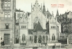
It was founded in 1590 by Mordechai Meisl, who was a wealthy
businessman and the primate of the Prague Jewish Community. The
Synagogue stood in the block between Jáchymova and Josefovská Streets.
It could be reached from Meislova and Úzká Streets. After the houses in
the eastern part of Úzká Street were destroyed, a new street was built
on the site. It bore the name Maiselova, somewhat altering the original
spelling of the name. The picture shows the new Maiselova Street and the
decorative western front of the Synagogue after its 1893-1905
Neo-Gothic reconstruction. The houses surrounding the Synagogue were
built in the first five years of the 20th century.
PHOTOTYPE. F. J. JEDLIČKA, AROUND 1907
| 257 - The original Meislova Street, in the direction of Staroměstské Square
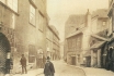
No. 935, on the corner of Meislova and the Old Town Square, closes
the view. House No. 935 and the neighbouring No. 934 were the first
houses to be demolished in Meislova in 1896 (see pictures 259 and 261),
thus launching the whole clearance project. Mikulášská Street was later
built on this site approximately along the line of the south ern part of
the original Meislova Street (see pictures 268 and 269). In the
postcard, we can still see the Renaissance palace, No. 73, belonging to
the banker J. Bassevi (on the left), and behind it, houses Nos. 72 and
71. On the right, on the corner of Jáchymova Street, there is No. 70 and
next, there is a small two-storey house with an open staircase, No.
277, which served as a customs-house (this is where theexcise tax - a
tax levied on food at the border of the Old Town and the Jewish Town was
collected). Beyond the customs-house stands the Benedictine Monastery.
The whole street was demolished in 1896 and 1897.
PHOTOGRAPHIC POSTCARD. PICTURE 1895. Z. REACH, 1920s
277 - Eliščina Street runs between the end of Klimentská Street and the Franz Josef I Bridge
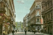
This street, which lies along the route of the former moat
surrounding the old town ramparts, consisted originally of ugly low-rise
buildings. This image persisted until the 1860s and 1870s. Following
the construction of the bridge, practically all the original buildings
were replaced by four-storey buildings with Neo-Renaissance facades.
While the right side of the street has remained extant, with slight
modifications, till today, the end of the 1920s saw gradual demolitions
on the left side of the street and the construction of new residental
and administrative buildings. The simultaneous removal of the street
line substantially broadened the road.
LACQUERED COLOURED COMBINED PRINT. MONOPOL PRAGUE, 1910
| 278 - The end of Eliščina Street, leading to the Franz Josef I Chain Bridge
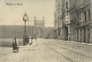
On the right we can see the residential building No. 1503 and the
Eliščiny Baths, No. 1248. These two structures replaced an old factory
built here in 1869 by J. Ehlen and J. Kandert in English Neo-Gothic
style which corresponded so well with architecture of the bridge. Most
flats in Prague at the turn of the century were still without bathrooms
and, in older quarters, even without water. People used to wash in the
kitchen, and water brought from outside was heated in kitchen pots. In
order to avoid this domestic discomfort, many Prague citizens used to
frequent the affordable public baths where they had a choice between
steam, shower or bathtub. The planned construction of a new bridge led,
in 1940, to the demolition of the public baths as well as of the
neighbouring structure, and the bridgehead attained its final form. On
the left we can still see the bank gently sloping towards the river.
This situation was changed only in 1908 with the completion of the
construction of the embankment between Na Františku and the Bridge.
PHOTOTYPE. K. BELLMANN, 1907
| 279 - The Franz Josef I Chain Bridge with a view of the Letná Quarter
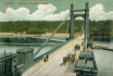
The bridge connected the old and new town with Holešovice Quarter. It
was built in the years 1865-1868 as Prague’s second chain bridge, to a
design by the British architects Ordish and Le-Feuvre, with the
cooperation of M. am Ende. The actual construction of the bridge was
carried out by the firms Ruston and Co. and Ing. F. Schön, from iron
imported from Sheffield. Even though the bridge impressed the public
with its beauty, it lacked the desirable stability, and it therefore
underwent two reconstructions. The first of these took place in 1888,
the other prior to 1898. However, even between the reconstructions, the
traffic on the bridge had to be limited and occasionally even stopped.
In view of the ongoing problems, and in order to meet the challenge of
the expected throngs of visitors trying to get to the other side of the
river to see the Jubilee exhibition, a makeshift wooden bridge was built
here in 1891 connecting the little square Na Františku with the Quarter
of Letná (see picture 142). In the foreground we can see the houses of
the collectors of the bridge toll and of the cashiers, with special
signs on the roofs which changed their position after the passage of
each new 100 pedestrians, i.e. after the collection of each new 100
kreutzers. This bridge was demolished in 1947, to be replaced in 1951 by
a ferroconcrete one.
COMBINED COLOURED PRINT. UNIE PRAGUE, AROUND 1905
| 280 - The Institute of Noblewomen at the intersection of Eliščina Street and Josefské (Josef) Square
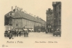
This bulky building, no. 655, with a garden, also known as
Norbertinum, was constructed in the years 1637-1640, and was used from
1787 as the new seat of the Institute of Noblewomen, which had
previously been housed in U Nemocnice Street (see picture 393). The
building of the Institute of Noblewomen and two other buildings standing
behind it, were demolished in 1928, thus giving rise to a new, extended
street line. It was on the corner of this new street that architect J.
Žák built the new Functionalist Kotva Building. In front of it we can
see a stand for horse-drawn carriages and fiacres. The area behind the
wall of the now defunct Královodvorské Barracks just off the picture on
the left was used in 1975 for the construction of Kotva department
store. On the right, at the intersection with Truhlářská Street, we can
see No. 1080, housing Merkur Café, later renamed U Pečenků. The
structure was rebuilt (probably in the 1920s), and one storey with an
attic roof was added. On the extreme right we can see a part of Josef
barracks.
PHOTOTYPE. H. SEIBT, MEISSEN, AROUND 1900
| 281 - A view from Josefské Square

A view from Josefské Square of the complex of structures built on the
location of the former Královodvorské Barracks with the Military
Academy. The building of the general representation of the Austrian
Allianz Insurance Company (on the right) was constructed in the years
1903-1904 by the Viennese architect J. Stiegler. The neighbouring
Chamber of Commerce, built in the same period by A. Turk, was an
association of eight regional chambers of businessmen, entrepreneurs and
craftsmen in the Kingdom of Bohemia. These chambers, founded in 1850,
were advisory institutions lobbying the legislature and the executive,
and profferring their proposals for the advancement of trade and
industry. They had registered members and they appointed members of the
Commercial Court. In the background we can see the completion works on
the Paříž (Paris) Hotel, while work was just beginning on the
construction of the municipal building (see picture 121) just off the
picture on the left.
COLOURED PHOTOTYPE. 1905
| 282 - A view of the north-eastern part of Josefské Square from the wall of the Military Academy
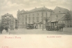
From 1875 it was a part of the first route of the horse-drawn tram
connecting Karlín Quarter with the Emperor Franz Chain Bridge. The
Square is also connected with the 1898 electrification of the first
section of the tram network, linking Josefské Square with Královská
Obora (a part of the longer route connecting Královská Obora with the
Královské Vinohrady Quarter). In the same year 1898, prior to the
electrification of yet another section of the route between Josefské
Square and Na Můstku, the passengers had to change from an electric tram
to a horse-drawn one.
PHOTOTYPE. L. J. ČECH, 1898
| 283 - A view of the north-eastern side of Josefské Square with a glimpse of Poříčská Street
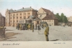
The tram standing in front of the waiting room operated on the
already fully electrified route Královská Obora - Královské Vinohrady.
In the background, on the corner of Truhlářská Street, we can see Josef
Barracks of 1860, Nos. 1078 and 1079, built on the site of the former
Capuchin Monastery in the English Neo-Gothic style. This was, in 1834,
the temporary workplace of the classic Czech playwright J. K. Tyl who
was employed here by the military as a quartermaster and who fought the
boredom of the job by composing here, among other things, the future
Czech national anthem Kde domov můj? (Where Is My Home?). The
neighbouring building on the right is the monastery Church of St Joseph,
a simple structure in the Capuchin style built in the first half of the
17th century by M. Mayer. From the beginning of the 19th century to
1833 it was used by the military. In the same year the Capuchin order
received compensation for the dissolution of the monastery in the form
of the two-storey corner building No. 1077.
COLOURED PHOTOTYPE. K. BELLMANN, 1900
| 284 - A view from Na Příkopě Street of the southern part of Josefské Square
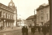
On the left we can see the recently constructed municipal building.
On the right we can see the bulky front of the building U Hybernů and
the adjacent building complex No. 1037, then serving as the customs’
office. The original building on this site was a monastery with St
Ambrose’s Church, founded in 1355 by Charles IV for Benedictines of the
Milan liturgy. The monastery complex included a large garden covering
the whole territory of the future block of buildings ranging as far as
Jezdecká Street (today called Havlíčkova). The lots on which we can see
the pictured buildings had a succession of owners and served many
different purposes. The name U Hybernů, i.e. The Hibernians, was derived
from the name of the Irish Franciscans who, after being exiled from
Britain, came in 1630 to Prague where emperor Ferdinand II granted them
this area and permitted them to build their monastery and church here.
Generously sponsored by their friends, the Hibernians (Hyberňáci, as the
Prague populace dubbed them) completed their building efforts here in
the period 1637-1739, and devoted themselves to teaching
school-children, educating missionaries and, last but not least, to
growing potatoes, until then unknown in Bohemia. After the closure of
the monastery in 1786, the monks returned to Ireland. In the 19th
century the building complex was used by the tax office which had the
complex remodelled in Neo-Classical style in 1808-1811 to be used as a
customs’ office and tax office.
PHOTOGRAPHIC POSTCARD. PRAGA PHOT., AROUND 1916
| 285 - A soda kiosk selling soda and other refreshments
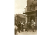
In Poříčská Street close to the intersection with Josefské Square,
situated on the side wall of No. 1035 (see picture 513). The kiosk was
owned by C. Widtman and its large size and unusual architecture made it
appear very different from the standard octagonal refreshment stalls
strewn over the main streets and squares of Prague from the 1870s. At
the stall we can see a gathering of drinking patrons dominated by the
corpulent Prague humorist, cabaret actor, publisher and bookseller J.
Šváb Malostranský (1860-1932). Originally a baker’s apprentice, he had a
predilection for rather different professions. He was first apprenticed
as a bookseller, then, in 1888, he opened a small stationery shop in
Mostecká Street, and a publishing house specializing in popular songs,
music-hall ditties and postcards (see picture 63. Selected postcards
published by him won the Grand Prix at the Paris World Exposition in
1900. As a popular singer and actor he became a representative of the
Czech folk humour of the time. Together with his colleagues Innemann,
Wanderer, Oberst and others he acted in cabarets both in Prague and in
other cities of the Czech Kingdom. In 1898 he became the first Czech
film actor in three short films shot at the Exhibition of Architecture
and Engineering by the pioneer of Czech cinema J. Kříženecký. Later Šváb
Malostranský acted in innumerable Czech silent films and even in four
sound films.
PHOTOGRAPHIC POSTCARD. PICTURE AROUND 1908.Z. REACH, 1920s
| Josef Šváb - Malostranský
Josef Šváb - Malostranský ( *16.3.1860 † 30.10.1932), Chiefly known
as a highly popular comic actor, Svab-Malostransky was a man of many
talents whose film career unusually lasted from the pionneering days of
1898 to 1932. First working in a Prague bookshop after leaving school,
he then set up his own business publishing postcards and songs. He also
developed a career as a café performer and in June 1898 he starred in
three comic shorts made by the first Czech filmmaker Jan Krizenecky:
Dostavencicko Ve Mlynici (Appointment at the Mill), Plac a Smich (Tears
and Laughter) and Vystavni Parkar a Lepic Plakatu (The Billsticker and
the Sausage Vendor). Sustaining a career on both stage and film that
included work with Antonin Pech, founder of the first Czech film company
Kinofa (1908), he went on to become actor manager of Prague's Svanda
Theatre in 1915, while continuing his publishing career. As well as
acting, he wrote film scenarios and on occasion directed, combining all
three talents in such films as The Five Senses of Man (1912) and Live
Corpses (1921).
Source : www.victorian-cinema.net
Thanks to Ing. Ján Podolský www.autogramy.cz
| 313 - A view of the Zlatý klobouček (The Golden Hat) Building
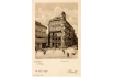
New No. 771, as seen from Můstek, on the corner of the narrow lane
dubbed Myší díra (The Mouse Hole) and Ovocná Street (on the right). On
the site of the Mouse Hole was once the entrance to the cemetery
connected with the Church of the Virgin Mary of the Snows. Soon after
founding of the New Town, the whole area between Ovocná Street and
Jungmannovo Square was used for the construction of 15 buildings
adjacent to the cemetery wall. The depth of the lots was approximately 8
metres away from the moat, which was running through what was to become
Ovocná Street. In 1418 a part of the cemetery premises was purchased
for construction purposes, and the depth of the built-up area was thus
extended to about 24 metres, a state unchanged till today. The
commercial and residential structure in the picture, built in the 1890s,
was occupied by the luxurious goldsmith’s owned by M. Kersch. The site
on which stood building No. 772 (on the left), demolished in the 1960s,
is still empty, and is used as an entrance to the metro.
PHOTOGRAVURE. K. FISCHL, 1899
| 314 - A view of the corner of Václavské Square and Ovocná Street from U Špinků Building
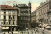
The building No. 772 on the left, housed the Kaiser Café on the
second storey which moved here in 1900 from Ovocná Street, and J. E.
Šátek’s stationery shop on the ground floor. Šátek was a specialised
seller of postcards. On the right we can see the U zlatého úlu Building
(The Golden Beehive), and the monumental building of the Prague Credit
Bank, new No. 377, built in 1902, probably by O. Polívka with the
assistance of the sculptor C. Klouček. The building beyond, U tří bílých
beránků (The Three White Lambs), new No. 376, built in 1892, is one of
the most important pre-Art Nouveau buildings by F. Ohmann. Its
unconventional elements include the use of metal decoration under the
ledge, the verandah on the fifth storey, and the large glassed-in
commercial premises on the ground floor, and on the second storey. The
building complex, which also includes the adjacent building (new No.
375) built in 1894-1895 by E. Sochor for the Bernsdorf Metal Goods
Factory, houses today the Old Town supermarket with a passage to
Rytířská Street.
COLOURED PHOTOTYPE. F. J. JEDLIČKA, AROUND 1905
| 315 - Ovocná Street as seen from Ferdinandova Street with a glimpse
of Na Příkopě Street
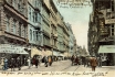
The buildings in the north-western section of Ovocná Street stand on
the site of the former walled moat and of the Old Town fortification.
Still in 1835 one could see here nothing but a row of low-rise
structures. The only higher building was U zlatého úlu (The Golden
Beehive) on the corner of Na Můstku Street. The development of this side
of the street in the 19th century occurred in several stages and was
completed in 1902 by the building of the Prague Credit Bank. Apart from
the two structures on the left, all the other buildings on this side of
the street are still extant. The first building, No. 371, standing on
the corner of Perlová Street and owned by the ironmonger Reach, and the
second building with glassed-in balconies, No. 953, were demolished in
the late 1920s and replaced by one of the first modern department stores
in Prague, Ara, later renamed Perla, and today the headquarters of the
Investment and Post Bank.
COLOURED PHOTOTYPE. AROUND 1904
| 316 - The old Mottlův dům (Mottl’s House), No. 761, in Ferdinandova
Street with a glimpse of Ovocná and Na Příkopě Streets
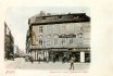
There are two stretches of vacant lots in the left row - in three
years the first shall be filled with the building of the Prague Credit
Bank, and the other one shall, in two years, become the site of Löbl’s
department store. The greater part of the picture shows the front of a
baroque building originally called U zlatého věnce (The Golden Wreath),
built on the site of three mediaeval houses. Around 1900 it was owned by
the wealthy tailor V. Mottl, an official supplier to the Imperial Royal
Court, as is proudly proclaimed in the large gilded plate advertisement
with the double-headed eagle on the corner. The building housed a
number of yet more exclusive firms, such as the hatter A. Srb, likewise
an official imperial and royal supplier. The corner of the structure was
occupied by the Central Shop of Postcards and Albums where one could
buy postcards of all kinds from all over the world. After all, it was
advertised as a world class shop.
COLOURED PHOTOTYPE. AROUND 1899
| 317 - The new Mottlův dům (Mottl’s House) taken from roughly the same angle as the previous picture
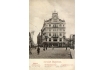
It was built in the years 1906-1907 to the design of the architect
K. Mottl. The palace-like Art Nouveau building served as the
headquarters of the Central Bank of the Czech Savings Banks, and of the
Czech Graphic Union. The Bohemian Kingdom then had 100 savings banks and
780 small loan and savings banks with the total sum of 800 million
guldens on their accounts. The Czech Graphic Union was a large Czech
publishing house specialising in stationery, including postcards. It
owned several printing houses, of which the most modern and later
substantially extended, stood in Svobodova Street near the Vyšehrad
Railway Station. From 1900 this publishers’ union comprised four
publishing firms: J. Otto, J. Vilímek, F. Šimáček and J. Vilím. From
this time it marked some of its products (including postcards) with the
brand name Unie-Vilím.
PHOTOTYPE. UNIE PRAGUE, AROUND 1908
| 318 - The Art Nouveau interior of the Central Bank of the Czech
Savings Banks
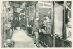
A view of the cashier’s counter showing the curious ratio of six
employees per one customer. The annual interest at that time ranged
between 4 and 4.75 per cent. Considering the fact that there was
virtually no inflation at all at this time, one could make a truly
decent profit from the deposited capital. However, this had not been the
case prior to 1892 as the Austro-Hungarian currency was until then
based on silver, whose price constantly fluctuated. However, in 1892 the
decision was made to replace the existing currency unit, the silver
gulden, with the golden gulden, with an exchange rate of 1 kilogram of
gold per 1640 golden guldens. The coin unit of this new gold-oriented
currency was the crown, with 1 golden gulden consisting of 2 crowns. The
coins of the old currency were in circulation until January 1, 1898. In
that year they were replaced for good by the new crown currency.
PHOTOTYPE. PHOTOGRAPHER J. MICHALUP. AROUND
1906
352 - Palackého Embankment viewed from the Palacký Bridge
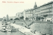
After completion of the Palacký Bridge between 1876 and 1878, the
construction of the embankment wall from the Bridge to Myslíkova Street
was launched. The northernmost part of then area of Podskalí (see
picture 360) was located in this section. The Embankment was elevated on
this site by some 12 metres and saw the construction of two blocks of
new buildings separated by Trojanova (formerly Kočičí) Street. In the
block behind this street you can see two buildings, new Nos. 2000 and
1980 (with light front and topped by cupolas), constructed by the
entrepreneur V. Havel between 1904 and 1905, with cooperation of J.
Čámský and possibly also O. Polívka. The size of individual flats was
over 250 square metres and exceeded the already luxury standard of the
new neighbouring buildings. Immediately after its completion a still
extant wharf for the popular pleasure-steamers was established on the
Embankment.
PHOTOTYPE. AROUND 1906
| 353 - A view through Voršilská Street from Ferdinandova Street towards the south
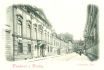
In the right of the picture you can see the elongated side wall of
the Ursuline Convent building, No. 139 (see picture 327). On the left,
behind part of the Neo-Classical Wallis Building, No. 138, there is the
Neo-Baroque Walter Building, No. 140. It bears the name of its owner of
1889, the renowned industrialist M. Walter, who had the originally
mediaeval building radically reconstructed according to the plans of F.
Ohmann. Nowadays, it houses the Apostolic nunciature. Beyond it, at the
corner of Ostrovní (Island) Street, the early Neo-Classical
Schwarzenberg Palace, No. 130, came into being on the site of three
mediaeval houses in 1789. The author of the reconstruction was I.
Palliardi, the sculptural decoration was carried out by I. F. Platzer.
In the background, on the other corner, an arch of the marvellous early
Baroque Klebelsberg Palace, No. 144, stands out. It was demolished in
1901 to the detriment of this street.
PHOTOTYPE. L. J. ČECH, AROUND 1900
| 354 - On the site of the former St Wenceslas Penitentiary in Zderaz
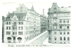
On the levelled-out terrain on the site of the former St Wenceslas
Penitentiary in Zderaz a row of remarkable buildings were erected in the
years 1890-1910. One of the buildings is located in the very vicinity
of the Church of St Wenceslas (on the left, just out of the picture) -
the Hlávka Student Dormitory, new No. 1966. The Art Nouveau building
designed by J. Fanta was constructed between 1902 and 1904 on a building
site donated by the city. Visually it consists of two buildings - a
lower one, at the corner of Dittrichova and Jenštejnská Streets, the
front of which is decorated with beautiful sgraffiti by K. L. Klusáček,
and a higher building with its front and entrance on Jenštejnská Street.
The Dormitory is linked with the name of the architect and entrepreneur
J. Hlávka, one of the major public benefactors of the period, who had
the Dormitory, serving more than 200 poor students with outstanding
study results, built from his own funds. On the right you can see a
residential block, new No. 1776, originating from the 1880s.
PHOTOTYPE. H. Z. ZUNA, 1906
| 355 - The spacious U Myslíků Building, No. 171
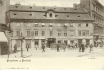
At the corner of Myslíkova and Spálená Streets (on the right) and
Černá Street (on the left, just out of the picture). Originally a
mediaeval house, with some Gothic fragments in the cellars, it started
to be extended as early as in the 15th century when neighbouring lots
and buildings were gradually attached to it. Its name, which was later
used for the whole street, arose through the corruption of the name of
the once owner of the house, E. Myslich. In 1800 the house received a
Neo-Classical facade. When the picture was taken, it housed the New Town
Café, a restaurant, a tap-room (as advertised in the sign in the shop
window, a regular pint of beer cost 6 kreutzers) and a fashion hall for
ladies. In front of the building there was a stop on the electrified
tram route Těšnov- Smíchov. Many people still remember the butcher’s and
the restaurant which were established in the 1970s by means of a
modification of the ground floor premises. In the late 1980s the house
was left empty and it started to fall into disrepair, however the
reconstruction of 1996 managed to restore the building’s original
beauty.
PHOTOTYPE. F. J. JEDLIČKA, 1901
| 356 - An eclectic building of the Women’s Production Association opposite
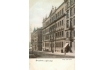
The Church of St Wenceslas and at the corner of Resslova and
Dittrichova Streets, new No. 1940. It was constructed by the J. Blecha
Company between 1895 and 1896. The Association, the founder of which was
the writer K. Světlá, was established in 1871 and constituted one of
the first successes of the women’s rights movement in Bohemia. It was a
girls’ school, where the fundamentals of practical professions were
taught. And so in this building the Girls’ Business and Secondary
Industrial School for over 600 girl-students was established. The
Association cooperated with Minerva, another association for the
educational advancement of women, which was closely linked with the
writer E. Krásnohorská. When the picture was taken, Minerva was running a
private Secondary Girls’ School, set up in 1890, from which the first
45 girl-students graduated after five years of study.
COLOURED PHOTOTYPE. F. J. JEDLIČKA, 1901
| 357 - The Czech-Slavonic Business Academy on the corner of Václavská and Resslova Streets
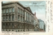
This Academy of three-year study was established in 1872 - some
decades later than in other developed European countries. It was
supposed to prepare students from Slavonic countries who had graduated
from lower secondary schools and secondary grammar schools (Gymnasium)
for business and industrial professions. In 1898 over 500 students
attended this institution. The tuition fees then amounted to 120 guldens
for those other than the 24 scholarship students. The Neo-Renaissance
building of the Academy was constructed in 1892 according to designs by
J. Drdínko. In 1915 it was reconstructed - after the removal of the
original, richly decorated tympanum it received one more storey and a
new facade. The Church of St Wenceslas, behind the building of the
Academy, is located on part of the original plateau of Břežská Skála, a
rock formation which was tunnelled through at the time of prolongation
of the originally short Resslova Street towards the embankment.
COLOURED PHOTOTYPE. H. Z. ZUNA, AROUND 1905
| 358 - The Church of St Charles Boromeus at the corner of Resslova and Na Zderaze Streets, No. 307
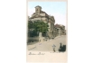
The Church was connected to the original house for retired priests.
It was constructed between 1730 and 1740 in an imposing Baroque style,
according to the original project of P. I. Bayer, and completed with
some modifications of the front by K. I. Dientzenhofer. Later, after
this house was abolished in 1783 as part of the Josefinian reforms, the
entire complex, including the Church, served as a military storage house
and later, from 1877, as a theatre storage space. During the
above-mentioned lowering of the level of the terrain in the mid-1880s
(in this place by about 3 metres), even the demolition of the Church was
contemplated. Fortunately this did not take place, the original masonry
of the saved Church was reinforced and later, following some
modification and restoration works, in the 1930s it was given to the
orthodox Church. In June 1942 the crypt of the Church sheltered, after
assassination of the Imperial Protector of Bohemia, Reinhard Heydrich,
the Czechoslovak parachutists who had been sent by the Czech Government
in exile in London. Following a short battle, besieged by SS units, the
parachutists ended their lives with their last bullets. In the
background, you can see the building of the Czech Technical University
in Charles Square.
COLOURED PHOTOTYPE. K. BELLMANN, 1899
| 394 - A part of Vyšehradská Street
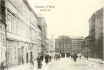
From the intersection with Charles Square to the building of the
municipal almshouse, No. 427 (see picture 397). The street descends from
the Square to the space in front of the side of the almshouse where we
come across the intersection of four streets of which two can be seen in
the picture: Na Slupi, with the tower of the Church of Our Lady of
Sorrows (see picture 398), which is a street connecting the New Town
with Nusle, and its continuation, Vyšehradská, which in the background
turns to the right and leads to Vyšehrad. These two streets copy the
time-honoured route between Prague Castle and Vyšehrad. The construction
of residential buildings after 1880, and the introduction of tram
transportation, turned these once quiet thoroughfares with practically
no traffic into relatively busy streets.
PHOTOTYPE. F. J. JEDLIČKA, 1903
| 395 - A part of Vyšehradská Street from the opposite angle to that in picture 394
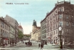
A part of Vyšehradská Street from the Municipal Almshouse to Charles
Square, from the opposite angle to that in picture 394. In the
background on the left we can see a part of the Church in Emauzy which
was a part of the Monastery of Slavonic Benedictines. The three
buildings on the left were constructed on a plot zoned off from the
monastery garden. In the background we can see the protruding towers of
the Church of St John Nepomuk in Skalka, built with architectural
mastery on the sloping terrain by K. I. Dientzenhofer in the years
1730-1749 on the site of an old chapel dating from 1691. The structure
standing in front of the church, No. 431, was built a short time before
the taking of the picture, in 1903. In picture 394 (at the furthest
left), on the site of No. 431, we can still see a wall of the church
garden. The five-storey buildings between Hrádecká and Benátská Streets
(at the furthest left) are typical of the turn-of-the-century type of
residential construction reflecting higher standards of housing. Around
the year 1900 it became possible, in public spaces and on corners, to
see street clocks which introduced the still sedate Prague to a more
hectic time-watching era.
COLOURED PHOTOTYPE. AROUND 1906
| 396 - The Botanical Garden on the corner of Benátská and Na Slupi Streets (on the right)
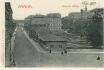
The predecessor of this Botanical Garden was located in Smíchov.
After its destruction by the great flood of 1890, the state purchased
the plot of the Social Garden in Na Slupi Street for 1.5 million
guldens, and in the years 1897-1898 established new botanical gardens
here. The plot was divided between the Czech University (the lower part
in the picture) and the German University (the upper part, beyond the
building in the middle). The collections of plants from the Smíchov
Botanical Garden were divided equally between the two universities. On
the left in the background we can see a two-storey structure in Benátská
Street (see picture 401). The buildings in the foreground are the old
exhibition pavilion inherited from the former Social Garden. An addition
to the complex of the Botanical Garden was the two-storey structure in
the middle. At the top right we can see the old Canon’s house, No. 447,
and the tower of the Church of St Apollinaris. In front of them is the
extensive complex of paint-shops and workshops of the National Theatre
of 1900.
PHOTOTYPE. A. L. KOPPE, 1907
| 397 - A view of the middle part of Vyšehradská Street
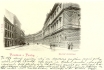
From the intersection of the streets Plavecká (on the left) and
Botičská (on the right), looking towards Benátská Street. The whole
eastern side of the street is covered by the three long structures of
the Municipal Almshouse, Nos. 424 and 427, built on the site of the
original almshouse, the Dt Bartholomew Church and a hospital founded by
the New Town burghers around 1505. The originally Gothic complex was
remodelled in Baroque style in the years 1686 and 1773, and demolished
in 1884. The old almshouse was a low, one-storey building which e.g. in
1784 became a refuge for 48 impoverished burghers. The inmates of the
almshouse even had their own uniforms: red coats with white facings. The
new almshouse was built in a Neo-Renaissance style in the years
1884-1886 to a design by J. Srdínek and with a capacity to house 400
burghers of both sexes who were in need. The building today houses the
Ministry of Justice.
PHOTOTYPE. L. J. ČECH, 1899
| 398 - Na Slupi Street
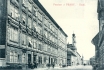
Between the Botanical Garden and the Church of the Annunciation of
our Lady (for a view from the opposite side - see 399). On the left are
three buildings, Nos. 1483-1485, constructed prior to 1880 on the lots
adjacent to the former Social Garden, later the Botanical Garden. These
residential buildings differ from the run-of-the-mill residential blocks
in their more ornate fronts and higher quality flats, with windows
facing the street for residents of a higher social class whilst the
inner sides of the buildings, with their characteristic enormous
porches, remained the domicile of the poorer tenants. One of the more
prestigious tenants in the first building was Dr. Č. Zíbrt, the author
of many ethnographic and other publications of European fame (the
history of dancing in Bohemia). Behind the protruding time-honoured
structure (and beyond Apolinářská Street behind this building) is the
Church of Our Lady of Sorrows with a convent and a hospital for women
operated by the Elizabethan Order. All the structures on the left,
except for the first two, as far as the church, were demolished in the
1920s and 1930s.
PHOTOTYPE K. ZUNA, 1908
| 399 - Na Slupi Street from the Church of the Annunciation of Our Lady to the Botanical Gardens
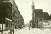
The Gothic church dates back to the second half of the 14th century.
Its slender tower slightly inclines towards the street, the vaulted
ceiling of the square-shaped nave is, in the centre, supported by a
single column - hence probably the name of the whole street (on the
column). Behind the Church is the former Servite Monastery founded by
Charles IV and dissolved in 1783. Until 1850 the former Monastery housed
the Military Institute for the Education of the Non-Commissioned
Officers of the Infantry Regiment No. 28. The Church and the Monastery
building were reconstructed by B. Grueber in the years 1856-1863.
Following this reconstruction the former Monastery housed a lunatic
asylum. Behind it is Albertov Street and the Elizabethan Order’s
Convent. The buildings on the left were built after 1880. he first of
them, No. 93, is still wholly within the cadastral limits of Vyšehrad.
The dividing line between Vyšehrad and the New Town then curiously
continues through the middle of the following five buildings.
PHOTOGRAPHIC POSTCARD. FOTO-FON, AROUND 1923
| 411 - Komenského (Comenius) Square with the intersection of Sokolská
and Ječná Streets
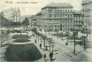
The present plot of the Square was, from the mid-17th century,
surrounded by a Baroque bastion. In the 1890s the Square was still
dominated by military barracks and a cattle market. The Square itself
was officially established in 1898 following the removal of the last
remnants of the Nw Town fortification a year previously. It is an
example of a truly well-executed piece of city planning which reckoned
with larger public green spaces. On the left, in front of the garden
wall, we can see a market established here in 1903 by the city of Prague
after the Vinohrady Municipal Council had moved its market from the
nearby Tylovo Square to a new location. Behind the garden, at the
intersection of Ječná and Kateřinská Streets, a new building, new No.
522, stands out from among the older structures. On the corner of
Sokolská Street stands building No. 1662, decorated by sgraffiti, and at
the extreme right we can see a part of a new building constructed on
the site of the former fortification.
PHOTOTYPE. AROUND 1905
| 412 - Táborská Street between Komenského Square, on the left, and the Royal Bohemian Museum
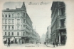
The street acquired its name from the old road connecting Koňská and
Žitná Gates with Nusle and eventually the south Bohemian town of Tábor.
But to be quite precise, this old road actually ran through what was to
become Havlíčkova Street, so that the name is in fact misleading. The
left side of the street is identical with the contour of the former
Baroque fortification. It was only after demolition of the fortification
that the construction of the buildings in the picture began. In terms
of belonging to a particular Prague quarter, Táborská is one of the
split Streets: while the left side of the street lies in the New Town,
the right side of the street lies in Královské Vinohrady. The most
recent building on the right stands on the corner of Komenského Square.
It housed the famous Březina Café. The large corner residential building
on the left, with its interesting bay and a row of elegant shops, was
built in approximately 1895, as was the adjacent building. Behind it we
can see the lower rear wing of the Municipal Court.
PHOTOTYPE. K. BELLMANN, 1899
| 413 - The Municipal Court of the New Town, No. 1595
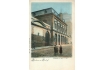
On the eastern side of Sokolská Street, opposite the building of the
Prague Sokol organization. This bulky Neo-Renaissance building, with two
entrances and a rear wing reaching as far as Táborská Street, was built
in 1883 at a cost of 155 thousand guldens. The Municipal Courts usually
served as firemen’s barracks, and this particular court housed the New
Town Fire Service. The basement housed stables, the underground area the
fire engines and the control-room. The traffic in the court was not
only connected with frequent fires, but on each morning and afternoon it
also saw the departure of numerous street cleaners. Compared with other
municipal courts in Prague, which were mostly located in mediaeval
buildings (see the Old Town Court in picture 146), the New Town
Municipal Court was an almost luxurious residence.
COLOURED PHOTOTYPE. K. BELLMANN, 1899
| 414 - Komenského Square
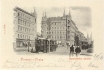
A view from the marketplace and the garden wall (see picture 411)
towards the east to Karlova Street. The Square is named after the
world-famous pedagogue Jan Amos Komenský (Comenius - 1592-1670). In the
foreground of the picture, along the line of Sokolská Street, the
mediaeval fortification once ran. It was here, at the axis of Ječná
Street, that the Svinská (the Hog) Gate once stood, so called after the
nearby pig market. After 1694 this gate came to be called Slepá (Blind)
as it was walled in in connection with the establishment of a gate at
the end of the Horse Market in the Baroque fortification built in front
of the mediaeval ramparts in the second half of the 17th century. It
also included a bastion, whose blade was on the site of the present-day
Karlova Street. The new buildings in the picture, on the site of the
former bastion were constructed after 1898. The outgoing four-axle
electric tram No. 19, produced by the Křižík factory, operated on a
route connecting Spálená Street with Purkyňovo Square.
PHOTOTYPE. L. J. ČECH, AROUND 1900
| 415 - The western section of a part of Sokolská Street with a view of Mezibranská Street
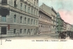
On the left is the residential building No. 1616 built at the end of
the 19th century on the corner of Sokolská and Hálkova Streets on the
site of a small factory. Further we can see a two-storey Neo-Renaissance
building of the Prague Sokol organization, No. 1437, built by I.
Ullmann in 1864 with a large gymnasium, offices and flats for Sokol
functionaries. The building was constructed on the site of a former
vegetable garden on the initiative and at the expense of J. Fügner, the
first head of Sokol, who donated the building to the organization. Sokol
started its physical culture activities in the building at the end of
1864. In 1865 the building hosted the first masked ball under the
auspices of the organization, an event high on the scale of Czech social
importance at this time. After Fügner’s death the building became a
home for another legendary figure of the Sokol movement, Dr. Miroslav
Tyrš. The next building in the row, Zlatý orel (The Golden Eagle), No.
572, stands on the corner of Žitná Street. A great deal of attention was
paid to street cleaning. In the centre of the picture we can see a hose
linked to a hydrant, on the right the street cleaners are busy sweeping
the already watered part of the street.
COLOURED PHOTOTYPE. E. ČÍŽEK, 1899
| 416 - A view of the whole extent of Mezibranská Street between Žitná Street and Václavské Square
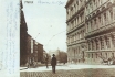
The street owes its name (meaning between gates) to its position
between the Horse Gate and the Rye Gate which stood in the New Town
fortification. The fortification ran along the contour of the buildings
on the right. These four-storey residential buildings, Nos. 1579 and
1575, built after 1880, offered a standard of housing substantially
higher than was the norm at the time. The block obscures the view of the
Čelakovského Public Gardens and of the Museum. In the background, on
the corner of Václavské Square, we can see building No. 812, built at
approximately the same time. For the buildings on the left see picture
417. In the forefront of the picture was an electric tram line turning
into Žitná Street. On both sides of the street we can see the stands of
public messengers waiting for their customers (the messengers were
members of one of the professions characteristic of the atmosphere of
the Monarchy). These men, with numbered red caps, always punctual and
reliable, transported con signments of any kind, including express
letters, messages, etc.
PHOTOGRAPHIC POSTCARD. PHOTOGRAPHER E. J. KABÁT, VESELÍ-MEZIMOSTÍ. 1901
| 417 - The western section of Mezibranská Street as seen from the front entrance ramp of the Royal Bohemian Museum
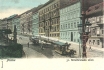
In the picture we can see most of the buildings on this side of the
street, beginning with the oldest structure on the right, on the corner
of Václavské Square, and ending at the intersection with Žitná Street,
forming a continuation of Sokolská Street (see picture 416). The other
structures in the block are of a more recent origin: they were built in
the period 1840-1895. We should note the lowered level of the road,
probably aimed at moderating the ascending terrain for vehicles. Even
so, the horse-drawn tram needed another horse and a driver to manage the
terrain (the car on the left). The ascent already began in the upper
third of Václavské Square where the additional horse was hitched, with
the tram continuing on its way with three horses as far as Královské
Vinohrady. On the right we can see a detail of a beautifully shaped
cast-iron lamp-post with two gas lanterns.
COLOURED PHOTOTYPE. E. ČÍŽEK, AROUND 1899]
https://www.old-prague.com/postcards-prague-new-town.php
|
|
|
|
|
|
|
|
|
|
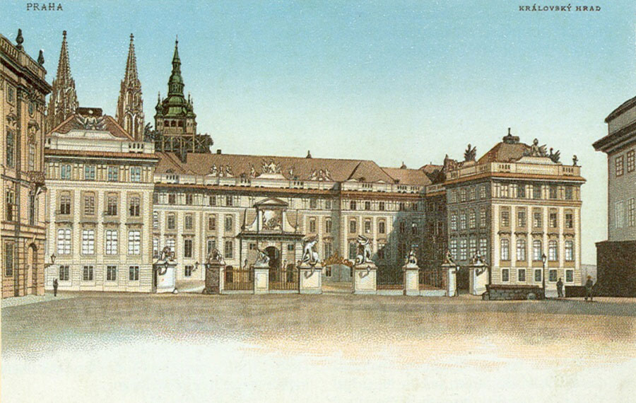
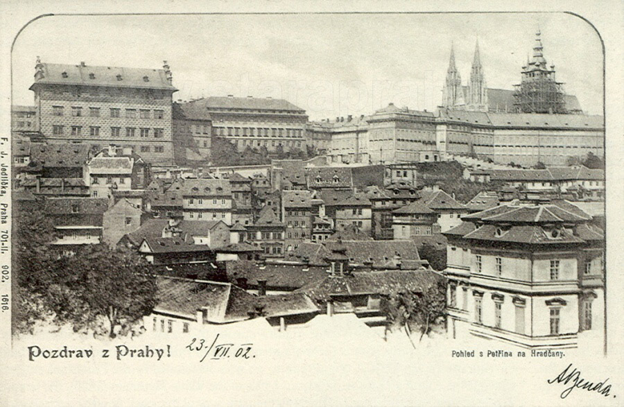
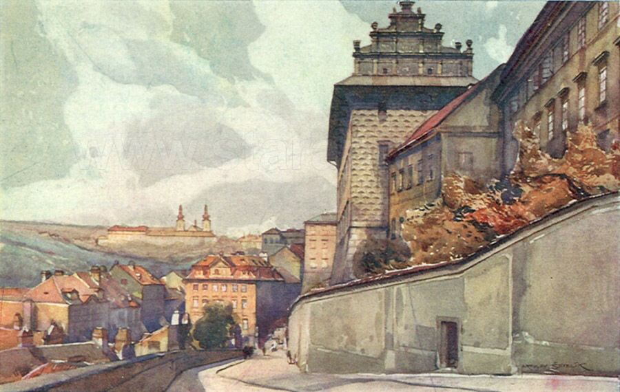
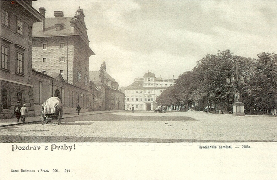
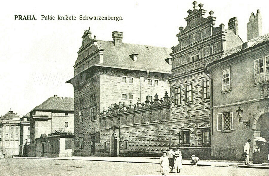

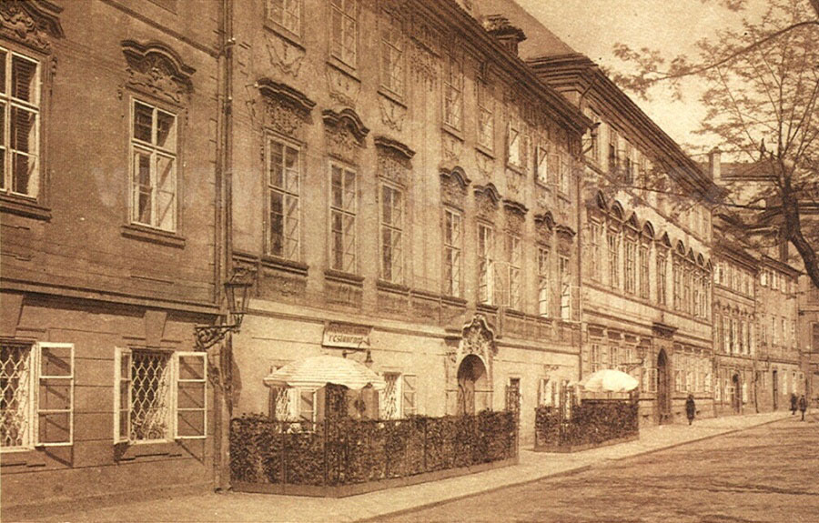
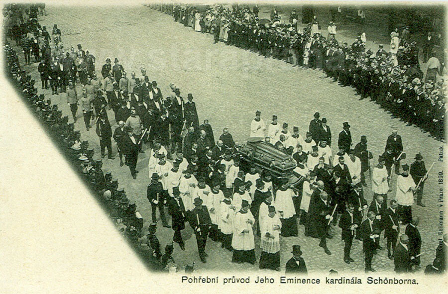
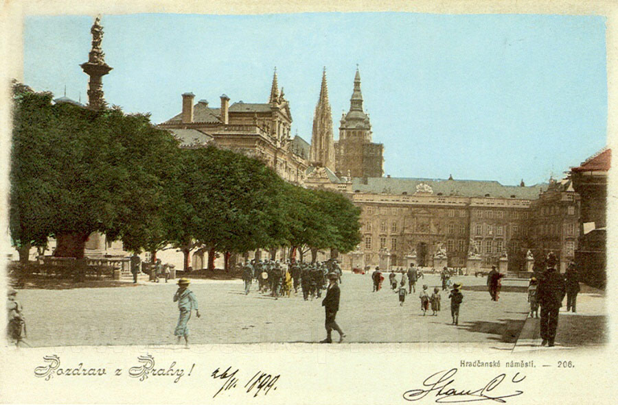
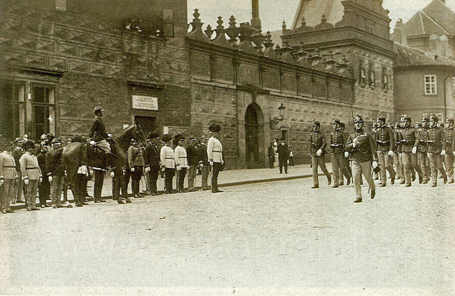
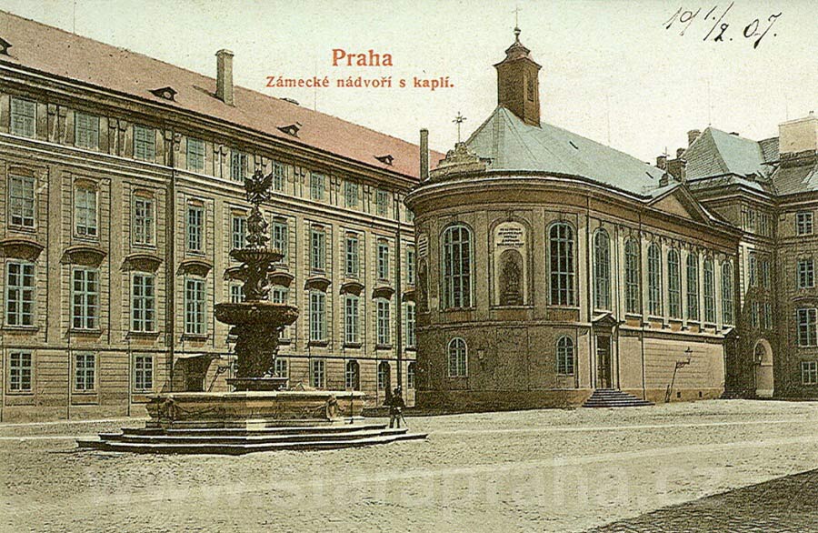
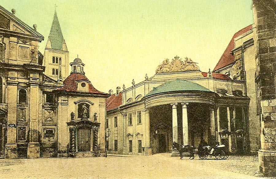
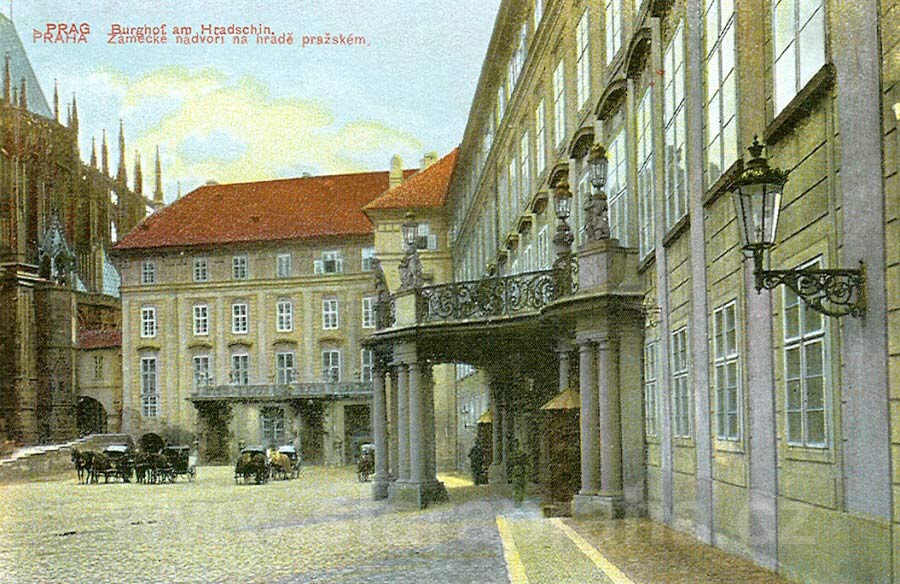
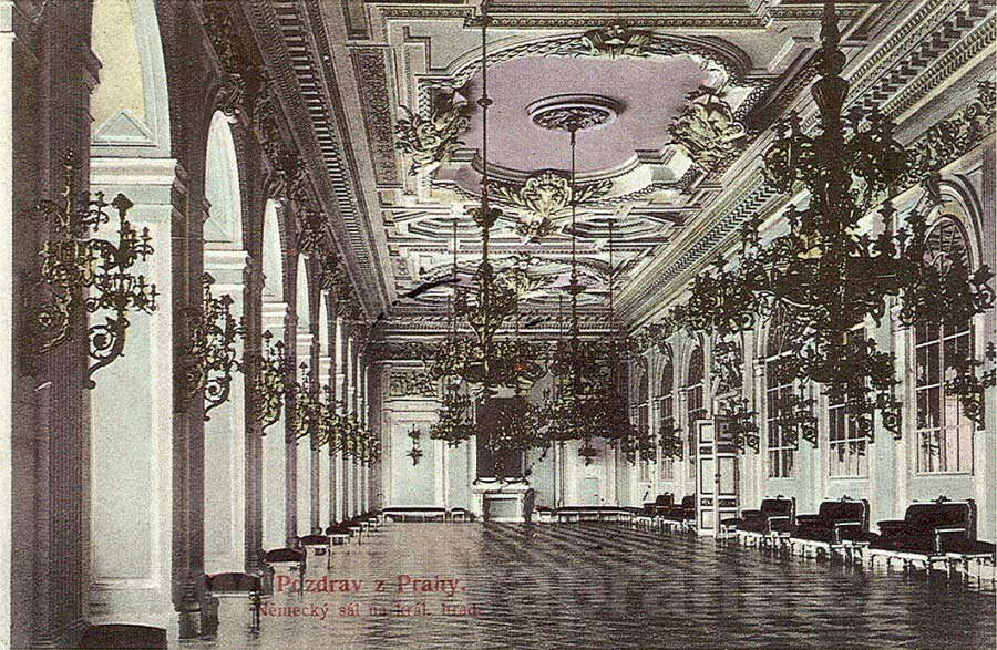
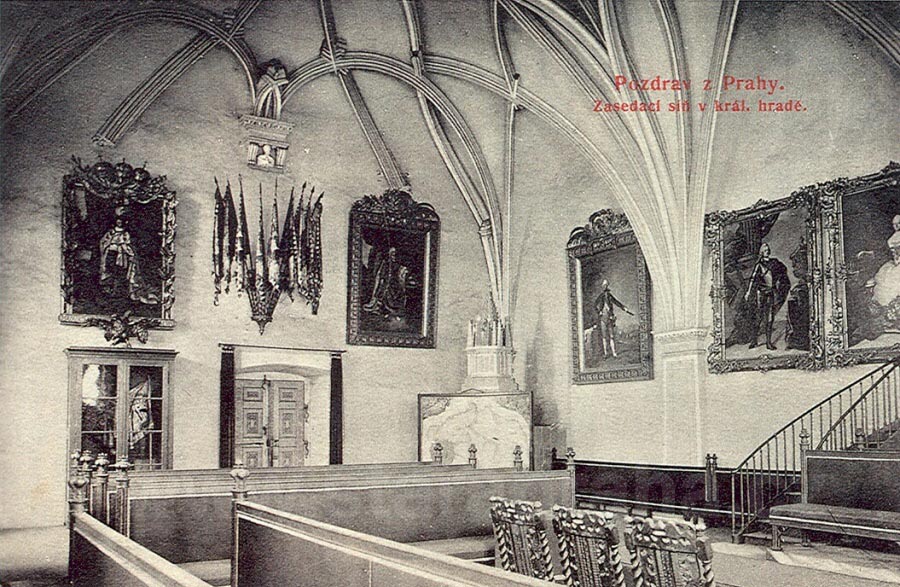
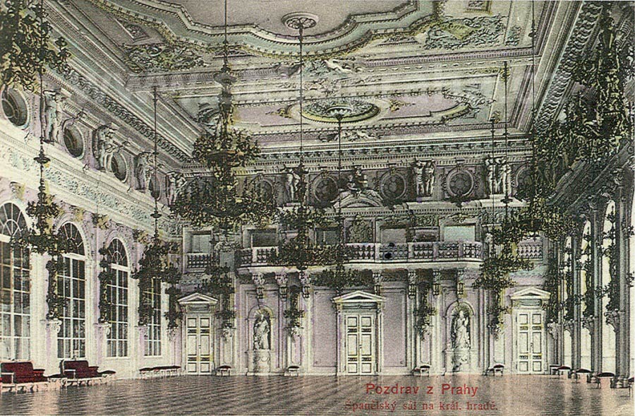
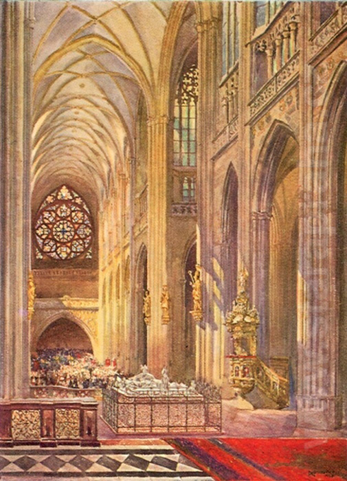
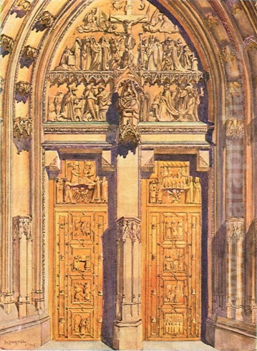
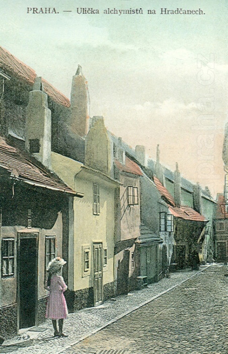
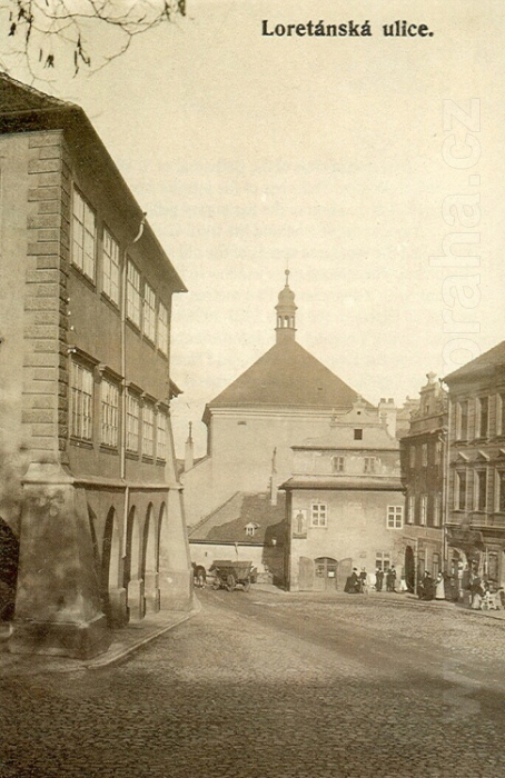
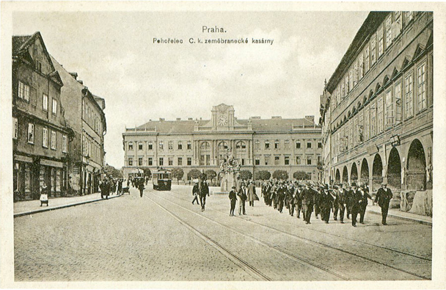
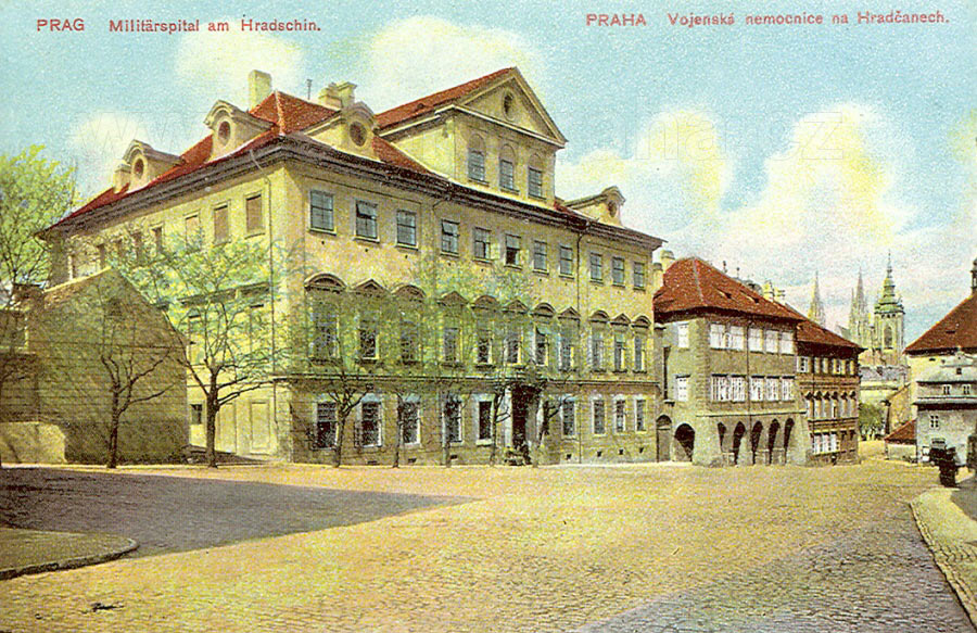
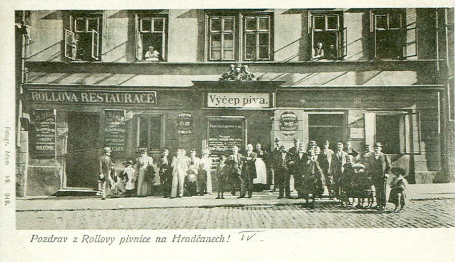
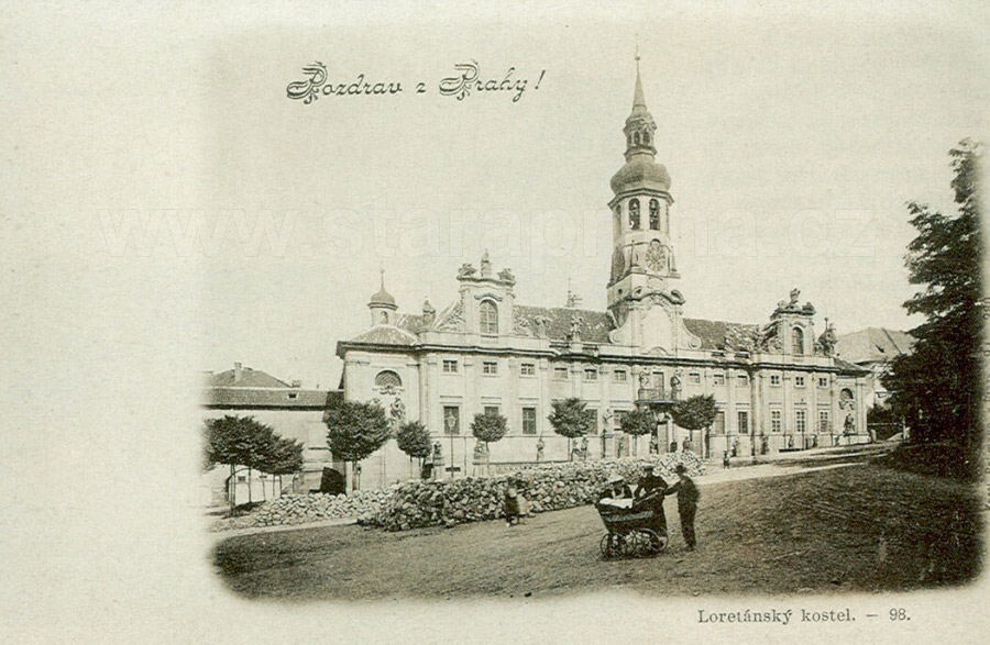
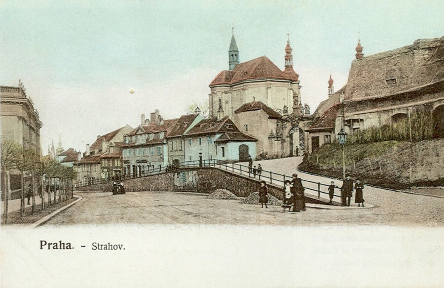
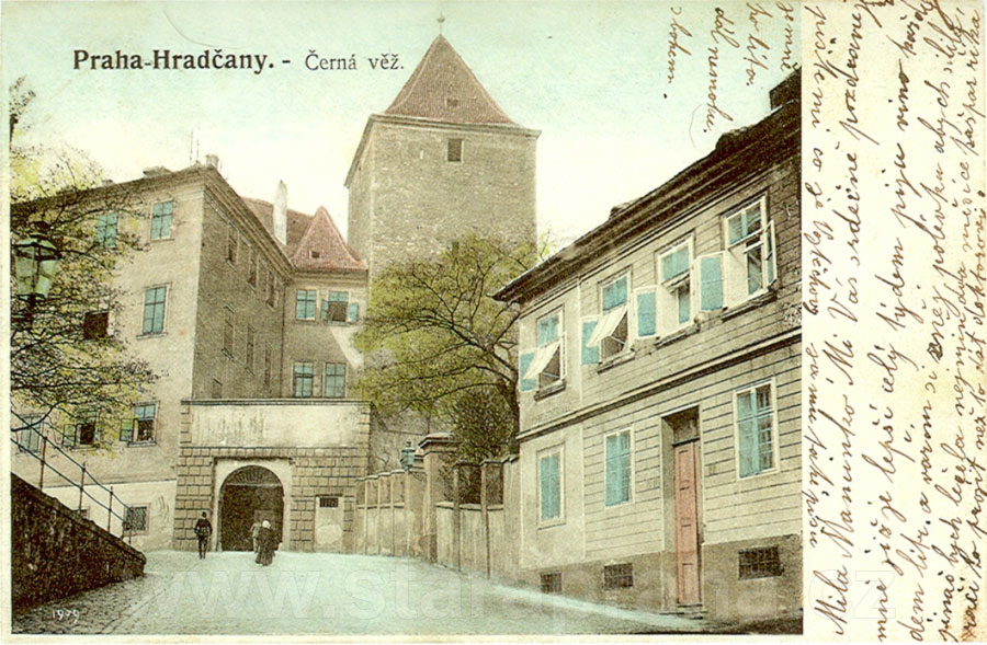
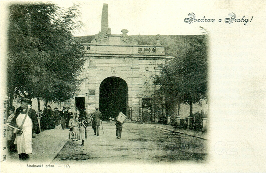
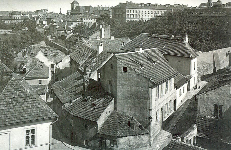
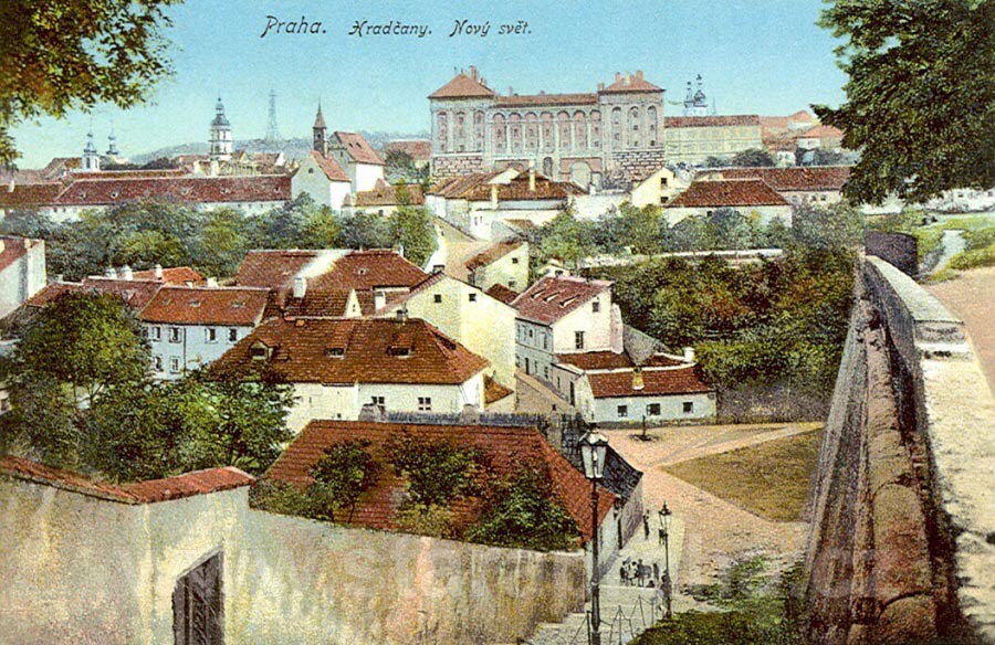 The previous picture (picture 29 was taken from approximately the same
place, from below the crown of the tree at the furthest right). When we
go down the steps, we get to the beginning of Černínská Street which
continues across the above-mentioned little square below the ramp, past a
well and the one-storey house No. 95, and ascends to Loretánské Square,
to the massive Černín Palace (then serving as military barracks). When
we turn to the left from the stairs, we enter Nový Svět Street. On the
left, we can see on the horizon the towers of the loreto and the tower
of the Prague counterpart of the Paris Eiffel Tower, the Petřín lookout
tower. To the right of the Černín Palace we can see the protruding
towers of the Strahov Monastery.
The previous picture (picture 29 was taken from approximately the same
place, from below the crown of the tree at the furthest right). When we
go down the steps, we get to the beginning of Černínská Street which
continues across the above-mentioned little square below the ramp, past a
well and the one-storey house No. 95, and ascends to Loretánské Square,
to the massive Černín Palace (then serving as military barracks). When
we turn to the left from the stairs, we enter Nový Svět Street. On the
left, we can see on the horizon the towers of the loreto and the tower
of the Prague counterpart of the Paris Eiffel Tower, the Petřín lookout
tower. To the right of the Černín Palace we can see the protruding
towers of the Strahov Monastery.
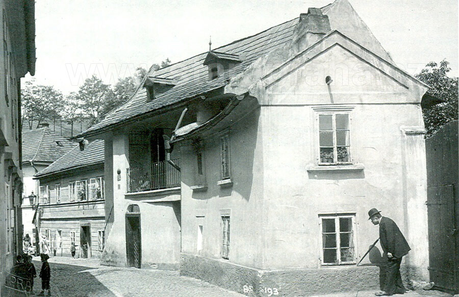
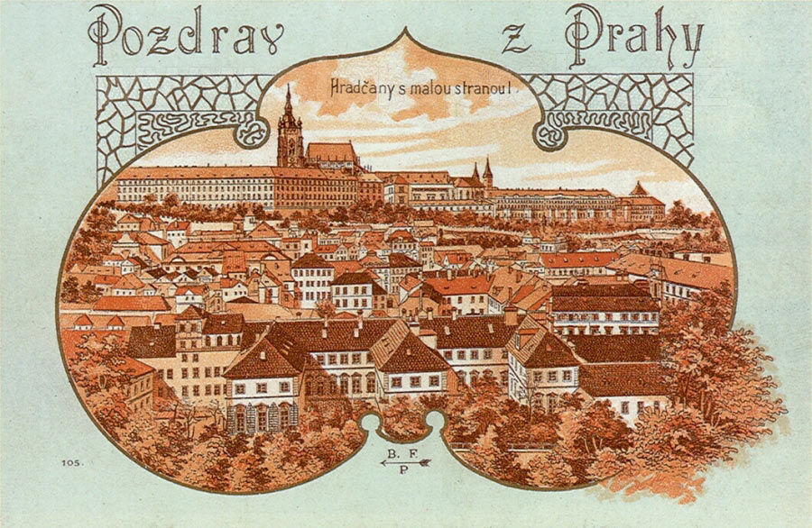
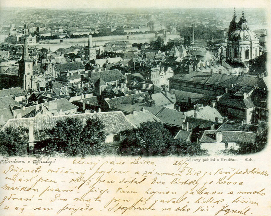
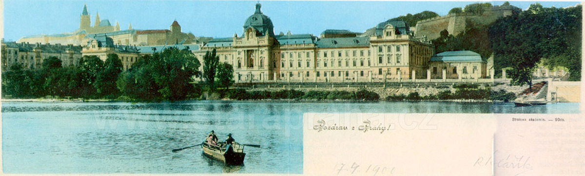
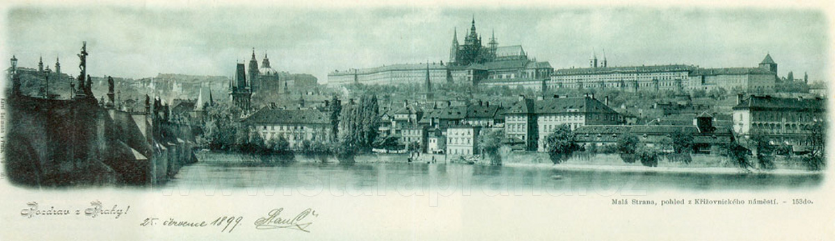
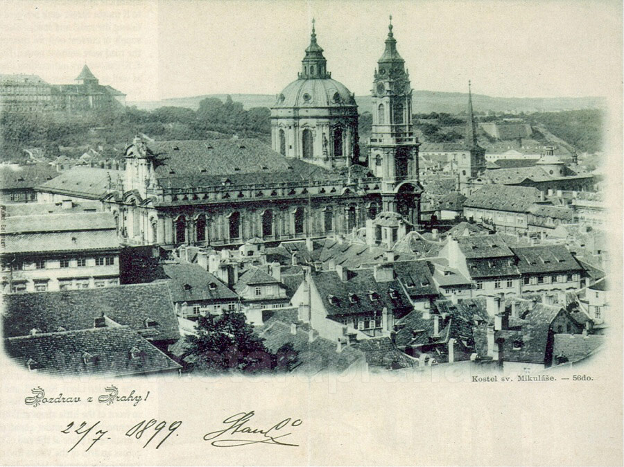
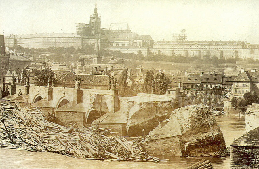
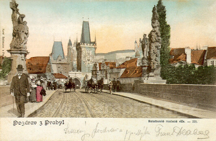
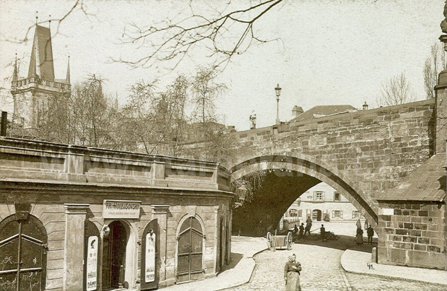
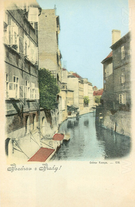
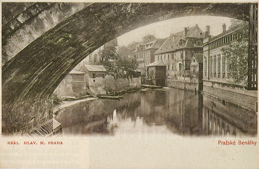
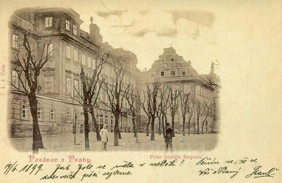
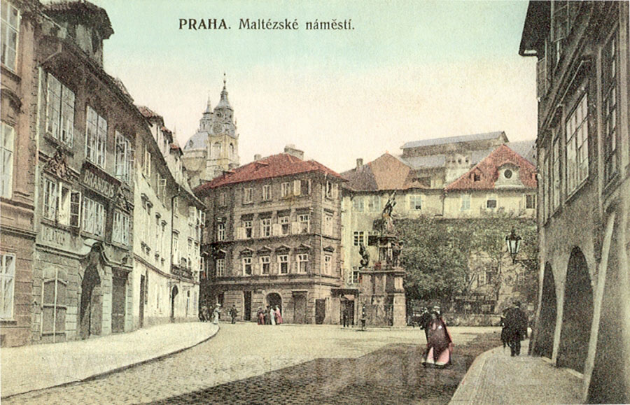
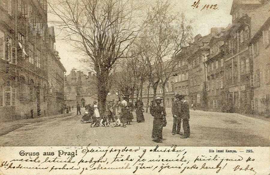
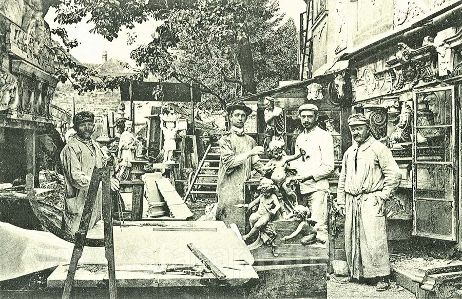
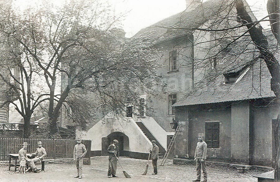
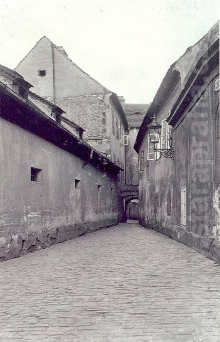
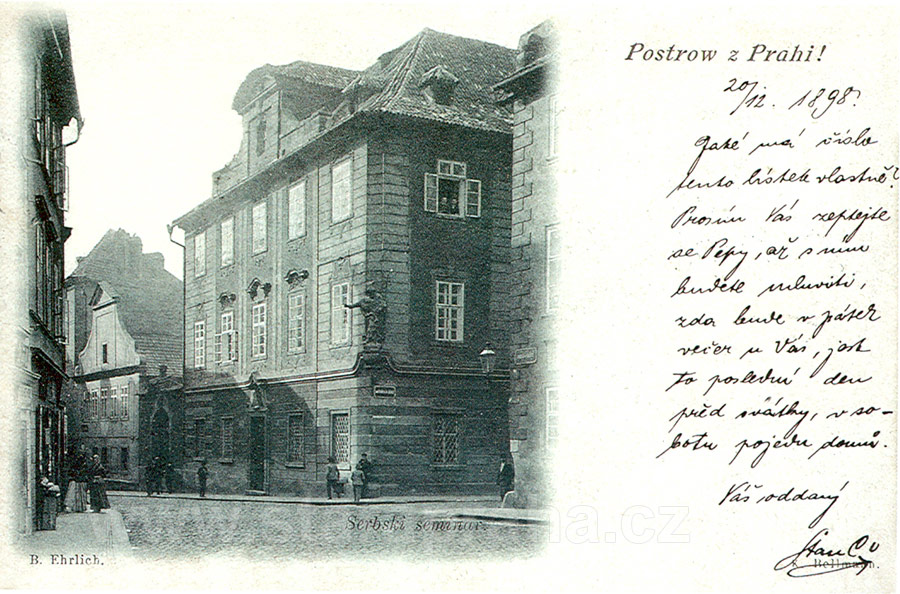
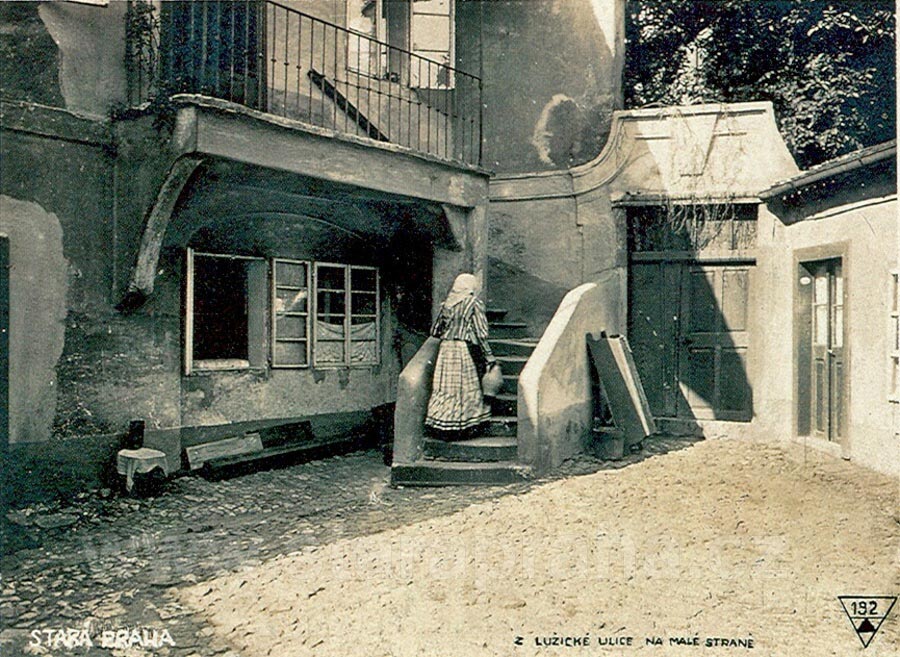
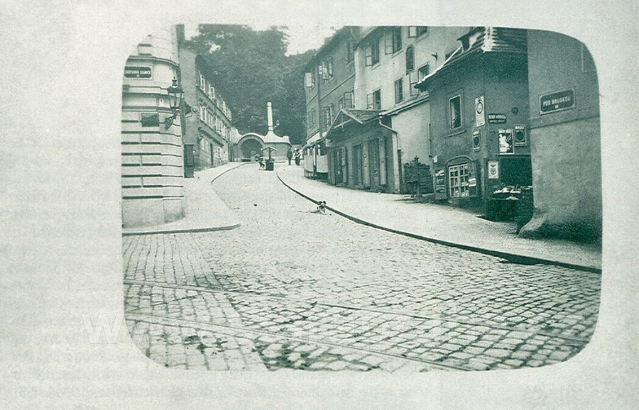
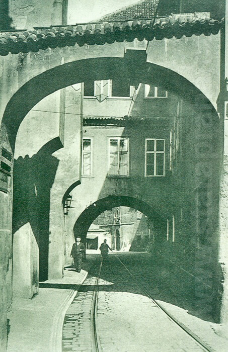
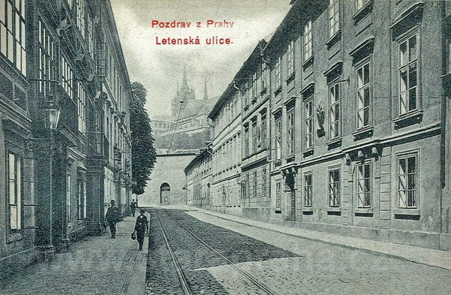

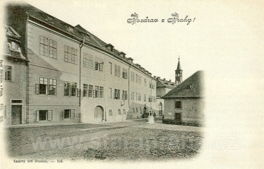
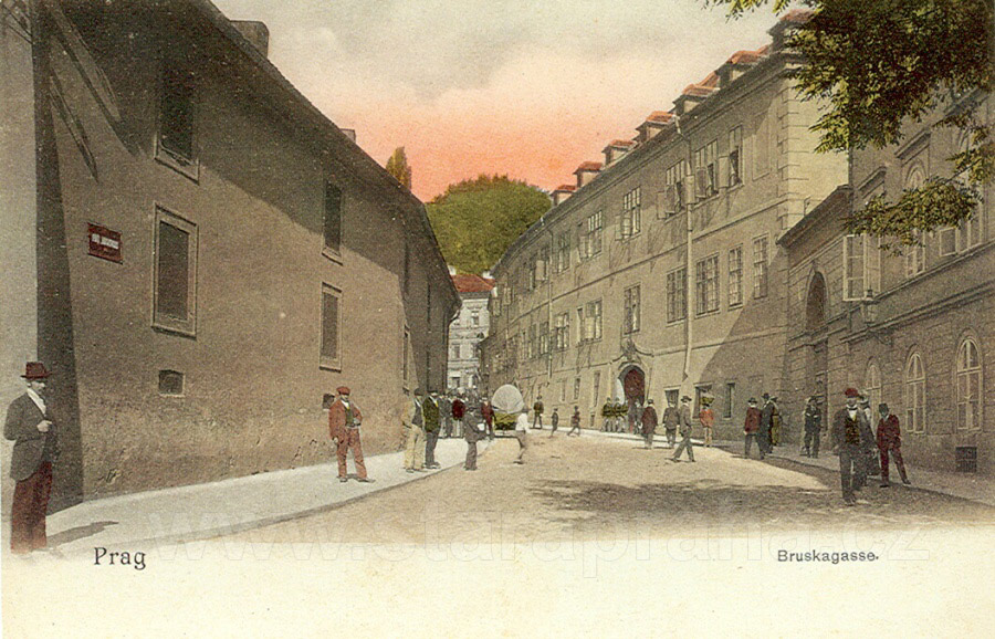
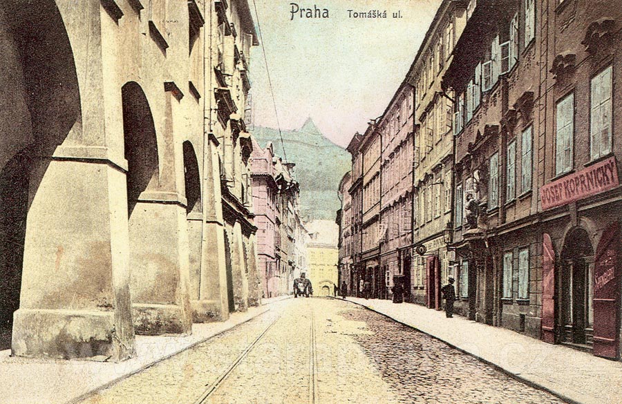
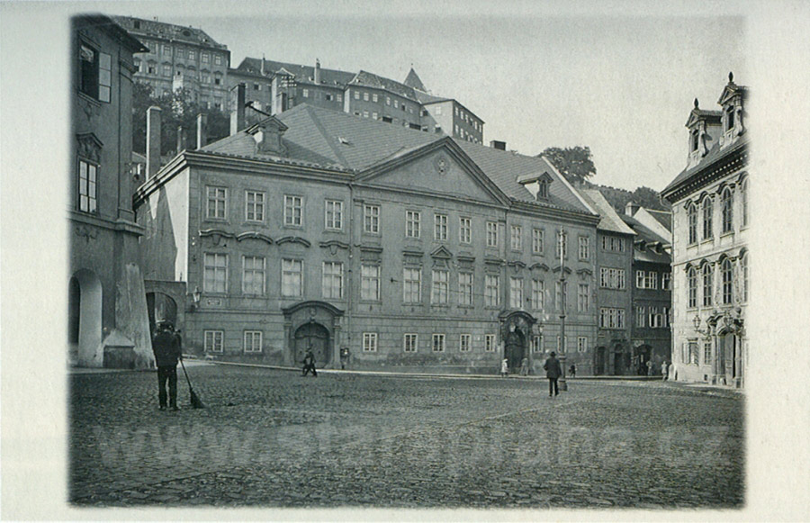
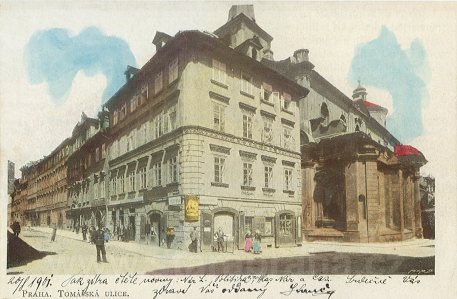
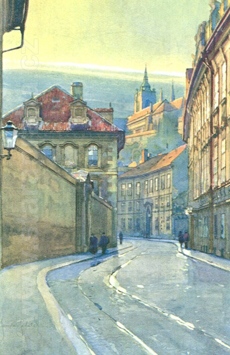
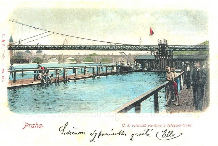
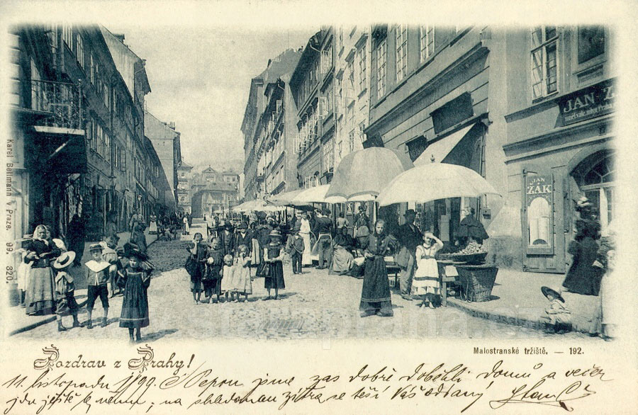
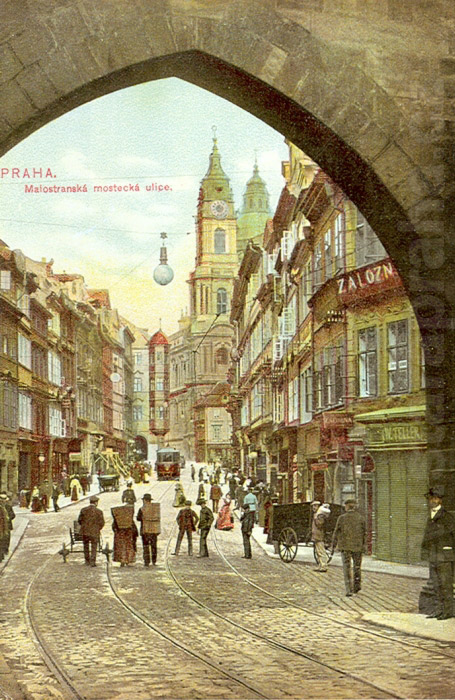
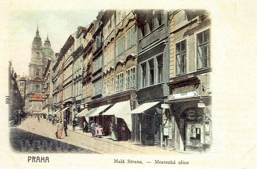
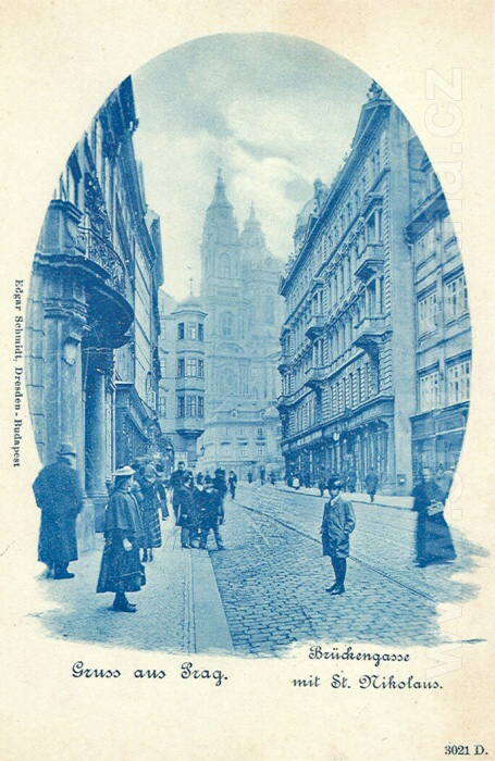
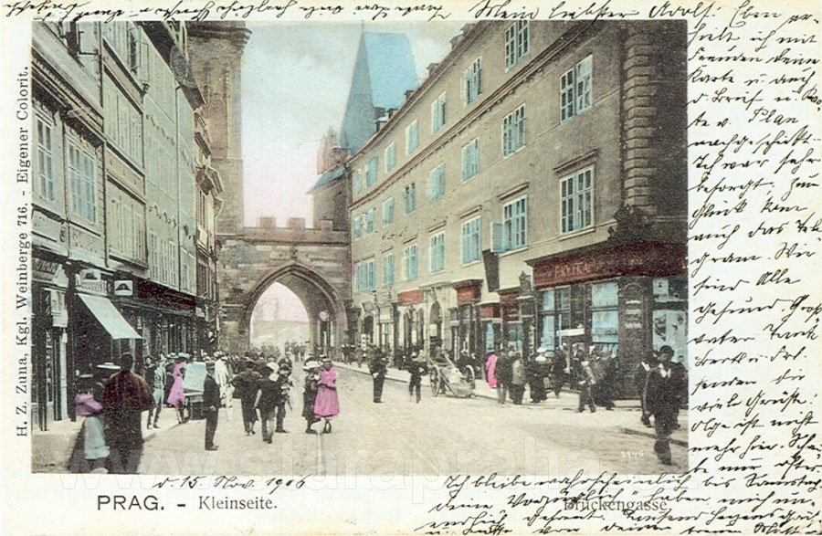
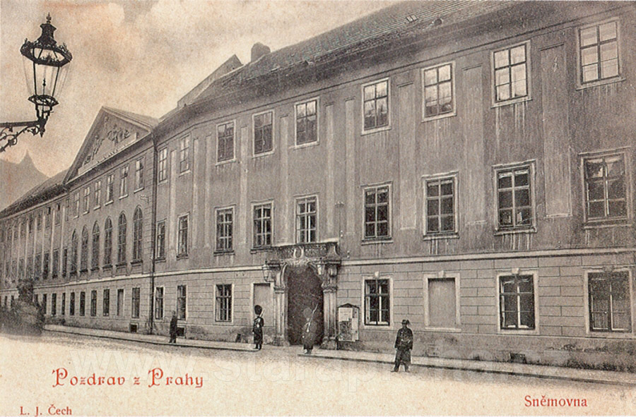

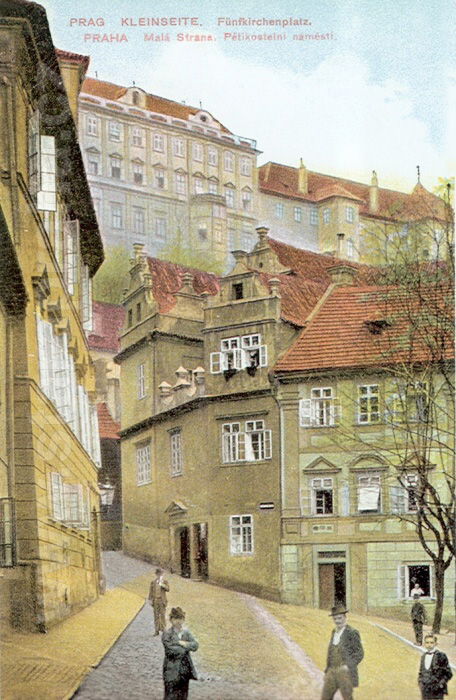
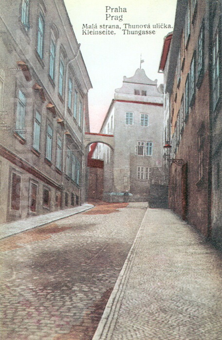
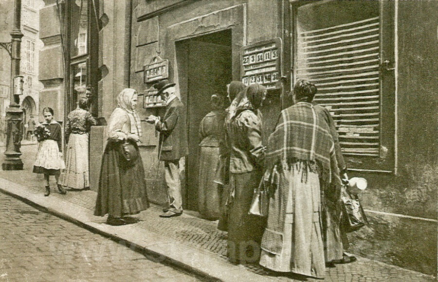
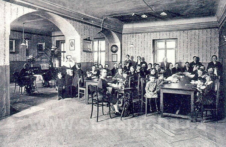
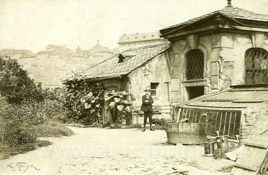
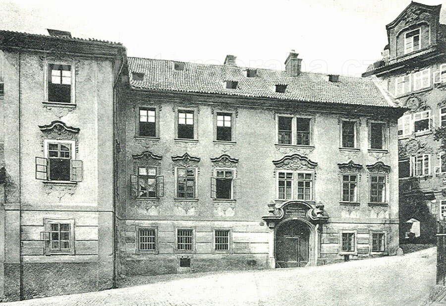
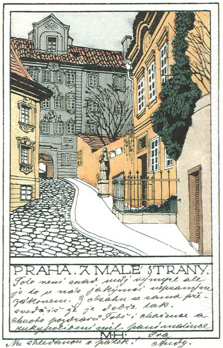
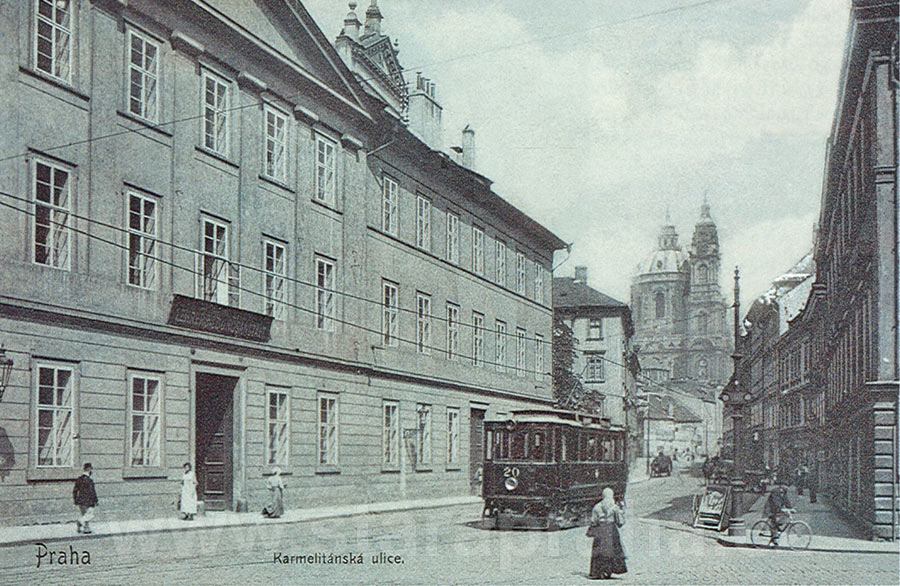
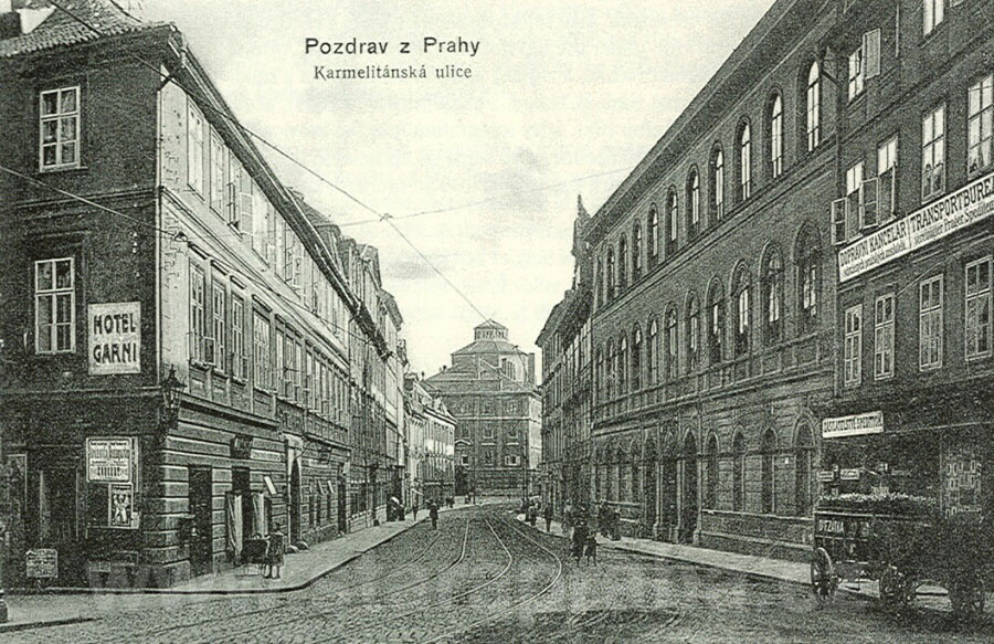
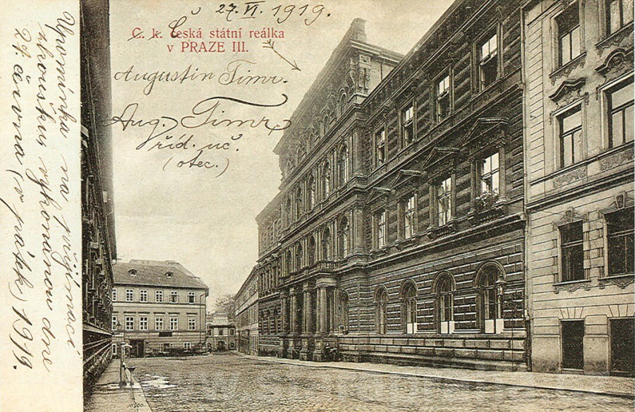
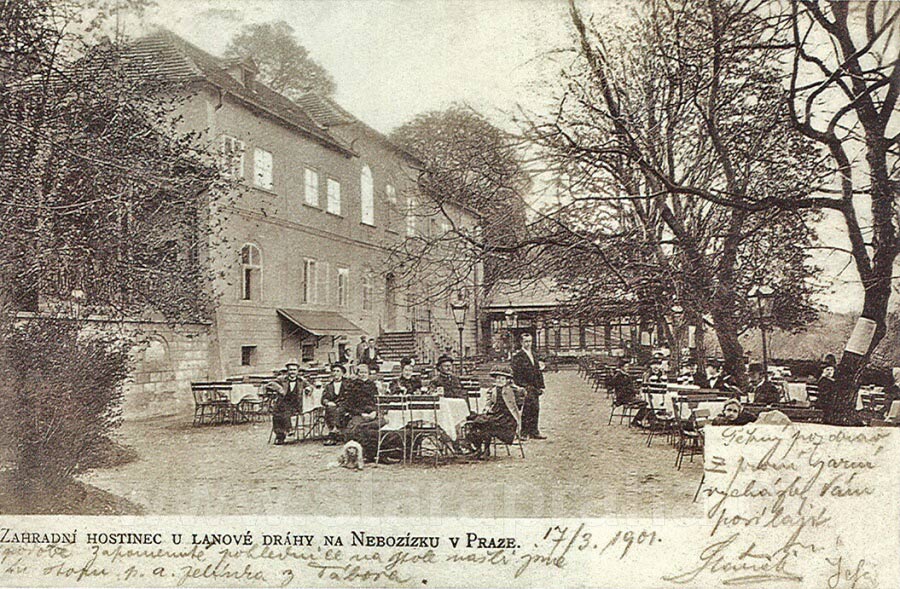
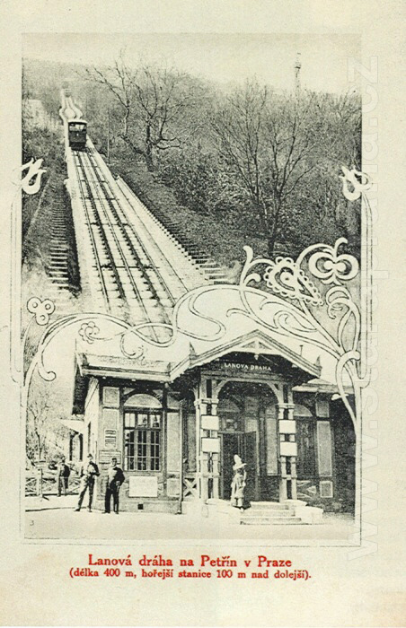
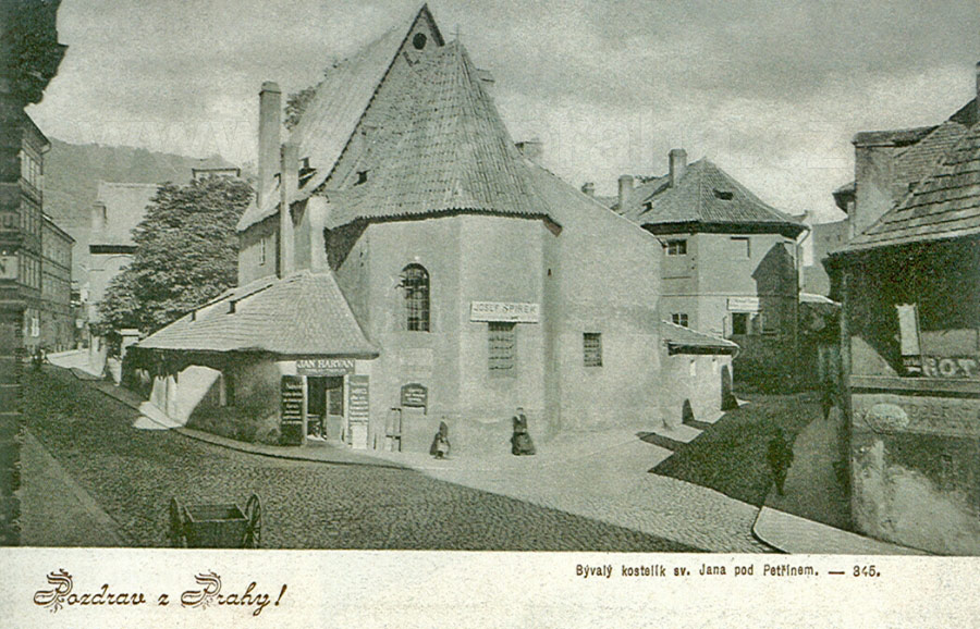
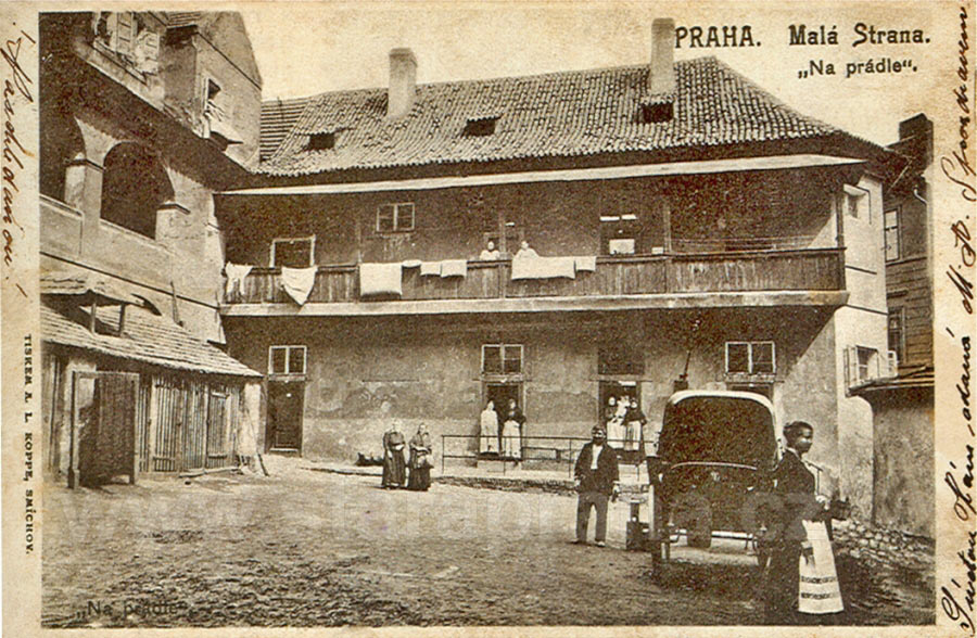
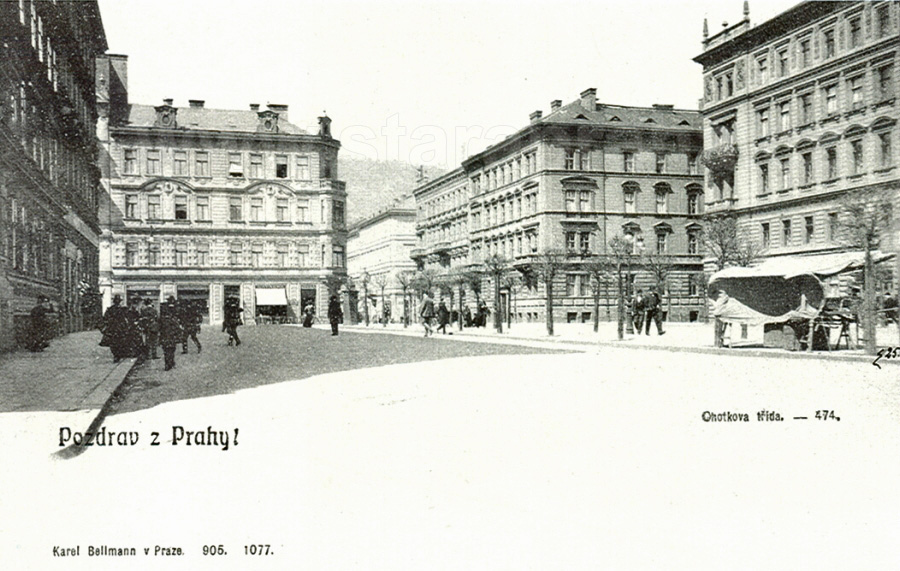
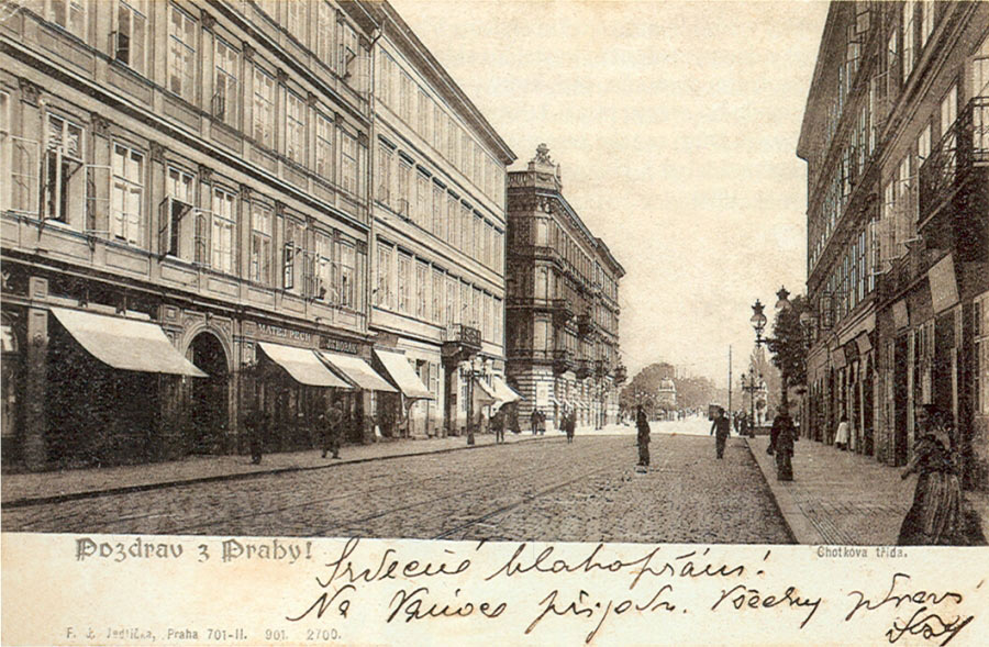
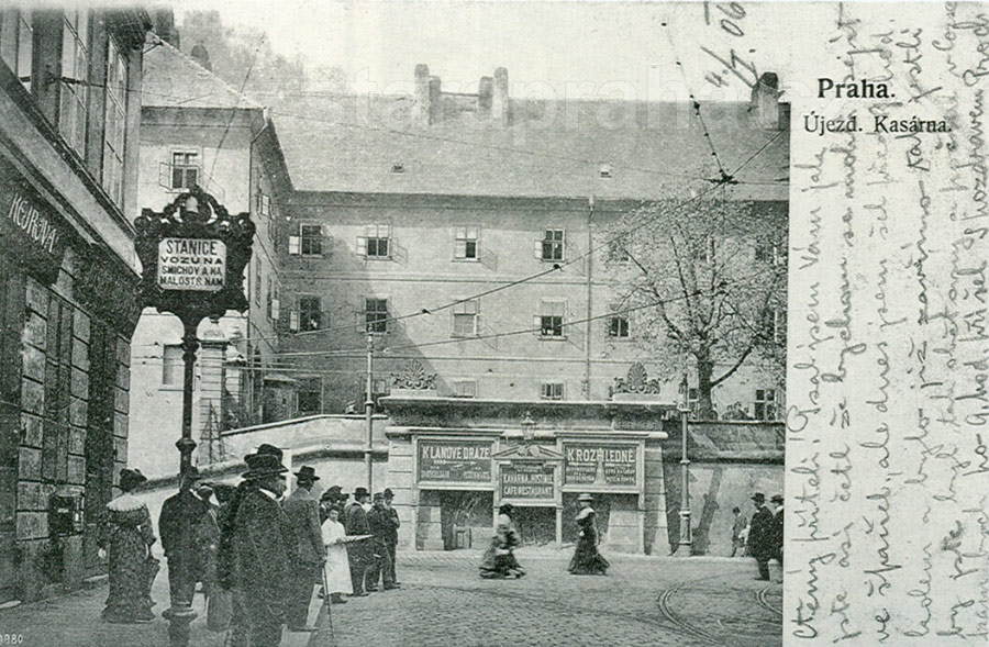
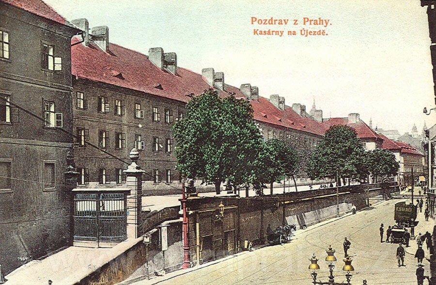
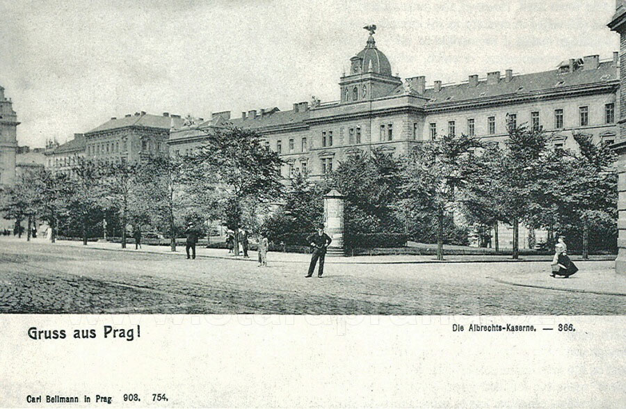
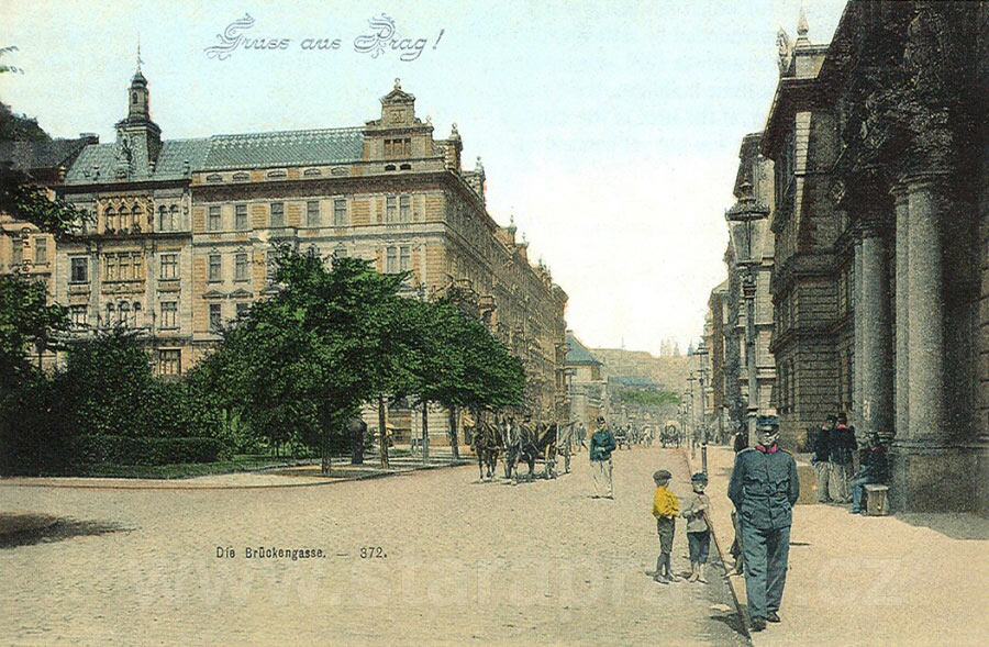
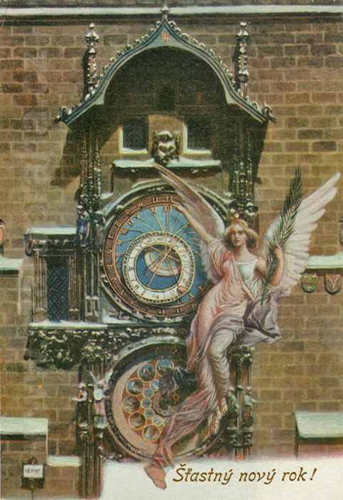
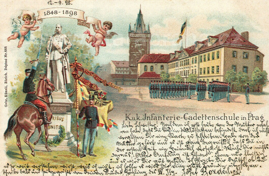
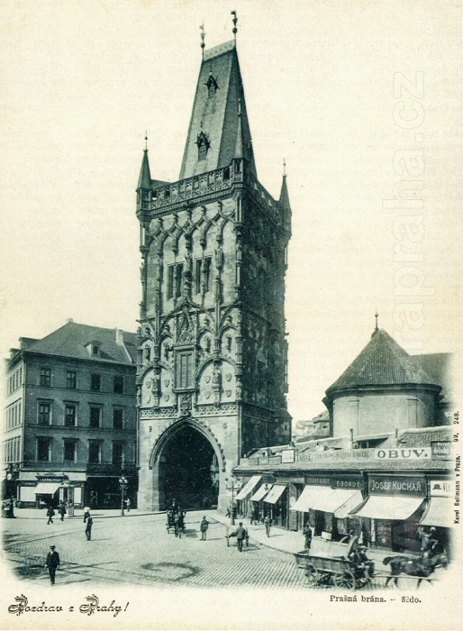
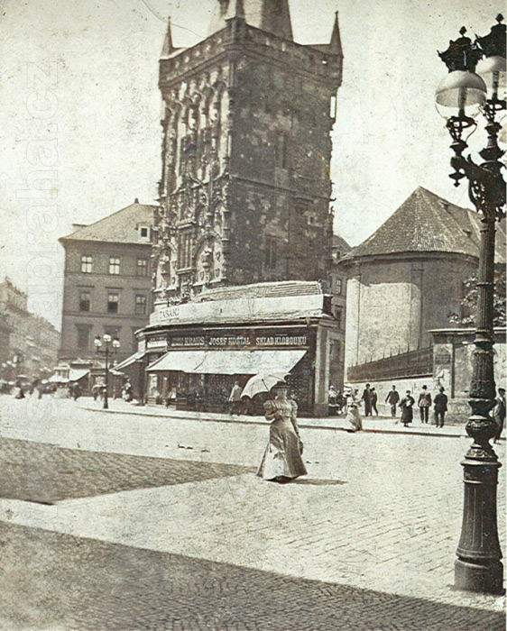
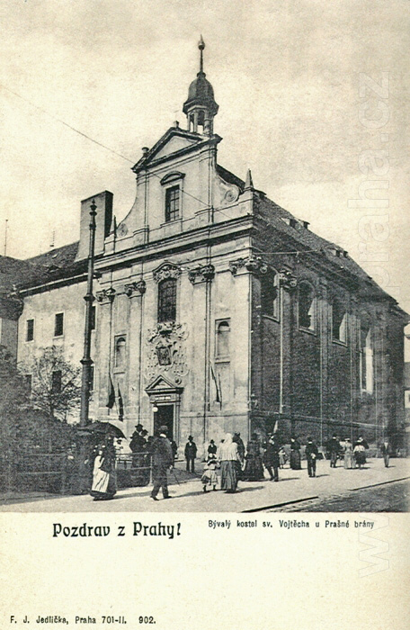
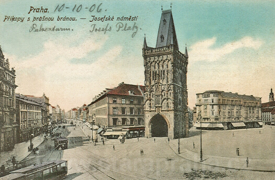
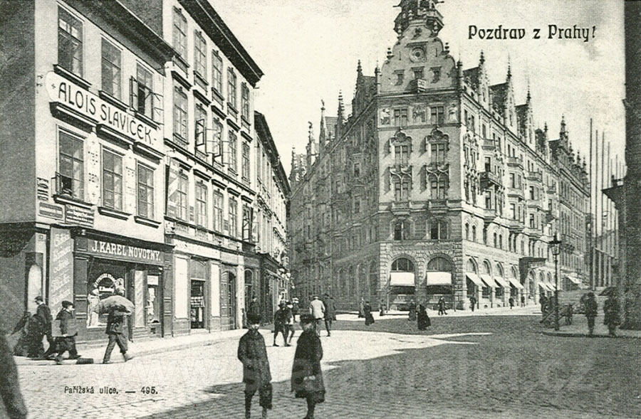
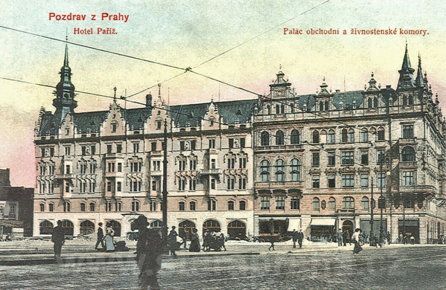
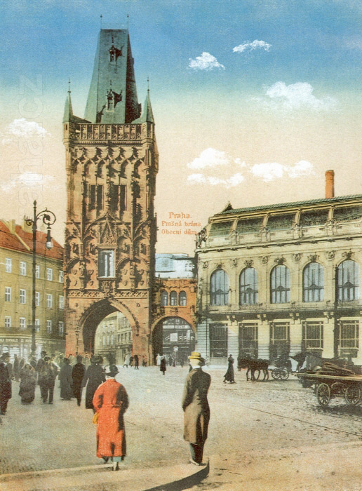
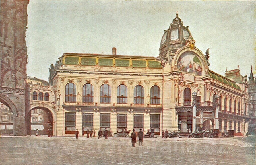
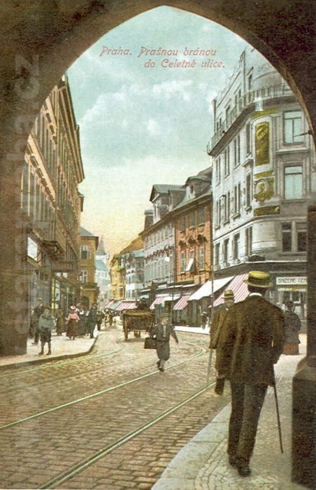
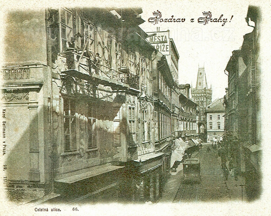
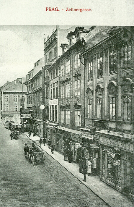
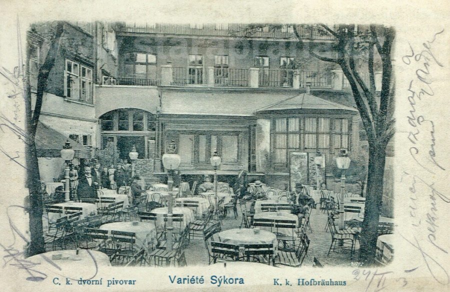
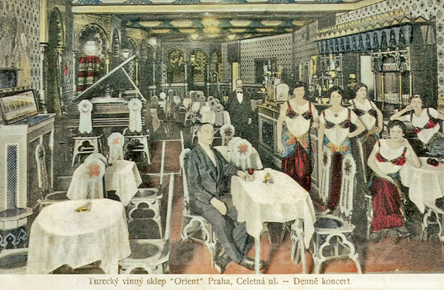
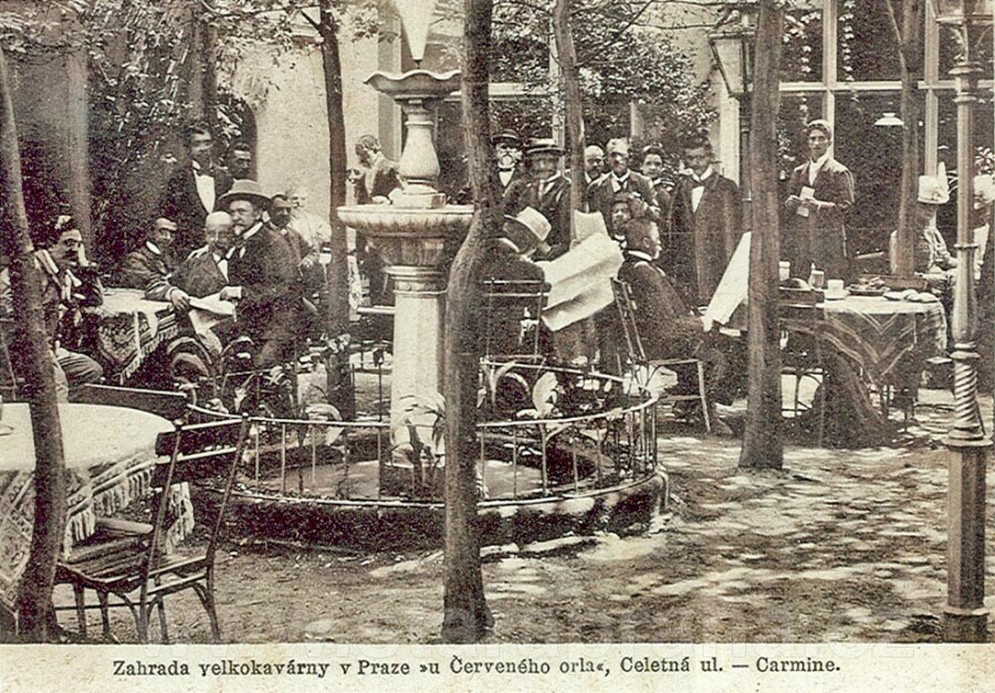
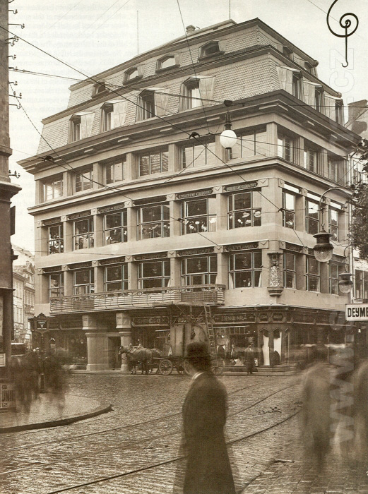
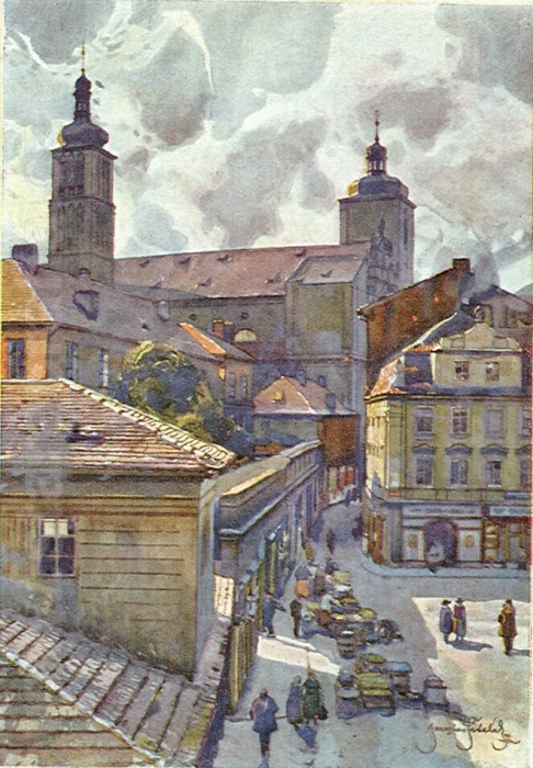
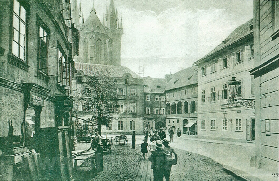
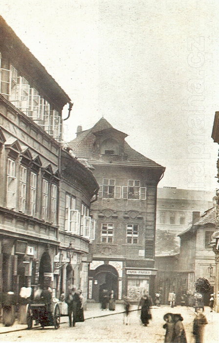
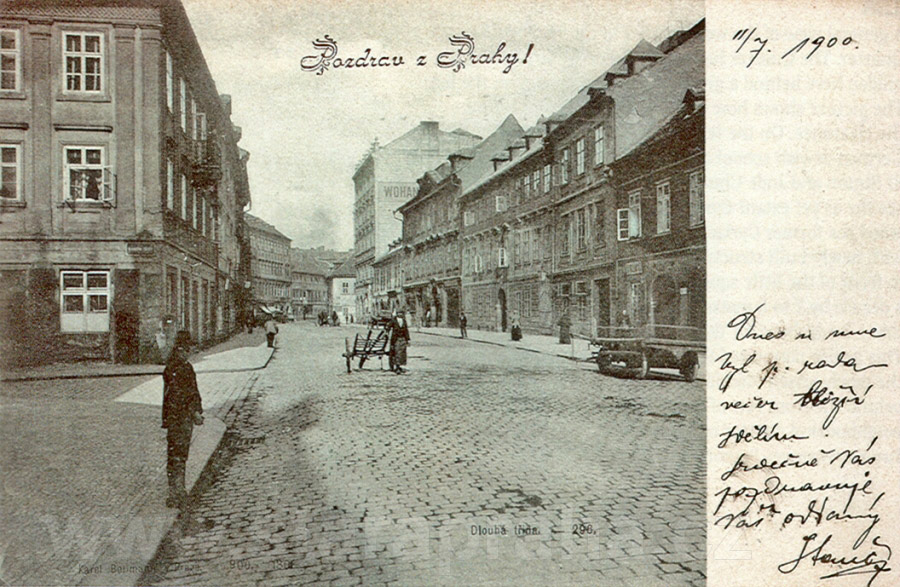
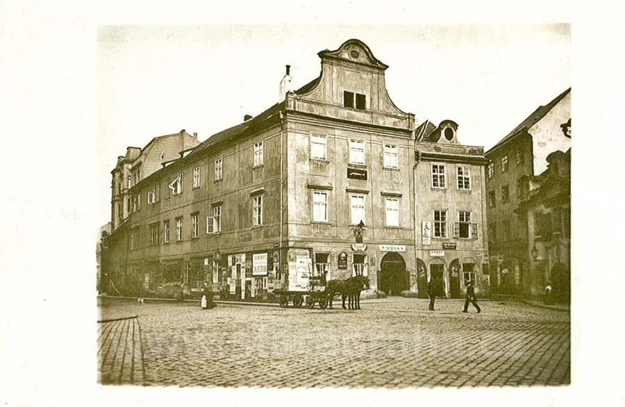
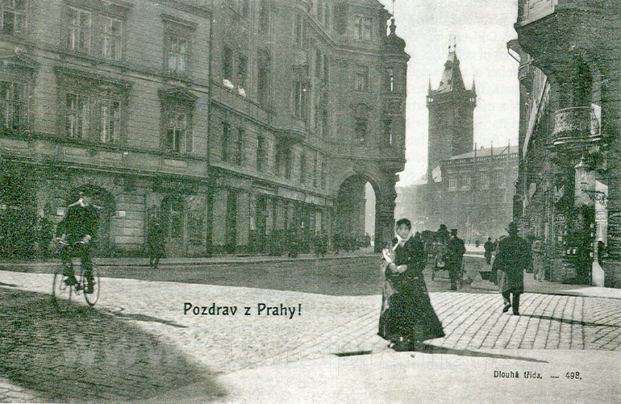
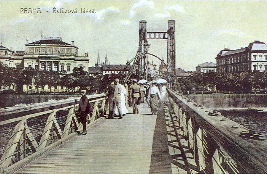
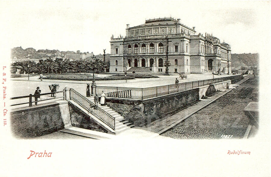
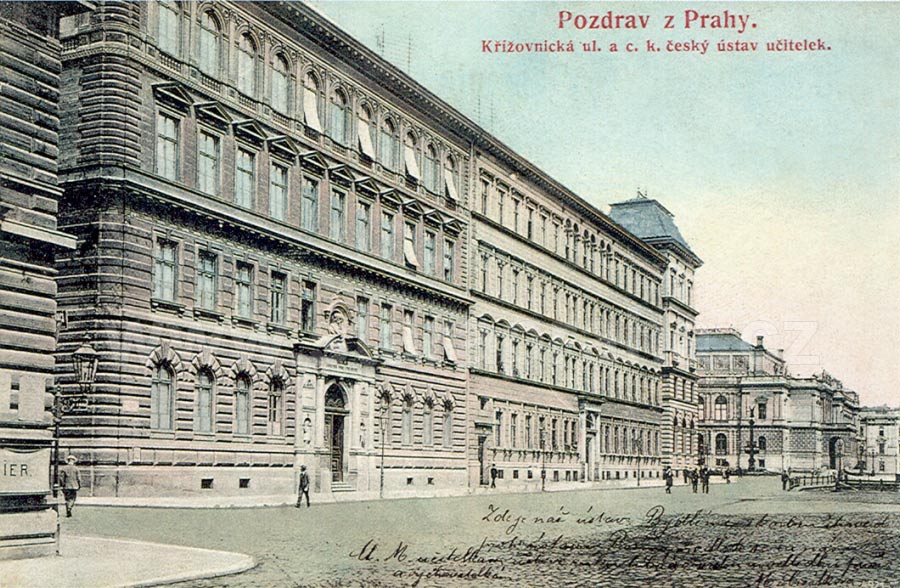
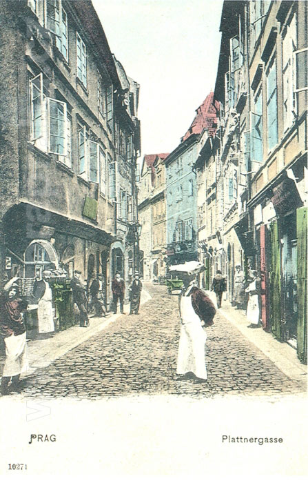
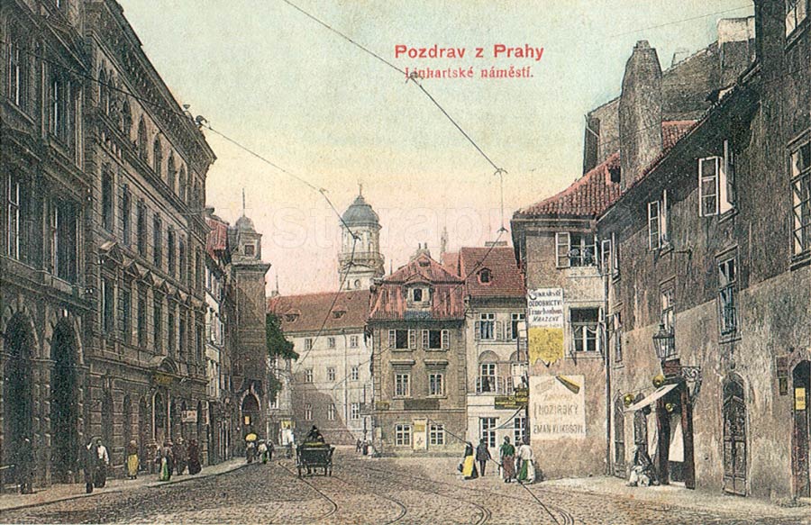

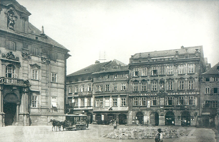
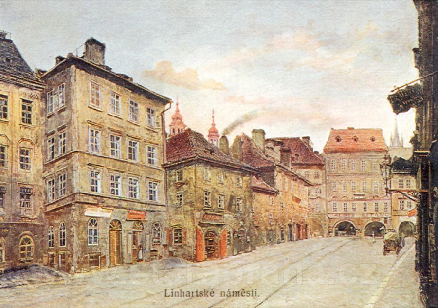
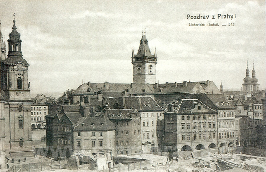
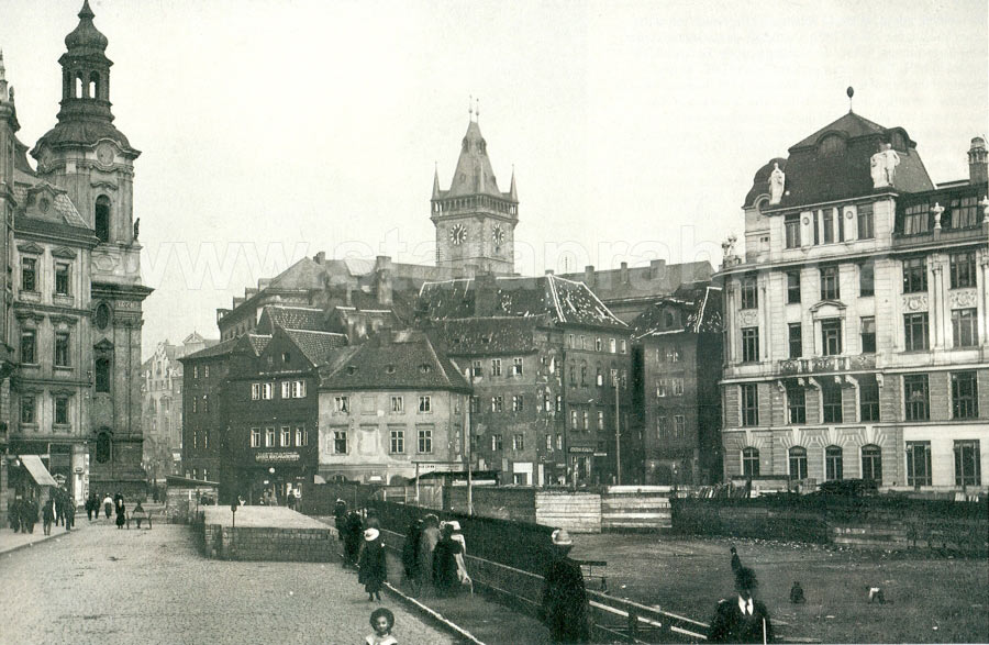
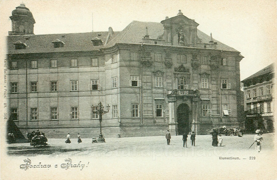
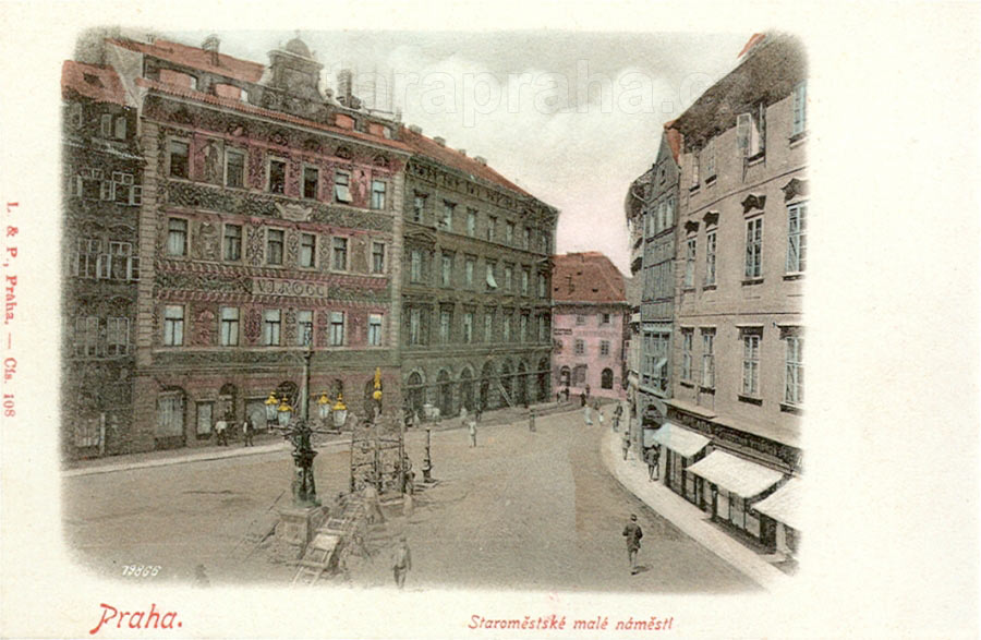
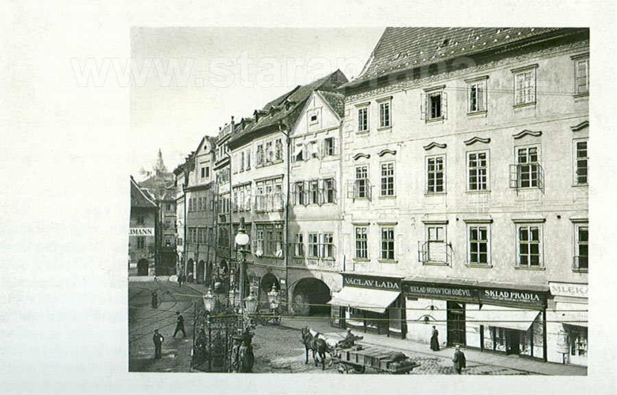
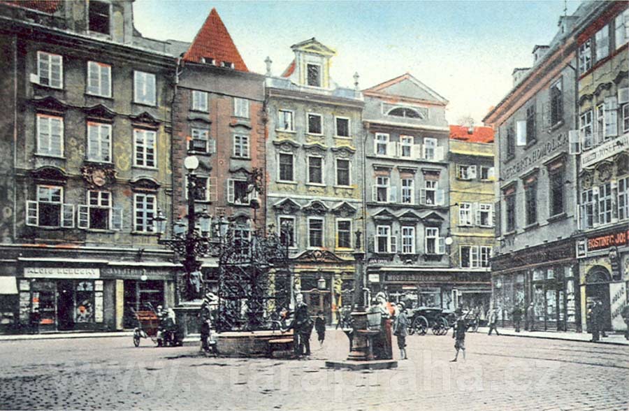
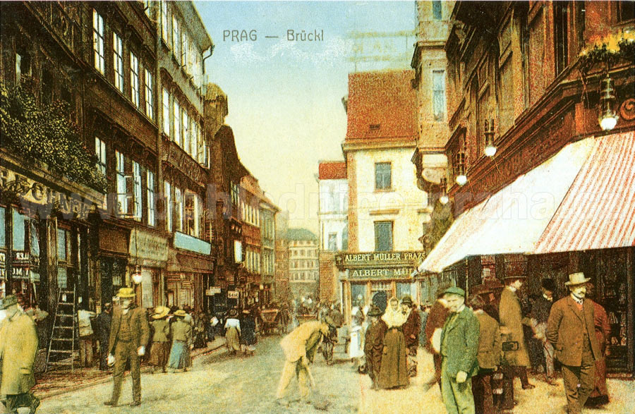
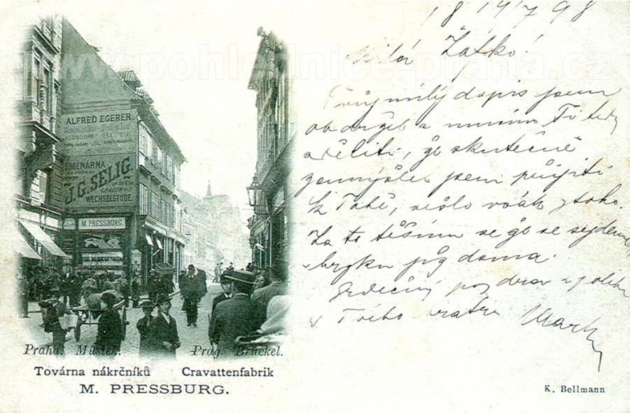
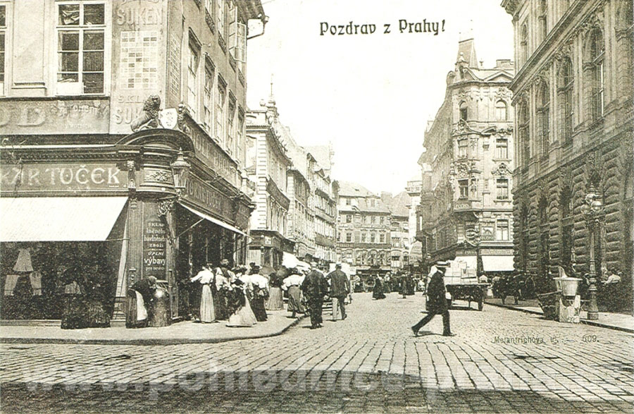
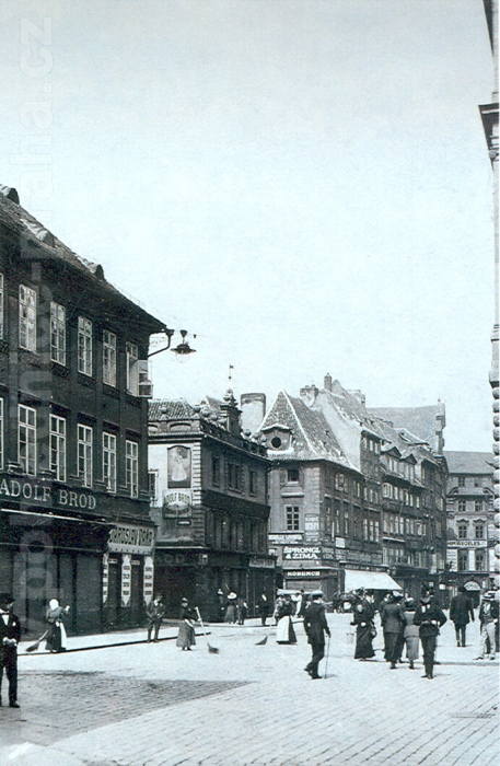
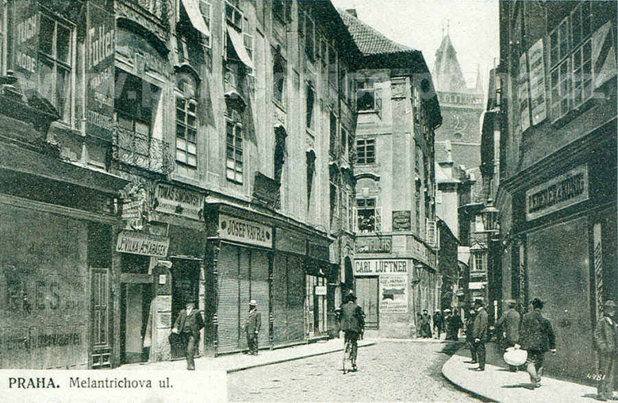
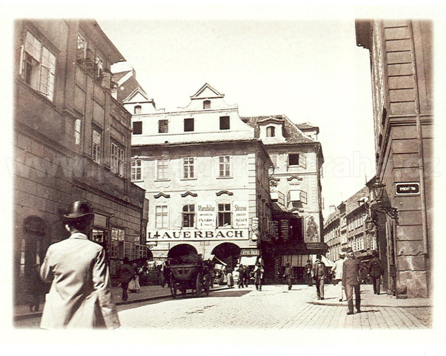
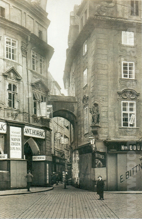
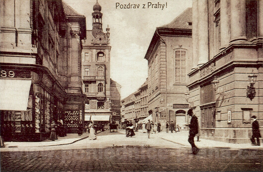
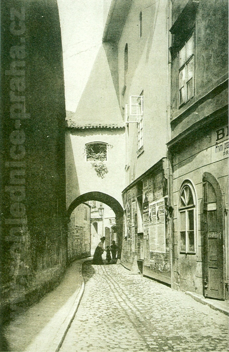
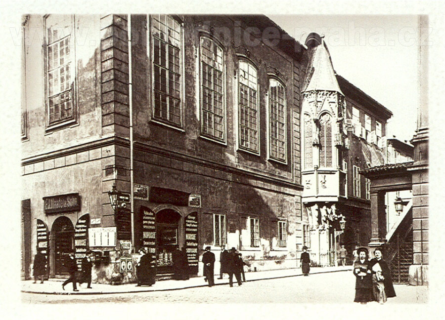
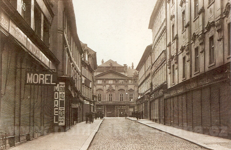
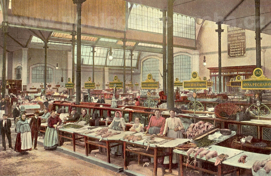
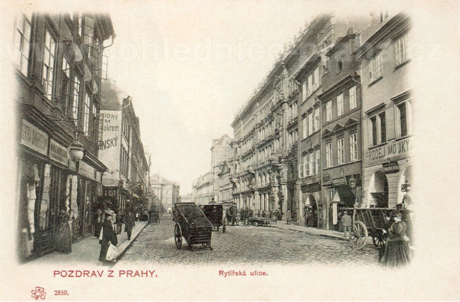

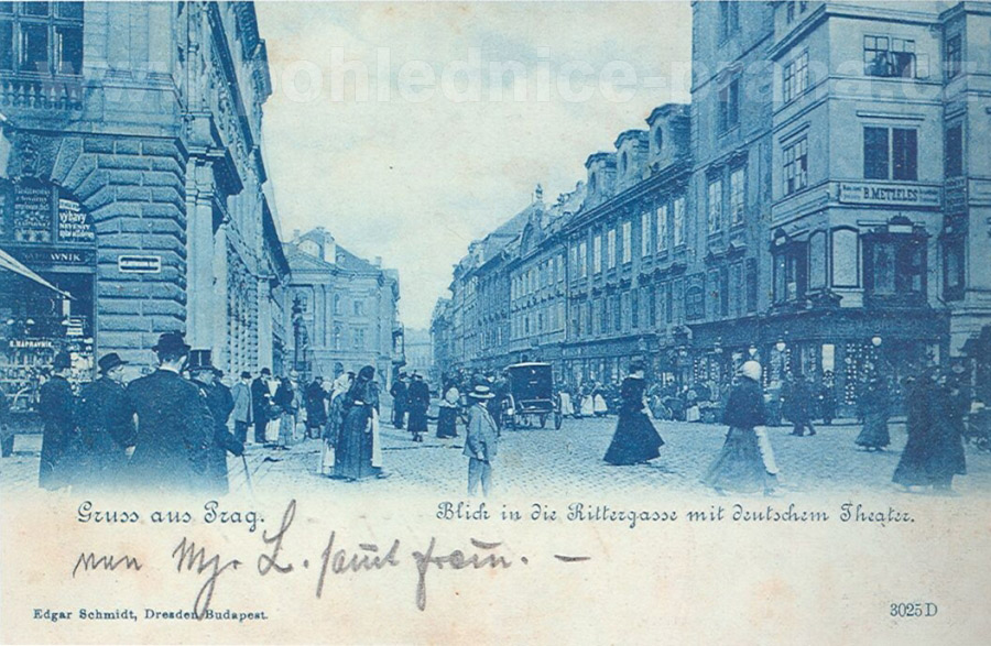
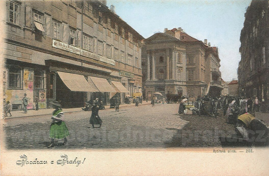
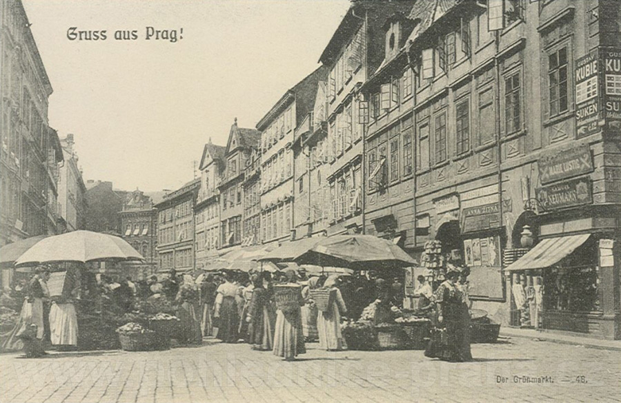
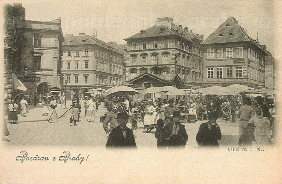
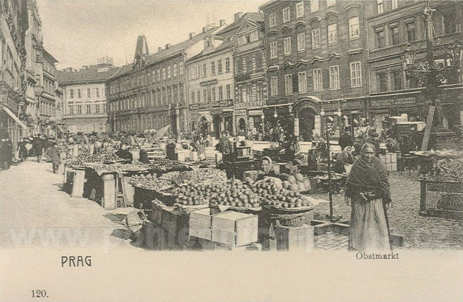
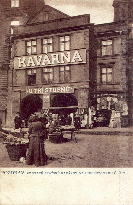
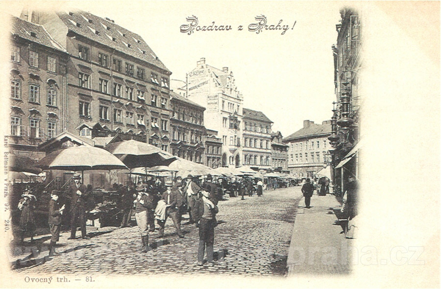
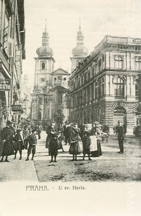
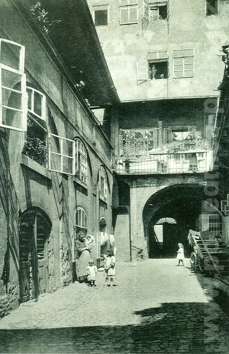
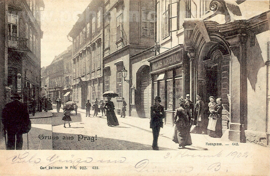
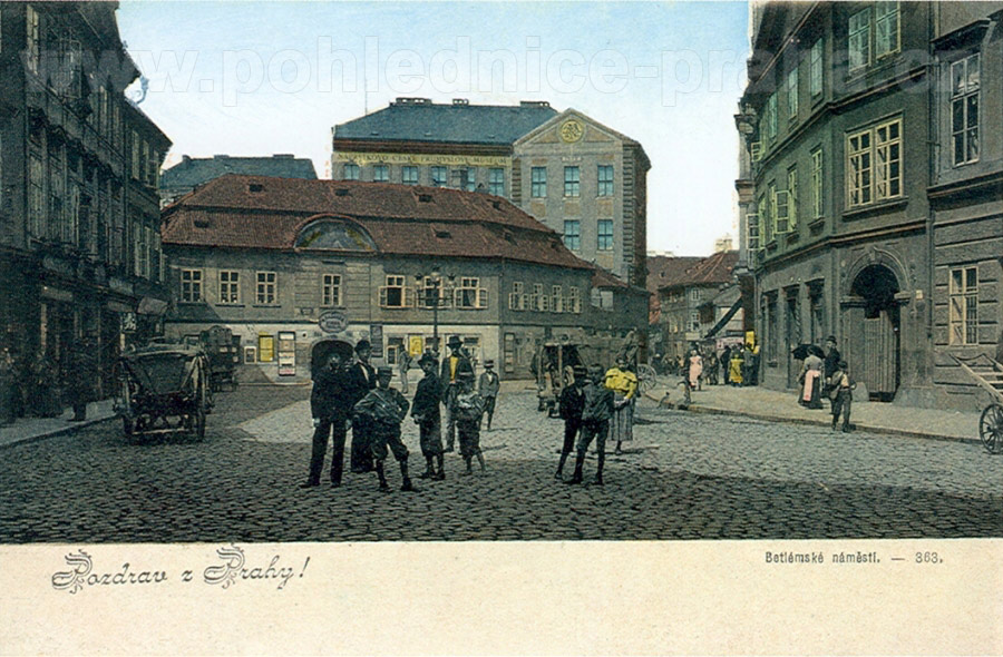
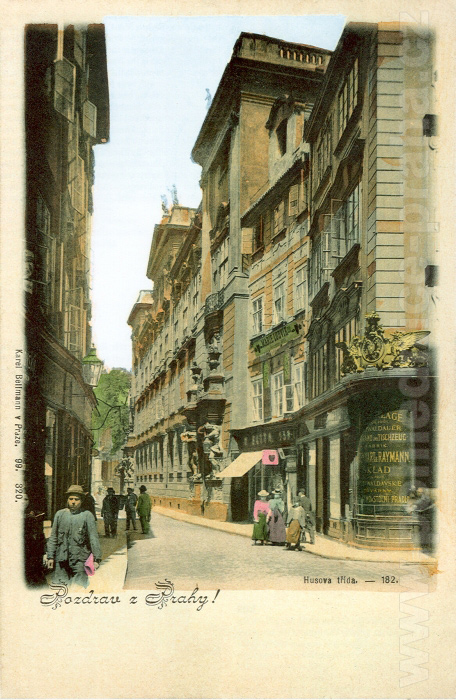
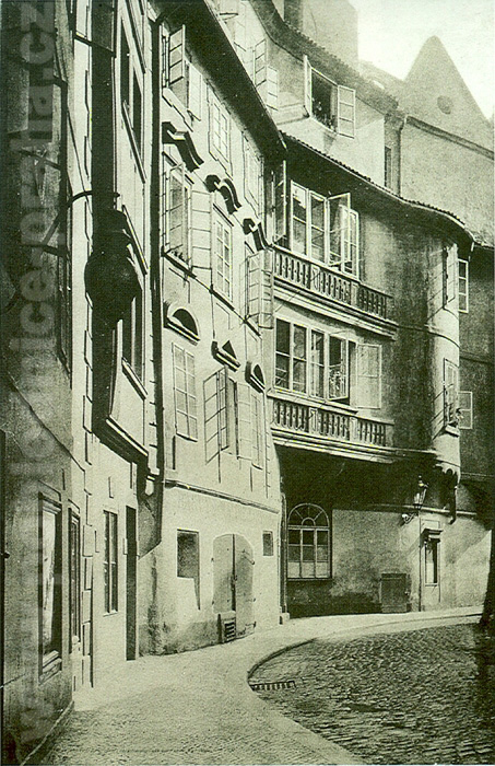
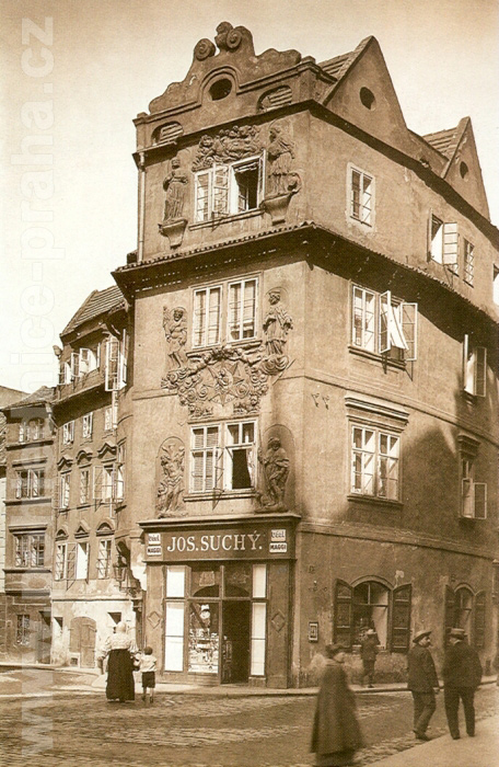
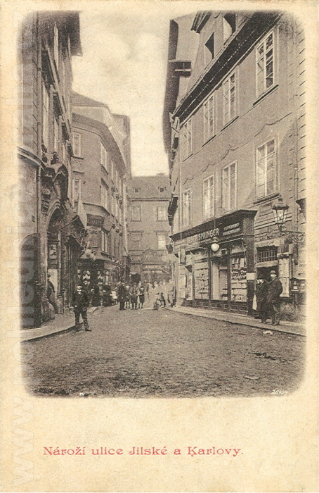
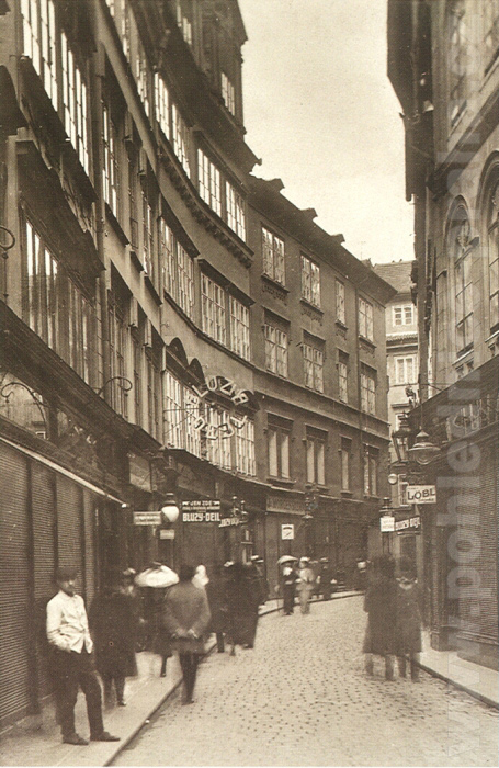
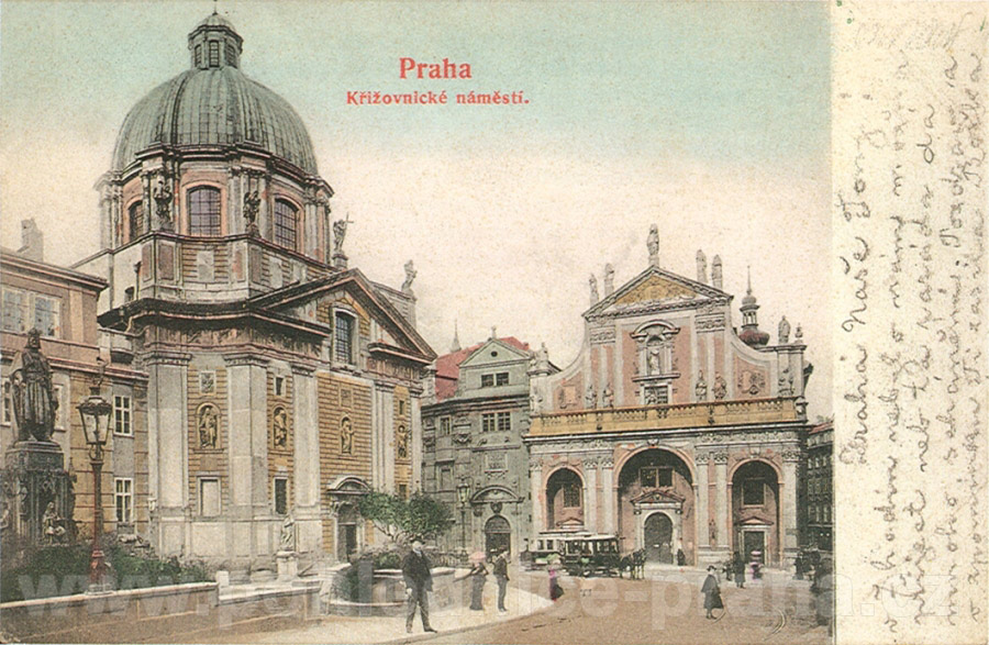
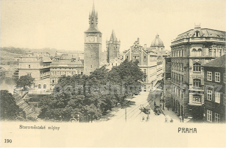
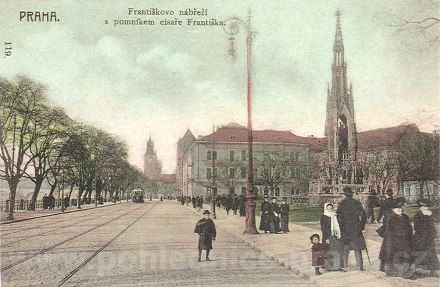
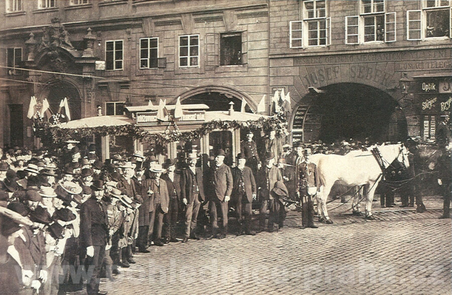
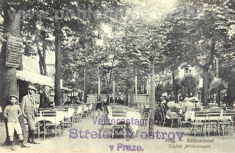
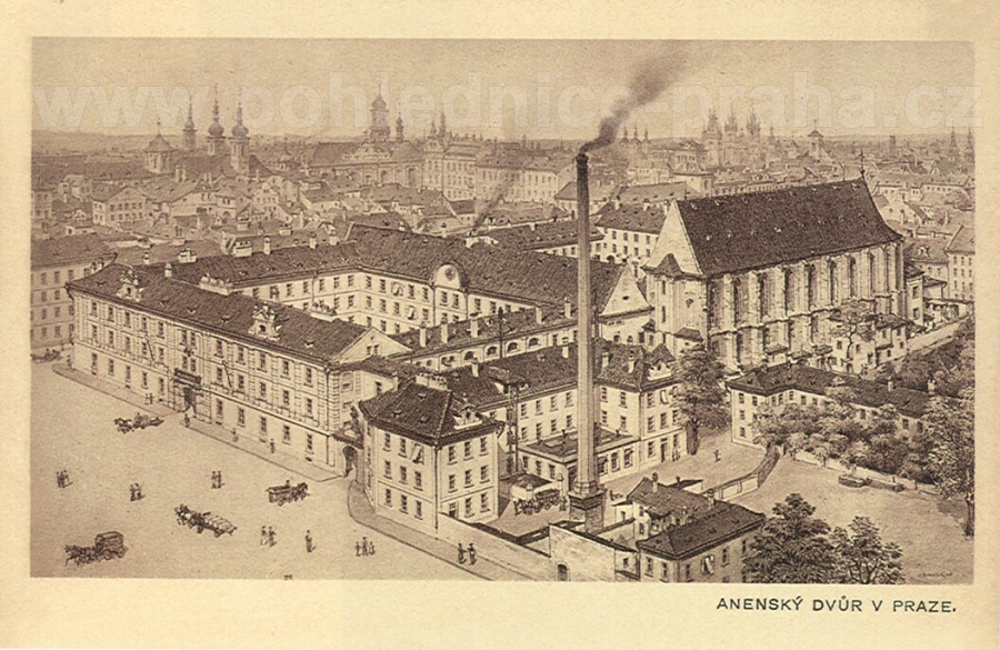
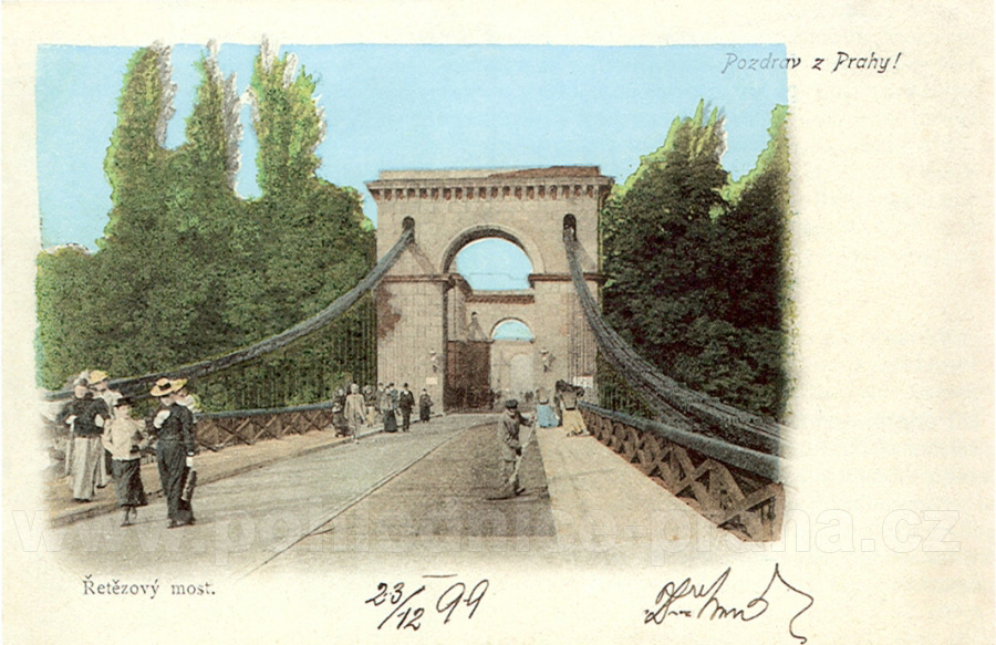
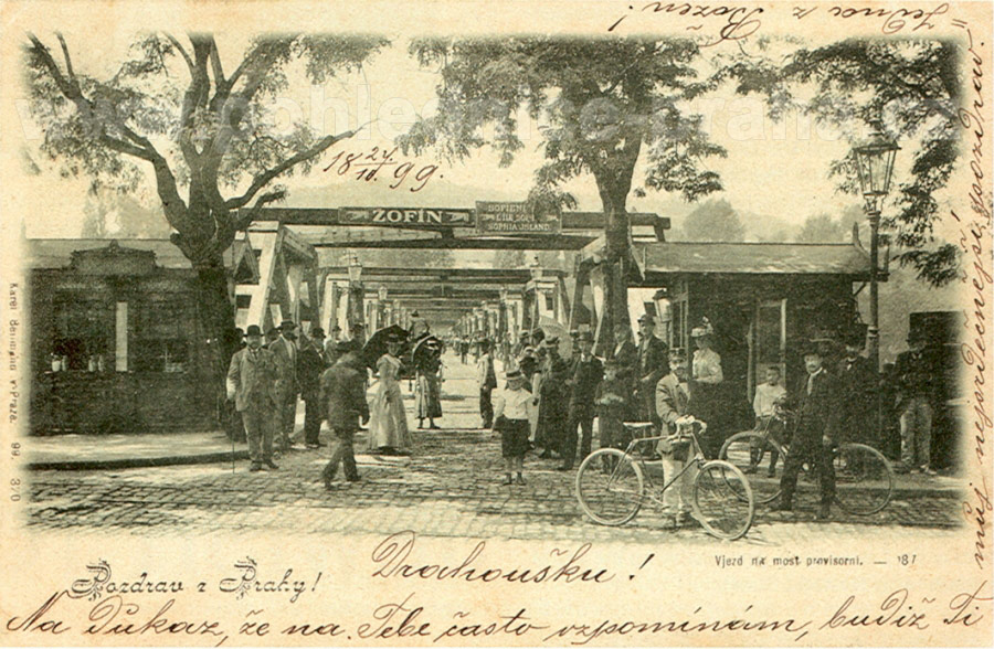
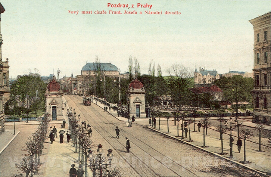
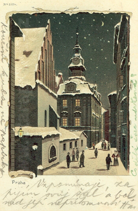
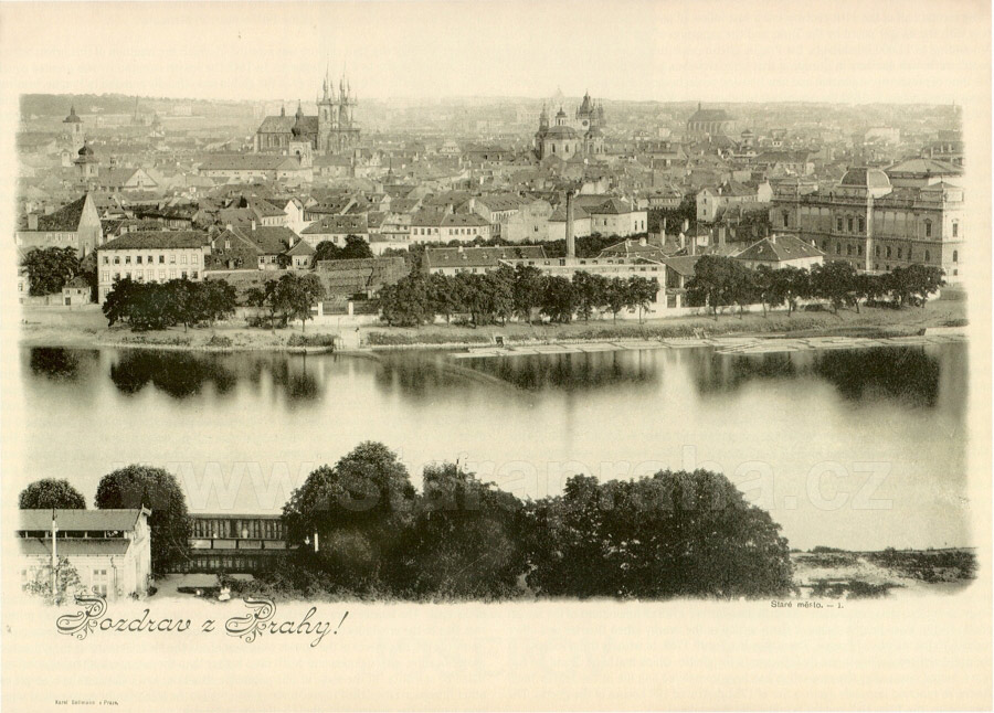
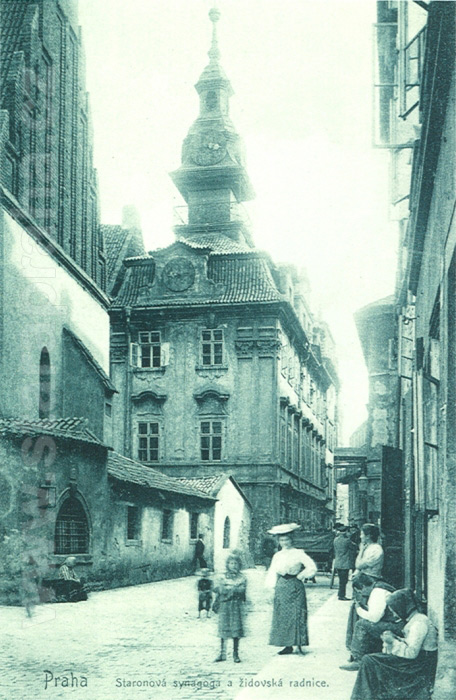
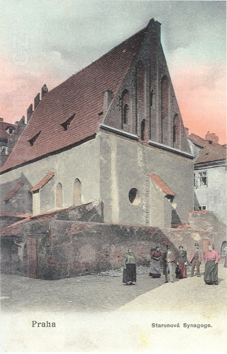
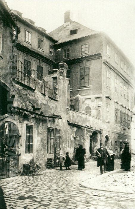
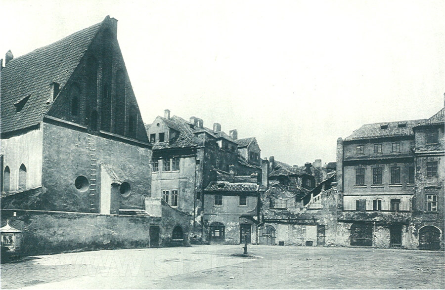
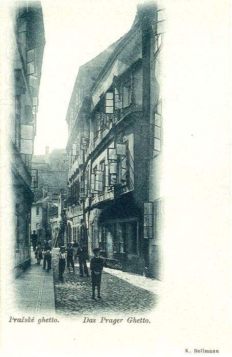
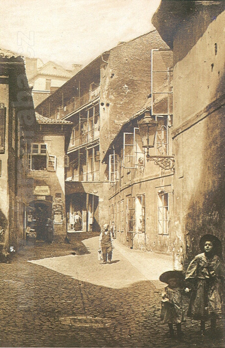
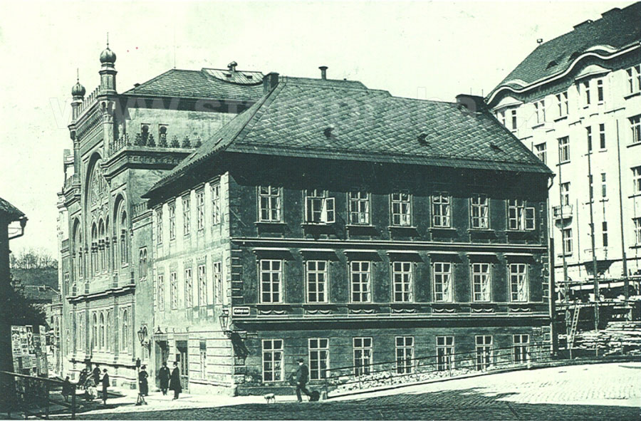
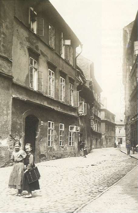
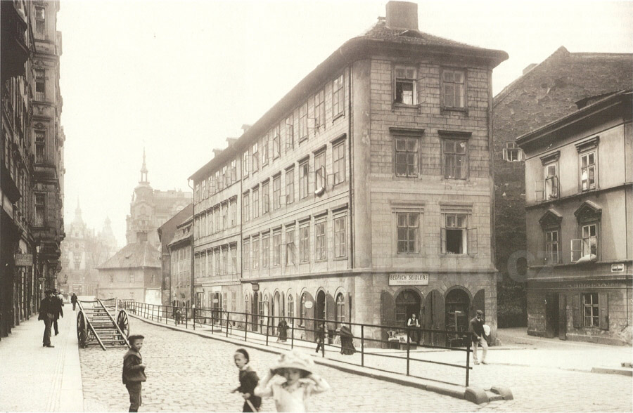
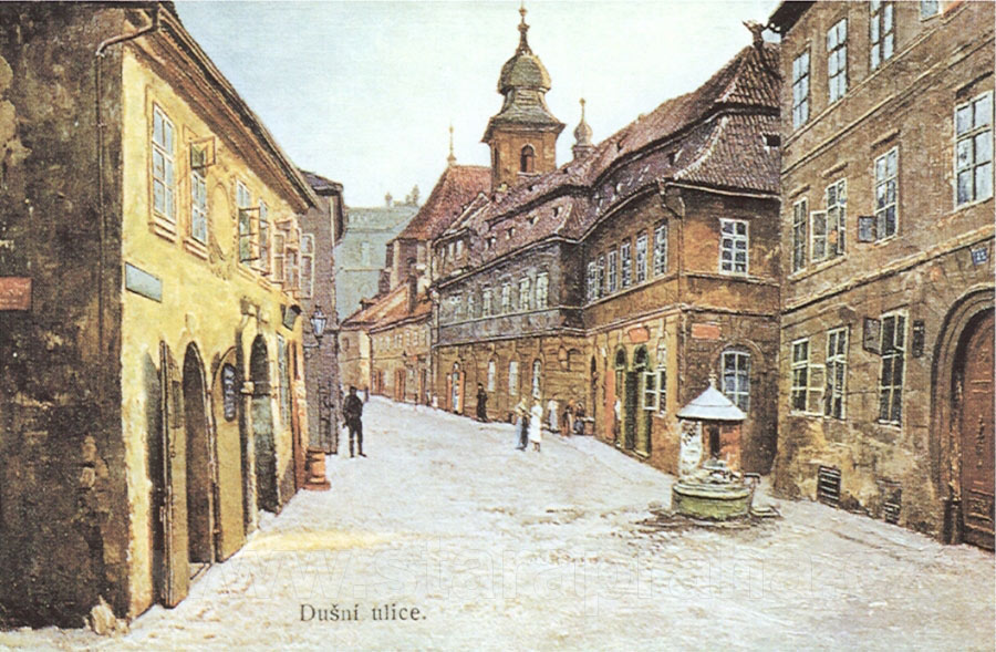
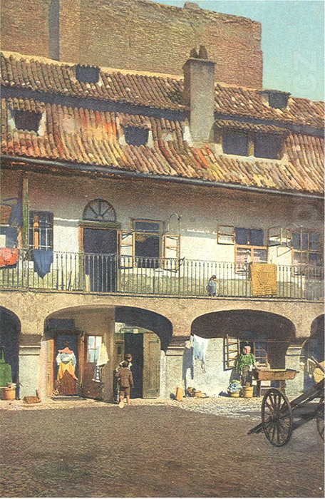
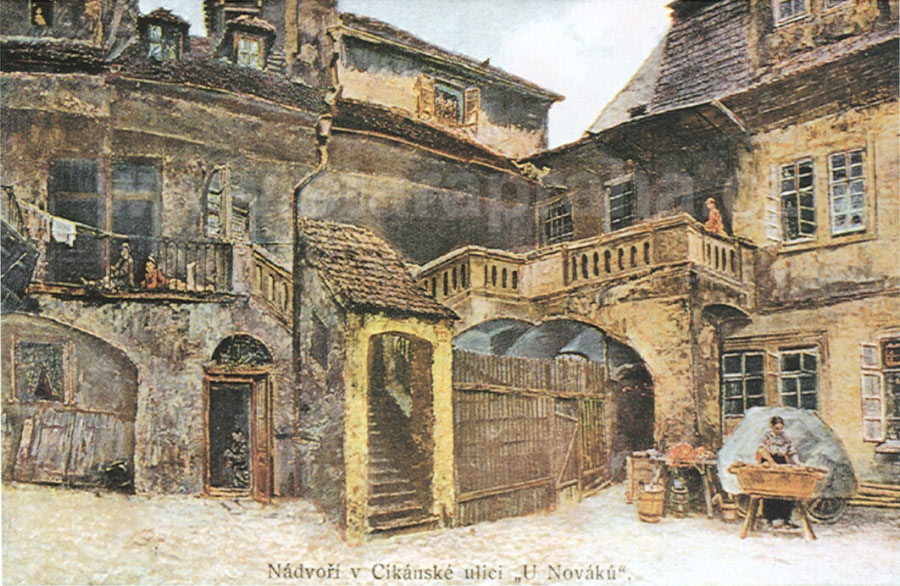
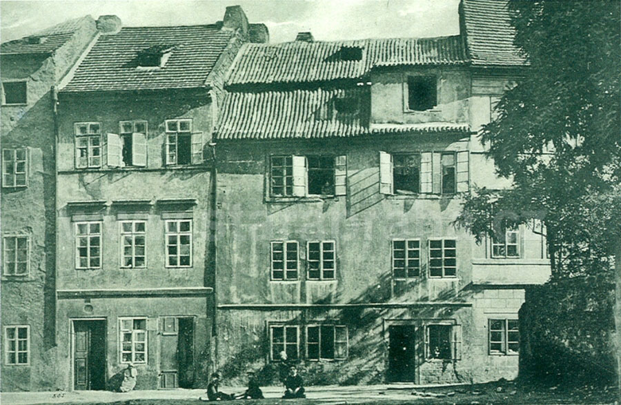
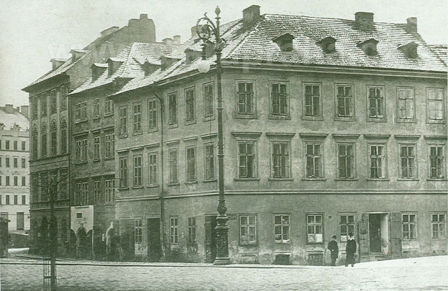
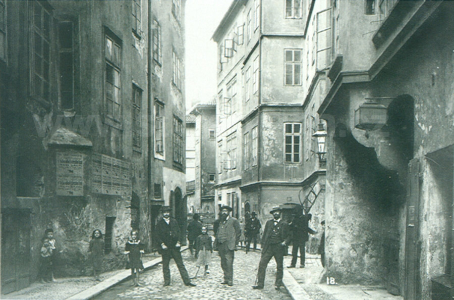
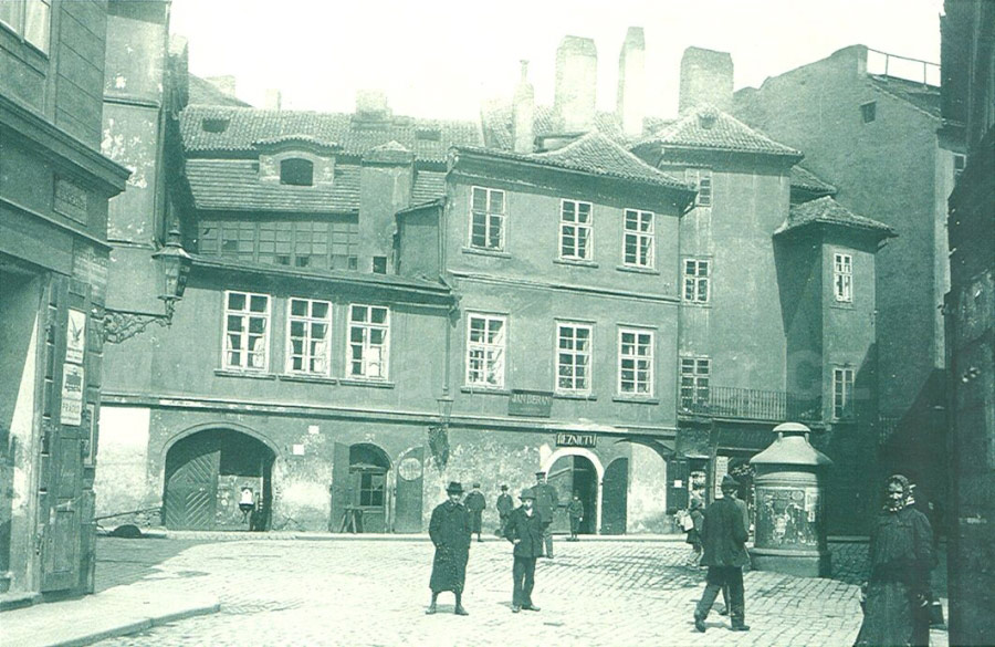
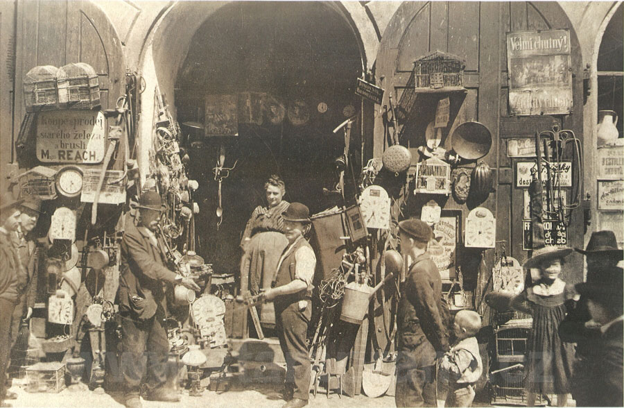
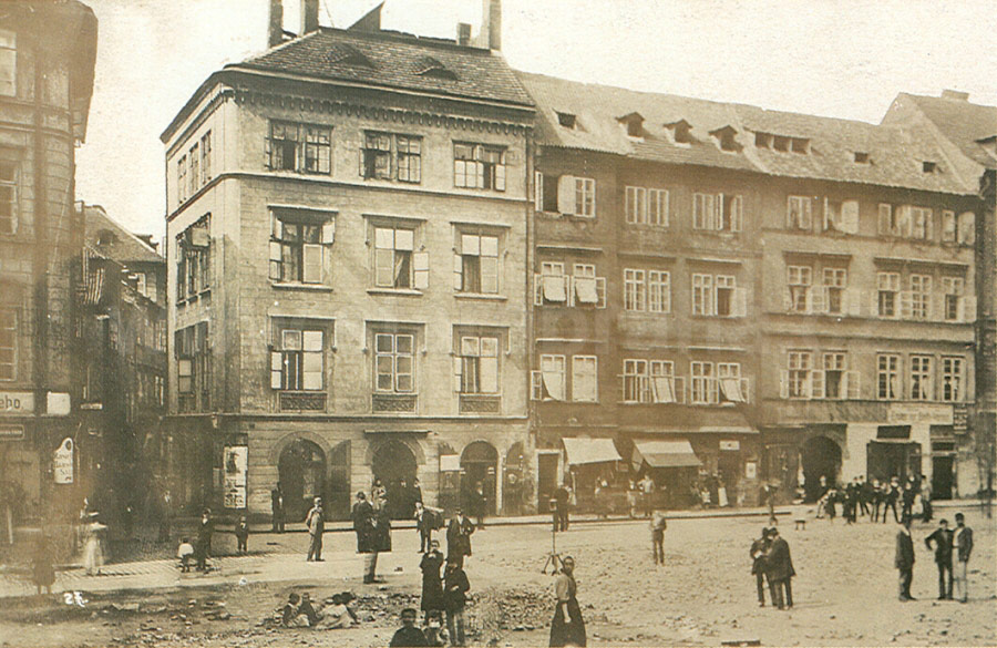
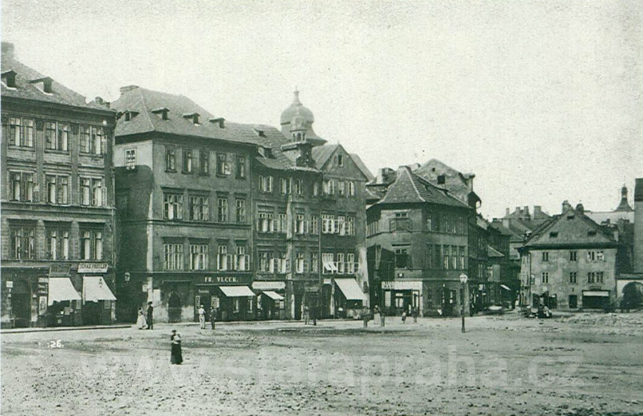
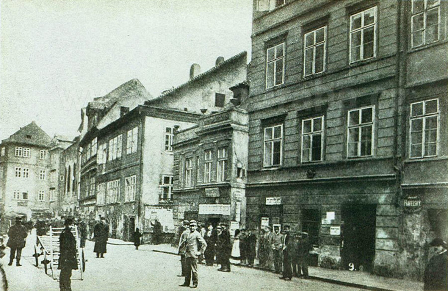
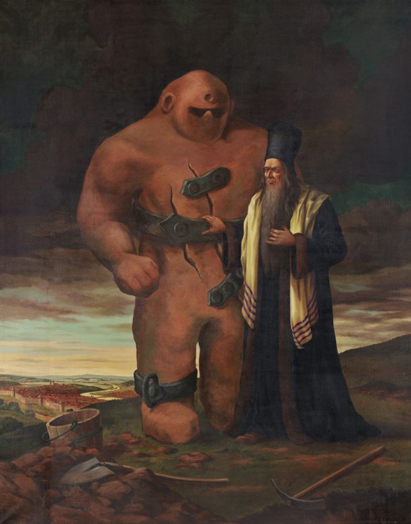
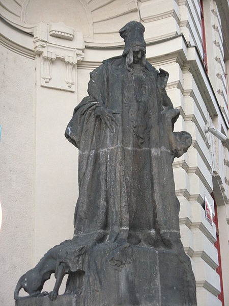
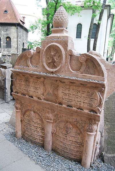
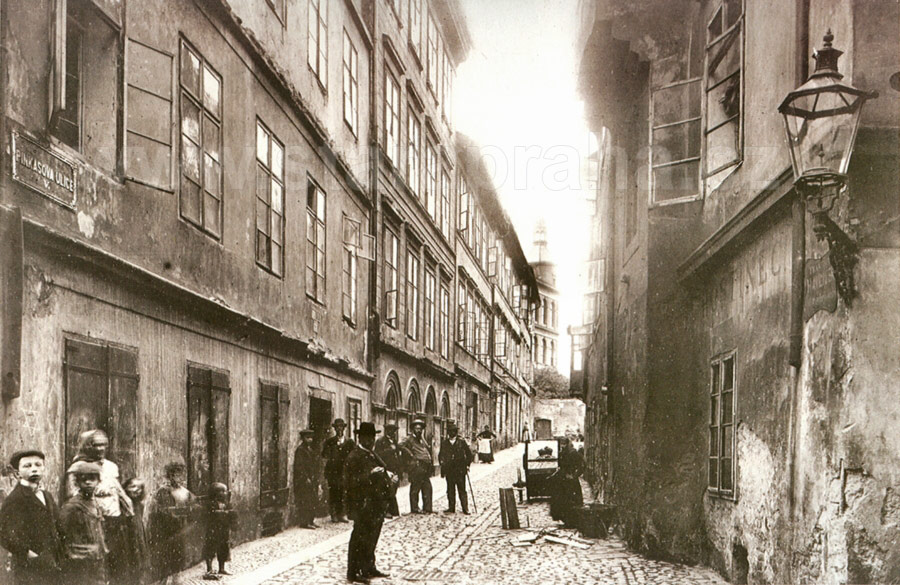
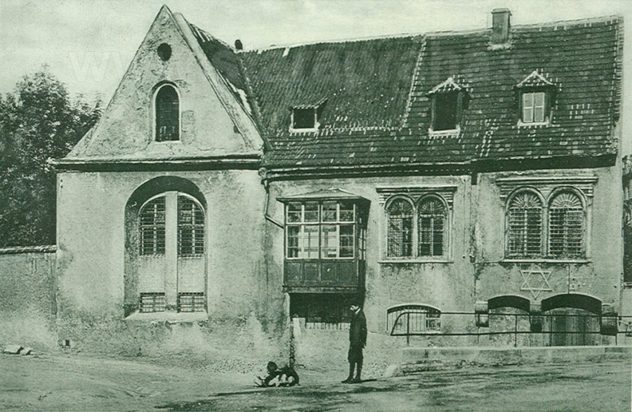
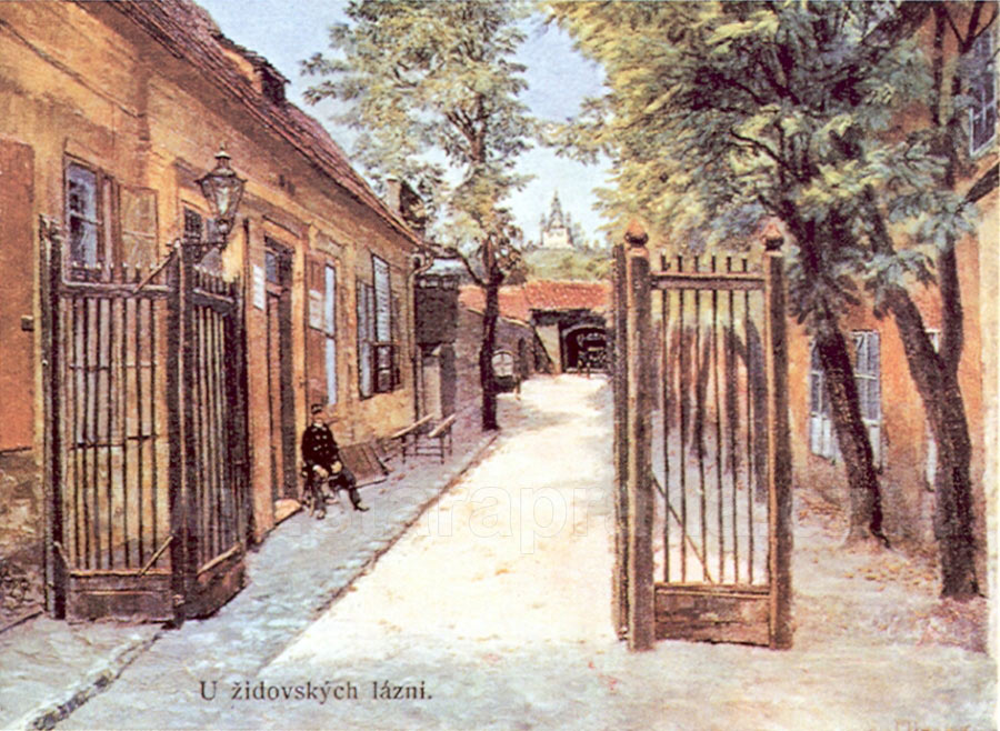


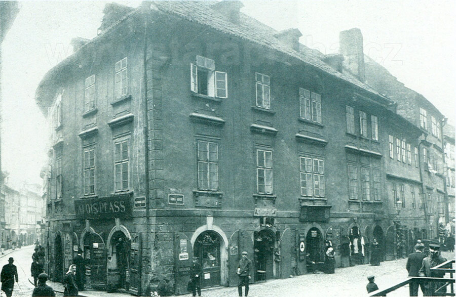
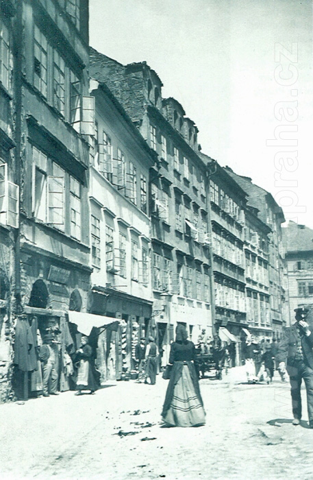
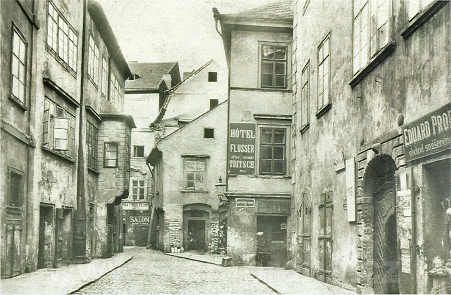
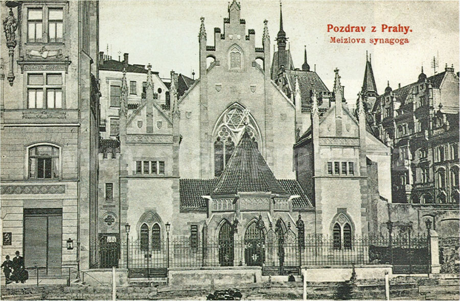
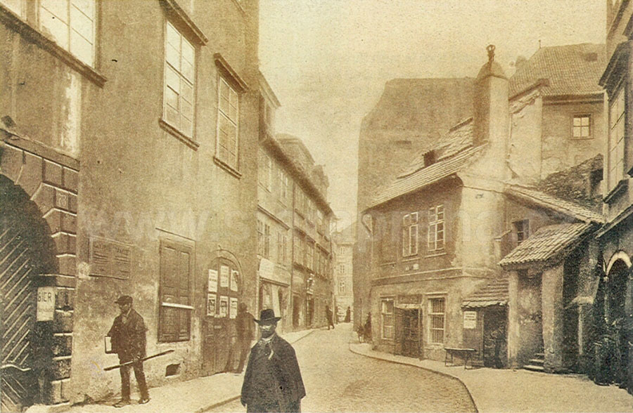
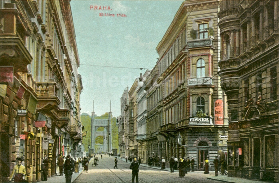
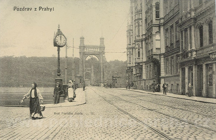
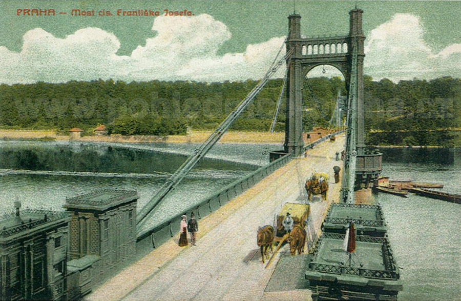

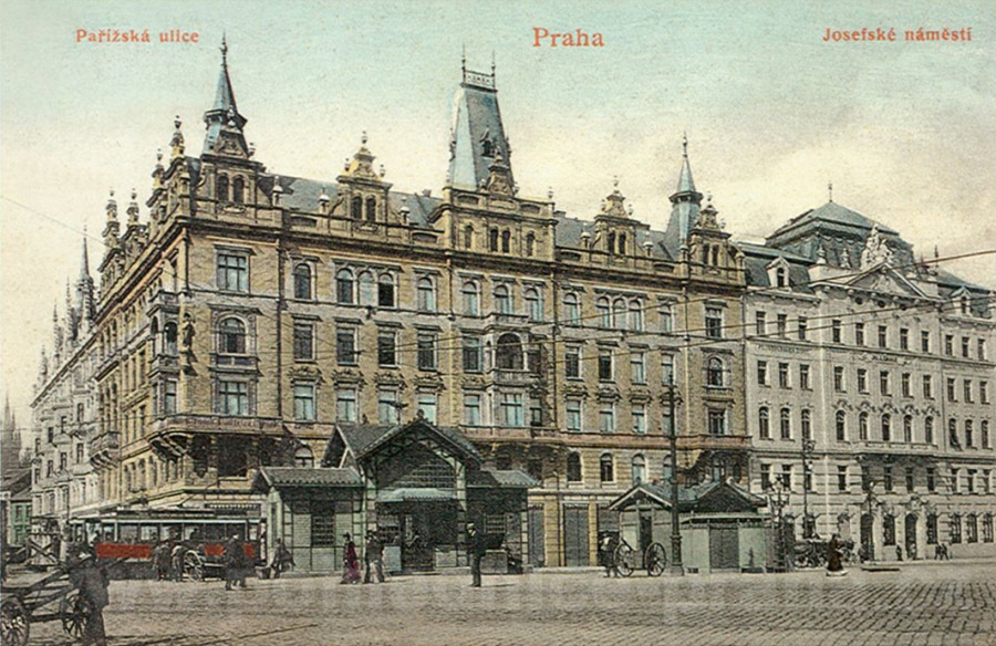
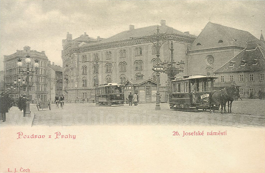
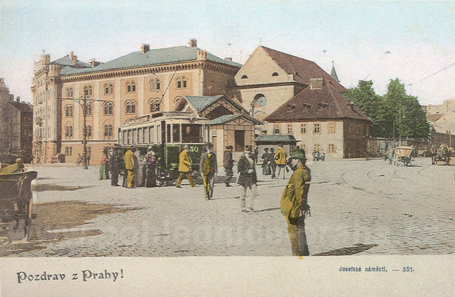
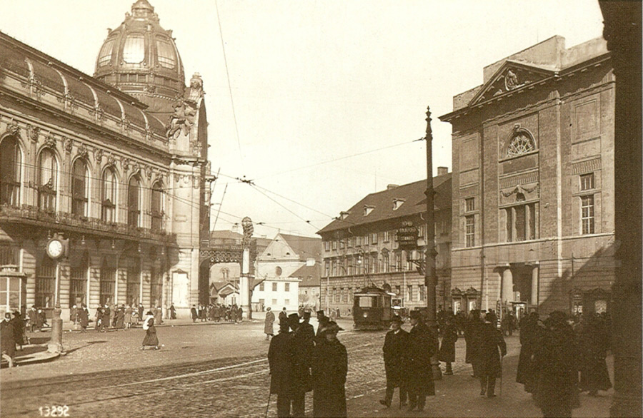
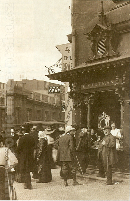
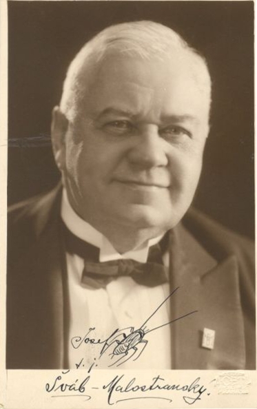
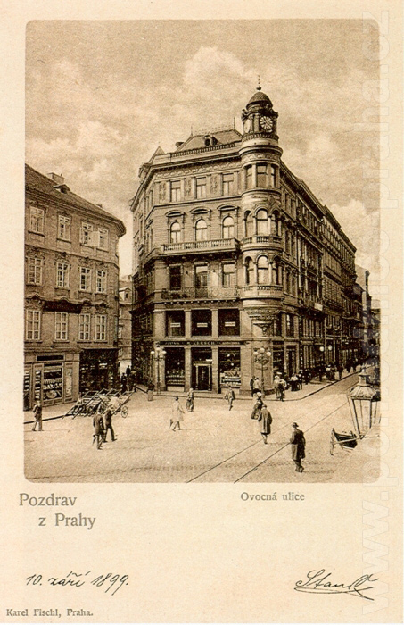
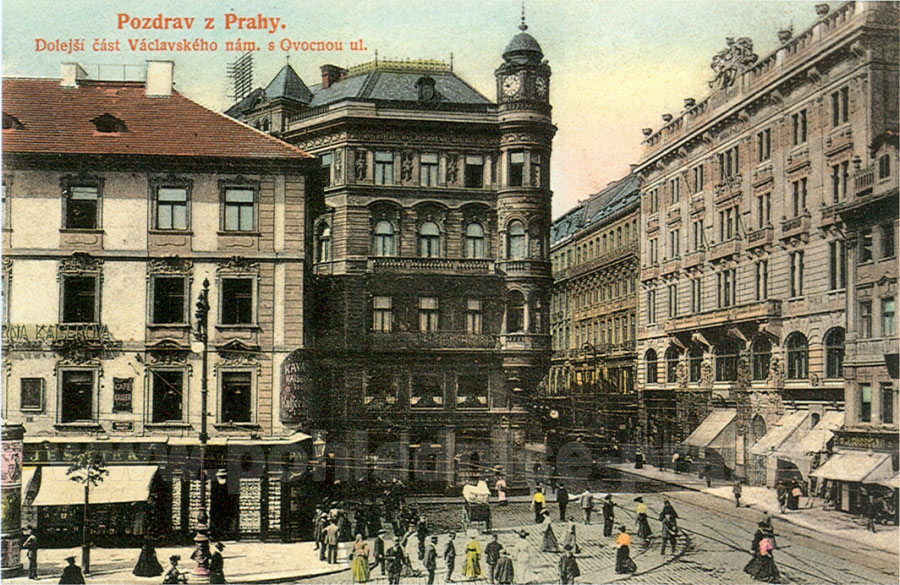

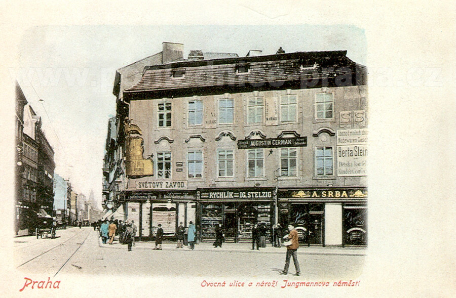
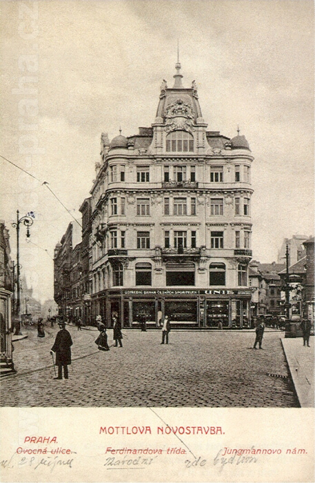
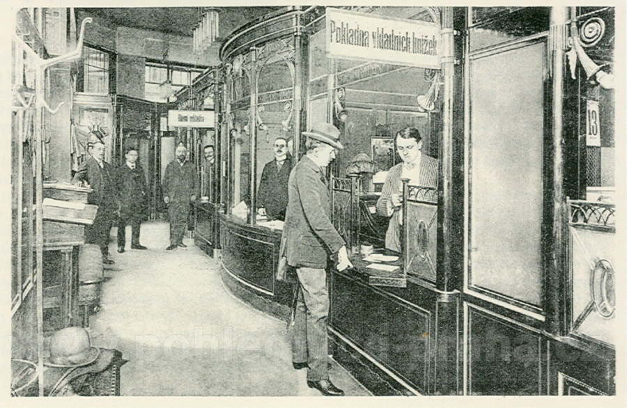
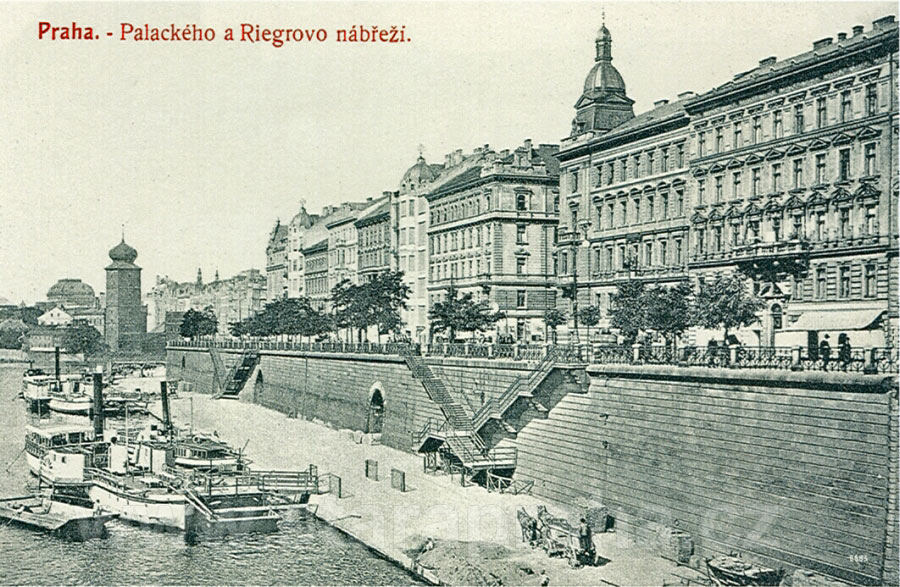
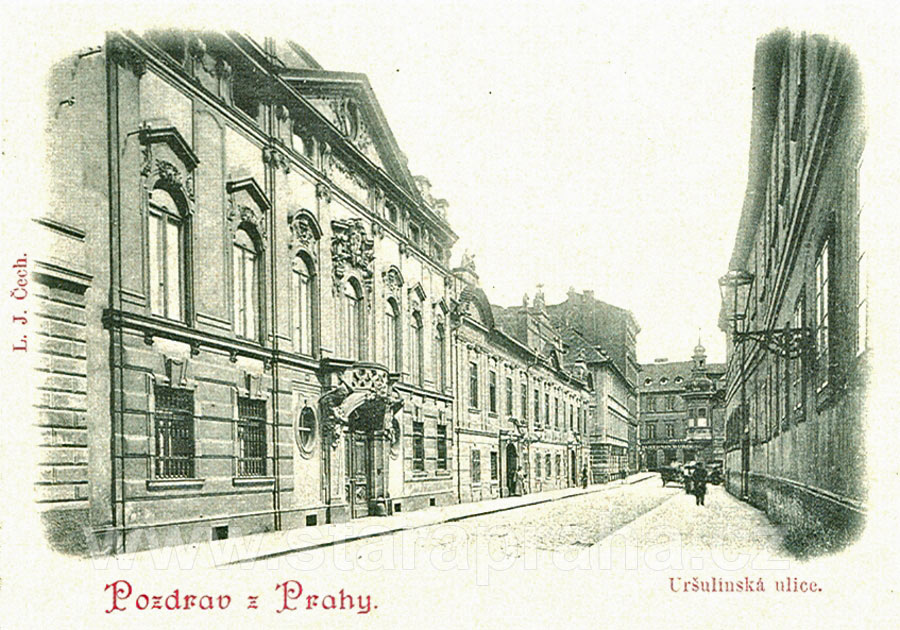
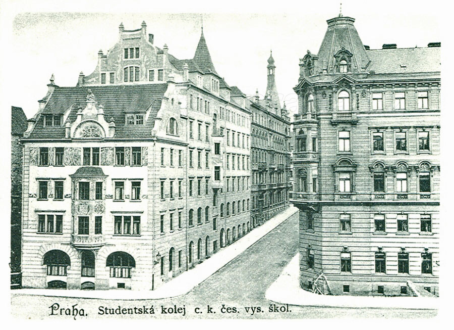
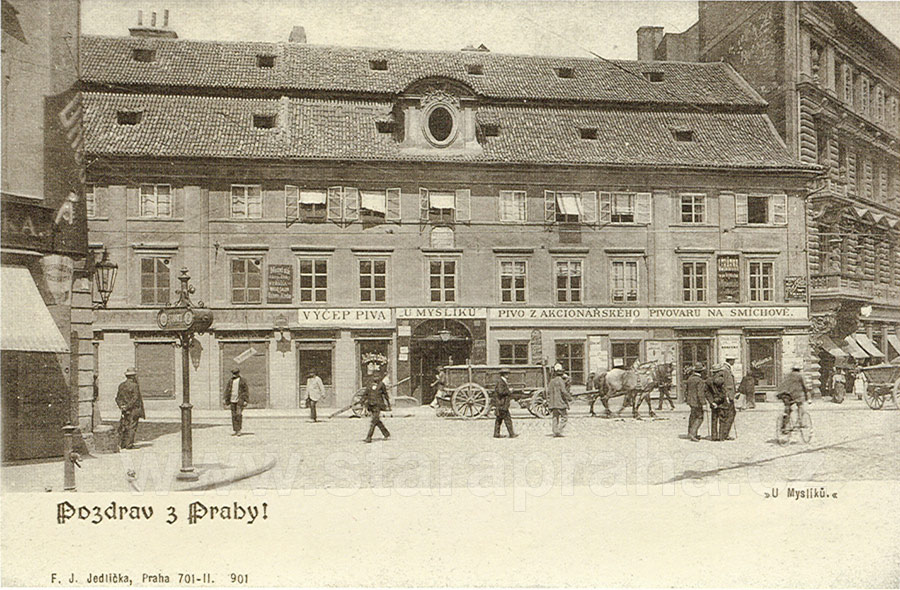
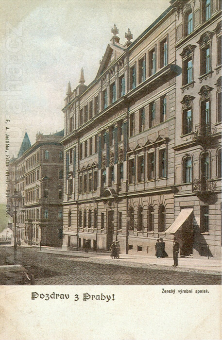
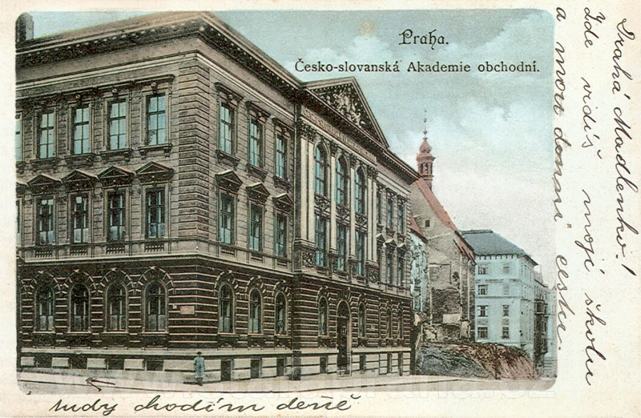
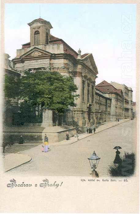
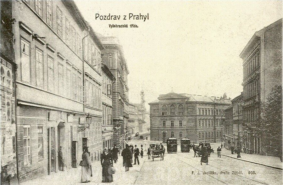
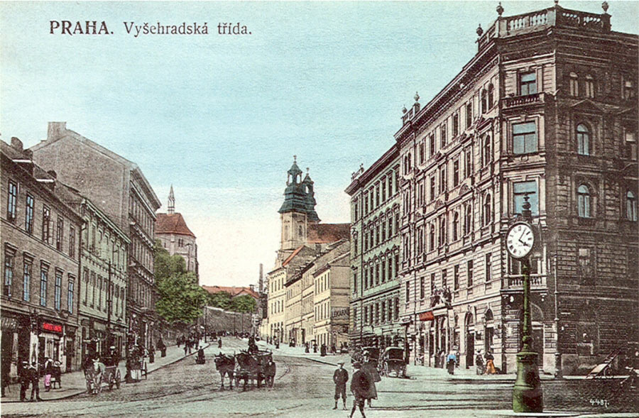
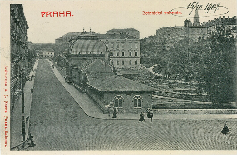
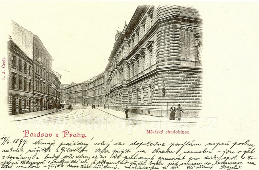
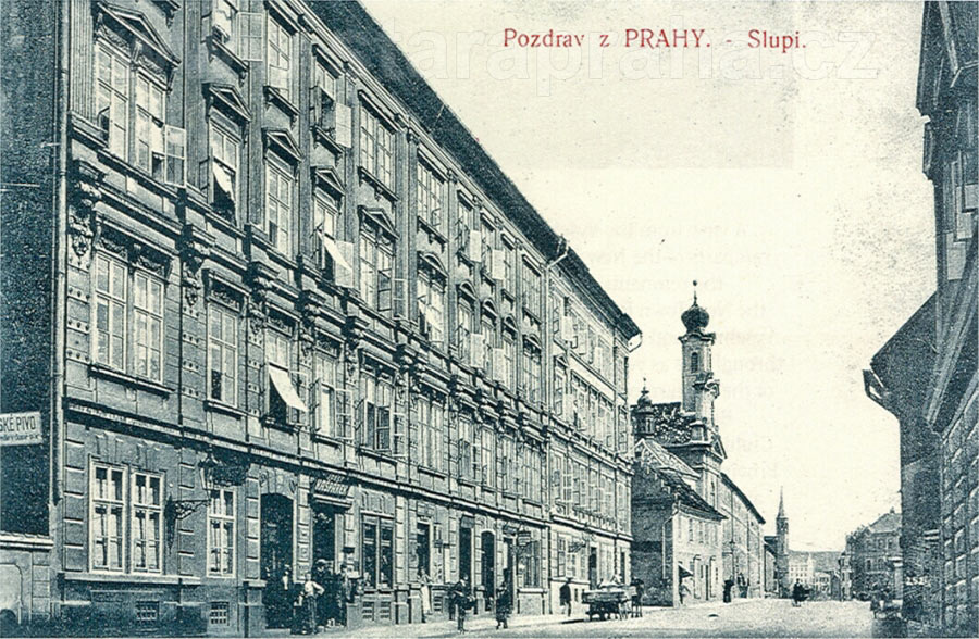
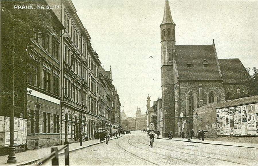
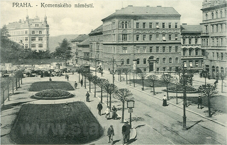
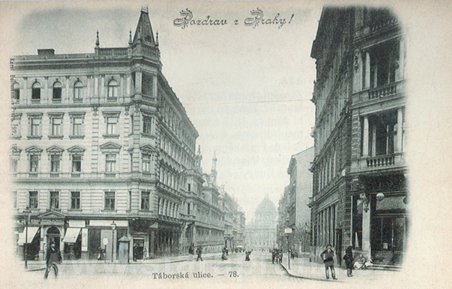
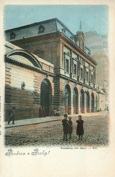
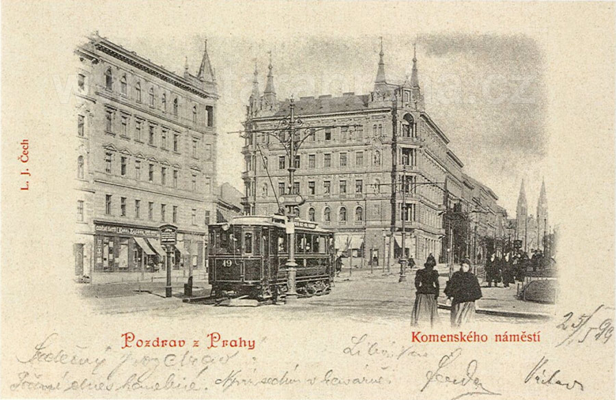
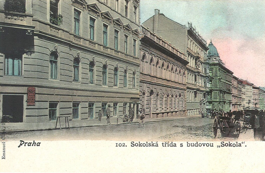
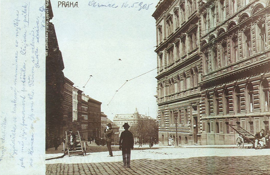
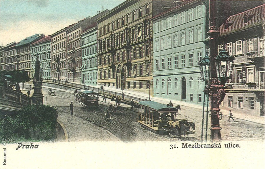


Comments
Post a Comment